Isotopic Evidence of the Moon’s Violent Origins

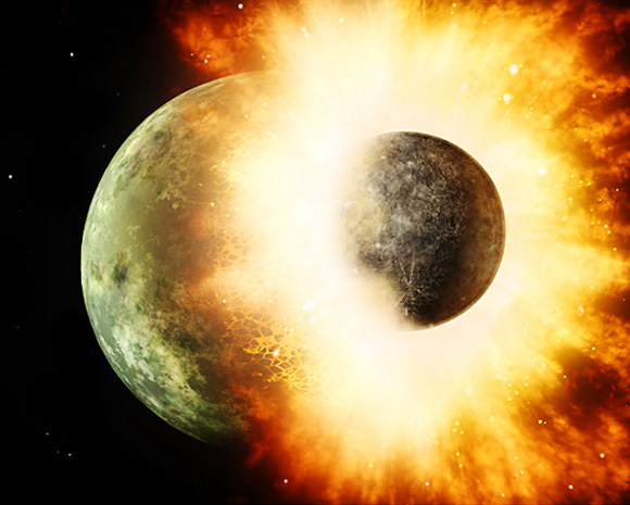
Artist’s impression of an impact of two planet-sized worlds (NASA/JPL-Caltech)

Scientists have uncovered a history of violence hidden within lunar rocks, further evidence that our large, lovely Moon was born of a cataclysmic collision between worlds billions of years ago.

Using samples gathered during several Apollo missions as well as a lunar meteorite that had fallen to Earth (and using Martian meteorites as comparisons) researchers have observed a marked depletion in lunar rocks of lighter isotopes, including those of zinc — a telltale element that can be “a powerful tracer of the volatile histories of planets.”

The research utilized an advanced mass spectroscopy instrument to measure the ratios of specific isotopes present in the lunar samples. The spectrometer’s high level of precision allows for data not possible even five years ago.

Scientists have been looking for this kind of sorting by mass, called isotopic fractionation, since the Apollo missions first brought Moon rocks to Earth in the 1970s, and Frédéric Moynier, PhD, assistant professor of Earth and Planetary Sciences at Washington University in St. Louis — together with PhD student, Randal Paniello, and colleague James Day of the Scripps Institution of Oceanography — are the first to find it.

The team’s findings support a now-widely-accepted hypothesis — called the Giant Impact Theory, first suggested by PSI scientists William K. Hartmann and Donald Davis in 1975 — that the Moon was created from a collision between early Earth and a Mars-sized protoplanet about 4.5 billion years ago. The effects of the impact eventually formed the Moon and changed the evolution of our planet forever — possibly even proving crucial to the development of life on Earth.

(What would a catastrophic event like that have looked like? Probably something like this:)

Read more: What’s the Moon Made Of? Earth, Most Likely.

“This is compelling evidence of extreme volatile depletion of the moon,” said Scripps researcher James Day, a member of the team. “How do you remove all of the volatiles from a planet, or in this case a planetary body? You require some kind of wholesale melting event of the moon to provide the heat necessary to evaporate the zinc.”

In the team’s paper, published in the October 18 issue of Nature, the researchers suggest that the only way for such lunar volatiles to be absent on such a large scale would be evaporation resulting from a massive impact event.

“When a rock is melted and then evaporated, the light isotopes enter the vapor phase faster than the heavy isotopes, so you end up with a vapor enriched in the light isotopes and a solid residue enriched in the heavier isotopes. If you lose the vapor, the residue will be enriched in the heavy isotopes compared to the starting material,” explains Moynier.

The fact that similar isotopic fractionation has been found in lunar samples gathered from many different locations indicates a widespread global event, and not something limited to any specific regional effect.

The next step is finding out why Earth’s crust doesn’t show an absence of similar volatiles, an investigation that may lead to clues to where Earth’s surface water came from.

“Where did all the water on Earth come from?” asked Day. “This is a very important question because if we are looking for life on other planets we have to recognize that similar conditions are probably required. So understanding how planets obtain such conditions is critical for understanding how life ultimately occurs on a planet.”

“The work also has implications for the origin of the Earth,”  adds Moynier, “because the origin of the Moon was a big part of the origin of the Earth.”

Read more on the Washington University news release and at the UC San Diego news center.

Inset image: Cross-polarized transmitted-light image of a lunar rock. Photo by James Day, Scripps/UCSD

35 Years Ago: Our First Family Portrait of the Earth and Moon

A crescent Earth and Moon as seen by Voyager 1 on September 18, 1977 (NASA)

35 years ago today, September 18, 1977, NASA’s Voyager 1 spacecraft turned its camera homeward just about two weeks after its launch, capturing the image above from a distance of 7.25 million miles (11.66 million km). It was the first time an image of its kind had ever been taken, showing the entire Earth and Moon together in a single frame, crescent-lit partners in space.

The view of Earth shows eastern Asia, the western Pacific Ocean and part of the Arctic. Voyager 1 was actually positioned directly above Mt. Everest when the images were taken (the final color image was made from three separate images taken through color filters.)

The Moon was brightened in the original NASA images by a factor of three, simply because Earth is so much brighter that it would have been overexposed in the images were they set to expose for the Moon. (Also I extended the sides of the image a bit above to fit better within a square format.)

Read the latest on Voyager 1: Winds of Change at the Edge of the Solar System

Previous images may have shown the Earth and Moon together, but they were taken from orbit around one or the other and as a result didn’t have both worlds fully — and in color! — within a single frame like this one does. In fact, it was only 11 years earlier that the very first image of Earth from the Moon was taken, acquired by NASA’s Lunar Orbiter I spacecraft on August 23, 1966.

It’s amazing to think what was happening in the world when Voyager took that image:
• World population was 4.23 billion (currently estimated to be 7.04 billion)
• The Space Shuttle Enterprise made its first test flight from a 747
• Star Wars, Close Encounters of the Third Kind and Saturday Night Fever were out in U.S. theaters
• Charlie Chaplin and Elvis Presley died
• U.S. federal debt was “only” $706 billion (now over $16 trillion!)
• And, of course, both Voyagers launched on their Grand Tour of the Solar System, ultimately becoming the most distant manmade objects in existence
(See more world stats and events here.)

Image: NASA/JPL

“Once a photograph of the Earth, taken from outside, is available – once the sheer isolation of the Earth becomes known – a new idea as powerful as any in history will be let loose.”
– Sir Fred Hoyle

Scientists Find Clues of Plate Tectonics on Mars

Valles Marineris NASA World Wind map Mars Credit NASA

Caption: Valles Marineris NASA World Wind Map Mars Credit: NASA

Until now, Earth was thought to be the only planet with plate tectonics. But a huge “crack” in Mars’ surface — the massive Valles Marinaris — shows evidence of the movement of huge crustal plates beneath the planet’s surface, meaning Mars may be showing the early stages of plate tectonics. This discovery can perhaps also shed light on how the plate tectonics process began here on Earth.

Valles Marineris is no ordinary crack on the Martian surface. It is the longest and deepest system of canyons in the Solar System. Stretching nearly 2,500 miles, it is nine times longer than Earth’s Grand Canyon.

An Yin, a planetary geologist and UCLA professor of Earth and space sciences, analyzed satellite images from THEMIS (Thermal Emission Imaging System), on board the Mars Odyssey spacecraft, and from the HIRISE (High Resolution Imaging Science Experiment) camera on NASA’s Mars Reconnaissance Orbiter.

“When I studied the satellite images from Mars, many of the features looked very much like fault systems I have seen in the Himalayas and Tibet, and in California as well, including the geomorphology,” he said.

The two plates that Yin calls Valles Marineris North and Valles Marineris South are moving approximately 93 miles horizontally relative to each other. By comparison, California’s San Andreas Fault, which is similarly over the intersection of two plates, has moved about twice as much, because Earth is about twice the size of Mars.

Yin believes Mars has no more than two plates whereas Earth has seven major plates and dozens of smaller ones. As Yin puts it “Earth has a very broken ‘egg shell,’ so its surface has many plates; Mars’ is slightly broken and may be on the way to becoming very broken, except its pace is very slow due to its small size and, thus, less thermal energy to drive it. This may be the reason Mars has fewer plates than on Earth.”

Mars also has several long, straight chains of volcanoes, including three that make up the Tharsis Montes, three large shield volcanoes which includes Olympus Mons, the tallest mountain in the Solar System at 22 km high. These volcanic chains may have formed from the motion of a plate sitting over a “hot spot” in the Martian mantle, in the same way the Hawaiian Islands are thought to have formed here on Earth. Yin also identified a steep cliff similar to cliffs in California’s Death Valley, which are generated by a fault, as well as a very smooth and flat side of a canyon wall which Yin says is also strong evidence of tectonic activity.

Yin also suggests that the fault is shifting occasionally, and may even produce “Marsquakes” every now and again. “I think the fault is probably still active, but not every day. It wakes up every once in a while, over a very long duration — perhaps every million years or more,” he said.

It is not known how far beneath the surface the plates on Mars are located. Yin admits “I don’t quite understand why the plates are moving with such a large magnitude or what the rate of movement is; maybe Mars has a different form of plate tectonics,” Yin said. “The rate is much slower than on Earth.”

“Mars is at a primitive stage of plate tectonics,” Yin added. “It gives us a glimpse of how the early Earth may have looked and may help us understand how plate tectonics began on Earth.”

Yin’s study was published in the August issue of the journal Lithosphere and he also plans to publish a follow-up paper hoping to shed more light on plate tectonics on both Mars and Earth.

Read the abstract.

Find out more at the

New Satellites Will Tighten Knowledge of Earth’s Radiation Belts


Surrounding our planet like vast invisible donuts (the ones with the hole, not the jelly-filled kind) are the Van Allen radiation belts, regions where various charged subatomic particles get trapped by Earth’s magnetic fields, forming rings of plasma. We know that the particles that make up this plasma can have nasty effects on spacecraft electronics as well as human physiology, but there’s a lot that isn’t known about the belts. Two new satellites scheduled to launch on August 23 August 24 will help change that.

“Particles from the radiation belts can penetrate into spacecraft and disrupt electronics, short circuits or upset memory on computers. The particles are also dangerous to astronauts traveling through the region. We need models to help predict hazardous events in the belts and right now we are aren’t very good at that. RBSP will help solve that problem.”
– David Sibeck, RBSP project scientist, Goddard Space Flight Center

NASA’s Radiation Belt Storm Probes (RBSP) mission will put a pair of identical satellites into eccentric orbits that take them from as low as 375 miles (603 km) to as far out as 20,000 miles (32,186 km). During their orbits the satellites will pass through both the stable inner and more variable outer Van Allen belts, one trailing the other. Along the way they’ll investigate the many particles that make up the belts and identify what sort of activity occurs in isolated locations and across larger areas.

“Definitely the biggest challenge that we face is the radiation environment that the probes are going to be flying through,” said Mission Systems Engineer Jim Stratton at APL. “Most spacecraft try to avoid the radiation belts — and we’re going to be flying right through the heart of them.”

Read: The Van Allen Belts and the Great Electron Escape

Each 8-sided RBSP satellite is approximately 6 feet (1.8 meters) across and weighs 1,475 pounds (669 kg).

The goal is to find out where the particles in the belts originate from — do they come from the solar wind? Or Earth’s own ionosphere? — as well as to find out what powers the belts’ variations in size and gives the particles their extreme speed and energy. Increased knowledge about Earth’s radiation belts will also help in the understanding of the plasma environment that pervades the entire Universe.

Read: What Are The Radiation Belts?

Ultimately the information gathered by the RBSP mission will help in the design of future science and communications satellites as well as safer spacecraft for human explorers.

The satellites are slated to launch aboard a United Launch Alliance Atlas V rocket from Cape Canaveral Air Force Station no earlier than 4:08 a.m. EDT on August 24.

Find out more about the RBSP mission here.

Video/rendering: NASA/GSFC.

Greenland Glacier Calves Another Huge Ice Island

Petermann glacier, a 70 km (43 mile) long tongue of ice that flows into the Arctic Ocean in northwest Greenland, recently calved an “ice island” approximately 130 square kilometers (50 sq. miles) — about twice the area of Manhattan. The image above, acquired by NASA’s Terra satellite, shows the ice island as it drifts toward the ocean five days after breaking off the main glacier.

Petermann glacier has been known for birthing massive ice islands; previously in August 2010 an even larger island broke away from the glacier, measuring 251 square kilometers (97 sq. miles). That slab of ice eventually drifted into the northern Atlantic and was even visible from the Space Station a year later!

Read: Manhattan-Sized Ice Island Seen From Space

Although some of Greenland’s glaciers have been observed to be quickening their seaward pace as a result of global warming, this particular calving event — which occurred along a crack that appeared in 2001 satellite imagery — isn’t thought to be a direct result of climate but rather of ocean currents and isn’t expected to have any significant effect on the rate of Greenland’s ice loss as a whole. Still, satellite observation of such events provides valuable data for researchers monitoring the processes that are involved with rapidly accelerating Arctic ice loss.

And if you want an idea of what a slab of ice this large looks like up close, here’s a video taken by researchers on approach to a smaller chunk of the 2011 island:

NASA Earth Observatory image by Jesse Allen, using data from NASA/GSFC/METI/ERSDAC/JAROS, and U.S./Japan ASTER Science Team. (NASA/Terra)

The Top 5 “Earth as Art” Images, Thanks to Landsat

NASA’s first Earth-observing Landsat satellite launched from Vandenberg Air Force Base on July 23, 1972, and to celebrate the 40th anniversary of the program they asked the public to vote on their favorite images of the planet from the Landsat Earth as Art gallery. After over 14,000 votes, these were chosen as the top 5 favorites. Happy 40th anniversary, Landsat!

Landsat images from space are not merely pictures. They contain many layers of data collected at different points along the visible and invisible light spectrum. A single Landsat scene taken from 400 miles above Earth can accurately detail the condition of hundreds of thousands of acres of grassland, agricultural crops or forests.

“Landsat has given us a critical perspective on our planet over the long term and will continue to help us understand the big picture of Earth and its changes from space,” said NASA Administrator Charles Bolden. “With this view we are better prepared to take action on the ground and be better stewards of our home.”

In cooperation with the U.S. Geological Survey (USGS), a science agency of the Interior Department, NASA launched six of the seven Landsat satellites. The resulting archive of Earth observations forms a comprehensive record of human and natural land changes.

“The first 40 years of the Landsat program have delivered the most consistent and reliable record of Earth’s changing landscape.”

– Michael Freilich, director of NASA’s Earth Science Division

“Over four decades, data from the Landsat series of satellites have become a vital reference worldwide for advancing our understanding of the science of the land,” said Interior Department Secretary Ken Salazar. “The 40-year Landsat archive forms an indelible and objective register of America’s natural heritage and thus it has become part of this department’s legacy to the American people.”

The next satellite in the series, the Landsat Data Continuity Mission (LDCM) is scheduled to launch on February 11, 2013.

(Source: NASA/GSFC)

Find out more about the ongoing Landsat mission here, and see recent visualizations from Landsat on the USGS site here.

Video: NASA/GSFC. Inset image: Industrial growth in Binhai New Area, China.  Sub-feature: Erg Iguidi, an area of ever-shifting sand dunes extending from Algeria into Mauritania in northwestern Africa, one of the chosen top 5 Earth as Art images. NASA/GSFC/USGS.

An Orbital Adagio: Nighttime Views from the ISS

People keep making these videos from ISS photography, and we keep loving them. Here’s the latest, assembled by photographer Knate Myers to a track by John Murphy (from the movie soundtrack for Sunshine) it’s a beautiful tour of nighttime passes of the Space Station over our planet. Stars, city lights, airglow, aurorae… it’s nothing you haven’t seen before, but everything worth seeing again. Watch it.

Video: Knate Myers. All images courtesy of the Image Science & Analysis Laboratory, NASA Johnson Space Center. Via the Gateway to Astronaut Photography of Earth.

Brazilian Band Soars to New Heights with a NASA-Inspired Video


Popular Brazilian rock band Fresno recently released a new video for their new song, “Infinito”, and it really rises above the rest — literally!

It’s a story of four guys who take their childhood dream of launching a package up into space and, after years apart, come back together to make it a reality. Along the way we get to see some great views from a camera that the band members actually sent up to the edge of space via weather balloon — an accomplishment that came with its fair share of challenges.

Fresno lead member Lucas Silveira shared some behind-the-scenes info with Universe Today. “We wasted two cameras. One of them landed on a military base — exactly in the middle of a mine field — and the other simply disappeared… completely lost due to the lack of cellular signal on the landing spot.”

And even on a successful third try there were some technical difficulties.

“In our third attempt we used a different balloon, with more capacity, and it managed to fly for over 3.5 hours… but our camera only survived for around 2.5 hours. So we had to send a smaller balloon just to capture the ‘popping up’ moment, and added it to the ‘main balloon ride’ on post production.”

Still, the results — a dizzying view of Earth from 35 km up — are well worth it, and the story is an inspiring one… inspired, in fact, by NASA.

“I wrote this song after watching a video by NASA in which they zoom out from the Himalayas to the edge of the universe, showing the areas that still yet to be mapped. We are so infinitely small in the middle of all this greatness, and suddenly our problems get as tiny in our heads as our lucky existence here. It’s about searching for better days, creating a better future through proactivity and not letting others letting you down.”

When you soar that high it’s hard to feel let down.

Video courtesy of Fresno. Technical and launch assistance provided by ACRUX Aerospace Technologies. Band photo by Gustavo Vara.

Why Doesn’t Earth Have More Water?

Water, water everywhere… Coleridge’s shipbound ancient mariners were plagued by a lack of water while surrounded by a sea of the stuff, and while 70% of Earth’s surface is indeed covered by water (of which 96% is salt water, hence not a drop to drink) there’s really not all that much — not when compared to the entire mass of the planet. Less than 1% of Earth is water, which seems odd to scientists because, based on conventional models of how the Solar System formed, there should have been a lot more water available in Earth’s neck of the woods when it was coming together. So the question has been floating around: why is Earth so dry?

According to a new study from the Space Telescope Science Institute in Baltimore, MD, the answer may lie in the snow.

The snow line, to be exact. The region within a planetary system beyond which temperatures are cold enough for water ice to exist, the snow line in our solar system is currently located in the middle of the main asteroid belt, between the orbits of Mars and Jupiter. Based on conventional models of how the Solar System developed, this boundary used to be closer in to the Sun, 4.5 billion years ago. But if that were indeed the case, then Earth should have accumulated much more ice (and therefore water) as it was forming, becoming a true “water world” with a water mass up to 40 percent… instead of a mere one.

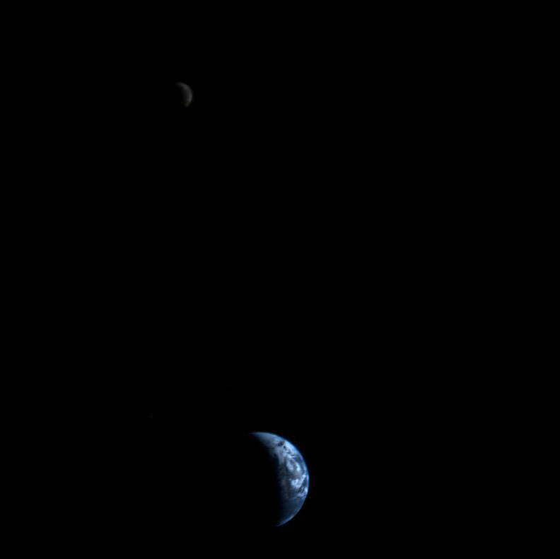
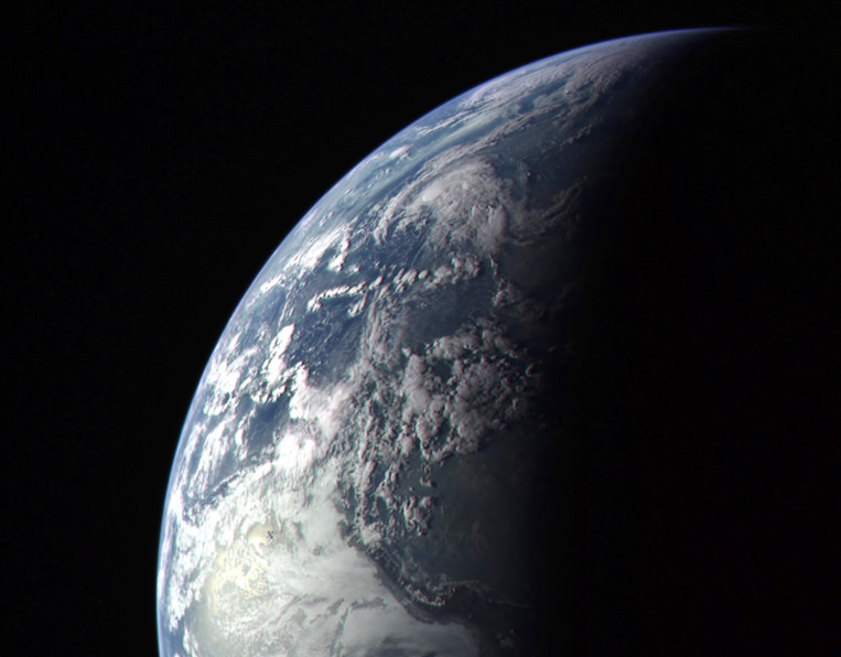
As we can see today, that wasn’t the case.

Planets such as Uranus and Neptune that formed beyond the snow line are composed of tens of percents of water. But Earth doesn’t have much water, and that has always been a puzzle.”

– Rebecca Martin, Space Telescope Science Institute 

A study led astrophysicists Rebecca Martin and Mario Livio of the Space Telescope Science Institute took another look at how the snow line in our solar system must have evolved, and found that, in their models, Earth was never inside the line. Instead it stayed within a warmer, drier region inside of the snow line, and away from the ice.

“Unlike the standard accretion-disk model, the snow line in our analysis never migrates inside Earth’s orbit,” Livio said. “Instead, it remains farther from the Sun than the orbit of Earth, which explains why our Earth is a dry planet. In fact, our model predicts that the other innermost planets, Mercury, Venus, and Mars, are also relatively dry. ”

Read: Rethinking the Source of Earth’s Water

The standard model states that in the early days of a protoplanetary disk’s formation ionized material within it gradually falls toward the star, drawing the icy, turbulent snow line region inward. But this model depends upon the energy of an extremely hot star fully ionizing the disk — energy that a young star, like our Sun was, just didn’t have.

“We said, wait a second, disks around young stars are not fully ionized,” Livio said. “They’re not standard disks because there just isn’t enough heat and radiation to ionize the disk.”


“Astrophysicists have known for quite a while that disks around young stellar objects are NOT standard accretion disks (namely, ones that are ionized and turbulent throughout),” added Dr. Livio in an email to Universe Today. “Disk models with dead zones have been constructed by many people  for many years. For some reason, however, calculations of the evolution of the snow line largely continued to use the standard disk models.”

Without fully ionized disk, the material is not drawn inward. Instead it orbits the star, condensing gas and dust into a “dead zone”  that blocks outlying material from coming any closer. Gravity compresses the dead zone material, which heats up and dries out any ices that exist immediately outside of it. Based on the team’s research it was in this dry region that Earth formed.

The rest, as they say, is water under the bridge.

The team’s results have been accepted for publication in the journal Monthly Notices of the Royal Astronomical Society.

Read the release on the Hubble news site here, and see the full paper here.

Lead image: Earth as seen by MESSENGER spacecraft before it left for Mercury in 2004. NASA/Johns Hopkins University Applied Physics Laboratory/Carnegie Institution of Washington. Disk model image: NASA, ESA, and A. Feild (STScI). Earth water volume image:  Howard Perlman, USGS; globe illustration by Jack Cook, Woods Hole Oceanographic Institution (©); Adam Nieman.

The Audacity to Dream

Making its debut at the TEDxISU (International Space University) event on July 6, the video above is an inspirational call-to-arms for anyone who’s ever looked to the stars and dreamed of a day when the sky was, in fact, not the limit. From Sputnik to Space Station, from Vostok to Virgin Galactic, the video reminds us of the spirit of adventure that unites us, regardless of time or place or politics. Dreaming, after all, is universal.

Check it out.

“A planet is the cradle of mind, but one cannot live in a cradle forever.”
– Konstantin Tsiolkovsky