What Does Antarctica Look Like Under the Ice?

New topography map of Antarctica by the British Antarctic Survey's Bedmap2 (NASA/GSFC)

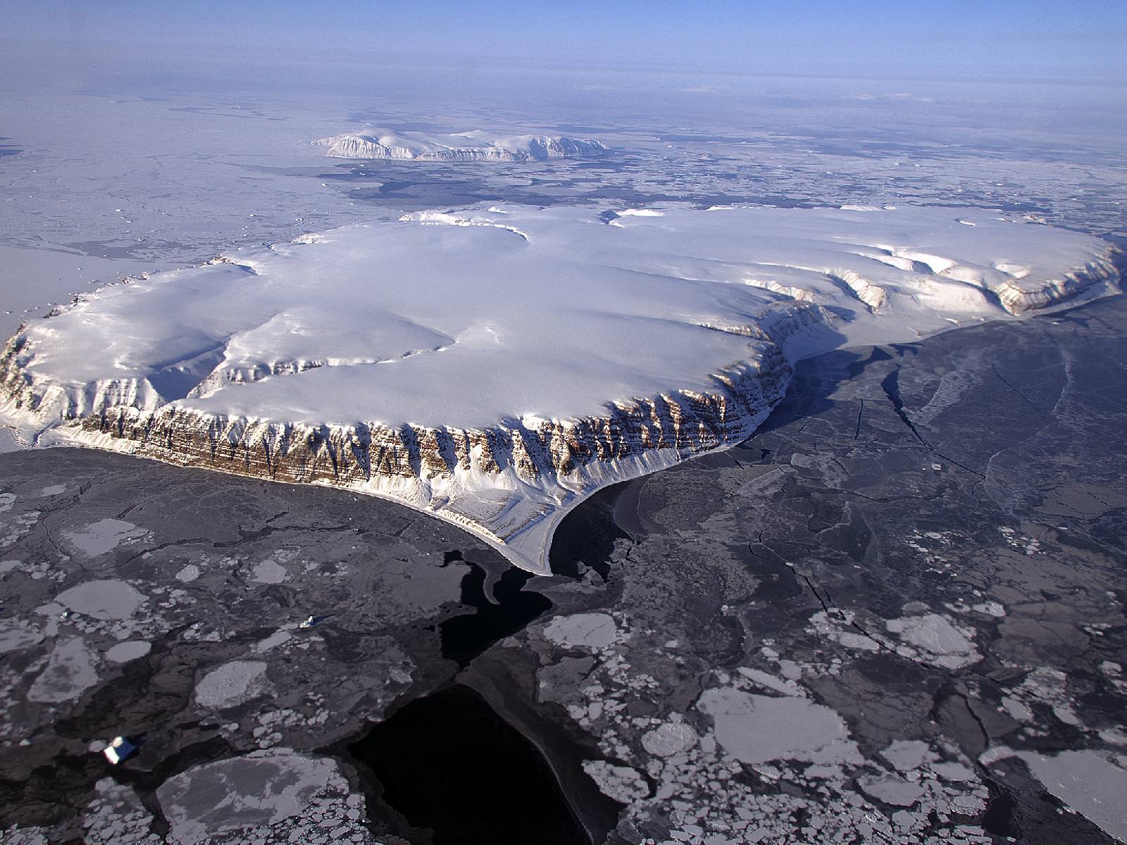
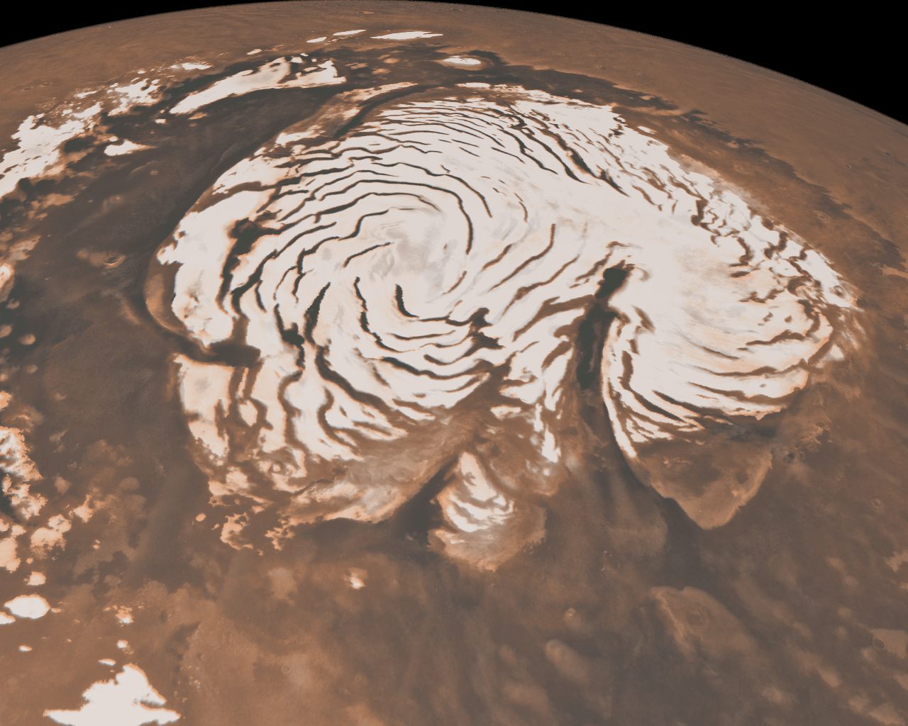
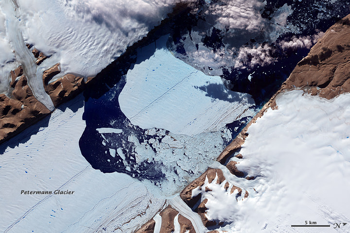
Although it sits isolated at the “bottom of the world” Antarctica is one of the most influential continents on Earth, affecting weather, climate, and ocean current patterns over the entire planet. But Antarctica is also one of the most enigmatic landmasses too, incredibly remote, extremely harsh, and covered by a layer of ice over 2 km thick. And as Earth’s global temperature continues to climb steadily higher, the future of ice in Antarctica — a continent half again as large as the contiguous United States — is a big concern for scientists… but in order to know exactly how its ice will behave to changing conditions, they need to know what’s under it.

This is where the British Antarctic Survey — using data gathered by NASA’s ICESat and Operation IceBridge missions — comes in, giving us a better view of what lies beneath the southern continent’s frozen veil.

A new dataset called Bedmap2 gives a clearer picture of Antarctica from the ice surface down to the bedrock below. Bedmap2 is a significant improvement on the previous collection of Antarctic data — known as Bedmap — that was produced more than 10 years ago. The product was a result of work led by the British Antarctic Survey, where researchers compiled decades worth of geophysical measurements, such as surface elevation measurements from NASA’s Ice, Cloud and Land Elevation Satellite (ICESat) and ice thickness data collected by Operation IceBridge.

Bedmap2, like the original Bedmap, is a collection of three datasets—surface elevation, ice thickness and bedrock topography. Both Bedmap and Bedmap2 are laid out as grids covering the entire continent, but with a tighter grid spacing Bedmap2 includes many surface and sub-ice features too small to be seen in the previous dataset. Additionally, the extensive use of GPS data in more recent surveys improves the precision of the new dataset.

Improvements in resolution, coverage and precision will lead to more accurate calculations of ice volume and potential contribution to sea level rise.

Ice sheet researchers use computer models to simulate how ice sheets will respond to changes in ocean and air temperatures. An advantage of these simulations is that they allow testing of many different climate scenarios, but the models are limited by how accurate the data on ice volume and sub-ice terrain are.

Only the tips of many of Antarctica's mountains are visible above thousands of feet of ice. (Oct. 2012 IceBridge photo. Credit: NASA / Christy Hansen)
Only the tips of many of Antarctica’s mountains are visible above thousands of feet of ice. (Oct. 2012 IceBridge photo. Credit: NASA / Christy Hansen)

“In order to accurately simulate the dynamic response of ice sheets to changing environmental conditions, such as temperature and snow accumulation, we need to know the shape and structure of the bedrock below the ice sheets in great detail,” said Michael Studinger, IceBridge project scientist at NASA Goddard.

Knowing what the bedrock looks like is important for ice sheet modeling because features in the bed control the ice’s shape and affect how it moves. Ice will flow faster on a downhill slope, while an uphill slope or bumpy terrain can slow an ice sheet down or even hold it in place temporarily. “The shape of the bed is the most important unknown, and affect how ice can flow,” said Nowicki. “You can influence how honey spreads on your plate, by simply varying how you hold your plate.” The vastly improved bedrock data included in Bedmap2 should provide the level of detail needed for models to be realistic.

Bedmap2 data of Antarctica's bedrock. Verical elevation has been exaggerated by 17x. (NASA/GSFC)
Bedmap2 data of Antarctica’s bedrock. Verical elevation has been exaggerated by 17x. (NASA/GSFC)

“It will be an important resource for the next generation of ice sheet modelers, physical oceanographers and structural geologists,” said Peter Fretwell, BAS scientist and lead author.

The BAS’ work was published recently in the journal The Cryosphere. Read more on the original release by George Hale here.

Source: NASA Earth

NASA Scientists Soar Over a Mini Ice Cap

Saunders Island and Wolstenholme Fjord with Kap Atholl in the background photographed during a NASA IceBridge flight. (NASA/Michael Studinger)

It’s quite a long way from Mars, but I can’t help but be reminded of the Red Planet’s ice-covered north pole when looking at this photo taken by Michael Studinger earlier this month, during a recent IceBridge survey flight over Greenland.

Called Saunders Island (also Appat Island) the 82-square-mile frozen slab of rock rises from the sea off the coast of northwestern Greenland, one of many islands within the Wolstenholme (Uummannaq) Fjord on the shore of Baffin Bay. Operation IceBridge, a six-year aerial survey of the changing ice coverage at our planet’s poles, is run by NASA to provide valuable ground-level information to supplement satellite data.

To me, the shape of the island’s steep rock faces and rugged inlets slice into its interior bear a striking resemblance to Mars’ ice cap.

Mars' north polar ice cap
Mars’ north polar ice cap

While Mars’ ice cap is shaped by very different processes — and obviously much bigger — you might see the connection too!

But rather than dark Martian dunes, sea ice can be seen surrounding the islands in varying thicknesses in the IceBridge photo above. Sea ice coverage in the fjord ranges from thicker, white ice in the background to thinner “grease” ice and leads with dark, open ocean water in the foreground.

The IceBridge P-3B airborne laboratory in a hangar at Wallops Flight Facility (NASA/George Hale)

As the amount of darker, ice-free water surfaces increase over the course of the year due to rising global temperatures, the more heat from solar radiation is collected in the ocean — thus speeding up the process of seasonal sea ice loss and overall Arctic warming.

Read more about the IceBridge mission here, and see a collection of more photos from this season’s flights here.

NASA’s Operation IceBridge images Earth’s polar ice in unprecedented detail to better understand processes that connect the polar regions with the global climate system. IceBridge utilizes a highly specialized fleet of research aircraft and the most sophisticated suite of innovative science instruments ever assembled to characterize annual changes in thickness of sea ice, glaciers, and ice sheets. In addition, IceBridge collects critical data used to predict the response of earth’s polar ice to climate change and resulting sea-level rise.


Global Temperatures Continue to Rise

This map represents global temperature anomalies averaged from 2008 through 2012. Credit: NASA Goddard Institute for Space Studies/NASA Goddard's Scientific Visualization Studio.

This week, scientists at NASA released their global climate analysis for 2012 which revealed that Earth continues to experience warmer temperatures than several decades ago. The past year was the ninth warmest year on record since 1880, continuing what appears to be a long-term global trend of rising temperatures. The ten warmest years in the 132-year record have all occurred since 1998, and the last year that was cooler than average was 1976. The hottest years on record were 2010 and 2005.

The analysis was done by NASA’s Goddard Institute for Space Studies (GISS) which monitors global surface temperatures on an ongoing basis, comparing temperatures around the globe to the average global temperature from the mid-20th century.

In 2012, the average temperature was about 14.6 degrees Celsius (58.3 degrees Fahrenheit). This is .55 degrees C (1.0 degree F) warmer than the mid-20th century baseline, with the global average temperature having risen about 0.8 degrees C (1.4 degrees F) since 1880. The majority of that change has occurred in the past forty years.

Additionally, last week the US National Climatic Data Center (NCDC) released their latest climate report from 2012 and found that it was the warmest year ever recorded in the contiguous United States. The average temperature for the contiguous United States for 2012 was 13 degrees C (55.3 degrees F) which was 3.2°F above the 20th century average.

The map depicts temperature anomalies, or changes, by region in 2012; while the line plot above shows yearly temperature anomalies from 1880 to 2011 as recorded by NASA GISS, the National Oceanic and Atmospheric Administration (NOAA) National Climatic Data Center, the Japanese Meteorological Agency, and the Met Office Hadley Centre in the United Kingdom. NASA Goddard Institute for Space Studies.

The data was gathered by NASA GISS, the National Oceanic and Atmospheric Administration (NOAA) National Climatic Data Center, the Japanese Meteorological Agency, and the Met Office Hadley Centre in the United Kingdom. All four institutions tally temperature data from stations around the world and make independent judgments about whether the year was warm or cool compared to other years. Though there are minor variations from year to year, all four records show peaks and valleys in sync with each other. All show rapid warming in the past few decades, and all show the last decade as the warmest.

Scientists emphasize that weather patterns cause fluctuations in average temperatures from year to year, but the continued increase in greenhouse gas levels in the atmosphere assures that there will be a long-term rise in global temperatures. Each individual year will not necessarily be warmer than the previous year, but scientists expect each decade to be warmer than the previous decade.

“One more year of numbers isn’t in itself significant,” GISS climatologist Gavin Schmidt said. “What matters is this decade is warmer than the last decade, and that decade was warmer than the decade before. The planet is warming. The reason it’s warming is because we are pumping increasing amounts of carbon dioxide into the atmosphere.”

See an interactive global temperature map from New Scientist.

Carbon dioxide traps heat and largely controls Earth’s climate. It occurs naturally but is also released by the burning of fossil fuels for energy. The level of carbon dioxide in Earth’s atmosphere has been rising consistently for decades, largely driven by increasing man-made emissions. The carbon dioxide level in the atmosphere was about 285 parts per million in 1880, the first year of the GISS temperature record. By 1960, the atmospheric carbon dioxide concentration, measured at NOAA’s Mauna Loa Observatory, was about 315 parts per million. Today, that measurement exceeds 390 parts per million.

The continental U.S. endured its warmest year on record by far, according to NOAA, the official keeper of U.S. weather records. NOAA also announced that global temperatures were 10th warmest on record by their analysis methods.

“The U.S. temperatures in the summer of 2012 are an example of a new trend of outlying seasonal extremes that are warmer than the hottest seasonal temperatures of the mid-20th century,” NASA GISS director James E. Hansen said. “The climate dice are now loaded. Some seasons still will be cooler than the long-term average, but the perceptive person should notice that the frequency of unusually warm extremes is increasing. It is the extremes that have the most impact on people and other life on the planet.”

For more explanation of how the analysis works, read World of Change: Global Temperatures (pdf).

Sources: NASA, NASA’s Earth Observatory

NASA Satellite Sees Ghostly Remains of Vanishing Arctic Sea Ice

Sea ice swirls in ocean currents off the coast of Greenland (NASA/GSFC)

Spooky spectral swirls of last season’s sea ice drift in currents off the coast of eastern Greenland in this image from NASA’s Aqua satellite, acquired on October 17. Although sea ice in the Arctic will start forming again after September’s record low measurements, these ghostly wisps are likely made up of already-existing ice that has migrated south.

As global temperatures rise — both over land and in the ocean — thinner sea ice builds up during the Arctic winter and thus more of it melts during the summer, a pattern that will eventually lead to an ice-free Arctic if trends continue. The past several years saw sea ice in the Arctic below the 1979-2000 average, with this past September displaying the lowest volumes yet recorded.

The graph below, made from data modeled by the Polar Science Center at the University of Washington, show the chilling — or, perhaps, not-so-chilling — results of this century’s recent observations.

Along Greenland’s east coast, the Fram Strait serves as an expressway for sea ice moving out of the Arctic Ocean. The movement of ice through the strait used to be offset by the growth of ice in the Beaufort Gyre.

Until the late 1990s, ice would persist in the gyre for years, growing thicker and more resistant to melt. Since the start of the twenty-first century, however, ice has been less likely to survive its trip through the southern part of the Beaufort Gyre. As a result, less Arctic sea ice has been able to pile up and form multi-year ice.

Thin, free-drifting ice — as seen above — moves very easily with winds and currents.

Aqua is a NASA Earth Science satellite mission named for the large amount of information that the mission is collecting about the Earth’s water cycle, including evaporation from the oceans, water vapor in the atmosphere, clouds, precipitation, soil moisture, sea ice, land ice, and snow cover on the land and ice. Aqua was launched on May 4, 2002, and carries six Earth-observing instruments in a near-polar low-Earth orbit. MODIS, which acquired the image above, is a 36-band spectroradiometer that measures physical properties of the atmosphere, oceans and land.

Source: NASA Earth Observatory

NASA image courtesy Jeff Schmaltz, LANCE MODIS Rapid Response Team at NASA GSFC. Graph by Jesse Allen based on modeled ice volume data from the Polar Science Center, University of Washington. Caption portions by Michon Scott with information from Ted Scambos, National Snow and Ice Data Center.

Manhattan-Sized Ice Island Heads Out to Sea

An “ice island” that calved from the Petermann Glacier in July is seen by NASA satellite (MODIS/Terra)

Remember that enormous slab of ice that broke off Greenland’s Petermann Glacier back in July? It’s now on its way out to sea, a little bit smaller than it was a couple of months ago — but not much. At around 10 miles long and 4.6 miles across (16.25 x 7.5 km) this ice island is actually a bit shorter than Manhattan, but is fully twice as wide.

The image above was acquired on September 14 by the Moderate Resolution Imaging Spectroradiometer (MODIS) aboard NASA’s Terra satellite.

Although the calving of this particular ice island isn’t thought to be a direct result of increasing global temperatures, climate change is thought to be a major factor in this year’s drop in Arctic sea ice extent, which is now below 4.00 million square kilometers (1.54 million square miles). Compared to September conditions in the 1980s and 1990s, this represents a 45% reduction in the area of the Arctic covered by sea ice.

Arctic sea ice extent data for June-July 2012 (NSIDC)

This year sea ice in the Arctic Ocean dropped below the previous all-time record, set in 2007. 2012 also marks the first time that there has been less than 4 million square kilometers (1.54 million square miles) of sea ice since satellite observations began in 1979.

The animation below, released today by the NOAA, shows the 2012 time-series of ice extent using data from the DMSP SSMI/S satellite sensor:

Read more here.

Greenland Glacier Calves Another Huge Ice Island

Petermann glacier, a 70 km (43 mile) long tongue of ice that flows into the Arctic Ocean in northwest Greenland, recently calved an “ice island” approximately 130 square kilometers (50 sq. miles) — about twice the area of Manhattan. The image above, acquired by NASA’s Terra satellite, shows the ice island as it drifts toward the ocean five days after breaking off the main glacier.

Petermann glacier has been known for birthing massive ice islands; previously in August 2010 an even larger island broke away from the glacier, measuring 251 square kilometers (97 sq. miles). That slab of ice eventually drifted into the northern Atlantic and was even visible from the Space Station a year later!

Read: Manhattan-Sized Ice Island Seen From Space

Although some of Greenland’s glaciers have been observed to be quickening their seaward pace as a result of global warming, this particular calving event — which occurred along a crack that appeared in 2001 satellite imagery — isn’t thought to be a direct result of climate but rather of ocean currents and isn’t expected to have any significant effect on the rate of Greenland’s ice loss as a whole. Still, satellite observation of such events provides valuable data for researchers monitoring the processes that are involved with rapidly accelerating Arctic ice loss.

And if you want an idea of what a slab of ice this large looks like up close, here’s a video taken by researchers on approach to a smaller chunk of the 2011 island:

NASA Earth Observatory image by Jesse Allen, using data from NASA/GSFC/METI/ERSDAC/JAROS, and U.S./Japan ASTER Science Team. (NASA/Terra)

Letter to NASA is Common Ploy in Climate Change Denial

Credit: Climate Change Encyclopedia

A group of 49 former NASA employees from Johnson Space Center have written a letter to NASA Administrator Charlie Bolden, requesting that the space agency refrain from “unproven and unsubstantiated remarks” regarding how human activities are causing global climate change.

“As former NASA employees, we feel that NASA’s advocacy of an extreme position … is inappropriate,” says the letter. “We believe the claims by NASA and GISS(Goddard Institute for Space Studies) that man-made carbon dioxide is having a catastrophic impact on global climate change are not substantiated.”

The letter was reportedly supported by Leighton Steward from the Heartland Institute, an organization known for its stance of trying to cast doubt on global warming science.

“NASA has always been about looking out to the skies and beyond, not burying our heads in the sand,” climate scientist Michael Mann told Universe Today in an email “This is an old ploy, trying to cobble together a small group of individuals and make it sound like they speak with authority on a matter that they have really not studied closely. In this case, the effort was led by a fossil fuel industry-funded (climate change) denier who works for the Heartland Institute, and sadly he managed to manipulate this group of former NASA employees into signing on to this misguided statement.”

Mann added that 49 people out of tens of thousands of former and current NASA employees is just a tiny fraction, and that “NASA’s official stance, which represents the full current 16,000 NASA scientists and employees, is clear if you go to their website or look at their official publications: human-caused climate change is real, and it represents a challenge we must confront.”

NASA has responded to the letter, inviting those who signed it – which includes Apollo astronauts, engineers and former JSC officials – to join the debate in peer-reviewed scientific literature and public forums.

“NASA sponsors research into many areas of cutting-edge scientific inquiry, including the relationship between carbon dioxide and climate,” wrote Waleed Abdalati, NASA Chief Scientist. “As an agency, NASA does not draw conclusions and issue ‘claims’ about research findings. We support open scientific inquiry and discussion.”

“If the authors of this letter disagree with specific scientific conclusions made public by NASA scientists, we encourage them to join the debate in the scientific literature or public forums rather than restrict any discourse,” Abdalati concluded.

As several different people have noted — including former astronaut Rusty Schweickart who was quoted in the New York Times — most of those who signed the letter are not active research scientists and do not hold degrees in atmospheric sciences or fields related to climate change.

Schweickart, who was not among those who signed the letter, said in the New York Times that those who wrote the letter “have every right to state and argue for their opinion,” and climate scientist Gavin Schmidt added in the article that people stating their views is completely legitimate, “but they are asking the NASA administrator to censor other peoples’ (which is something else entirely).”

The letter from the former NASA employees – including Apollo astronauts Jack Schmitt, Walt Cunningham, Al Worden, and Dick Gordon — chides that since “hundreds of well-known climate scientists and tens of thousands of other scientists publicly declaring their disbelief in the catastrophic forecasts, coming particularly from the GISS leadership, it is clear that the science is NOT settled.”

Schmidt wrote previously on the RealClimate website that he certainly agrees the science is not settled. “No scientists would be scientists if they thought there was nothing left to find out…The reason why no scientist has said this (that the science is settled) is because they know full well that knowledge about science is not binary – science isn’t either settled or not settled. This is a false and misleading dichotomy.”

However, he added, “In the climate field, there are a number of issues which are no longer subject to fundamental debate in the community. The existence of the greenhouse effect, the increase in CO2 (and other GHGs) over the last hundred years and its human cause, and the fact the planet warmed significantly over the 20th Century are not much in doubt.”

For further reading:
Letter from former NASA employees
Letter from Waleed Abdalati
Article by Andrew Revkin in the New York Times
Article by Eric Berger in the Houston Chronicle
NASA’s Climate Change website
Real Climate

The Sky Is Falling, Scientists Report

Clouds over the southern Indian Ocean, July 23, 2007. (NASA/JPL-Caltech)

[/caption]

Ok, maybe not the sky itself… but the clouds. According to recent research by climate scientists in New Zealand, global cloud heights have dropped.

Researchers at The University of Auckland have reported a decreasing trend in average global cloud heights from 2000 to 2010, based on data gathered by the Multi-angle Imaging SpectroRadiometer (MISR) on NASA’s Terra satellite. The change over the ten-year span was 30 to 40 meters (about 100 to 130 feet), and was mostly due to fewer clouds at higher altitudes.

It’s suspected that this may be indicative of some sort of atmospheric cooling mechanism in play that could help counteract global warming.

“This is the first time we have been able to accurately measure changes in global cloud height and, while the record is too short to be definitive, it provides just a hint that something quite important might be going on,” said lead researcher Professor Roger Davies.

A steady reduction in cloud heights could help the planet radiate heat into space, thus serving as a negative feedback in the global warming process. The exact cause of the drop in cloud altitude is not yet known, but it could reasonably be resulting from a change in circulation patterns that otherwise form high-altitude clouds.

Rendering of the Terra spacecraft. (NASA)

Cloud heights are just one of the many factors that affect climate, and until now have not been able to be measured globally over a long span of  time.

“Clouds are one of the biggest uncertainties in our ability to predict future climate,” said Davies. “Cloud height is extremely difficult to model and therefore hasn’t been considered in models of future climate. For the first time we have been able to accurately measure the height of clouds on a global basis, and the challenge now will be to incorporate that information into climate models. It will provide a check on how well the models are doing, and may ultimately lead to better ones.”

While Terra data showed yearly variations in global cloud heights, the most extreme caused by El Niño and La Niña events in the Pacific, the overall trend for the years measured was a decrease.

Continuing research will be needed to determine future trends and how they may impact warming.

“If cloud heights come back up in the next ten years we would conclude that they are not slowing climate change,” Davies said. “But if they keep coming down it will be very significant.”

The team’s study was recently published in the journal Geophysical Research Letters.

Terra is a multi-national, multi-disciplinary mission involving partnerships with the aerospace agencies of Canada and Japan. An important part of NASA’s Science Mission, Terra is helping scientists around the world better understand and protect our home planet.

Read more on the NASA/JPL news release here.

Getting to the Core of Earth’s Falling Snow

Visualization of the GPM Core Observatory and Partner Satellites. Credit: NASA

[/caption]

An international plan is unfolding that will launch satellites into orbit to study global snowfall precipitation with unprecedented detail. With the upcoming Global Precipitation Measurement (GPM) satellites, for the first time we will know when, where and how much snow falls on Earth, allowing greater understanding of energy cycles and how best to predict extreme weather.

Snow is more than just a pretty winter decoration… it’s also a very important contributor to fresh water supply in many regions around the world, especially those areas that rely on spring runoff from mountains.

The snowmelt from the Sierra Nevadas, for example, accounts for a third of the water supply for California.

But changing climate and recent drought conditions have affected how much snow the mountains receive in winter… and thus how much water is released in the spring. Unfortunately, as of now there’s no reliable way to comprehensively detect and measure falling snow from space… whether in the Sierras or the Andes or the Alps.

Engineers are building and testing the GPM Core Observatory at Goddard Space Flight Center. (NASA/GSFC)

The GPM Core satellite, slated to launch in 2014, will change that.

“The GPM Core, with its ability to detect falling snows, it’s one of the very first times that we’ve put sensors in space to specifically look at falling snow,” said GPM Deputy Project Scientist Gail Skofronick-Jackson in an online video. “We’re at that edge where rain was fifty years ago. We’re still figuring out how to measure snow.”

And why is snow such a difficult subject to study?

“Rain tends to be spherical like drops,” says Skofronick-Jackson. “But if you’ve ever been out in a snowfall and you’ve looked at your shirt, you see the snow comes in all different forms.”

Once GPM scientists calculate all the various types of snowflake shapes, the satellite will be able to detect them from orbit.

“The GPM Core, with its additional frequencies and information on the sensors, is going to be able to provide us for the first time a lot more information about falling snow than we’ve ever done before.”

Knowing where and how much snow and rain falls globally is vital to understanding how weather and climate impact both our environment and Earth’s energy cycles, including effects on agriculture, fresh water availability, and responses to natural disasters.

Snowfall is a missing part of the puzzle, and GPM will fill those pieces in.

Find out more about the GPM program at pmm.nasa.gov/GPM.

GPM Core is currently being assembled at NASA’s Goddard Space Flight Center and scheduled to launch in 2014 on a Japanese H-IIA rocket.  Initiated by NASA and the Japanese Aerospace Exploration Agency (JAXA), GPM consists of a consortium of international agencies, including the Centre National d’Études Spatiales (CNES), the Indian Space Research Organization (ISRO), the National Oceanic and Atmospheric Administration (NOAA), the European Organization for the Exploitation of Meteorological Satellites (EUMETSAT), and others. 

Hansen on Climate: “We need to make clear to the public what’s really going on”

Line plot of global mean land-ocean temperature index, 1880 to present, with the base period 1951-1980. The dotted black line is the annual mean and the solid red line is the five-year mean. The green bars show uncertainty estimates. Credit: Hansen et al. (2006).

[/caption]

Editor’s note: This interview is from DailyClimate.org and Climate Query is a semi-weekly feature offered by Daily Climate, presenting short Q&A’s with players large and small in the climate arena. Read other articles in the series more at Climate Query.

NASA’s chief climate scientist James E. Hansen built his career studying Earth’s atmosphere and modeling humans’ potential impacts on climate. Then he realized that laboratory work wasn’t enough. Hansen never thought his decision to study atmospheric models would lead to his arrest. But there he was in handcuffs this summer, protesting at the White House against a pipeline that would carry crude oil from Alberta’s oil sands to the Gulf of Mexico.

It wasn’t the first arrest, either. Hansen, who has directed NASA’s Goddard Institute for Space Studies for 31 years, earned the sobriquet “father of global warming” after testifying before Congress in 1988 on the dangers of global warming. He appeared again in 1989. Then he quietly returned to his work, turning aside television and media requests for the next 15 years because, as he said, “you have no time to do the science if you’re talking to the media.”

That approach changed in 2004, when he realized government climate policies worldwide failed to reflect the dangerous story his science was telling. Emerging from his lab, Hansen attacked Bush Administration officials for censuring and watering down climate findings. In 2008 he testified in British court on behalf of the “Kingsnorth Six,” a group of Greenpeace activists who successfully claimed their effort to shut down a power plant was justified under British law because it prevented the greater harm of climate change. In 2009 and 2010, Hansen was arrested protesting mountaintop-removal coal mining.

Dr. James Hansen, arrested for his participation in a protest calling for abolition of mountaintop mining. Photo: Rich Clemen, Rainforest Action Network Flickr streamt

DailyClimate.org editor Douglas Fischer caught up with Hansen in December at the American Geophysical Union meeting in San Francisco, where the scientist previewed findings about impacts the world courts with its unslacked appetite for carbon-based fuels.

Question: Do you fear you have lost some of your scientific credibility by protesting at the coal plants or by becoming more of a voice in the climate debate?

Hansen: If I was not publishing papers in the peer reviewed literature, then that would be a valid criticism. But I am still publishing. I’m trying to make that science clear to the public. It’s not easy: The scientific evidence has really become very clear, and we’re not doing a very good job of communicating that.

Q: Climate policy has become less a scientific question and more a cultural marker. How can science influence those values and attitudes?

Hansen: We need to make clear to the public what’s really going on. If they just listen to politicians, they don’t understand the story because nothing is being done.

Q: Do reporters ever say, “Look, I can’t touch you as a source because you’re involved in 350.org or the coal plants or these protests”?

Hansen: The fossil fuel industry and those who prefer business as usual – they will use that. But look at my coauthors. I’ve got some of the best scientists in the world.

Q: Let’s flip the question: Do scientists ever say, “Jim, I wish I could get out there the way you are, but I’m afraid, I don’t have the support”?

Hansen: There are consequences of becoming a target. Look at the people who have been the principal targets: Phil Jones, Michael Mann, Ben Santer. Their science has been confirmed. And yet (the attacks) took a toll on them. Of course that’s going to cause other scientists not to step out.

Q: Failure to develop a climate policy isn’t a fault of just one party or one person.

Hansen: That’s right, and that’s not understood. If you say, “Democrats are the ones who favor doing something,” look at the records of the last several administrations: Emissions increased fastest during the Clinton/Gore administration. And (Democrats) proposed a policy that is not going to do anything significant. It’s designed by big banks and it favors big oil and big coal and big utilities.

Q: You’ve never liked a “cap-and-trade” approach.

Hansen: The only way you can solve the problem is with a simple, honest price on carbon. There’s no reason to bring banks into this.

Q: Where’s the clear climate message?

Hansen: Obama could’ve done it if he had started out when he had 70 percent approval and if he followed a policy like Franklin Roosevelt and had fireside chats. It’s not that difficult. It can be explained.

Q: How long can emissions increase before we risk serious impacts?

Hansen: We really should be aiming to keep CO2 no higher than about 350 parts per million and possibly somewhat less than that if we want to maintain stable ice sheets and stable shore lines and avoid many other issues. That would require starting today. We’d have to reduce CO2 emissions at six percent a year if we began next year. If we began five years ago, it would’ve been three percent. If we wait until 2020, it becomes 15 percent.

So if we’re hoping to maintain a planet that looks like the one that humanity has known, we’re out of time right now.

Interview conducted and condensed by Douglas Fischer, DailyClimate.org