Jupiter, Saturn Plowed Through Asteroids, Study Says

Asteroids
Artist's depiction of the asteroid belt between Mars and Jupiter. Credit: David Minton and Renu Malhotra


[/caption]

When Mars and Jupiter migrated to their present orbits around 4 billion years ago, they left scars in the asteroids belt that are still visible today.

The evidence is unveiled in a new paper in this week’s issue of the journal Nature, by planetary scientists David Minton and Renu Malhotra from the University of Arizona in Tucson.  

The asteroid belt has long been known to harbor gaps, called Kirkwood gaps, in distinct locations. Some of these gaps correspond to unstable zones, where the modern-day gravitational influence of Jupiter and Saturn eject asteroids. But for the first time, Minton and Malhotra have noticed that some clearings don’t fit the bill.

“What we found was that many regions are depleted in asteroids relative to other regions, not just in the previously known Kirkwood gaps that are explained by the current planetary orbits,” Minton wrote in an email. In an editorial accompanying the paper, author Kevin Walsh added, “Qualitatively, it looks as if a snow plough were driven through the main asteroid belt, kicking out asteroids along the way and slowing to a stop at the inner edge of the belt.” 

Walsh hails from the Observatoire de la Côte d’Azur in France. In his News and Views piece, he explains that the known Kirkwood gaps, discovered by Daniel Kirkwood in 1867, “correspond to the location of orbital resonances with Jupiter — that is, of orbits whose periods are integer ratios of Jupiter’s orbital period.” For example, if an asteroid orbited the Sun three times for every time Jupiter did, it would be in a 3:1 orbital resonance with the planet, he wrote. Objects in resonance with a giant planet have inherently unstable orbits, and are likely to be ejected from the solar system. When planets migrated, astronomers believe objects in resonance with them also shifted, affecting different parts of the asteroid belt at different times. 

“Thus, if nothing has completely reshaped the asteroid belt since the planets settled into their current orbits, signatures of past planetary orbital migration may still remain,” Walsh wrote. And that’s exactly what Minton and Malhotra sought.

The asteroid belt easily gave up its secrets, showing the lingering evidence of planetary billiards on the inner edge of the asteroid belt and at the outer edge of each Kirkwood gap. The new finding, based on computer models, lends additional support to the theory that the giant planets — Jupiter, Saturn, Uranus and Neptune — formed twice as close to the sun as they are now and in a tighter configuration, and moved slowly outward. 

“The orbit of Pluto and other Kuiper belt objects that are trapped in [orbits that resonate] with Neptune can be explained by the outward migration of Neptune,” Minton and Malhotra write in the new study. “The exchange of angular momentum between planetesimals and the four giant planets caused the orbital migration of the giant planets until the outer planetesimal disk was depleted.”  Planetesimals are rocky and icy objects left over from planet formation.

“As Jupiter and Saturn migrated,” the authors continue, they wreaked havoc on the young asteroid belt, “exciting asteroids into terrestrial planet-crossing orbits, thereby greatly depleting the asteroid belt population and perhaps also causing a late heavy bombardment in the inner Solar System.”

The late heavy bombardment is proposed to have occurred about 3.9 billion years ago, or 600 million years after the birth of the Solar System, and it’s believed to account for many of the Moon’s oldest craters. Walsh said a reasonable next step, to corroborate the theory about the newly described clearings in the asteroid belt, is to link them chronologically with the bombardment.

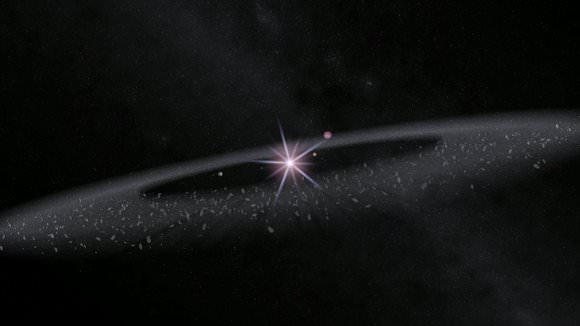
LEAD PHOTO CAPTION: Artist’s depiction of the asteroid belt between Mars and Jupiter. Credit: David Minton and Renu Malhotra

Source: Nature

JPL Offers a Peek Inside MSL Clean Room

Engineers and scientists for MSL work in JPL's clean room. Credit: JPL

[/caption]

The Jet Propulsion Laboratory offered a web audience the chance to watch activities in the clean room on February 24 for the Mars Science Laboratory, the car-sized rover set to head to Mars in 2011. A two-hour live video feed on UStream included questions and answers with MSL engineer David Gruel and Ashwin Vasavada, MSL Deputy Project Scientist. The best part, however, was watching a check-out of the MSL “Skycrane,” the brand new landing system, and seeing the different parts of the rover and spacecraft. The Skycrane will lower the rover down to the surface with tethers as it hovers over the planet’s surface. On Tuesday, the Skycrane was hoisted high above the rover as the tethers were deployed. “We’ve just completed an environmental testing campaign for MSL,” said Gruel, MSL manager of assembly, testing and launch operations, where the components are subjected to the various conditions of heat, cold and vibrations of launch and space travel. “Now we’re separating the stages, making sure umbilical works as we expect, and making sure the system will deploy properly.”

Screenshot of JPL's MSL clean room activities on UStream.

During the clean room tests on Tuesday, the Skycrane tethers were only deployed two-thirds of the way. During the actual landing on Mars, the tethers will roll out to about 7.5 meters (24 feet). Only three tethers will hold the big rover as it descends to the surface.

Gruel said after launch, landing is by far and away the biggest challenge of the mission. “We’re heading ballistically towards Mars, and when we hit the atmosphere we’ll have to burn off energy that energy and speed, get the parachutes to work, and then have the Skycrane do its job.”

Visible on the Skycrane are the thrusters that will keep it in the air as the rover descends.

Screen shot of the folded up MSL rover.

MSL is a huge rover. Gruel said it is the same size as a Mini Cooper car. Visible in this image is one of the rover’s wheels, and the Pathfinder rover that went to Mars in 1997 is about the same size as just of one of MSL’s wheels. This image below shows the comparisons between the different Mars rovers.
Rover comparison.  Credit: JPL
Rover comparison. Credit: JPL

Screen shot of MSL's heat sheild.

Here’s a shot of the heatshield and backshell for MSL, which are far bigger than the ones used for the Apollo capsules. The heatsheild pictured is a non-flight heat shield. The insulative material isn’t included on this version, which makes it easier to handle in the clean room.

Then after landing, the challenge will be to come up with interesting science, said Gruel, “just like we’re doing with Spirit and Opportunity, and try to continue to operate as long as possible.”

Screen shot of vertical decsent radar.

This is the Terminal Descent Radar and Imager, which will take images as the lander comes down through atmosphere. There are several other cameras on the rover, and Gruel said the cameras will have the ability to create “movies” by taking several pictures quickly in succession. “They won’t be like the latest action packed thriller, but we should be able to see what is like to traverse across surface of Mars,” said Gruel.

Vasavada answered questions in depth about the different scientific instruments on MSL.

“Not only will MSL be a robotic field geologist,” he said, “but it will have a mobile geochemistry laboratory, have the ability to drive up to a rock and sample it, take a scoop of soil, and take to instruments inside the rover to see what minerals are there, the chemistry and if there are any organics. MSL will have a Swiss Army Knife bag of tricks, giving us a virtual presence on Mars.”

“One instrument, Chem Cam has a high powered laser connected to a telescope,” Vasavada continued, “the laser points towards a target, and creates a spark. The instrument observes the spark and all the colors in the spectrum that comes back to see the chemical composition of rocks and soil.” This instrument doesn’t have to be up close to an object to study it, which will increase the areas of study. “There will be some places the rover can’t get to, like up a canyon wall, or down in crater, but this instrument can reach those areas,” Vasavada said.

Screen shot of the MSL clean room from UStream video.

A weather station will be on the rover, supplied by scientists from Spain, studying wind, temperature, pressure, and relative humidity.

“We will attack Mars in a bunch of ways, to lend some more definitive answers to if there was liquid water, how long did it flow, how did the mineralogy work in Mars past, was it ever habitable, what were things like in the past and what are they like in the present, or was there any organics, and can we find evidence of past life. It’s a broad mission and everybody is really thrilled.”

A recording of the event is available on JPL’s USTream channel.

Penetrating New View Into The Helix Nebula

The blue-green glow in the centre of the Helix comes from oxygen atoms shining under effects of the intense ultraviolet radiation of the 120 000 degree Celsius central star and the hot gas. Further out from the star and beyond the ring of knots, the red colour from hydrogen and nitrogen is more prominent. Cerdit: Max-Planck Society/ESO telescope at the La Silla observatory in Chile


[/caption]

ESO’s La Silla Observatory has snapped a new image of the famous Helix planetary nebula, revealing a rich — and rarely photographed — background of distant galaxies.

The Helix Nebula, NGC 7293, about 700 light-years away in the constellation of Aquarius, is a Sun-like star in its final explosion before retirement as a white dwarf.

Shells of gas are blown off from the surface of such stars, often in intricate and beautiful patterns, and shine under the harsh ultraviolet radiation from the faint, hot central star. The main ring of the Helix Nebula is about two light-years across, or half the distance between the Sun and its nearest stellar neighbour.

Despite being photographically spectacular, the Helix is hard to see visually as its light is thinly spread over a large area of sky. The history of its discovery is rather obscure. It first appears in a list of new objects compiled by the German astronomer Karl Ludwig Harding in 1824. The name Helix comes from the rough corkscrew shape seen in the earlier photographs.

Although the Helix looks very much like a doughnut, studies have shown that it possibly consists of at least two separate discs with outer rings and filaments. The brighter inner disc seems to be expanding at about 100,000 km/h (about 62,000 miles/h) and to have taken about 12,000 years to form.

Because the Helix is relatively close — it covers an area of the sky about a quarter of the full Moon — it can be studied in much greater detail than most other planetary nebulae and has been found to have an unexpected and complex structure. All around the inside of the ring are small blobs, known as “cometary knots,” with faint tails extending away from the central star. Although they look tiny, each knot is about as large as our Solar System. These knots have been extensively studied, both with the ESO Very Large Telescope and with the NASA/ESA Hubble Space Telescope, but remain only partially understood. A careful look at the central part of this object reveals not only the knots, but also many remote galaxies seen right through the thinly spread glowing gas. Some of these seem to be gathered in separate galaxy groups scattered over various parts of the image.

For a sweet treat, throw a little of this into your coffee: Helix Nebula pan and zoom (video)

LEAD IMAGE CAPTION: The blue-green glow in the center of the Helix comes from oxygen atoms shining under effects of the intense ultraviolet radiation of the 120,000 degree Celsius (about 216,000 degrees F) central star and the hot gas. Further out from the star and beyond the ring of knots, the red color from hydrogen and nitrogen is more prominent. Credit: Max-Planck Society/ESO telescope at the La Silla observatory in Chile

Source: ESO

Venus is Glowing in the Dark!

A false-colour composite image of Venus’s atmosphere was obtained by the Visible and Infrared Thermal Imaging Spectrometer (VIRTIS) on board ESA’s Venus Express, from a limb (or profile) perspective.

[/caption]
Venus is glowing in infrared! At least at night, anyway. The Venus Express spacecraft has observed an eerie glow in the night-time atmosphere of Venus. This infrared glow comes from nitric oxide and is showing scientists that the atmosphere of Earth’s nearest neighbor is a temperamental place of high winds and turbulence. Since this glow is infrared, we can’t see it with our eyes but lucky for us, the ESA’s spacecraft is equipped with the Visible and Infrared Thermal Imaging Spectrometer (VIRTIS) instrument, which can see these wavelengths. A glow like this has never been detected in the atmospheres of Earth or Mars, even though nitric oxide molecules are present. So just why is Venus glowing, and what is this glow telling us?

“The nightglow can give us a lot of information,” says Antonio García Muñoz, who was at the Australian National University when the research was carried out; he is now located at the Instituto de Astrofísica de Canarias, Tenerife, Spain. “It can provide details about the temperature, wind direction, composition and chemistry of an atmosphere.”

VIRTIS has made two clear-cut detections of the so-called nightglow for nitric oxide at Venus. This is the first time such infrared detections have been made for any planet and provide a new insight into Venus’s atmosphere

The nightglow is ultimately caused by the Sun’s ultraviolet light, which streams into a planet’s atmosphere and breaks the molecules up into atoms and other simpler molecules. The free atoms may recombine again and, in specific cases, the resulting molecule is endowed with some extra energy that is subsequently lost in the form of light. On the day-side of the planet, any atoms that do find their way back together are outshone by the sunlight falling into the atmosphere.

But on the night-side, where atoms are transported by a vigorous diurnal circulation, the glow can be seen with appropriate instruments, such as VIRTIS.

It also highlights a new mystery. “These results show that there could be at least twice as much hydrogen in the upper atmosphere of Venus than we thought,” says Delva. The detected hydrogen ions could exist in atmospheric regions high above the surface of the planet; but the source of these regions is unknown.

Artist's impression shows Venus Express focussing on studying the peculiar atmosphere of Venus,

The nightglow on Venus has been seen at infrared wavelengths before, betraying oxygen molecules and the hydroxyl radical, but this is the first detection of nitric oxide at those wavelengths. It offers data about the atmosphere of Venus that lies above the cloud tops at around 70 km. The oxygen and hydroxyl emissions come from 90-100 km, whereas the nitric oxide comes from 110-120 km altitude.

Yet, even VIRTIS cannot see the nitric oxide nightglow all the time because it is often just too faint. “Luckily for us, Venus has a temperamental atmosphere,” says García Muñoz, “Packets of oxygen and nitrogen atoms are blown around.” Sometimes these become dense enough to boost the brightness of the nightglow, making it visible to VIRTIS.

Venus Express can observe the three nightglow emissions simultaneously, and this gives rise to a mystery. The nightglows from the different molecules do not necessarily happen together. “Perhaps when we have more observations, we will understand the correlation between them,” says García Muñoz.

In order to do that, the VIRTIS team plans to continue monitoring the planet, building up a database of this fascinating phenomenon.

Source: ESA

Introducing NASA’s Virtual Universe “Astronaut: Moon, Mars and Beyond”

A scene from Astronaut: Moon, Mars and Beyond

[/caption]

If, like me, you are a fan of first-person computer games and space exploration, you may be more than a little excited to hear about this news. A group of companies are currently working with NASA to create a Massively Multiplayer Online Role Playing Game (MMORPG) based around the space agency’s endeavours. They will use a game engine more familiar driving first-person shooters than online roleplay adventures; the tried and tested Unreal Engine 3 technology.

The Internet has a growing number of vast space-based MMORPGs, but NASA is hoping to use one of the most advanced gaming engines to develop an engrossing first-person online adventure, where players can choose their own mission to explore space, interact with other players and build settlements on other worlds. All this will take place in a scientifically accurate vision of a near-future Universe in 2035…

ammb_feb20Players will pick a profession like a roboticist, space geologist, astrobiologist or mechanical engineer and work together as a team as they explore space and complete missions, establishing bases and outposts and traveling to the farthest reaches of the solar system,” explained Jerry Heneghan, founder and CEO of Virtual Heroes, one of the companies involved with developing the NASA MMORPG Astronaut: Moon, Mars and Beyond. “The game will offer both individual challenges and team-based objectives to encourage players to use real-life applications of science, math and engineering to unlock new in-game vehicles, spacesuits, robotics and mining apparatus that will propel them further into space.”

MMORPGs are increasingly popular gaming platforms, where players can participate in seemingly boundless virtual universes. Popular examples of MMORPGs are World of Warcraft (which dominates with a monthly subscriber base of 11.5 million people), Second Life, EverQuest and space-based rollplayer games such as EVE Online and Star Trek Online.

Ever wanted to take a spin on the Moon?

Now NASA is hoping to create a very popular online gaming/educational experience that will not only entertain, but get young people interested in a career in science and engineering. What’s more, it is hoped the game will incorporate the Unreal Engine 3 Editor so that players can design their own content, from spaceships and stations to mission profiles. The developers will also include scenarios, such as the threat of near-Earth asteroid impacts and other reality-based events as the online community develops. This will provide a problem-solving/adventure element, while keeping the science grounded in science fact.

See more screenshots from the game »

There are concerns that a NASA space reality platform may not be very popular, as other in-space universes offer space fantasy, with epic spaceship battles and alien encounters. Also, the technical detail in carrying out “mundane” astronaut tasks may be a turn-off; virtual universes depend on exploration rather than educational tasks. Hopefully NASA and MMORPG developers will strike a healthy balance between education and entertainment.

Exploring Mars with NASAs MMORPG

However, I’m very excited to see Astronaut appear online sometime next year.

Sources: Big Download, Softpedia

Satellite Images Show Devastation from Fire and Floods in Australia

Bushfires in Australis on Feb. 23. NASA image courtesy the MODIS Rapid Response Team.

[/caption]
Australia has been battling natural disasters on opposite ends of the spectrum: fire and water. Deadly bushfires and massive flooding have plagued different parts of the country. Bushfires in Victoria, Australia, have flared up again during this last week of February, 2009. This region has been battling deadly fires for over a month, only brief periods of respite. According to news reports from the Australian Broadcasting Corporation on February 23, new emergency evacuation warnings over the weekend had forced hundreds of residents from communities across the state into shelters. This image from the Moderate Resolution Imaging Spectroradiometer (MODIS) on NASA’s Aqua satellite shows the fires on February 23 in natural color. Red outlines show the locations where MODIS detected active fires. Below, see an image in different wavelengths highlighting the burned areas, with more images showing the widespread flooding in western Australia.

Bushfires around Marysville, Victoria. NASA image created by Jesse Allen, using data provided courtesy of NASA/GSFC/METI/ERSDAC/JAROS, and U.S./Japan ASTER Science Team

The bushfire pictures use a combination of visible and near-infrared wavelengths of light to make the smoke more transparent and to highlight burned areas. Unburned vegetation is red, while burned areas are charcoal. Other areas where bushfires were threatening communities were Daylesford, Warburton, and Belgrave.
Floods in Australia.  NASA images courtesy the MODIS Rapid Response Team at NASA GSFC
Floods in Australia. NASA images courtesy the MODIS Rapid Response Team at NASA GSFC

While southeastern Australia battles deadly fires and high heat, much of the rest of Australia is flooded. Wet-season rains brought severe flooding to Western Australia, Queensland, and New South Wales. The most widespread flooding was in Queensland, where more than one million square kilometers flooded, reported the AFP wire service. The image above shows flooding along the Flinders River system in northern Queensland. Below is an image of the area taken on December 16, 2008 before the rain started. On the earlier image, the Flinders River system is discernible only by the lines of green vegetation that follow their courses through the dry land. But two months later, the flooded river system, with its myriad of channels, covered more than 100 kilometers.

Flinders Rivers System in Dec. 2008. Credit: NASA

Below, floodwaters surround the town of Normantown Australia—population 1,150—in this satellite image. Water had been encroaching on the town, located along the Norman River in the far northwest of Australia’s Queensland territory, since the start of 2009. The curves of the normal river channel are visible under the water to the right of the town. According to the Australian Broadcasting Corporation nearly 120 centimeters (50 inches) of rain had fallen in the region since the start of the new year.

Floodwaters surround Normantown, Australia.  Formosat image © 2009 Dr. Cheng-Chien Liu, National Cheng-Kung University, and Dr. An-Ming Wu, National Space Organization, Taiwan
Floodwaters surround Normantown, Australia. Formosat image © 2009 Dr. Cheng-Chien Liu, National Cheng-Kung University, and Dr. An-Ming Wu, National Space Organization, Taiwan
Much of the area’s road system was underwater, leaving Nomanton and the nearby town of Kurumba accessible only by air. Only the bridge over the Norman River (above and to the right of town) remained above water along the road from Norman to Kurumba. The Remote Sensing Instrument (RSI) aboard Taiwan’s Formosat-2 satellite acquired this natural-color image of the flooding on February 19, 2009.

Source: NASA Earth Observatory

How To See Comet Lulin

Comet Lulin on Feb. 22, taken by John Nassr, Baguio, Philippines, via Spaceweather.com

[/caption]
We’ve received a few emails asking for more information about how to attempt to observe Comet Lulin. And Sky and Telescope has put out a great primer for seeing this green smudgeball in North America. Right now is the optimum time to try and see it. Sky and Telescope editor-in-chief Robert Naeye says Lulin should be at its best from Feb. 23 through the 28th. “In a very dark, unpolluted, natural night sky — such as few people see any more — the comet is dimly visible to the unaided eye,” writes Naeye. “Even in a more light-polluted suburban sky, however, a good pair of binoculars will do the trick. But you have to know exactly where to look.”

Start looking for Lulin after 9:00 pm (your local time) but the view will be better after 10:00 pm.

Here’s a star chart from SkyandTelescope.com/CometLulin.

And here’s the info from S&T:

Lulin's path.  Credit:  SkyandTelescope.com
Lulin's path. Credit: SkyandTelescope.com

“It shows the starry view high in the east-southeast in mid-evening. You should have no trouble spotting the planet Saturn and the star Regulus in the constellation Leo. They’re the two brightest things in the area.

“Using those as your guide, aim at the point on the comet’s path that’s labeled with the current date. The comet’s position is indicated for the evening hours on each date for the time zones of the Americas. The orientation of the scene with respect to the horizon is drawn for North America.

“You’re looking for a very dim, biggish, slightly oval cotton-puff floating among the tiny pinpoint stars. Look carefully, and you may detect the spike of the comet’s “anti-tail” pointing toward the lower left. The comet’s regular tail is actually dimmer, and it points in almost the opposite direction. In binoculars the whole thing looks more gray than greenish; to see color you need more light. In a large amateur telescope, the color and the comet’s structure are a lot more clearly visible.

“I saw it out my bathroom window with 10-by-50 binoculars,” says Alan MacRobert, a senior editor of Sky & Telescope. “It’s pretty plain if you get aimed at exactly the right spot.”

For more about Comet Lulin, its discovery, the reason for its two tails, check out Universe Today’s previous articles: one by Tammy about Lulin’s twisty tails, and one by Nancy, “Comet Lulin is on the Way!”.

Check out Spaceweather.com’s posting of pictures of Lulin from astronomers from all over the world.

OCO Press Conference Notes: Fairing Did Not Separate

NASA’s Orbiting Carbon Observatory and its Taurus booster lift off from Vandenberg Air Force Base. A contingency was declared a few minutes later. Image credit: NASA TV

[/caption]
As Ian reported earlier this morning, NASA’s Orbiting Carbon Observatory satellite failed to reach orbit after its 4:55 a.m. EST liftoff Tuesday from California’s Vandenberg Air Force Base. At a press conference, officials said preliminary indications are that the fairing on the Taurus XL launch vehicle failed to separate about three minutes into the flight. The fairing, or nosecone, is a clamshell structure that covers the satellite as it travels through the atmosphere. “The fairing has considerable weight, and when it separates off you get a jump in acceleration,” said John Brunschwyler from Orbital Sciences Corporation, the rocket’s manufacturer. “We did not have that jump of acceleration and as a direct result of carrying that extra weight, we could not make orbit. And so, the initial indications are that the vehicle did not have enough Delta V to reach orbit, and landed just short of Antarctica in the ocean.”

Brunschwyler added, “Our whole team, at a very personal level, is disappointed in the events of this morning….Certainly for the science community it’s a huge disappointment. It’s taken so long to get here.”

Watch the launch video below:


A mishap investigation board has convened, and will endeavor to determine the cause of the failure. “We need to come to a most probably cause for this failure,” said NASA’s Expendable Launch Vehicle launch director Chuck Dovale. “Our goal will be to find a root cause, and we won’t fly the Glory mission until we have that data known to us.” Glory is the next Earth science mission, set to launch in June of 2009, and will collect data on aerosols and black carbon in the Earth’s atmosphere and climate system.

Orbiting Carbon Observatory (OCO) was intended to help target the key locations on our planet’s surface where CO2 is being emitted and absorbed. The project has been in the works for eight years.

NASA’s Expendable Launch Vehicle launch director Chuck Dovale said the countdown proceeded normally. “Stage zero ignition occurred at 1:55:31. All indications were nominal. The motor burned for 1 minute 24 seconds, then the first stage ignited. That proceeded normally, and burned 2 minutes and 43 seconds. Stage 1 separation occured five seconds later, and allowed second stage to ignite. At that point we expected to see fairing separate. We got indications that the sequence was sent, but shortly after that we started getting indication that the fairing did not separate.”

Brunschwyler explained how the fairing separates and what indications the team received about the anomaly.

“The fairing separates by a sequence of electrical pulses,” he said, “and the clamshell fairing is a two piece device that separates with four pulses from an electrical box, two primary pulses and two redundant pulses, which separate the longitudinal fairing rails, or the vertical part of the fairing. About 80 milliseconds later, the base joint is severed in a similar fashion. We have confirmation that correct sequence was sent. We had good power, and also healthy indications from electronics box that sent the signal. Three minutes into the flight, we had observed various pieces of telemetry, which we tried to correlate. When the fairing comes off, we have wires that break to give indication it has separated, but those indications did not change.”

There are also temperature sensors, but Brunschywler said the most significant data was no jump in acceleration from less weight if the fairing had properly separated.

“We constantly take altitude and velocity measurements. The vehicle didn’t fly over any land and all indications are it landed just short of Antarctica,” he said. “We’ll know a more accurate location tomorrow.” Brunschyler said since all the stages had burned, there shouldn’t be much, if any, hazardous hydrazine fuel left on board the rocket.

“OCO was an important mission to measure critical elements of the carbon cycle,” said Michael Freilich, director of NASA’s Earth Science Division. “Over the next several days, weeks and months we will carefully evaluate how to move forward and advance science, given our evaluations of the assets that are on orbit now, assets from our international partners and the existence of flight spares, in order to thoughtfully put together flight program, to as rapidly as possible to pick up where OCO left off and advance Earth systems science.”

Orbiting Carbon Observatory Launch Failure

The OCO launches on board a Taurus booster from Vandenberg Air Force Base (NASA TV)

[/caption]This morning (Tuesday), shortly after 2am PST (10am GMT), the launch of Orbiting Carbon Observatory (OCO) mission resulted in failure. According to reports from NASA, a “launch contingency” was declared shortly after the Taurus rocket upper stage finished firing T+12 minutes, 30 seconds into the flight. The rocket nose cone fairing failed to separate as expected, therefore the satellite could not be released. Further news is pending, but it appears that the failed Taurus XL upper stage plus OCO satellite remains in orbit. The OCO mission is declared lost…

The Orbiting Carbon Observatory (OCO) was launched by a Taurus XL rocket at 1:55:30 am PST from California’s Vandenberg Air Force Base, set for a polar orbit at an altitude of 438 miles (704 km) to begin an important and detailed study into the carbon dioxide content of our atmosphere. The satellite was designed to provide NASA with an insight to the sources of human and natural carbon emissions, as well as pin-pointing our planet’s carbon “sinks”. Unfortunately, the opportunity to gather valuable data with this about the global impact of carbon emissions with the advanced OCO mission has been lost.

At 2:16 am (PST), NASA launch commentator George Diller confirmed that a launch contingency had been implemented:

This is Taurus launch control. It appears that we have had a launch contingency. We don’t have the exact nature of the loss of mission, but NASA launch director Chuck Dovale has directed that the launch contingency plan be implemented. We will try to bring you any additional information as soon as we have it.” — Chuck Dovale (courtesy of Spaceflight Now)

The Orbiting Carbon Observatory (NASA)
A few minutes later, Diller went into some more detail about the failure to get the OCO into orbit. The casing (or fairing) failed to separated successfully, trapping the satellite inside the Taurus XL upper stage. NASA scientists continued to ascertain what condition the spacecraft was in, but any hopes of a successful outcome to the contingency were dashed when Diller said, “Right now, we do know that we have not had a successful launch tonight and will not be able to have a successful OCO mission.”

A terribly sad night for NASA and a terrible set-back to efforts to understand the full impact of human activity on the Earth’s atmosphere.

Special thanks to @govertschilling and @Zurack for their help with notifying me of the situation and forwarding me links via Twitter.

Source: Spaceflight Now

Evidence of Supernovae Found in Ice Core Sample

Ice core sample. Credit: University of Alaska Geophysical Institute

[/caption]
Chinese and Arabic astronomers left historical documentation of a supernova that occurred in our own galaxy in the year 1006 (SN 1006), and another one 48 years later (SN 1054). Some of the writings about SN 1006 say there was a visual explosion half the size of the moon, and it shone so brightly that objects on the ground could be seen at night. We know these writings weren’t just fantastical imaginations because we now have the “leftovers” of these supernovae; Supernova Remnant 1006 and the Crab Nebula. But now there is more evidence. A team of Japanese scientists has found the first evidence of supernovae in an ice core sample.

The gamma rays from nearby supernova ought to have a significant impact on our atmosphere, in particular by producing an excess of nitrogen oxide. Ice cores are known to be rich in information regarding past climates, and scientists thought core samples could record astronomical phenomena, as well. In 1979, a group of researchers suggested the idea when they found nitrate ion (NO3-) concentration spikes in an ice core sample from the South Pole ice core that might correlate with the known historical supernovae Tycho (AD 1572), Kepler (AD 1604), and SN 1181 (AD 1181). Their findings, however, were not supported by subsequent examinations by other researchers using different ice cores, and the results remained controversial and confusing.

But in 2001, a team of scientists from Japan drilled a 122 meter ice core sample at the Dome Fuji station in Antarctica, an inland site in Antarctica. At a depth of about 50 metres, corresponding to the 11th century, they found three nitrogen oxide spikes, two of which were 48 years apart and easily identifiable as belonging to SN 1006 and SN 1054. The team speculates that the mysterious third spike may have been caused by another supernova, visible only from the southern hemisphere.

Graph showing NO3 concentrations in an ice core sample.  Credit: Yuko Motizuki, et al.
Graph showing NO3 concentrations in an ice core sample. Credit: Yuko Motizuki, et al.

Additionally, the team saw a 10 year variation in the background levels of nitrogen oxide, almost certainly caused by the 11-year solar cycle, an effect that has been seen before in ice cores. This is one of the first times that a distinct 11-year solar cycle has been observed for a period before the landmark studies of sunspots by Galileo Galilei with his telescope.

They also saw a number of sulphate spikes from known volcanic eruptions such as Taupo, New Zealand, in 180 AD and El Chichon, Mexico, in 1260 AD.

The team said that by further extending their analysis to deeper and shallower ice cores would give fruitful information on galactic supernova and solar activity histories, and they are now in the process of making ionic measurements covering the past 2,000 years, including analyses of all known historical supernovae and solar periods.

Sources: arXiv, arXiv Blog