US Spy Satellite Could Crash To Earth In February

mir_reentry.thumbnail.jpg

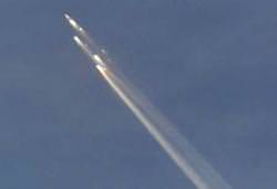
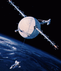
After all the excitement surrounding the possibility of asteroid 2007 WD5 hitting Mars and the concern of Near Earth Asteroid 2007 TU24 dropping to Earth, we now have something new (and manmade) to worry about. A US spy satellite has lost power and its orbit has begun to degrade. Officials are sketchy about the details, but the large satellite could survive the burn of re-entry and crash into the surface… but we don’t know where. The satellite might contain dangerous materials… but we can’t be sure. Either way, the dead spy satellite is expected to drop to Earth late February or early March.

This event could prove embarrassing for the US government, as there is little idea where the site of impact will be, sensitive US secrets could be exposed about the technology behind the orbital capabilities of the superpower nation. Officials have declined to comment whether the satellite could be shot down by missile, but this will surely remain an option.

Numerous satellites over the years have come out of orbit and fallen harmlessly. We are looking at potential options to mitigate any possible damage this satellite may cause.” – Spokesman for the National Security Council, Gordon Johndroe

The problem doesn’t stop with the possibility of fatal damage should the satellite fall in the wrong place. An anonymous official has added there may be the possibility the satellite could be carrying hazardous materials. During atmospheric burn-up, this unknown material could be spread over thousands of miles of atmosphere.

This usually isn’t a concern when satellites and other debris are brought to Earth in controlled re-entries. Large defunct satellites can usually have their orbital trajectories finely tuned so they fall safely though the atmosphere and crash into “satellite graveyards” in deep ocean trenches (i.e. the Mir space station was guided out of orbit in 2001 and sunk in the Pacific 6000 km off the Australian coast).

Hopefully a solution to this tricky problem can be found quickly, but it is hoped that most of the satellite will disintegrate during re-entry and any leftovers drop into the ocean… but it would be nice to know if there is a risk of impact anywhere other than the oceans. 

Source: MSNBC.com

Gigantic Delta 4-Heavy Blasts Off

2007-1113delta.thumbnail.jpg

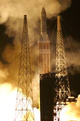
On Saturday night, the largest US rocket blasted off, carrying a 2.3 tonne Defense Support Program satellite into orbit. This was the second time a Delta IV-Heavy rocket has ever lifted off. With three core boosters strapped together, it’s like three rockets launched at once.

The launch was made even more spectacular because it was held at night. Launched at 0150 GMT Sunday (20:50 EST on Saturday), the 70-metre tall (230 feet) rocket has three separate engines, each of which can generate more than 2,900 kiloNewtons (650,000 pounds) of force. They guzzle a tonne of propellant every second.

On board the rocket was the Defense Support Program 23 spacecraft; the last in a program of Earth observation satellites designed to spot enemy missile launches and nuclear explosions.

Although the Delta IV-Heavy can carry 13 tonnes into a geostationary transfer orbit, it’s not a commercial provider – just military and government satellites. Europe’s Ariane 5 ECA is the most powerful commercial provider, able to blast off with 10 tonnes.

The Delta IV-Heavy first flew back in 2004. Boeing had originally proposed it as the vehicle that could carry the next wave of space exploration vehicles into orbit. In the end, though, NASA decided to go with the new Ares vehicle for its post-shuttle program.

During that previous test flight, the Heavy encountered a problem with its fuel lines, which caused the engines to go out early, and left the rocket lower than its intended orbit.

Just to put the capabilities of the rocket in perspective, though, the Saturn 5 could put out three times the thrust.

Original Source: United Launch Alliance

The Tiger Stripes and Geysers are Linked on Enceladus

2007-1010enceladus.thumbnail.jpg

Saturn’s moon Enceladus is one of the most peculiar objects in the Solar System. We now know there are geysers of water ice blasting from its southern pole; a place marked with long gashes that researchers have dubbed “tiger stripes”. Ever since the geysers were first discovered, scientists have been puzzling out their source. Now they understand how the geysers and tiger stripes are linked.

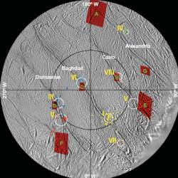
New research by the Cassini imaging team, CICLOPS, shows that the jets of Enceladus emanate from its southern pole, pouring out of four of the tiger stripes. The researchers have named them Alexandria, Cairo, Baghdad and Damascus. Of the four, Baghdad and Damascus are the most active and Alexandria is the least.

By taking Cassini’s two-year observations of the jets that spray from the surface, and combining this with thermal imaging of the stripes, the team was able to determine that the jets were spraying vertically out of the stripes, which are cracks on the surface of Enceladus.

The water sprays through the cracks because the gravity of Saturn pulls and pushes on Enceladus, and this motion – called a tidal force – heats up the frozen water underneath the surface. Much like geysers on Earth, the water is heated and expands below the surface, and follows the easiest path it can find to escape; this path happens to be right through the tiger stripes on the surface.

The researchers noted that when the tidal pull of Saturn was compressing this region of Enceladus, the geysers were not very active, if at all. But when the tides pulled and created tension, they began to erupt. Also, the hotter the region was, the stronger and larger the jet plume tended to be.

There may be other areas of Enceladus capable of producing jets, and now that the origins of the geysers are confirmed, more thermal and digital imaging of the surface could reveal other geysers in the future.

The researcher paper, entitled “Association of the jets of Enceladus with the warmest regions on its south-polar fractures” was published in the October 11th edition of the journal Nature.

Source: Nature

Ariane 5 Lofts Two Satellites

2007-1008satellites.thumbnail.jpg

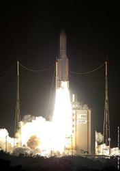
An Ariane 5 rocket blasted off its launch pad on Friday, October 5, carrying two telecommunications satellites into orbit. The rocket lifted off at 22:02 UTC, and the satellites were put into their geostationary transfer orbits 30 minutes later.

The two satellites were the Intelsat 11, which will provide broadcast and data communications services to Latin America, and the Optus D2, which will serve Australia and New Zealand. The payload mass for the two satellites was 4832 kg.

This was the fourth launch of the year for the Ariane rocket.

Original Source: ESA News Release

Google Maps are Going to Get Better After Today’s Satellite Launch

2007-0918delta.thumbnail.jpg

Come on, admit it, you’ve spent hours gazing at Google Maps and Google Earth, finding your house, school, and seeing what various building and features look like from space. And after today’s launch of DigitalGlobe’s WorldView-1, the resolution is going to get even better. In fact, it’s going to have the highest resolution permitted by the US government to be installed on a commercial satellite – half a metre (20 inches).

How much better is this? Currently, the highest resolution commercial satellite images are taken by DigitalGlobe’s Quickbird. It was originally slated to have a 1-metre resolution, but engineers were able to get better images by adjusting its orbit so that it flies a little closer to the ground. It’s been able acquire images at 61 cm (about 2 feet). So, WorldView-1 will be able beat this resolution; the rumours say it’s even better, but it’s not permitted to take higher resolution images because of government regulations.

But more importantly, WorldView-1 can take a mountain of images, collecting up to 500,000 square kilometres (200,000 square miles) of imagery every day – 4.5 times the rate of any previous system. This means it’ll be able to quickly fill in regions missed by other satellites.

The satellite will have many customers, including Google and the US Government, but it’ll also be used by any number of urban planners, real estate developers and environmental monitors.

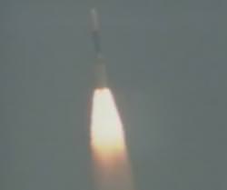
A Delta 2 rocket carrying WorldView-1 lifted off today at 11:35 PDT from Vandenberg Air Force Base in California. The rocket launched right on time, and there were no reported problems at the time that I wrote this up (it’s about 81 km altitude and climbing quickly).

This is just the first of two missions. WorldView-2 will be launched in 2008.

Original Source: Ball Aerospace

Ariane 5 Lofts Two Satellites

toucan.thumbnail.jpg

Two satellites were carried into space Tuesday evening, atop a massive Ariane 5 rocket, which blasted off from Europe’s Spaceport in French Guiana. The rocket lifted off at 23:44 UTC, and the satellites were put into their geosynchronous transfer orbits 30 minutes later.

On board the Ariane 5 booster were the Spaceway 3 and BSAT-3a satellites. Spaceway 3 was built by Boeing, and will serve as a broadband data communications satellite to customers in North America. BSAT-3a will provide television services to Japan.

Telemetry after the launch confirmed that the two satellites were accurately placed into their transfer orbits, and ground controllers received communications from both satellites, confirming that they’re healthy and operational.

This was the 3rd of 6 planned launches for 2007, and the 19th consecutive successful launch for the Ariane 5 rocket.

Original Source:ESA News Release

The Whole Sky Seen in Infrared

2007-0711allsky.thumbnail.jpg

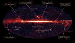
Okay, shift your eyes into the infrared, and then look up into the night sky. What? You can’t see in infrared? Ah well, you’ll have to just enjoy this photograph of the entire sky, seen by the Japanese AKARI probe.

Launched back in February 2006, AKARI has been working away to map the entire sky in various wavelengths of infrared light. Just in the last year, it completed these all-sky observations in six different wavelength bands, and has now imaged 90 of the entire sky. It has also performed detailed observations on about 3,500 specific targets.

The picture attached to this story is the infrared sky at nine micrometres. The bright stripe extending across the middle of the image is disc of our own Milky Way galaxy. The bright regions in the disc are sites of newly born stars.

This sky map will give astronomers a much better understanding of the formation and evolution of galaxies, stars, and planetary systems.

Original Source: ESA News Release

Gamma Ray Observatory Will Launch in December

Cleanroon.thumbnail.jpg

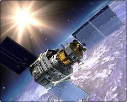
NASA has Hubble, Spitzer and Chandra to cover visible, ultraviolet, infrared and X-ray portions of the electromagnetic spectrum. The next wavelength to get its own space telescope is gamma rays. When NASA’s Gamma ray Large Area Telescope (GLAST) launches in December, there will be a powerful new observatory in space, capturing more gamma rays than any space observatory to date.

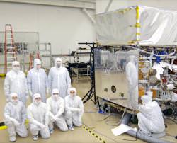
GLAST is currently living in a “clean room” at General Dynamics in Arizon. This is a special enclosed environment with very low levels of contaminants or environmental pollutants. It will remain in this clean room until it’s transfered to the launch pad later this year.

When GLAST finally makes it into orbit, it’ll be the most powerful and sensitive gamma ray observatory ever launched, gathering photons that can contain hundreds of billions of times more energy than we perceive with our eyes. These gamma rays are generated in the most extreme events in the Universe, such as the disks of gas swirling around black holes.

Unlike the other space-based observatories, GLAST doesn’t have a mirror to focus the photons; gamma rays don’t work that way. Instead, it’s got a large detector capable of detecting any gamma rays in 20% of the sky. It’ll orbit the Earth every 95 minutes, and image most of the sky 16 times a day. It can also be directed to stare in a specific direction to image an event, such as the afterglow from a gamma ray burst.

Original Source: NASA News Release

Servicing Spacecraft Makes an Automated Fly Around

2007-0625orbexpress.thumbnail.jpg

Launching a spacecraft is a big investment. If anything goes wrong, you’ve got hundreds of millions of dollars of junk in space. And even if the spacecraft is working perfectly, but just runs out of fuel, its communications equipment can’t be directed at the Earth properly.

Boeing took a step forward to solving that problem last week with a test of its Orbital Express system, a spacecraft that will validate on-orbit servicing. During a 5-hour test on June 16, the Autonomous Space Transport Robotic Operations (ASTRO) servicing spacecraft separated from another spacecraft, made an automated fly around, and then re-attached.

The important thing here is that the entire maneuver was done autonomously. It simulated the approach that a servicing spacecraft would take when docking with a spacecraft, making sure to avoid its antennas and cameras.

During its next test, ASTRO will depart and fly to a range of 4 km (2.5 miles) before approaching and performing a free-fly capture with its robotic arm.

Original Source: Boeing

NASA Working on a Folding Tether System

origami.thumbnail.gif

Science@NASA has a cool article about how US and Japanese researchers are working on a folding tether system that could help keep satellites in their proper orbits, and return spent rocket stages to Earth.

Space tethers were first demonstrated on the Gemini 11 and 12 missions, showing how spacecraft could be connected by a cable. Possible applications include artificial gravity, spacecraft stabilization, and even raising a spacecraft into higher and higher orbits through a series of tether slingshots.

The new design is nicknamed Fortissimo, and provides a new method for unfolding a tether system. Instead of unraveling a cable from a spool, this tether would look like a thin strip of aluminum foil. It would be folded up using a clever origami technique so that it unravels quickly; similar to a firefighter’s hose.

Under this design, a 1km tether could deploy in just a few minutes.

Original Source: Science@NASA