Latest News on Apophis: 13 -year-old Boy Corrects NASA’s Estimates of Earth Impact — Not! (Update)

Annimation of Apophis.  Image Credit:  Osservatorio Astronomico Sormano
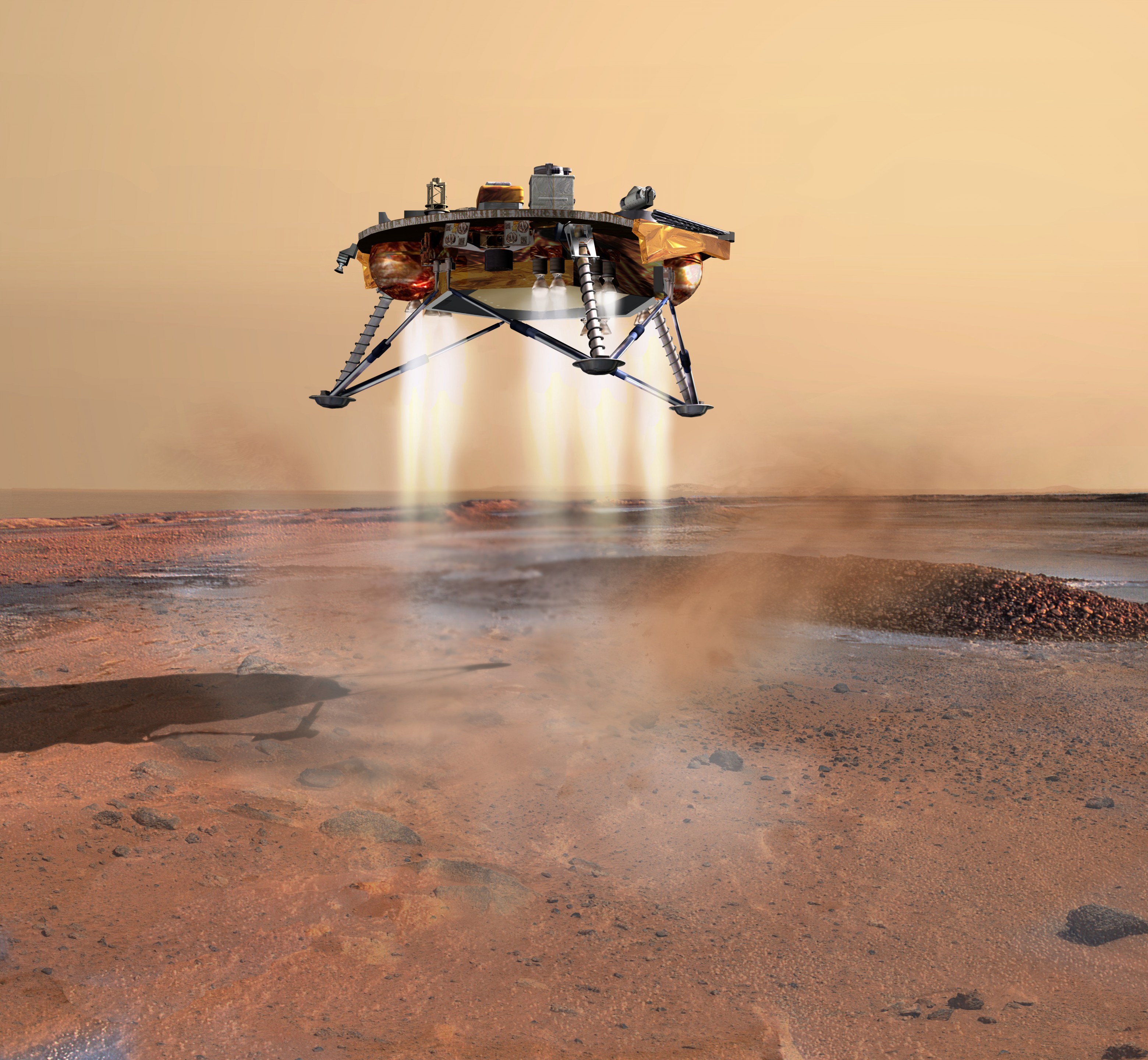
Update: It turns out this story is a fabrication and AFP didn’t check the facts with NASA as I suspected. According to the blog Cosmos4u, they talked with Don Yeomans at NASA’s NEO office and this is what Yeoman’s said about the news story of a 13-year old boy correcting NASA’s estimates of Apohpis impacting earth: “We have not corresponded with this young man and this story is absurd, a hoax or both. During its 2029 Earth close approach, Apophis will approach the Earth to about 38,900 km, well inside the geosynchronous distance at 42,240 km. However, the asteroid will cross the equatorial belt at a distance of 51,000 km – well outside the geosynchronous distance. Since the uncertainty on Apophis’ position during the Earth close approach is about 1500 km, Apophis cannot approach an Earth satellite. Apophis will not cross the moon’s orbital plane at the Moon’s orbital distance so it cannot approach the moon either.”

Also, the scientist mentioned in AFP’s story said he wasn’t conferred with either by the news agency. So don’t give any heed to this story that has been running amok around the internet.

But here’s our story on this as it originally ran: Here’s a story that supports the value of science fairs. And it also makes one wonder where else NASA’s decimal points might be off by a couple of places. One caveat on this news piece, however: as far as I know there hasn’t been an official NASA press release on this.

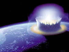
Reportedly, a 13-year-old German schoolboy doing research for a science competition found errors in NASA’s estimates on the chances of the asteroid Apophis colliding with Earth. The boy, Nico Marquardt used data from the Institute of Astrophysics in Potsdam to calculate that there was a 1 in 450 chance that the Apophis asteroid will collide with Earth. NASA had previously estimated the chances at only 1 in 45,000, but according to an AFP news release, NASA now acknowledges the kid is right. (Actually, no they don’t.)
Continue reading “Latest News on Apophis: 13 -year-old Boy Corrects NASA’s Estimates of Earth Impact — Not! (Update)”

Where In The World (and What World) Is This?

Anyone care to guess what orbiting spacecraft is responsible for taking this image, or even what world this is a picture of? At first glance, with all those craters, it could be Mars. However, the coloring isn’t quite right for the Red Planet. Is it a photograph of Mercury or an image of the moon?

OK, yes, this is an image of Earth, but you were wondering there for awhile, weren’t you! Interestingly enough, the white area is not snow, and the craters are not impact craters, but volcanic. And what spacecraft gets credit for the image? The International Space Station. This is one of the most recent images taken by the astronauts on board the ISS as part of the Earth Observatory program. A wonderful website, NASA’s Gateway to Astronaut Photography of Earth, hosts an incredible collection of photographs that astronauts have taken of our home planet.

Beginning with the Mercury missions in the early 1960s, astronauts have taken photographs of the Earth. As of April 7, 2008, this website has 759,527 views of the Earth, which includes 315,923 from the ISS. The site processes images coming down from the International Space Station on a daily basis, so the database is continually growing. The U.S. Destiny Laboratory module has a science window with high optical quality, which usually faces the Earth, and most of the ISS’s images are taken from that window on the world. On board the ISS is a nice selection of professional digital cameras, and a variety of lenses. One could spend hours (or days or a lifetime!) browsing through the striking photographs of Earth the astronauts have taken. The website also includes lots of information about each of the images, and a fun Where In the World quiz to test your geographical knowledge.

The image above is of the Harrat Khaybar volcanic field, a 14,000-square-kilometer area located in the western Arabian peninsula. The volcanic field was formed by eruptions along a 100-kilometer, north-south vent system over the past 5 million years. The most recent recorded eruption took place between 600-700 AD.

Harrat Khaybar contains a wide range of volcanic rock types and spectacular landforms, several of which are represented in this astronaut photograph. There are dark, fluid basalt lava flows, and the white deposits are sand and silt that accumulate in the depressions. There are lava domes and cones from the past volcanic activity.

The ISS astronauts take images daily of our planet. The image of Harrat Khaybar was taken on March 31, 2008, with a Kodak 760C digital camera fitted with a 400 mm lens, and is provided as part of the the ISS Crew Earth Observations experiment.

Original News Source: Earth Observatory website

New Technique Can Estimate Size and Frequency of Meteorite Impacts

News today from the National Science Foundation will have an impact on how scientists are able to study…. well, impacts. A team of geologists has developed a new way of determining the size and frequency of meteorites that have collided with Earth in the past. By studying sediments found on the ocean floor and looking for isotopes of the rare element osmium, scientists can now figure out not only when a meteorite impact occurred in Earth’s history, but also the size of the meteorite. One of the most exciting benefits of this new technique is the potential for identifying previously unknown impacts.

When meteorites collide with Earth, they carry a different osmium isotope ratio than the levels normally seen throughout the oceans.

“The vaporization of meteorites carries a pulse of this rare element into the area where they landed,” says Rodey Batiza of the National Science Foundation, which funded the research. “The osmium mixes throughout the ocean quickly. Records of these impact-induced changes in ocean chemistry are then preserved in deep-sea sediments.”

François Paquay, a geologist at the University of Hawaii at Manoa analyzed samples from two sites where core samples of the ocean floor were taken, one near the equatorial Pacific and another located off of the tip of South Africa. He measured osmium isotope levels during the late Eocene period, a time during which large meteorite impacts are known to have occurred.

“The record in marine sediments allowed us to discover how osmium changes in the ocean during and after an impact,” says Paquay.

The scientists believe this new approach to estimating impact size will become an important complement to a more well-known method based on iridium.

Paquay’s team also used this method to make estimates of impact size at the Cretaceous-Tertiary (K-T) boundary 65 million years ago. Since the osmium carried by meteorites is dissolved in seawater, the geologists were able to use their method to estimate the size of the K-T meteorite as four to six kilometers in diameter. The meteorite was the trigger, scientists believe, for the mass extinction of dinosaurs and other life forms.

But Paquay doesn’t believe this method will work for events larger than the K-T impact. With such a large meteorite impact, the meteorite contribution of osmium to the oceans would overwhelm existing levels of the element, making it impossible to sort out the osmium’s origin.
But it will be interesting to follow this to see if new, unknown impacts in Earth’s history can be discovered.

Original News Source: Eureka Alert

More Space News From Russia

When it rains space news from Russia, it pours. Not only did the news break today about the Russian Space Agency’s plans to send monkeys to Mars, but also, Russia wants to build an Earth-orbiting factory to build large, interplanetary ships that might be too large to launch from Earth. Additionally, Roscosmos, the Russian space agency said that beginning in 2010, they will likely terminate ferrying space tourists to the International Space Station.

According to the head of Roscosmos Anatoly Perminov, the space agency proposed building a manned assembly complex in Earth orbit and the Russian Security Council supported the idea in an April 11, 2008 meeting. No word on exactly when an orbiting spaceship assembly line would be constructed, but Perminov said it likely wouldn’t be built until after the ISS is completed, which they said would be about 2020. Also, no word if the interplanetary ships will be built for humans or monkeys.

As far as curtailing the program that brings space tourists to the ISS, the Perminov said the increase in crew size on the ISS from the current three members to six in 2009, and then the proposed retirement of the space shuttle in 2010, will put “growing pressure” on the Russian Soyuz spacecraft that carries crews and supplies to the space station. Perminov said they will no longer accept proposals from space tourists, adding that space tourism shouldn’t interfere with scientific research. Roscosmos teamed up with the company Space Adventures beginning in 2001 to bring tourists to the ISS, which seemed to be a fairly lucrative program for the cash-strapped Russian space agency. Existing contracts to bring tourists to the station will be fulfilled, Perminov said.

Dennis Tito became the first space tourist in 2001 when he paid $20 million to ride the Soyuz for a week-long stay on the ISS. The next (and sixth) tourist will be game developer Richard Garriott, scheduled for a Soyuz flight in October 2008.

Original News Source: Lenta Ru (translated)

Finally, A Sport for Geeks: Rocket Racing League Announces First Live Exhibition

Combining the exhilaration of racing, with the power of rocket engines and the appeal of video gaming, Rocket Racing League (RRL) CEO Granger Whitelaw said the new sports entertainment league is the sport for geeks. “We haven’t really had a sport, but now we do,” said Whitelaw, a self-professed geek at a press conference on April 14, 2008. “We now have one where we combine real athletes and real heroes with rocket planes and with gaming that we love to do so much.” At the press conference, members of the RRL announced its live first exhibition, to be held August 1st and 2nd at the EAA AirVenture airshow in Oshkosh, Wisconsin, one of the largest airshows in the world. Additional exhibitions later in the year were also announced.

Whitelaw said in this new “futuristic and innovative sport” pilots will race rocket powered aircraft through a three-dimensional track in the sky. The planes will compete side by side, and feature multiple races pitting up to ten Rocket Racers with a 4-lap, multiple elimination heat format on a 5-mile “Formula One”-like closed circuit raceway. The Rocket Racer pilots will view the “raceway in the sky” via cockpit in-panel and 3D helmet displays. On the ground, spectators at airshows can watch the action live, or on screens that include the 3-D raceway. And in this ultimate reality show, viewers at home can watch on television, and gamers can take part with virtual competition.

In August, for the first exhibition, two Rocket Racers will compete head-to-head in a demonstration race and the expected 700,000 people in attendance at EAA AirVenture will witness the racing action live on multiple 50 foot large projection screens.

The RRL will have multiple aerial cameras and 5 cameras on each plane.

Whitelaw said that although they believe their rocket planes are some of the safest air vehicles available, they will take multiple precautions to ensure crowd safety at the live events, specifically, never flying directly at the crowds. “Every step we are taking with the development of the rocket racers now, involves safety considerations,” Whitelaw said.

Each of the four heats will last about 10-12 minutes, with pitstops of 10-12 minutes. “It will similar to periods in hockey or football, and will give us time to do color and introduce the pilots,” said Whitelaw. The RRL will be better than football, he said, which only has about seven minutes of real action in a game with the rest being just talk. “It will be very exciting and it will be all about competition.”

Whitelaw said the RRL has been offered two television deals, and that all the competitions will be televised. “We are going to reach out to different audiences, both in the US and worldwide,” he said.

Whitelaw predicted the RRL video game will also be a big success. The RRL built a video game simulator 2 years ago that they have set up at air shows for people to try. “The tent is usually full all day with young and old alike…this is really going to bring out a new fan base,” Whitelaw said. The full video game won’t be released until the league is actually in operation.

Here are the remaining exhibition dates:

Reno National Championship Air Races (Reno, NV) – September 10-14
X Prize Cup (Las Cruces, NM) – TBD 2008
Aviation Nation, Nellis AFB, (Las Vegas, NV) – November 8-9

In these days of environmental concerns, Whilelaw was asked about the types of fuel used in the rocket planes. “I like to say that 95% of our fuel grows on trees,” he said. “We use cryogenic compressed liquid oxygen for the main part of the thrust for the rocket planes. The Armadillo plane uses ethanol. The X-COR rocket racer uses kerosene. We’re trying to be environmentally friendly as possible.”

The RRL was founded in 2005 by Whitelaw, a two-time Indianapolis 500 winning team partner and X PRIZE Chairman and CEO Peter Diamandis. For more information on the Rocket Racing League, visit www.rocketracingleague.com.

Original News Source: RRL Press Conference

New Earthrise and Earthset Movies from Kaguya

Ian reported yesterday on the high definition topographical maps recently released by the Japanese SELENE mission, also known as Kaguya, which will provide exact locations of essential minerals to future lunar explorers. And now, via Emily Lakdawalla at the Planetary Society comes more from Kaguya — movies of an Earthrise and Earthset from the moon. While the movies don’t provide much as far as scientific data, they are off the charts as far being aesthetically pleasing and just tremendously magnificent. Emily grabbed individual frames from the longer, but smoother high-definition movies that the Japanese Space Agency JAXA created from the HD Camera on board the moon-orbiting Kaguya to create quick little movies. Above is the Earthrise quick movie.


Here’s the quick Earthset movie Emily created. And here’s the links to the hi-def versions at JAXA for Earthrise and Earthset.

However, these longer and smoother movies are still only 25% of the full resolution of the movies. JAXA has not been releasing the full resolution Kaguya data on the internet, as they are “saving” the really high-def stuff for commercial and educational purposes.

Emily reported that HD camera on board the Kaguya spacecraft generates too much data for live transmission; instead the video is compressed and stored within the camera system. Then, it takes about 20 minutes to transmit a 1-minute video to Earth. See Emily’s post for more info.

Original News Source: The Planetary Society

Phoenix Spacecraft Maneuvers for Mars Landing

Looking towards a May 25 landing for the Phoenix Mars Lander, the navigation team for mission adjusted the flight path for the spacecraft on April 10. “This is our first trajectory maneuver targeting a specific location in the northern polar region of Mars,” said Brian Portock, chief of the Phoenix navigation team at the Jet Propulsion Laboratory. The mission’s two prior trajectory maneuvers, made last August and October, put the spacecraft on target to just intersect with Mars. But this recent maneuver put it on course to land at a site called “Green Valley,” a broad, flat valley in Mars north polar region. NASA announced they have “conditionally” approved this site, but a final decision has yet to be made. And why, you ask, hasn’t a final decision been made on a landing site at this late date?

Phoenix mission managers are still looking for a safe, yet exciting place to land. The proposed landing area is an ellipse about 62 miles by about 12 miles (100 kilometers by 20 kilometers). In looking at high resolution images of this area, researchers have mapped more than five million rocks in and around that ellipse, each big enough to end the mission if hit by the spacecraft during landing. “The environmental risks at landing — rocks and slopes — represent the most significant threat to a successful mission. There’s always a chance that we’ll roll snake eyes, but we have identified an area that is very flat and relatively free of large boulders,” said JPL’s David Spencer, Phoenix deputy project manager and co-chair of the landing site working group.

MRO’s High Resolution Imaging Science Experiment (HiRISE) camera has taken more than three dozen images of the area. Analysis of those images prompted the Phoenix team to shift the center of the landing target 13 kilometers (8 miles) southeastward, away from slightly rockier patches to the northwest. Navigators used that new center for planning the recent trajectory correction maneuver.

“Our landing area has the largest concentration of ice on Mars outside of the polar caps. If you want to search for a habitable zone in the arctic permafrost, then this is the place to go,” said Peter Smith, principal investigator for the mission, at the University of Arizona , Tucson .

When Phoenix lands, it will dig to an ice-rich layer expected to lie within arm’s reach of the surface. It will analyze the water and soil for evidence about climate cycles and investigate whether the environment there has been favorable for microbial life.

The April 10 trajectory adjustment began by pivoting Phoenix 145 degrees to orient and then fire spacecraft thrusters for about 35 seconds, then pivoting Phoenix back to point its main antenna toward Earth. The mission has three more planned opportunities for maneuvers before May 25 to further refine the trajectory for a safe landing at the desired location.

In the final seven minutes of its flight on May 25, Phoenix must perform a challenging series of actions to safely decelerate from nearly 21,000 kilometers per hour (13,000 mph). The spacecraft will release a parachute and then use pulse thrusters at approximately 914 meters (3,000 feet) from the surface to slow to about 8 kilometers per hour (5 mph) and land on three legs.

For more information about Phoenix , visit NASA’s site, and ASU’s site

Space Debris Illustrated: The Problem in Pictures

Trackable objects in Earth ORbit. Image Credit: ESA

Space junk, space debris, space waste — call it what you want, but just as junk and waste cause problems here on Earth, in space spent booster stages, nuts and bolts from ISS construction, various accidental discards such as spacesuit gloves and cameras, and fragments from exploded spacecraft could turn into a serious problem for the future of spaceflight if actions to mitigate the threat are not taken now. The European Space Operations Centre has put together some startling images highlighting this issue. Above is a depiction of the trackable objects in orbit around Earth in low Earth orbit (LEO–the fuzzy cloud around Earth), geostationary Earth orbit (GEO — farther out, approximately 35,786 km (22,240 miles) above Earth) and all points in between.

Trackable objects in Low Earth Orbit.  Image Credit:  ESA
Between the launch of Sputnik on 4 October 1957 and 1 January 2008, approximately 4600 launches have placed some 6000 satellites into orbit; about 400 are now travelling beyond Earth on interplanetary trajectories, but of the remaining 5600 only about 800 satellites are operational – roughly 45 percent of these are both in LEO and GEO. Space debris comprise the ever-increasing amount of inactive space hardware in orbit around the Earth as well as fragments of spacecraft that have broken up, exploded or otherwise become abandoned. About 50 percent of all trackable objects are due to in-orbit explosion events (about 200) or collision events (less than 10).
Impact from space debris on shuttle window
Officials from the space shuttle program have said the shuttle regularly takes hits from space debris, and over 80 windows had to be replaced over the years. The ISS occasionally has to take evasive maneuvers to avoid collisions with space junk. And of course, this debris is not just sitting stationary: in orbit, relative velocities can be quite large, ranging in the tens of thousands of kilometers per hour.

For the Envisat satellite, for example, the ESA says the most probable relative velocity between the satellite and a debris object is 52,000 kilometers per hour. If a debris objects hits a satellite, the ISS or the Shuttle, at those speeds it could cause severe damage or catastrophe.

Space Debris in polar orbit.  Image Credit:  ESA

Above is a depiction of debris in polar orbit around Earth. From the image below, it’s evident how explosions of spacecraft causes even more scattered debris. Even after the end of the mission, batteries and pressurised systems as well as fuel tanks explode. This generates debris objects, which contribute to the growing population of materials in orbit, ranging from less than a micrometer to 10 centimeters or more in size.
An upper stage of a spacecraft exploding.  Image Credit:  ESA

About 40% of ground-trackable space debris come from explosions, now running at four to five per year. In 1961, the first explosion tripled the amount of trackable space debris. In the past decade, most operators have started employing on-board passive measures to eliminate latent sources of energy related to batteries, fuel tanks, propulsion systems and pyrotechnics. But this alone is insufficient. At present rates, in 20 or 30 years, collisions would exceed explosions as a source of new debris.

2112 future simulation.  Image credit: ESA
The ESA says it is crucial to start immediately to implement mitigation measures. This image shows a simulation of the the 2112 GEO environment in the case when no measures are taken. In the top panel, with mitigation measures, a much cleaner space environment can be observed if the number of explosions is reduced drastically and if no mission-related objects are ejected. The bottom panel shows the “business-as-usual” scenario, without any mitigation measures taken. However, to stop the ever-increasing amount of debris, more ambitious mitigation measures must be taken. Most importantly, spacecraft and rocket stages have to de-orbited and returned to Earth after the completion of their mission.

They’ll burn up in the atmosphere, or splash down in uninhabited ocean areas. In the case of telecommunication and other satellites operating in the commercially valuable geostationary zone, they should boost their satellites to a safe disposal orbit, as shown below.
Graveyard orbit.  Image credit:  ESA

There are other measures, like reducing the number of mission-related objects and controlling the risk for reentry, but these are the basics. The issue is that such mitigation measures cost fuel and operational time, and therefore they increase cost. In the commercial world, this may competitiveness, unless there is an international consensus to accept such costs.

Original News Source: ESA

Evidence of Asteroid Impact For Sodom and Gomorrah?

Cuneiform clay tablet. Image Credit: Bristol University

A Cuneiform clay tablet that has puzzled researchers for over 150 years is now believed to describe an asteroid impact in 3123 BC in Austria. Researchers believe the tablet, which seemingly describes a cataclysmic event, may account for the biblical tale of Sodom and Gomorrah. No mention of pillars of salt however, on the clay tablet.

Geologists discovered evidence of a giant landslide centered at Köfels, Austria back in the 19th century. At 500 meters thick and five kilometers in diameter, this landslide mystified researchers trying to figure out why such an event occurred. Some researchers thought the landslide may have been caused by a meteorite impact, because of the evidence of crushing pressures and explosions. But there was no crater, so it didn’t look as an impact site should, and the impact theory fell out of favor. But researchers knew this wasn’t just an ordinary landslide.

But new research brings the impact theory back into play. It centers on another 19th century mystery, a Cuneiform tablet in the British Museum, known as “the Planisphere”. It was found in the remains of the library in the Royal Place at Nineveh, and was made by an Assyrian scribe around 700 BC. It is an astronomical work with drawings of constellations and the text has known constellation names. The clay tablet has attracted a lot of attention but until now no one has come up with a convincing explanation as to what it is.

Alan Bond and Mark Hempsell from Bristol University used computer programs to simulate trajectories and reconstruct the night sky thousands of years ago to establish what the Planisphere tablet refers to. It is a copy of the night notebook of a Sumerian astronomer as he records the events in the sky before dawn on the 29 June 3123 BC (Julian calendar). Half the tablet records planet positions and cloud cover, but the other half of the tablet records an object large enough for its shape to be noted even though it is still in space. The astronomer made an accurate note of its trajectory relative to the stars, which to an error better than one degree is consistent with an impact at Köfels.

The observation suggests the asteroid is over a kilometer in diameter and the original orbit about the Sun was an Aten type, a class of asteroid that orbits close to the earth, that is resonant with the Earth’s orbit. This trajectory explains why there is no crater at Köfels. The incoming angle was very low (six degrees) and means the asteroid clipped a mountain near the town of Längenfeld, 11 kilometers from Köfels, and this caused the asteroid to explode before it reached its final impact point. As it travelled down the valley it became a fireball, about five kilometers in diameter (the size of the landslide). When it hit Köfels it created enormous pressures that pulverized the rock and caused the landslide but because it was no longer a solid object it did not create a classic impact crater.

Mark Hempsell, hinting at the possible fate of Sodom and Gomorrah, added, “Another conclusion can be made from the trajectory. The back plume from the explosion (the mushroom cloud) would be bent over the Mediterranean Sea re-entering the atmosphere over the Levant, Sinai, and Northern Egypt. The ground heating though very short would be enough to ignite any flammable material – including human hair and clothes. It is probable more people died under the plume than in the Alps due to the impact blast.”

This evidence seems to coincide with the biblical story of the legendary dens of vice (“Then the Lord rained down burning sulfur on Sodom and Gomorrah – from the Lord out of the heavens” – Genesis 19:24) but it’s never been categorically proven that the towns actually existed in their suspected location close to the Dead Sea. And the story of Lot’s wife turning into a pillar of salt for turning around to witness the mayhem is just biblical legend as well.

The full translation of the tablet together with the analysis supporting these conclusions can be found in the book, “A Sumerian Observation of the Kofels’ Impact Event” by Bond and Hempsell.

Original News Sources: Bristol University and The Register

Smallest Exo-planet Found

Ignasi Ribas with simulated picture of the new planet. Image Credit: REUTERS/Sergio Perez

We’re getting closer to finding an Earth-like planet out there in the universe. Spanish astronomers announced the discovery of the smallest exo-planet found to date, located 30 light years from earth. “I think we are very close, just a few years away, from detecting a planet like Earth,” team leader Ignasi Ribas said at a news conference on Wednesday April 9, 2008. The newest planet, “GJ 436T” was discovered by a team led by Ribas through its gravitational pull on other planets already discovered around the same star in the constellation of Leo.

The planet has a mass five times the size of Earth, which makes it the smallest extrasolar planet among the roughly 300 identified so far, Ribas said. The astronomers believe the planet could possibly be a rocky, Earth-like planet because of its size. Most of the planets found so far are gas giants like Jupiter.

But Ribas said the new planet is uninhabitable due to the close distance that it orbits its star, which is far less than that between the earth and the sun. Planet GJ 436 orbits close to its small, relatively cool star once every 5.2 Earth days and rotates every 4.2 Earth days.

This latest planet was found by analyzing distortions in the orbit of another, larger planet around the star GJ 436, a technique similar to that used more than 100 years ago to discover Neptune.

“Planets with a mass similar to Earth situated at a distance from their star which allows liquid water on the surface, in other words, a habitable planet, we’re probably a bit further from (discovering those), but we surely will in a decade,” said Ribas of Spain’s CSIC scientific research institute.

Original News Source: Reuters