
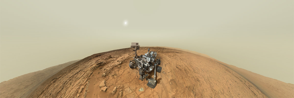
There’s an incredible new interactive panorama from the latest Curiosity rover’s self-portrait and surroundings at the “John Klein” drilling site. It was put together by photographer Andrew Bodrov and combines the recent self-portrait and other images to create a full 360-degree panorama created from hundreds of images. The mosaic stretches about 30,000 pixels width.
Click here to see (and go play with) the panorama.
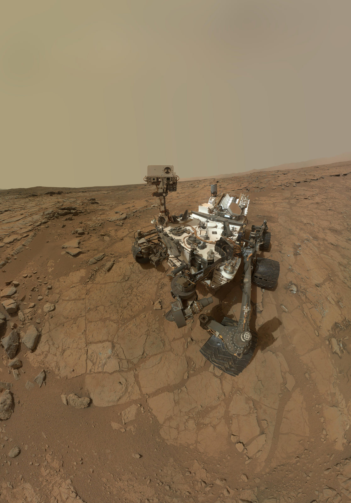
The pan includes the self-portrait, which consists of 66 different images (seen above) taken by the rover’s Mars Hand Lens Imager (MAHLI) during the 177th Martian sol, of Curiosity’s work on Mars (Feb. 3, 2013 here on Earth), along with 113 images taken on Sol 170 and an additional 17 images taken on Sol 176.
Here’s the full pan in a non-interactive view:
In the pan, you can see the holes in the rock named John Klein — in memory of a Mars Science Laboratory deputy project manager who died in 2011. The historic first drilling took place on Feb. 8, 2013, and by zooming around and in, you can also see the weird little shiny protuberance we’ve been talking about (look for the pile of rocks to the right of the rover.)
Bodrov is a photographer from Estonia who specializes in interactive panoramic photography. He did a previous Curiosity pan in August 2012 and he’s also taken lots of images at the Baikonur Cosmodrome.
uptil I saw the draft which was of $6520, I accept ...that...my neighbours mother woz like actualy bringing in money parttime from there labtop.. there dads buddy started doing this for only about 1 year and at present took care of the morgage on their mini mansion and purchased a great new BMW 5-series. this is where I went, jump14.ℂom
Curiosity: if only posing for self portrait is actual science…
Just how many interactive-ultra-resolution-panorama-mosaic images does NASA think we need from the rover?
To navigate the surface, controllers and geologists need see what’s surrounding the rover. That way, we’re less likely to miss any valuable targets to probe and discover. Seeing these panoramas brings an exhilarating experience for scientists, laymen, and almost everyone, while documents the rover’s progress, external condition, and firsts, such as drilling into Mars and exposing untouched material. Apparently the panorama was made by a 3rd party company using a the Rover’s mosaic. To produce an experience that feels as if we were standing next to the rover and looking around with great clarity is quite a feat. Apparently JPL doesn’t really loose anything by doing it, perhaps taken and sent during a weekend. It takes time for the scientists to analyze the data and determine what to do next. Drilling into Mars is a first, and seeing where it happened in relation to its surroundings is well worth documenting. Knowing it caries 17 cameras, it’s obvious that Curiosity was designed to be a big shutterbug. More panoramas, please!
Well, your post bolsters my point: NASA patronizes us by bring to people like you an “exhilarating experience”. As if Curiosity is out there to serve our entertainment purpose, to make you “feels as if we were standing next to the rover”.
There is a vast amount of information in those images that NASA could publish as a lay-person’s introduction to geology, e.g., they could post images that illustrate Martian soil mechanics, aeolian transport, mud(?) crack physics, …ad infinitum. Instead, we have images after images of vapid vacation mosaic that I suppose NASA hopes would help with their future budget.
That information is made available. It is revealed after analysis and data intepretation. That takes time. Science…takes time. Please be patient. That knowledge isnt as apparent as a picture taken. Indeed, these missions MUST be entertaining. If it does not interest and stir the minds and hearts of the scientists, nor the public, why bother? Would crack physics alone help future budgets? I think not, but images help the scientists determine that. That’s why we have powerful eyes on the surface, and we get these fantastic images as a bonus. A third party company took the pictures and make a panorama out of it, recall?
Before flaming me: Yes I know those images contain valuable scientific data in them. Why doesn’t NASA detailed those information (no matter how minute or technical they are)–instead of just releasing pretty images. Does it think the public is too dumb, too uninterested, too attention-span-deficient to be enlightened by them?
How about a rover that does less stopping and more roving? Here is curiosity, but it won’t leave the crater for 2 full years! how dull. Why not create a rover who’s sole purpose is to explore and photograph the surface, including places like Mariner Valley, Hellas Basen and the Tharsis bulge? From there, we’ll be much better informed about were to send rovers like Curiosity for deeper analysis.