
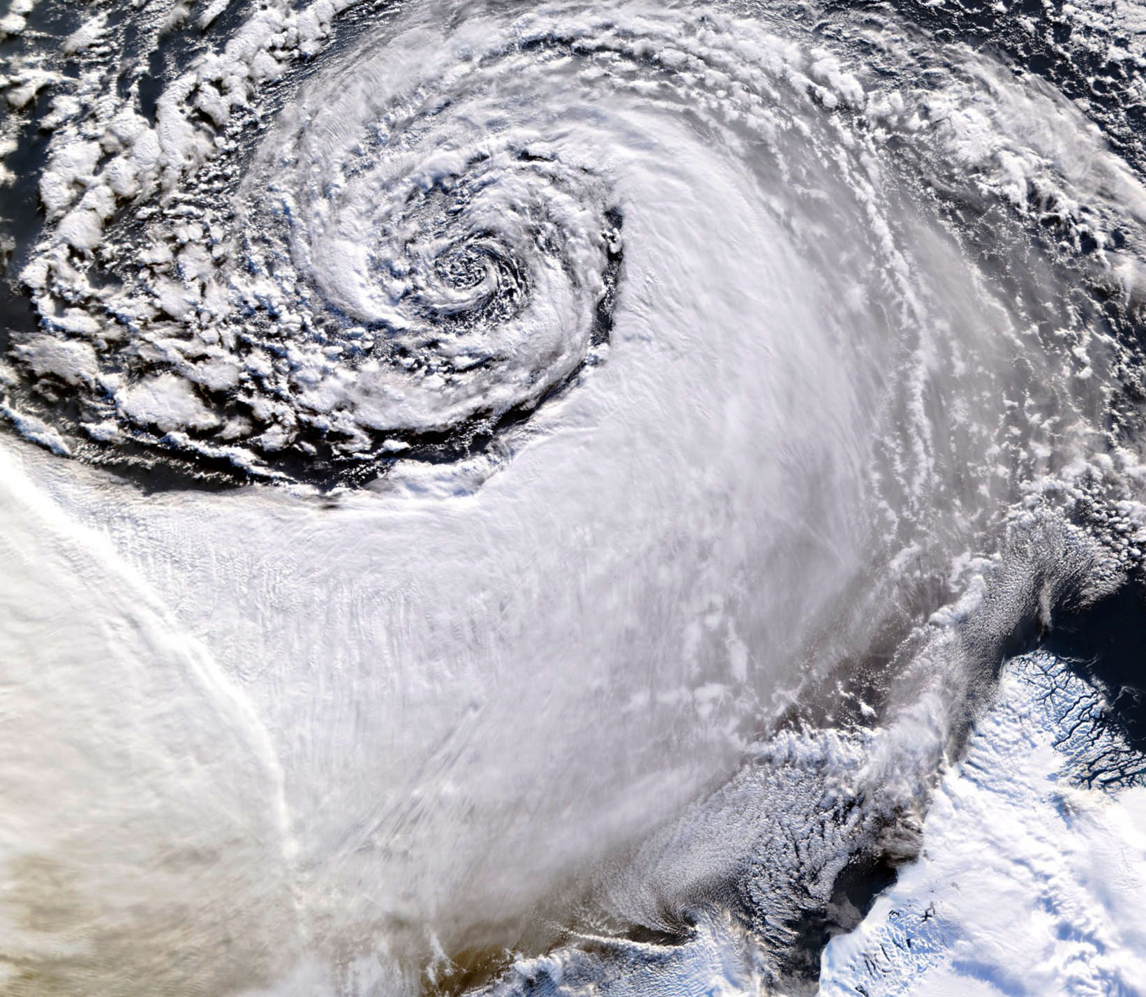
Looking south across the southern tip of Greenland, this satellite image shows an enormous cloud vortex spiraling over the northern Atlantic ocean on January 26, 2013. An example of the powerful convection currents in the upper latitudes, these polar low cyclones are created when the motion of cold air is energized by the warmer ocean water beneath.
Sometimes referred to as Arctic cyclones, these spiraling storms can bring gale-force winds and heavy snowfall over a wide area of ocean during their 12- to 36-hour lifespans. Hurricane-type storms don’t only form in the tropics!
This image was captured by the MODIS instrument on NASA’s Aqua satellite from its polar orbit 705 km (438 miles) above the Earth. The view has been rotated so south is up; the southernmost tip of Greenland can be seen at lower right. Click for an impressive high-resolution view.
Image via EOSNAP/Chelys
I hope Jake Gyllenhaal is there to save everyone!