Mississippi River Flooding As Seen from the Space Station
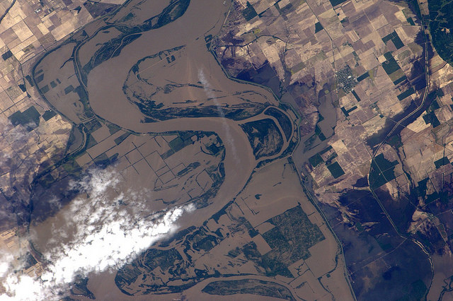
Flood water from the Mississippi river near New Madrid, Missouri, as seen by Paolo Nespoli on board the International Space Station. Credit:ESA/NASA
[/caption]
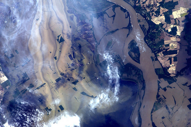
Big Muddy, as the Mississippi River is known, looks especially big and muddy these days with record flooding occurring along the largest river in the US. The Mississippi has risen to levels not seen in since the 1920’s and 30’s, fed by heavy spring rains and the spring thaw from heavy snows in the northern US this winter. Here are some new images taken by International Space Station astronaut Paolo Nespoli, which show surprising detail of how the river has spread across farmland and through cities and towns. The image above shows the area around New Madrid, Missouri, along the border of Kentucky.
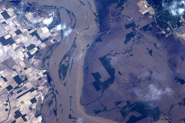
In this image, levees are visible which are containing the flood near Ridgely, Tennessee.
Last week, the US Army Corps of Engineers opened floodways in Missouri to keep pressure off levees protecting the town of Cairo, Illinois, flooding thousands of acres of farmland. This week, the Corp is preparing to flood up to three million acres in southern Louisiana in hopes of protecting large cities along the Mississippi River such as Baton Rouge and New Orleans, Louisiana. More than 25,000 people are preparing to leave the region before the spillways would be opened.
Recent Posts
The Milky Way’s History is Written in Streams of Stars
The Milky Way is ancient and massive, a collection of hundreds of billions of stars,…
The Current Mars Sample Return Mission isn’t Going to Work. NASA is Going Back to the Drawing Board
Hmmm spaceflight is not the easiest of enterprises. NASA have let us know that their…

Peter Higgs Dies at 94
Just like Isaac Newton, Galileo and Albert Einstein, I’m not sure exactly when I became…
More Views of the 2024 Eclipse, from the Moon and Earth Orbit
It's been just over a week since millions of people flocked to places across North…
Baby Stars Discharge “Sneezes” of Gas and Dust
I’m really not sure what to call it but a ‘dusty sneeze’ is probably as…
How Did Pluto Get Its Heart? Scientists Suggest an Answer
The most recognizable feature on Pluto is its "heart," a relatively bright valentine-shaped area known…