Satellite Images of Red River Flooding in North Dakota
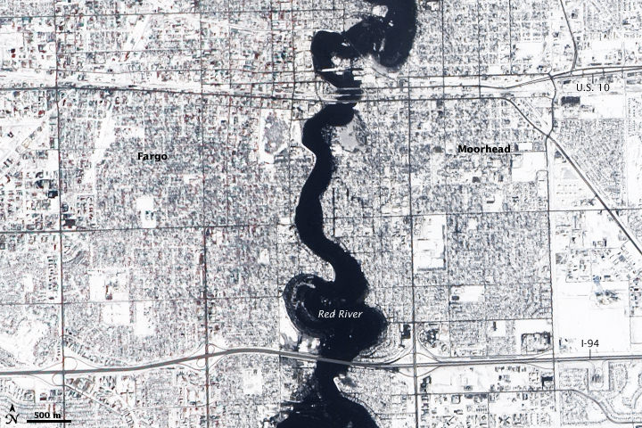
[/caption] The Red River reached a record high of 40.82 feet at Fargo, North Dakota on March 28, 2009, and flood stage for the river is 18 feet. This image, taken by the Advanced Land Imager on the Earth Observer-1 (EO-1) satellite on March 28, shows the swollen river, held in place by reinforced levees … Continue reading "Satellite Images of Red River Flooding in North Dakota"
Nancy Atkinson