
The United Arab Emirates Space Agency releases a unique comprehensive Mars Atlas of the Red Planet.
You have never seen Mars like this. Recently, the New York University of Abu Dhabi (NYUAD) released an 88-page look at Red Planet, dubbed The Atlas of Mars. The Atlas is free online, and uses spectacular imagery taken from the United Arab Emirates Space Agency’s ambitious Mars Hope mission.
“This atlas is created with data from the Hope probe in an attempt to provide readers with a holistic view of the planet,” says NYUAD Research Scientist Dr. Dimitra Atri in the preface of the Atlas. “Our aim is to capture and show how Mars changes during the day across seasons through the entirety of the mission.”
Mars Hope was launched atop an H-IIA rocket from the Tanegashima Space Center in Japan on July 19, 2020, and arrived in orbit around Mars on February 9, 2021. Mars Hope became the very first interplanetary mission for the fledgling United Arab Emirates Space Agency, which became the sixth nation to successfully reach Mars. This was all part of a banner year for Mars exploration, as NASA’s Perseverance rover and China’s Tianwen-1 mission also successfully made their way to the Red Planet in 2020-2021. The mission was very much an international collaboration, with a Japanese Aerospace Agency (JAXA) launch carrier, the spacecraft mission control located at the Mohammed bin Rashid Space Center in UAE, and spacecraft construction and support provided by Arizona State University and in Laboratory for Atmospheric and Space Physics (LASP) in Boulder, Colorado.

Mars Hope entered a wide-ranging, 55 hour 20,000 by 43,000 kilometer orbit around Mars early last year. Unlike other missions, this vantage point affords the orbiter a full disk view, to study climate and weather variations. To this end, Mars Orbiter is equipped with the Emirates Mars Infrared Spectrometer (EMIRS), the Emirates Mars Ultraviolet Spectrometer (EMUS), and a main multi-band high-resolution camera, the Emirates eXploration Imager (EXI).

The ‘eye candy’ portions of the Atlas weres primarily constructed from EXI images, which provide stunning natural vistas of Mars and a thrilling study of the dichotomy of the two opposing hemispheres. One of our favorites is the full page splash of the enormous Valles Marineris chasm; the Atlas really gives you the sense of size of the enormous open gash across the surface of the Red Planet:

But there’s also some amazing science in the Atlas as well. Towards the second half of the book, we see studies of ultraviolet dayglow, daily surface temperatures, and something we generally don’t think of when it comes to Mars: its tenuous magnetic field:

It’s worth checking back on the Atlas as well, as the Mars Hope team plans to update it periodically with new images, creating the first comprehensive hi-res study of seasonal changes on Mars.
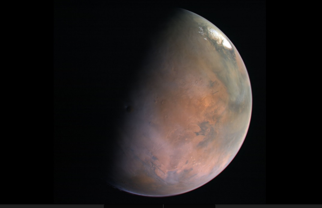
The Atlas ends with a set of beautiful crescent phase images of Mars, pole caps and all. These really give you a sense of ‘you are there,’ hanging in space and gazing upon the Red Planet in living color. These are views that human eyes have yet to see in person.
Hopefully, that will change in the coming decade. But for now, be sure to enjoy The Atlas of Mars, courtesy of the Mars Hope Team.
Lead image credit: A gibbous Mars. Credit: Mars Hope/NYUAD/Atlas of Mars.