
For fans of astrophotography, Kevin M. Gill needs no introduction. Even if you’re not up on the latest astronomical news and developments, chances are you’ve still seen some of his images over the years. From beautiful artist renditions to breathtaking photographs of far-off planets, Gill has covered it all. Among the latest images available on his official Flickr page are pictures of a unique feature on Mars: the Chasma Boreale Megadunes!
Gill is a California-based software engineer, planetary and climate data “wrangler,” and science data visualization artist with a long history of working with NASA. In addition to artistic renderings of space missions, Solar bodies, and exoplanets, he is also renowned for his images of extraterrestrial environments. These images are obtained by NASA missions, which are black and white and unprocessed when they reach Earth.
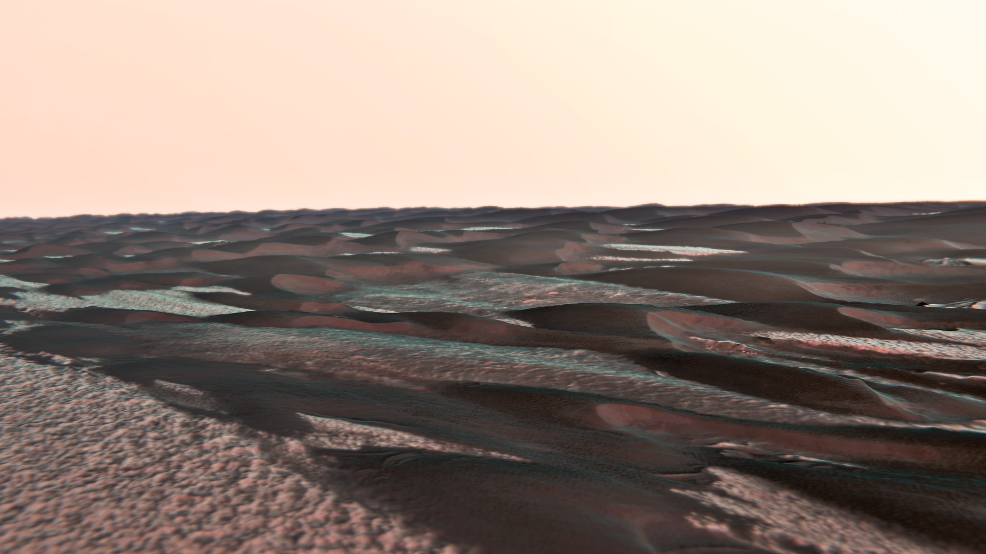
By adding color, depth, and better resolution, Gill is able to convey these extraterrestrial environments’ true depth and beauty. This time around, Gill used images acquired by the High Resolution Imaging Experiment (HiRISE) – a camera aboard the Mars Reconnaissance Orbiter (MRO) – of the Chasma Boreale region, a large canyon located in the vicinity of Mars’s northern polar ice cap.
These images are part of a series taken by HiRISE to create Martian Digital Terrain Models (DTMs) of various geographical regions on Mars. HiRISE DTMs are made from two images of the same area taken from different angles, then processed using sophisticated software. The DTM of the Chasma Boreale region (shown below) highlights the layered features known as “megadunes” that are the result of seasonal deposition from melting ice and dust storms.
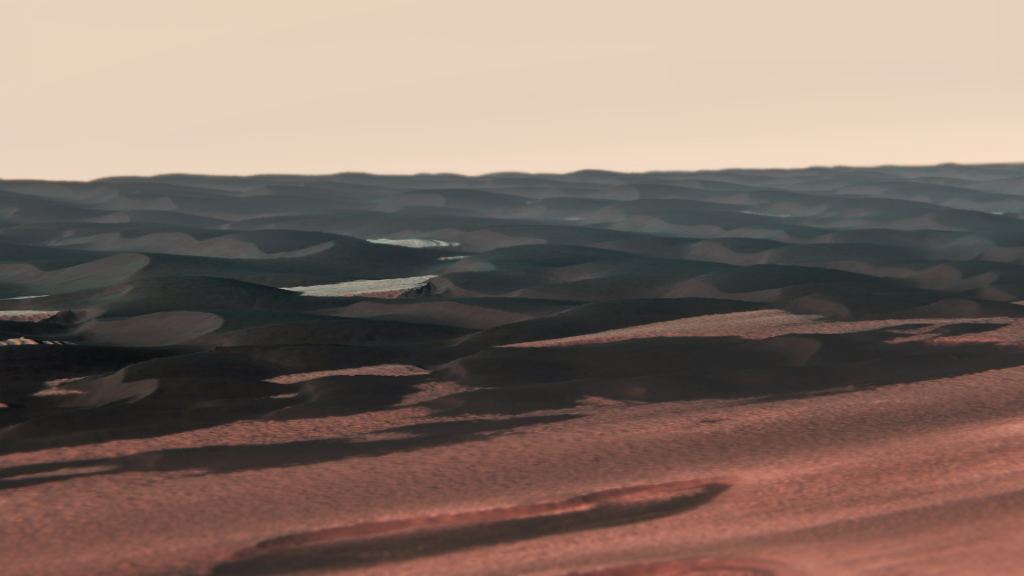
These dunes are similar to Barchan dunes (see image below), a feature that has been imaged by the MRO’s HiRISE and other Martian orbiters for decades. These dunes are located in the northern polar reaches of Mars and are largely the result of wind-borne deposition. These same winds, caused by seasonal temperature variations between the northern and southern hemispheres, are what the barchan dunes their signature shape.

These dunes are hard to detect during the winter because they are covered in frost. But come summer, the frost sublimates, and they become visible because their mineral composition makes them appear darker than their surroundings. Like their counterparts on Earth, these dunes slowly migrate as the Martian winds push them across the surface. The megadunes, in contrast, have the barchans beat in terms of size and may even contain secrets about Mars’ past.
To create his photos of the megadunes, Gill processed the HiRISE data using Geospatial Data Abstraction Library (GDAL) software, an open-source geospatial data processing platform. The images were then rendered using the 3D computer graphics software Blender and Adobe Lightroom, the cloud-based photo editing platform. The resulting images he created show what the megadunes look like from the surface.
These features could be witnessed by surface missions destined for the northern polar region in the near future. It’s also possible that astronauts will see them up-close when the first crewed missions to Mars are conducted in the next decade! Studying these megadunes and other layered features could reveal clues about how Mars’ climate changed, which would be apparent from how wind patterns and glacial melting changed over time.
In the meantime, the artist’s rendering provides us with a glimpse of what we could be seeing soon!
Further Reading: Kevin Gill (Flickr)/AU HiRISE/LPL