
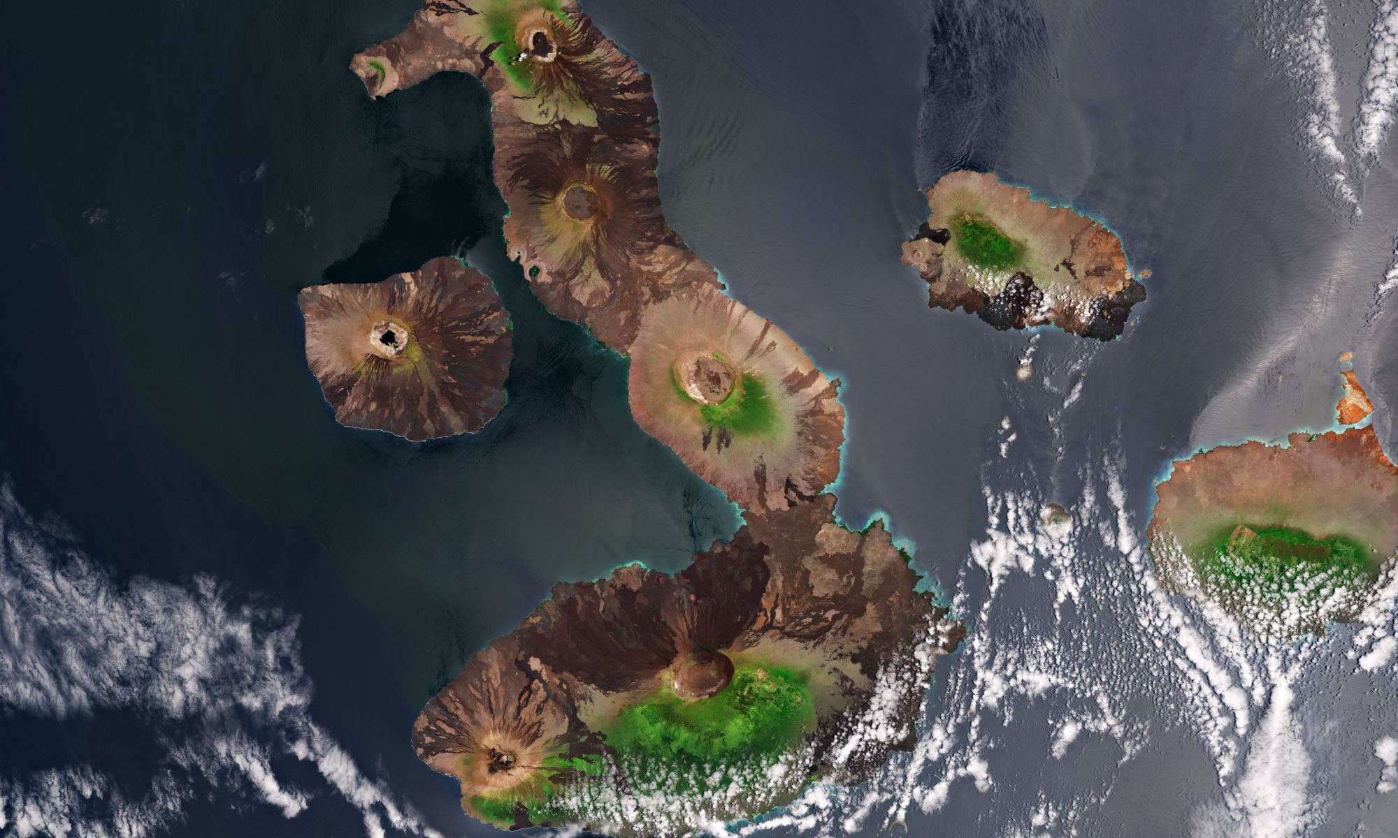
The Galápagos Islands hold an honored place in science history. I often wonder, if Charles Darwin could have seen this volcanic archipelago from this vantage point – a satellite view – how might have that aided or changed his research on evolution?
This picture is from ESA’s Copernicus Sentinel-2 mission, which consists of two satellites which each carry a high-resolution camera, capable of taking pictures of Earth’s surface in 13 spectral bands. The mission is mainly used to track changes in the way land is being used and to monitor the health of the Earth’s vegetation.
The Galápagos Islands are best known for their diverse array of plant and animal species, many of which are endemic — meaning they are not found anywhere else in the world. These include species such as the giant Galapagos tortoise, the marine iguana, the flightless cormorant and the Galapagos penguin – the only species of penguin that lives north of the equator.
Darwin observed these species during the voyage of the HMS Beagle in 1835 and inspired his theory of evolution by natural selection. The entire archipelago of 13 major islands and several smaller islets were named as national park in 1959 by the government of Ecuador. The Galápagos Islands are located about 1,000 km (620 miles) west of Ecuador in the Pacific Ocean.
In this image, captured on September 23, 2020, circular volcanic cones can be seen atop the islands. At the ESA website, you can zoom in to see this image at a high, full 10 m resolution.
Here’s another view of the islands, from the Envisat satellite. The image was obtained by combining three different images gathered on different dates across 2008 and 2009 by the satellite’s Advanced Synthetic Aperture Radar (ASAR).
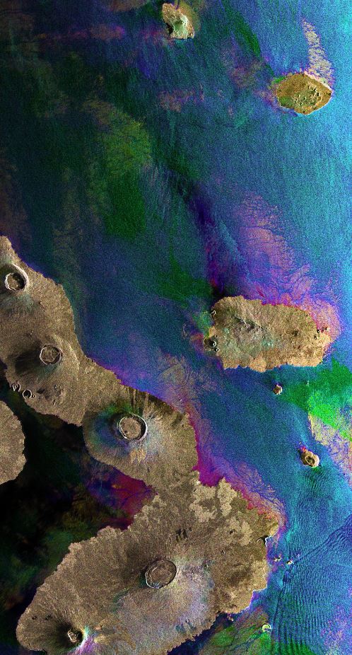
The colors in the image result from variations in the surface that occurred between acquisitions. In addition to mapping changes on the land surface, radar data can also be used to determine sea surface parameters like wind speed, wind direction and wave height. Different wave types and wind speeds are visible in the image as ripples on the water surface.
The Galápagos Islands cover approximately 60,000 sq km (23,166 sq miles) of ocean. Repeated volcanic eruptions and ongoing seismic activity formed the rugged mountain landscape of the islands.
The largest island is named Isabela, and is shaped like a seahorse. It is about 132 km (82 miles) in length, and was created by multiple large volcanoes merging into a single land mass. The five volcanoes seen on the island are (from north to south): Wolf Volcano, Darwin Volcano, Alcedo Volcano, Sierra Negra Volcano and Cerro Azul Volcano. Two of the island’s volcanoes, Ecuador and Wolf, lie directly on the Equator. Wolf is the highest peak in the Galápagos Islands, at 1,707 m (5,600 ft), and the last time it erupted was in 2015.