
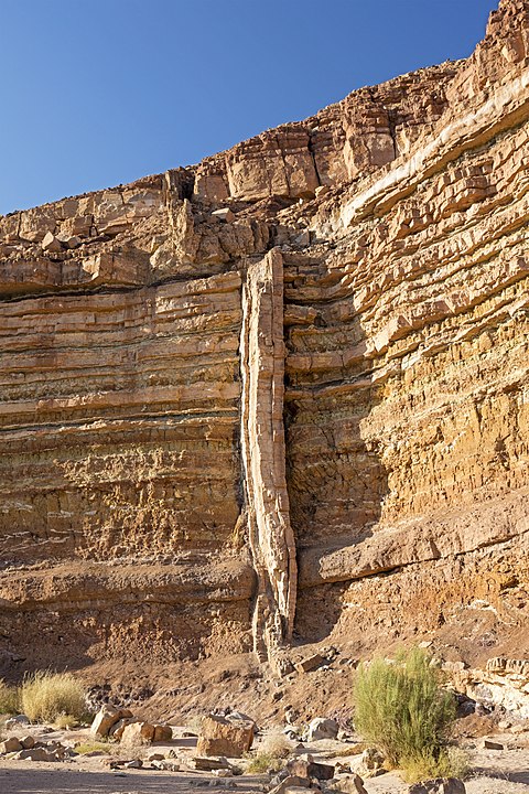
Here on Earth, geologists seek out deep channels into Earth’s rock, carved over the ages by flowing water. The exposed rock walls are like a visual timeline of a region’s geological history. On Mars, the surface water is long gone. But it flowed long enough to expose layers of rock just like here on Earth.
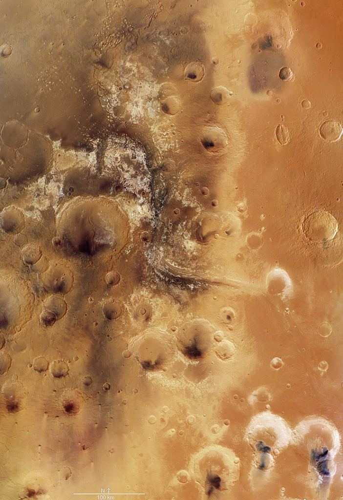
One of those water-exposed areas on Mars is Mawrth Vallis, an outflow channel that feeds into the Chryse Basin.
Mawrth Vallis (Mawrth is Welsh for Mars) is one of several outflow channels leading into Chryse Planitia, or Chryse Basin. Researchers think it’s one of the oldest valleys on Mars. It contains phyllosilicate minerals, clays that form in the presence of water. For that reason, and others, it was one of the sites under consideration for the ExoMars (Rosalind Franklin) Rover, scheduled for launch in 2022.
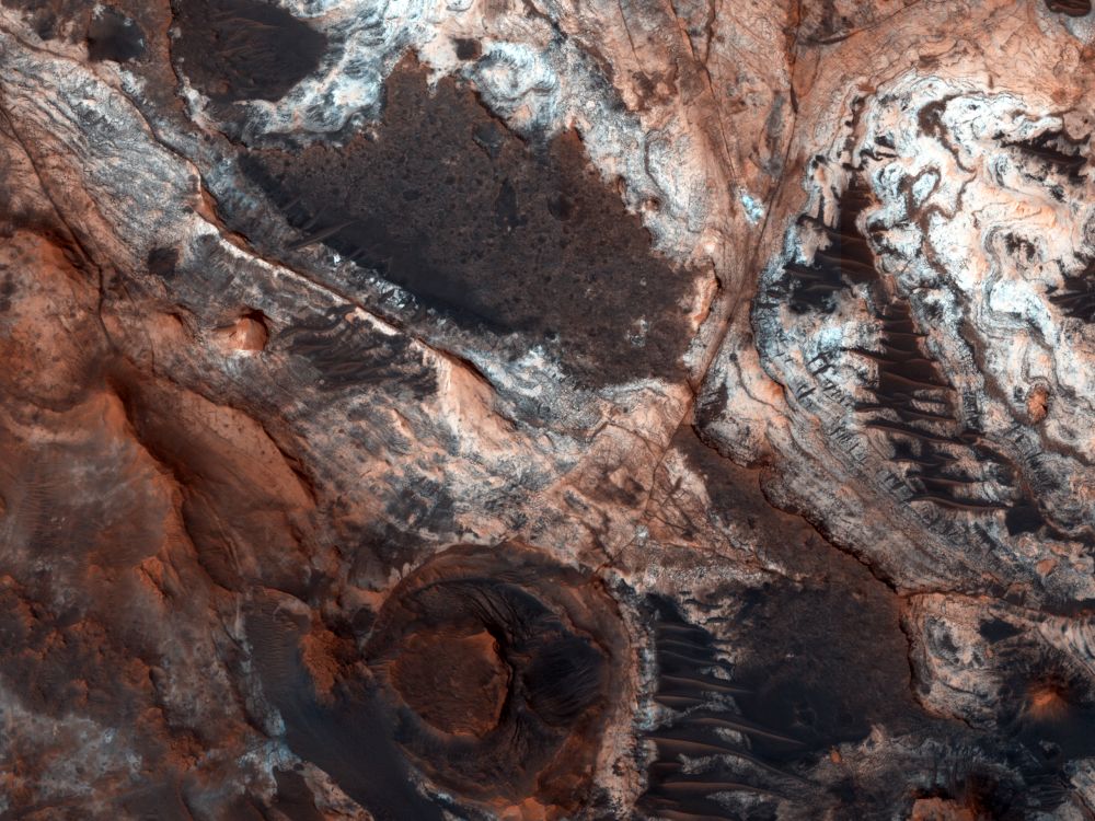
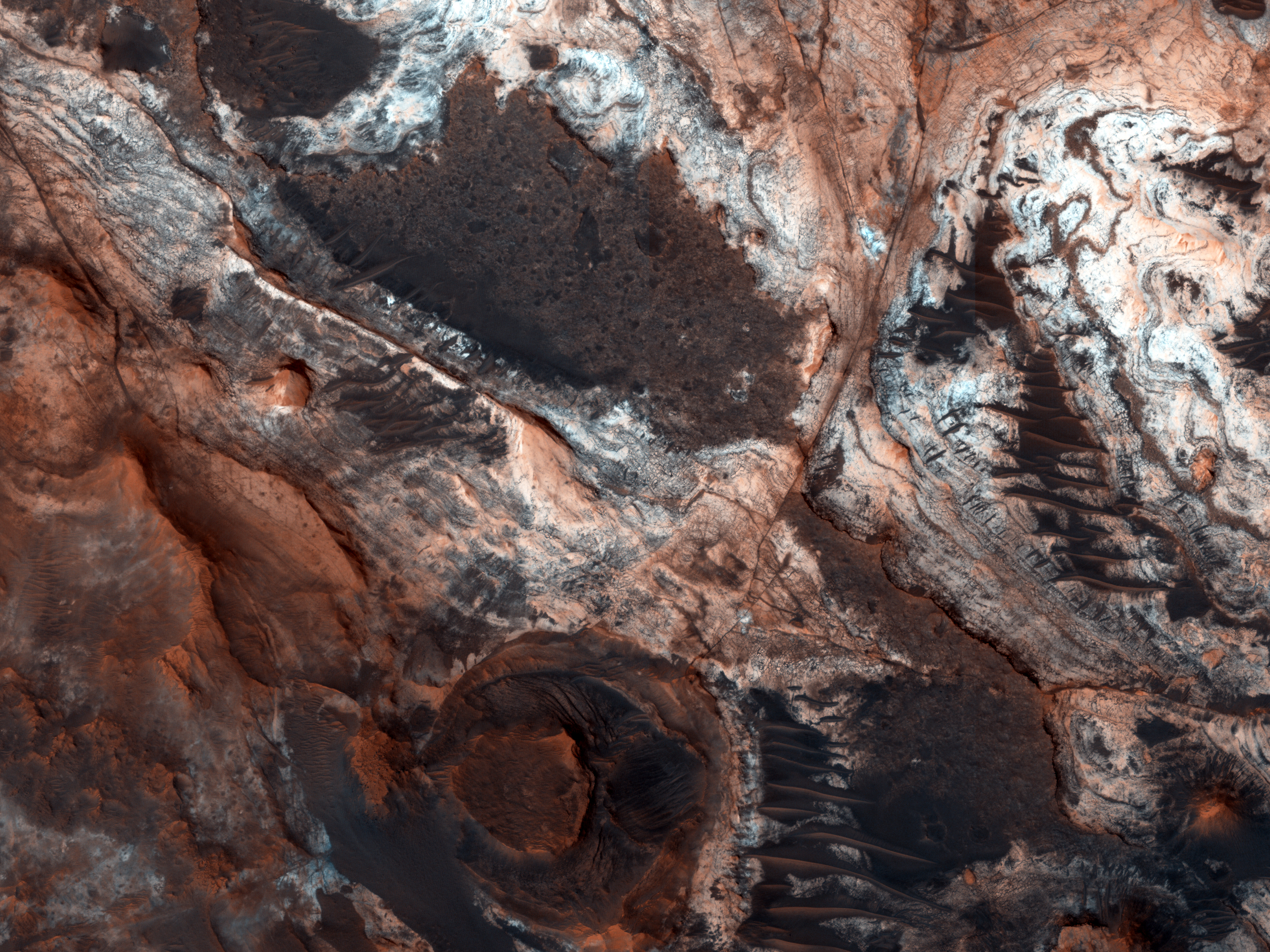
It wasn’t chosen, but as this HiPOD (HiRISE Picture of the Day) from November 26th shows, it was a target of great scientific interest.
If Mars was habitable at one time, then Mawrth Vallis would’ve hosted life up to about 3.6 billion years ago. Water flowed here for a long time and left the valley rich in colourful phyllosilicates. Mawrth Vallis is sometimes called the most colourful place on Mars.
It’s about 600 km (373 miles) long and about 2 km (1.25 miles) deep, making it one of the planet’s larger valleys. It’s also a very geodiverse place.
Large amounts of light coloured phyllosilicates are found here and dark cap rock, which is the remains of ancient volcanic dust. That dark cap covers some of the phyllosilicates, which astrobiologists think may have provided shelter to microbes living in the wet clays.
The river that flowed here revealed a bunch of different layered geological formations. The way each layer is positioned above or below others tells geologists a lot. So do all the fractures and faults. Taken together, these features are a narrative of Mars’ geology and climate.
The bedrock in the region is heavily fractured, from the scale of kilometres down to the scale of meters. That tells geologists that the area’s history is complex, with forces like compression, stretching, and twisting leaving their marks. The region also contains what geologists call dikes, dark ridges that travel through the bedrock. They’re nearly vertical fissures in the subsurface rock that were filled with magma at one point.
The magma cooled and solidified into the dark ridges and left exposed veins of volcanic rock. The dikes may be related to the dark cap rock that lays over the lighter strata below.
The dark cap rock and the dikes have resisted erosion. As water flowed through here, it was redirected around the cap rock and excavated deep trenches into the underlying material, revealing multiple layers of lighter-toned rock. Those layers tell their own story.
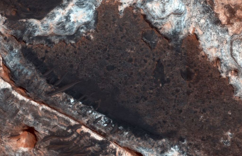
Each of those distinct layers is an accumulation of geologic material laid down in the planet’s ancient past. It can include fine sand, dust, and volcanic ash. That material could’ve settled in the air or a standing body of water. These materials have a spectroscopic signature, and orbiting spacecraft have confirmed phyllosilicates’ presence, meaning the rock has been altered through the ages by water.
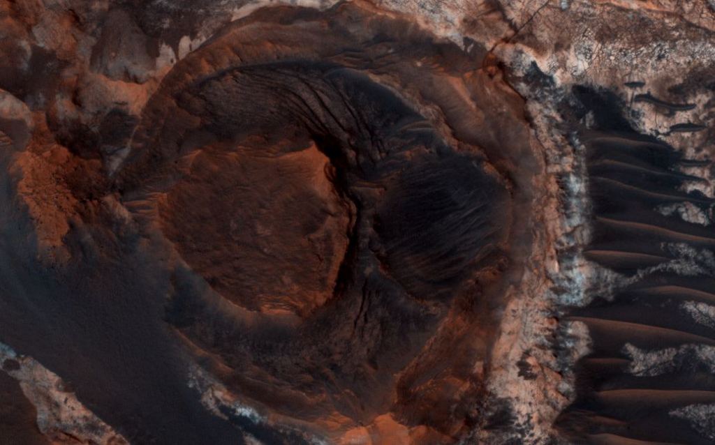
The water and the processes that formed all these structures predate the water that carved Mawrth Vallis. And geological processes are still ongoing. Mars may have cooled and dried, but it’s still active geologically in some ways. Scattered dunes and sheets of the planet’s ever-present dust cover some of the region, showing that even though water erosion is a relic of the past, aeolian erosion is ongoing.
Mawrth Vallis was in the running for the ESA/Roscsmos Rosalind Franklin mission’s landing spot. It was a great candidate, but one of many. Unfortunately, it wasn’t selected. But its rich geological diversity and exposed layers still beckon.
One day, maybe, we’ll get a closer look.
More:
- HiRISE: HiRISE Picture of the Day (HiPOD)
- ESA: Mars Express
- NASA: Mars Reconnaissance Orbiter
- Universe Today: Sediments on Mars, Created By Blowing Wind or Flowing Water