
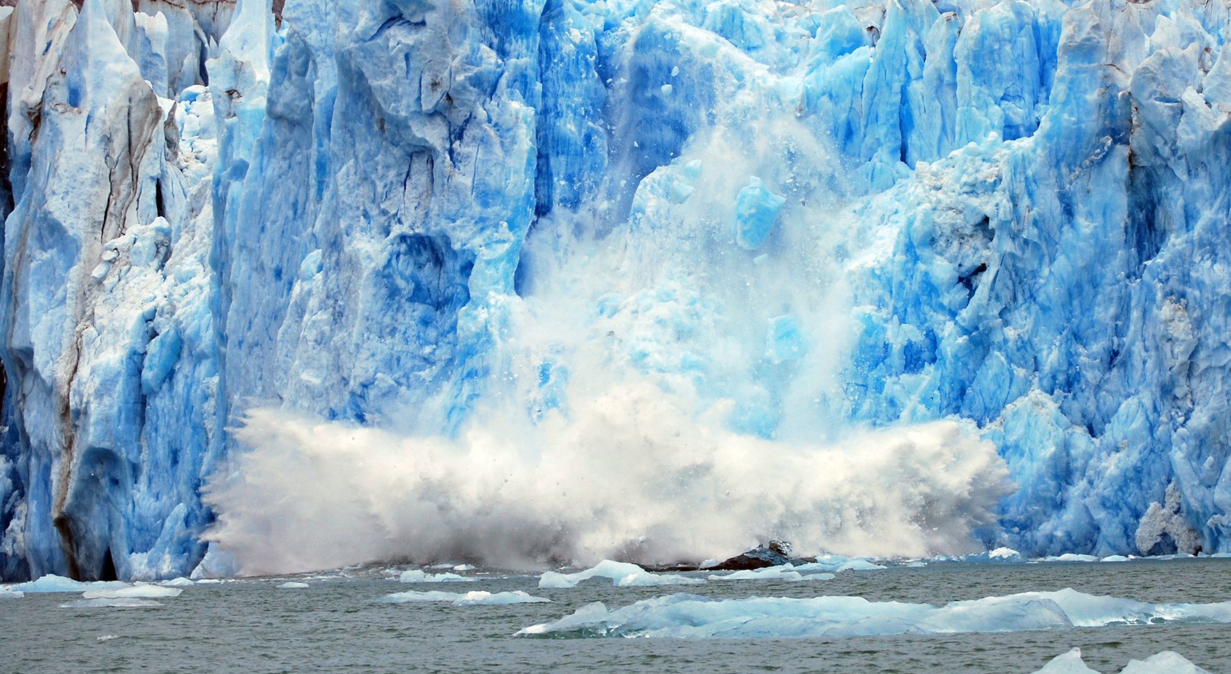
The rate at which Greenland is losing its ice is accelerating. This unsurprising conclusion comes from a new study based on 25 years of satellite data from the European Space Agency. The new study was published in Earth and Planetary Science Letters.
The study is called 25 years of elevation changes of the Greenland Ice Sheet from ERS, Envisat, and CryoSat-2 radar altimetry. It compiles 25 years of radar altimetry measurements of the GIS from three different satellites to build an image of the thickness of the sheet. As the study says, “The shape of the large ice sheets responds rapidly to climate change, making the elevation changes of these ice-covered regions an essential climate variable.”
Laser altimetry is an effective way of measuring the thickness of ice. The altimeters send signals down to Earth from orbiting satellites then measure how long it takes the signals to bounce back to the satellite. Using precision measurements of the timing interval between the transmission and reception, the satellites can measure the thickness.
Over time, in this case a 25 year span, the data builds an image of the changing thickness of the ice.
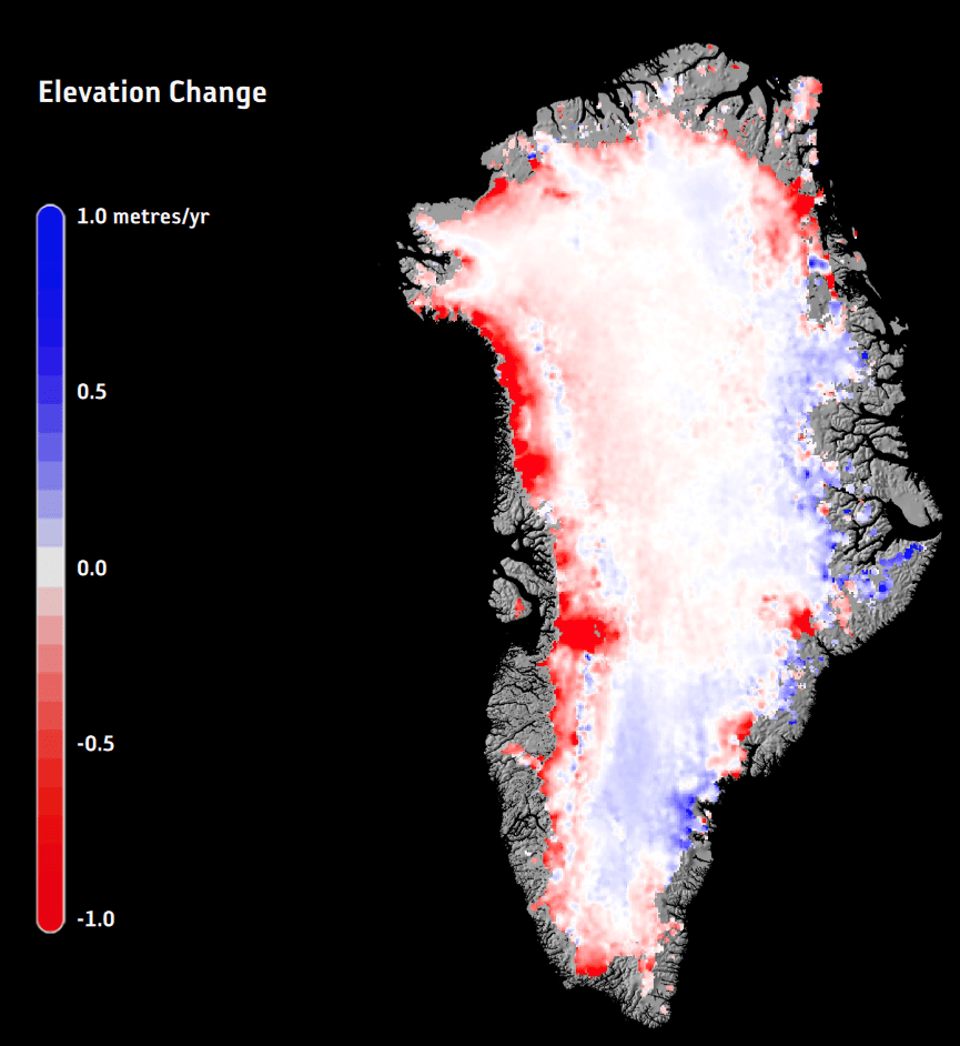
The study shows that throughout the 90s there were only modest changes to the ice thickness. But in the mid 2,000s, that rate of change sped up, and it’s still speeding up.
The satellites behind this study are the European Remote Sensing 1 (ERS-1), launched in 1991, followed by the ERS-2 which was launched in 1995, and the Envisat launched in 2002. The Cryosat-2, which was launched in 2010, also provided data used in this study. The Sentinel 3 will continue this laser altimetry, as will the 3 others in the Sentinel series to be launched in the future. In case we need more data to tell us there’s a problem.
According to the study and the data, there is an abundantly clear thinning of the ice beginning in 2003.
“A pattern of thinning appears to dominate a large fraction of the ice sheet margins at the beginning of the millennium, with individual outlet glaciers exhibiting large thinning rates,” says Louise Sandberg Sørensen, the paper’s lead author. “Over the full 25-year period, the general picture shows much larger volume losses are experienced in west, northwest and southeast basins of Greenland compared to the more steady-state situations in the colder far north.”
According to Sorensen, this shows that the outlet glaciers on the coast are much more susceptible to climate change than other areas.
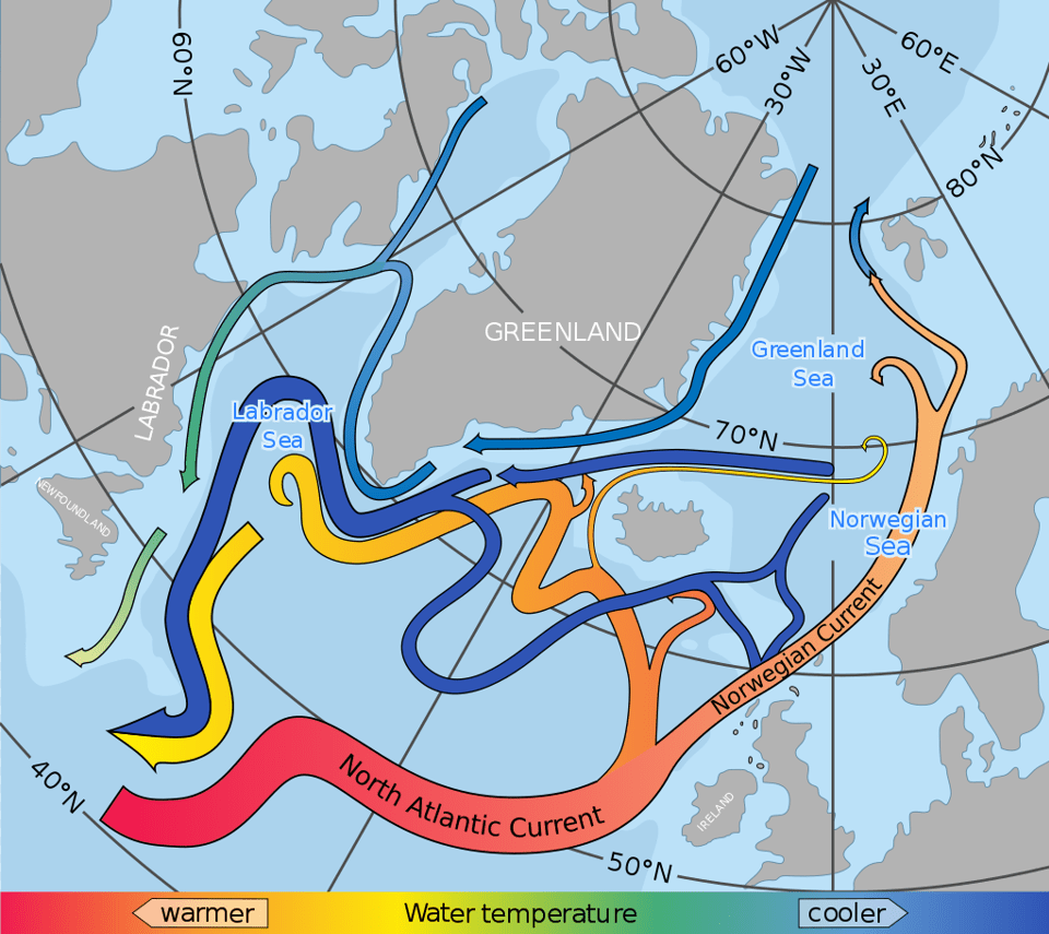
The Greenland Ice Sheet is not just an ice sheet. It’s an important part of the climate puzzle. Among other things, meltwater coming from it influences ocean circulation and currents in the North Atlantic. These currents, along with winds like the Gulf Stream, play a role in keeping Europe warm.
Measuring the height of the ice above the land or sea it sits on is the established way of measuring the mass of an ice sheet. If a climate warming skeptic suggests that studies like this don’t reflect the amount of ice, only the thickness, they are incorrect. As the study says, “The shape of the large ice sheets responds rapidly to climate change, making the elevation changes of these ice-covered regions an essential climate variable.”
The ESA isn’t the only body studying ice from space and from the air. NASA is busy studying Earth’s shrinking ice too. Their Operation IceBridge is the largest-ever airborne study of Earth’s polar ice regions. NASA satellites are also studying the polar ice, and together, there hasn’t been much good news. In March 2018, NASA reported that the Arctic Wintertime sea ice was at its lowest coverage on record. 2015, 2016, 2017, and 2018 are the four lowest on record. Not a pretty picture.
This study is a part of ESA’s Climate Change Initiative, which is a research programme using four decades of Earth observation archives established by ESA and its Member States to support the climate information requirements of the United Nations Framework Convention on Climate Change. The GIS is only one of 22 climate variables being studied over time. The ESA is developing long-term, consistent data products based on satellite derived observations for all of the climate variables.
It isn’t all about the shrinking ice, it’s part of an ongoing attempt to understand all of Earth’s climate variable to the best of science’s ability. We’re going to need that understanding as we respond to climate change.
Sources:
- ESA Press Release: Greenland ice loss quickening
- Research Paper: 25 years of elevation changes of the Greenland Ice Sheet from ERS, Envisat, and CryoSat-2 radar altimetry
- ESA Climate Change Initiative: Surface Elevation Change
- NASA: Operation IceBridge Mission Overview
- NASA Press Release: Arctic Wintertime Sea Ice Extent Is Among Lowest On Record
- Wikipedia Entry: North Atlantic Current
- ESA’s Climate Change Initiative
Not too long ago, Greenland was, well, Green. None too very little ice anywhere. And exactly how much was man’s fault?
It still is. There has always been tiny parts of Greenland that were ice free during the summer and large enough for subsistance settlement. These areas are getting bigger too.
Nice to think there’ll be somewhere to go when Florida goes under water later this century.
Frasier, I am a supporter on Patreon. Please stop with the global warming propaganda.
Get back to Russia.