
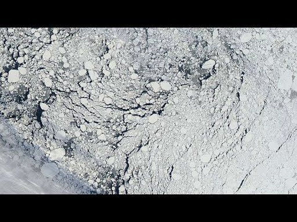
Arctic sea ice is getting thinner and younger. Satellite data and sonar records from submarines show how the ice coverage in the north is getting more and more seasonal. In the past, ice would build up year over year, getting thicker and stronger. But seasonal ice disappears each summer, meaning more open ocean in the summer, and less of the Sun’s energy being reflected back into space.
A new video from NASA shows in clear detail the peril that Arctic sea ice faces in our warming world. Approximately 70% of all the ice is now seasonal. The ice is the thinnest and youngest it’s been in the 60 years that records have been kept.
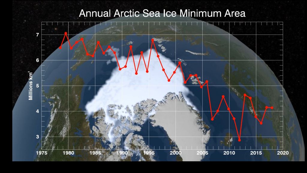
NASA’s been keeping track of the minimum coverage of arctic sea ice for 40 years. Over that time, it’s been shrinking due to climate change. The loss of perennial ice, or ice that builds up and lasts year over year, is speeding up. The thinner seasonal ice is much more susceptible to all kinds of atmospheric disruption, not just warming.
At the end of each summer NASA measures the extent of the arctic sea ice. The measurement is called the “Annual Arctic Sea Ice Minimum Area.” After that, temperatures drop and the ice spreads and thickens.
Ice measurements are about to get even more accurate in the near future. NASA recently launched the Ice, Cloud, and land Satellite-2 (ICESat-2). ICESat-2 will orbit the Earth from pole to pole, at an altitude of 467km (290 miles).

ICESat-2 carries a single instrument: the Advanced Topographic Laser Altimeter System (ATLAS). ATLAS is a high-resolution instrument that will provide data on Earth’s polar ice caps, improve forecasts of sea level rise bolstered by ice sheet melt in Greenland and Antarctica, and help scientists understand the mechanisms that are decreasing floating ice and assess how that sea ice loss affects the ocean and atmosphere. ICESat-2 will pick up where the original ICESat mission left off in 2009.