
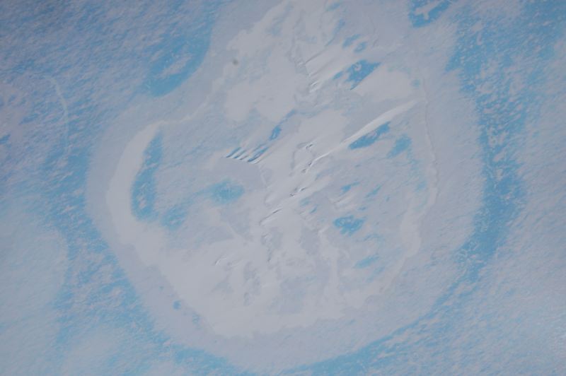
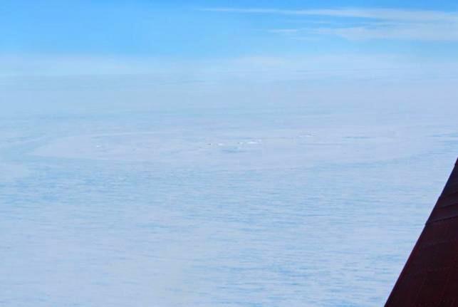
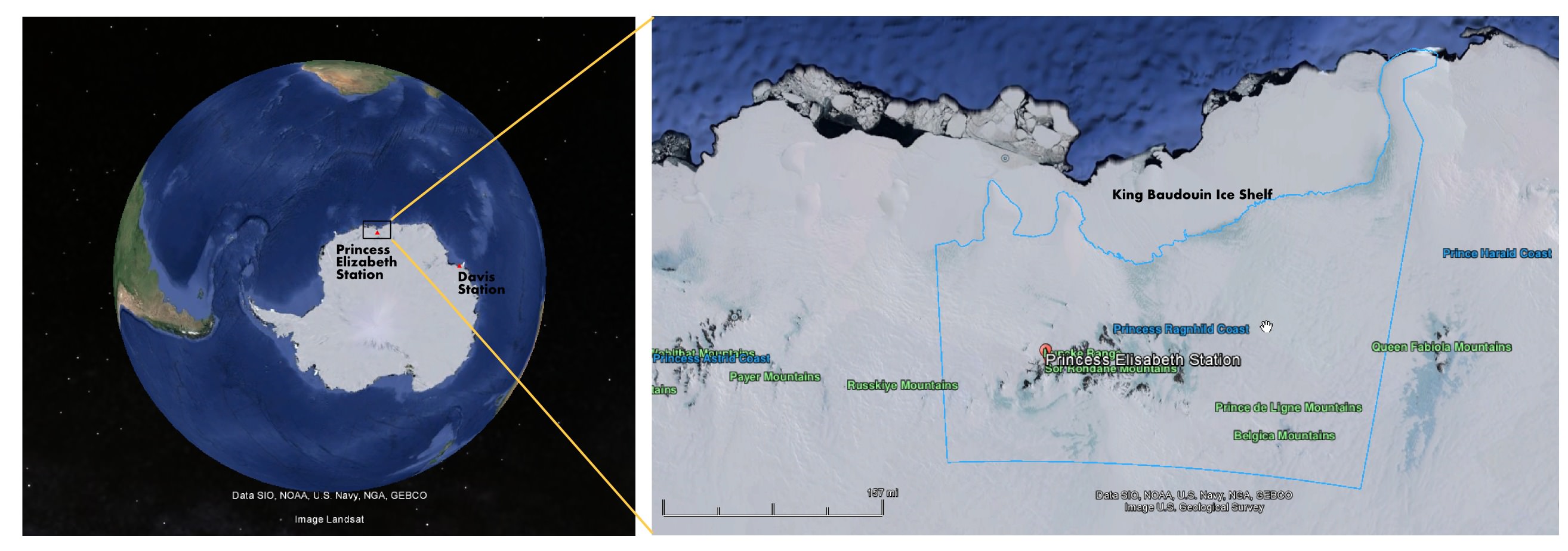
Ever since its discovery was announced earlier this year, the 3 km-wide ring structure discovered on the of Antarctica has been a source of significant interest and speculation. Initially, the discovery was seen as little more than a happy accident that occurred during a survey of East Antarctica by a WEGAS (West-East Gondwana Amalgamation and its Separation) team from the Alfred Wegener Institute.
However, after the team was interviewed by the Brussels-based International Polar Foundation, news of the find and its possible implication spread like wildfire. Initial theories for the possible origin of the ring indicated that it could be the result of the impact of a large meteor. However, since the news broke, team leader Olaf Eisen has offered an alternative explanation: that the ring structure is in fact the result of other ice-shelf processes.
As Eisen indicated in a new entry on the AWI Ice Blog: “Doug MacAyeal, glaciologist from the University of Chicago, put forward the suggestion that the ring structure could be an ice doline.” Ice dolines are round sinkholes that are caused by a pool of melt water formed within the shelf ice. They are formed by the caving in of ice sheets or glaciers, much in the same way that sinkholes form over caves.
“If the melt water drains suddenly,” he wrote, “like it often does, the surface of the glacier is destabilised and does collapse, forming a round crater. Ice depressions like this have been observed in Greenland and on ice shelves of the Antarctic Peninsula since the 1930s.”
However, in glaciers, these cavities form much more rapidly, as the meltwater created by temperature variations causes englacial lakes or water pockets to from which then drains through the ice sheet. Such dolines have been observed for decades, particularly in Greenland and the Antarctic Peninsula where the ice melts during the summertime.
Initial analysis of satellite images appear to confirm this, as they indicate that the feature could have been present before the supposed impact took place around 25 years ago. In addition, relying on data from Google Maps and Google Earth, the WEGAS (West-East Gondwana Amalgamation and its Separation) team observed that the 3 km ring is accompanied by other, smaller rings.
Such formations are inconsistent with meteorite impacts, which generally leave a single crater with a raised center. And as a general rule, these craters also measure between ten to twenty times the size of the meteorite itself – in this case, that would mean a meteorite 200 meters in diameter. This would mean that, had the ring structure been caused by a meteorite, it would have been the largest Antarctic meteor impact on record.
It is therefore understandable why the announcement of this ring structure triggered such speculation and interest. Meteorite impacts, especially record-breaking ones are nothing if not a hot news item. Too bad this does not appear to be the case.
However, the possibility that the ring structure is the result of an ice doline raises a new host of interesting questions. For one, it would indicate that dolines are much more common in East Antarctica than previously thought. Ice dolines were first noticed in the regions of West Antarctica and the Antarctic Peninsula, where rapid warming is known to take place.
East Antarctica, by contrast, has long been understood to be the coldest, windiest and driest landmass on the planet. Knowing that such a place could produce rapid warming that would lead to the creation of a significant englacial lake would certainly force scientists to rethink what they know about this continent.
“To form an ice doline this size, it would need a considerable reservoir of melt water,” Eisen said. “Therefore we would need to ask, where did all this melt water come from? Which melting processes have caused such an amount of water and how does the melting fit into the climate pattern of East Antarctica?”
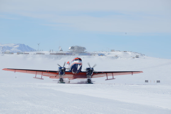
In the coming months, Eisen and the AWI scientists plant to analyze the data from the Polar 6 (Eisen’s mission) measurements thoroughly, in the hopes of getting all the facts straight. Also, Jan Lenaerts – a Belgian glaciologist with AWI – is planning an land-based expedition to the site; which unfortunately due to the short Antarctic summer season and the preparation time needed won’t be taking place until the end of 2015.
Credit: International Polar Foundation / Jos Van Hemelrijck
But what is especially interesting, according to Eisen, is the rapid pace at which the debate surrounding the ring structure occurred. Within days of their announcement, the WEGAS team was astounded by the nature of the debate taking place in the media and on the internet (particularly Facebook), bringing together glaciologists from all around the world.
As Eisen put it in his blog entry, “For the WEGAS team, however, our experience of the last few days has shown that modern scientific discussion is not confined to the ivory towers of learned meetings, technical papers, and lecture halls, but that the public and social media play a tremendous role. For us, cut off from the modern world amongst the eternal ice, this new science seems to have happened at an almost breathtaking pace.”
This activity brought the discussion about the nature of the ring structure forward by several weeks, he claims, focusing attention on the true causes of the surprise discovery itself and comparing and contrasting possible theories.
Further Reading: Helmholtz Gemeinschaft, AWI
The Thing, of course.
If that thing was created by melted subsurface water… could it be due to volcanic activity under the ice? If it IS simply from melted ice below due to rising temperatures – that can’t be good. We might one day actually see huge sections of the Antarctic ice sheet collapsing? How’s about a rise in worldwide sea levels in the course of several weeks or even days? Ack!
I just read a National Geographic article in the May 2014 issue called “Digging Utah’s Dinosaurs”, which included is a map showing the extent of the land masses in North America 77 million years ago. The whole West coast of North America, from Alaska to Guatemala is separated from the East coast by the Western Interior Seaway with more than half of California submerged. This land mass is called Laramidia. The land mass on the eastern side of that sea is called Appalachia. That’s right, there was an ocean between the west and east coasts. Cuba and most of Central America are submerged as is all of Florida and much of the east coast. Due to tectonic plates shifting and lifting along with erosional forces that land mass has been substantially modified. But were sea levels to unexpectedly rise, North America might look somewhat like this map… Check it out?
Just a wild guess, but after comparing the geometry to Reservoir Manicouagan in Quebec, Canada, it looks like a hit by a large, fast rock.
It’s superman’s fortress!
as usual: don’t get (over) excited before you have ALL the necessary data. Speculation doesn’t help… start digging the Internet for more data.
Ah and BTW: so much for mankind’s ability to constantly monitor incoming rocks. If that was a meteorite… it wasn’t that small!
It came from Outer Space.
C’mon Government, Illuminati or whomever the hell is in charge of your garbage cover-up b.s.
Inner Earth ring a bell? New Berlin? It’s not the 40’s anymore… Tell the truth.
MAYBE IT’S A GIANT WEATHER BALLOON!!???LOL
no, it’s not the 40th anymore, but mankind hasn’t evolved! The majority still believes what the governments announce… what religious leaders sell as “the one n only truth”… I wait for Thor’s Hammer to hit us and wipe these stupids away. The “educated rest” has a better chance to build a new society.
I strongly suggest people read the article, as it seems now that this structure was caused by melting. There’s no reason to assume a government conspiracy or a cover-up of any kind, and little reason to suspect that it was in fact a large meteorite that we somehow all missed.
It isn’t really a ring; you just think it is.
It’s a 2 km-wide circular ice structure in the Earth. What would you call it?
A ring. I’m making fun of the pareidolia (if that is the word) crowd.
Ah, I see. Yes, its good to know they don’t just obsess over Mars, right? 🙂
They’ve been in business a long time. Before tectonic plates were discovered, the same wiseacres (or their predecessors) used pareidolia as an explanation for why the continents, such as South America and Africa, appear to fit into each other. When continental drift was established by science, they quietly withdrew and prepared to debunk something else.
For Matt Williams, your article is very informative and well written. Don’t let the non-serious commenters bother you; some like to dream, want to share a laugh, or just daydream. Nevertheless, your writing has strength in composition and style. I am not qualified to comment on the “ice ring” but it is curious. Your photo additions were appropriate as well as quotes by the scientists. Best wishes and continue the great work!