Artist's concept of the Dawn spacecraft arriving at Vesta. Image credit: NASA/JPL-Caltech
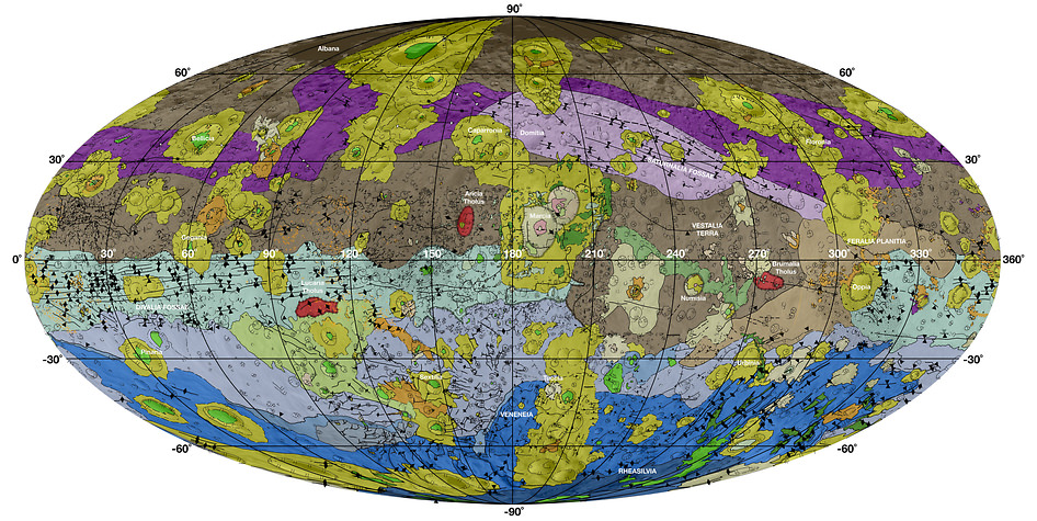
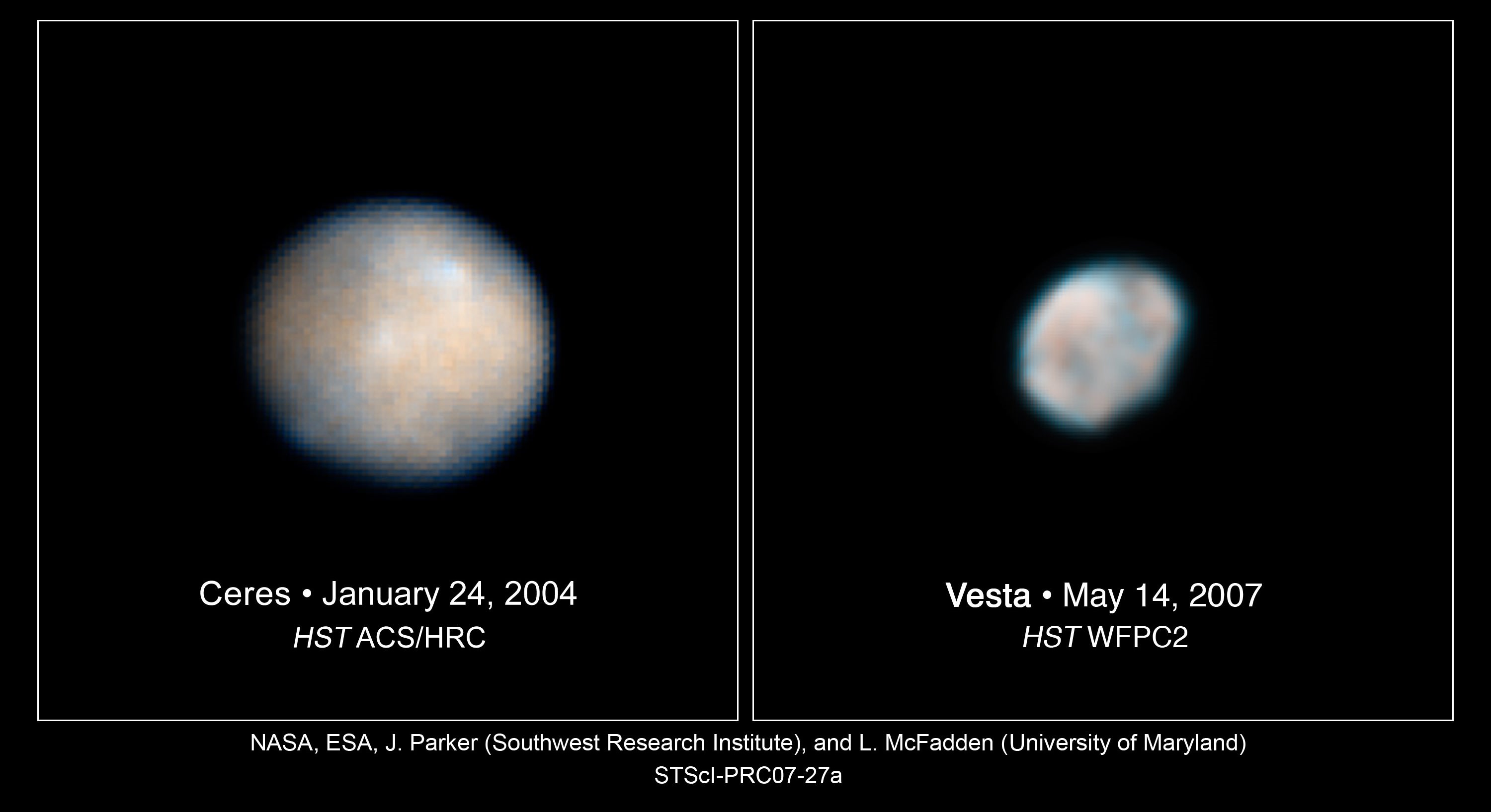
Vesta is one of the largest asteroids in the Solar System. Comprising 9% of the mass in the Asteroid Belt, it is second in size only to the dwarf-planet Ceres. And now, thanks to data obtained by NASA’s Dawn spacecraft, Vesta’s surface has been mapped out in unprecedented detail.
These high-resolution geological maps reveal the variety of Vesta’s surface features and provide a window into the asteroid’s history.
“The geologic mapping campaign at Vesta took about two-and-a-half years to complete, and the resulting maps enabled us to recognize a geologic timescale of Vesta for comparison to other planets,” said David Williams of Arizona State University.
Geological mapping is a technique used to derive the geologic history of a planetary object from detailed analysis of surface morphology, topography, color and brightness information. The team found that Vesta’s geological history is characterized by a sequence of large impact events, primarily by the Veneneia and Rheasilvia impacts in Vesta’s early history and the Marcia impact in its late history.
The geologic mapping of Vesta was made possible by the Dawn spacecraft’s framing camera, which was provided by the Max Planck Institute for Solar System Research of the German Max Planck Society and the German Aerospace Center. This camera takes panchromatic images and seven bands of color-filtered images, which are used to create topographic models of the surface that aid in the geologic interpretation.
A team of 14 scientists mapped the surface of Vesta using Dawn data. The study was led by three NASA-funded participating scientists: Williams; R. Aileen Yingst of the Planetary Science Institute; and W. Brent Garry of the NASA Goddard Spaceflight Center.
The brown colored sections of the map represent the oldest, most heavily cratered surface. Purple colors in the north and light blue represent terrains modified by the Veneneia and Rheasilvia impacts, respectively. Light purples and dark blue colors below the equator represent the interior of the Rheasilvia and Veneneia basins. Greens and yellows represent relatively young landslides or other downhill movement and crater impact materials, respectively.
The map indicates the prominence of impact events – such as the Veneneia, Rheasilvia and Marcia impacts, respectively – in shaping the asteroid’s surface. It also indicates that the oldest crust on Vesta pre-dates the earliest Veneneia impact. The relative timescale is supplemented by model-based absolute ages from two different approaches that apply crater statistics to date the surface.
“This mapping was crucial for getting a better understanding of Vesta’s geological history, as well as providing context for the compositional information that we received from other instruments on the spacecraft: the visible and infrared (VIR) mapping spectrometer and the gamma-ray and neutron detector (GRaND),” said Carol Raymond, Dawn’s deputy principal investigator at NASA’s Jet Propulsion Laboratory in Pasadena, California.
The objective of NASA’s Dawn mission is to characterize the two most massive objects in the main asteroid belt between Mars and Jupiter – Vesta and the dwarf planet Ceres.
Asteroids like Vesta are remnants of the formation of the solar system, giving scientists a peek at its early history. They can also harbor molecules that are the building blocks of life and reveal clues about the origins of life on Earth. Hence why scientists are eager to learn more about its secrets.
The Dawn spacecraft was launched in September of 2007 and orbited Vesta between July 2011 and September 2012. Using ion propulsion in spiraling trajectories to travel from Earth to Vesta, Dawn will orbit Vesta and then continue on to orbit the dwarf planet Ceres by April 2015.
The high resolution maps were included with a series of 11 scientific papers published this week in a special issue of the journal Icarus. The Dawn spacecraft is currently on its way to Ceres, the largest object in the asteroid belt, and will arrive at Ceres in March 2015.
Further Reading: NASA
Recent Posts
Artemis Astronauts Will Deploy New Seismometers on the Moon
Back in the 1960s and 1970s, Apollo astronauts set up a collection of lunar seismometers…
Ice Deposits on Ceres Might Only Be a Few Thousand Years Old
The dwarf planet Ceres has some permanently dark craters that hold ice. Astronomers thought the…

The Mystery of Cosmic Rays Deepens
Cosmic rays are high-energy particles accelerated to extreme velocities approaching the speed of light. It…
NASA Confirms that a Piece of its Battery Pack Smashed into a Florida Home
NASA is in the business of launching things into orbit. But what goes up must…
Are Titan's Dunes Made of Comet Dust?
A new theory suggests that Titan's majestic dune fields may have come from outer space.…
The Solar Wind is Stripping Oxygen and Carbon Away From Venus
The BepiColombo mission, a joint effort between JAXA and the ESA, was only the second…