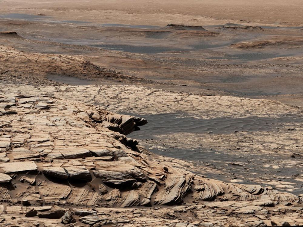
Stitched together from 28 images, this view from NASA's Curiosity Mars rover was captured after the rover ascended the steep slope of a geologic feature called "Greenheugh Pediment." In the distance at the top of the image is the floor of Gale Crater, which is near a region called Aeolis Dorsa that researchers believe was once a massive ocean. The layered structure of the rocks indicated they were created by waterborne sediment. Credit: NASA/JPL-Caltech/MSSS.
Scientists have long suspected that Mars was once warm and wet in its ancient past. The Mars Ocean Hypothesis says that the planet was home to a large ocean around 4 billion years ago. The ocean filled the Vastitas Borealis basin in the planet’s northern hemisphere. The basin is 4–5 km (2.5–3 miles) below Mars’ mean elevation.
A new topographic map of Mars reinforces the hypothesis and adds more detail.
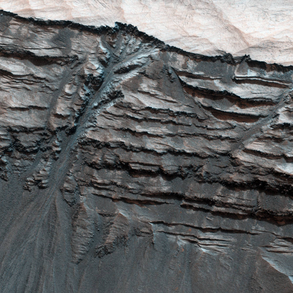
Possible water-formed gullies cut through sedimentary layers in Terby Crater
[/caption]
Terby Crater, a 170-km-wide (100-mile-wide) crater located on the northern edge of the vast Hellas Planitia basin in Mars’ southern hemisphere, is edged by variable-toned layers of sedimentary rock – possibly laid down over millennia of submersion beneath standing water. This image (false-color) from the HiRISE camera aboard the Mars Reconnaissance Orbiter shows a portion of Terby’s northern wall with what clearly looks like liquid-formed gullies slicing through the rock layers, branching from the upper levels into a main channel that flows downward, depositing a fan of material at the wall’s base.
But, looks can be deceiving…
Terby Crater. Credit: NASA/JPL/University of Arizona
Dry processes – especially on Mars, where large regions have been bone-dry for many millions of years – can often create the same effects on the landscape as those caused by running water. Windblown Martian sand and repetitive dry landslides can etch rock in much the same way as liquid water, given enough time. But the feature seen above in Terby seem to planetary scientists to be most likely the result of liquid erosion… especially considering that the sedimentary layers themselves seem to contain clay materials, which only form in the presence of liquid water. Is it possible that some water existed beneath Mars’ surface long after the planet’s surface dried out? Or that it’s still there? Only future exploration will tell for sure.
“While formation by liquid water is one of the proposed mechanisms for gully formation on Mars, there are others, such as gravity-driven mass-wasting (like a landslide) that don’t require the presence of liquid water. This is still an open question that scientists are actively pursuing.”
– Nicole Baugh, HiRISE Targeting Specialist
Terby Crater was once on the short list of potential landing sites for the new Mars Science Laboratory (aka Curiosity) rover but has since been removed from consideration. Still, it may one day be visited by a future robotic mission and have its gullies further explored from ground level.