One of the hardest things for many people to conceptualize when talking about how fast something is going is that they must ask, “Compared to what?” All motion only makes sense from a frame of reference, and many spacecraft traveling in the depths of the void lack any regular reference from which to understand how fast they’re going. There have been several different techniques to try to solve this problem, but one of the ones that have been in development the longest is StarNAV – a way to navigate in space using only the stars.
A pulsar with its magnetic field lines illustrated. The beams emitting from the poles are what washes over our detectors as the dead star spins.
A team of researchers at the University of Illinois Urbana-Champaign have found a way for travelers through the Solar System to work out exactly where they are, without needing help from ground-based observers on Earth. They have refined the pulsar navigation technique, which uses X-ray signals from distant pulsars, in a way similar to how GPS uses signals from a constellation of specialized satellites, to calculate an exact position .
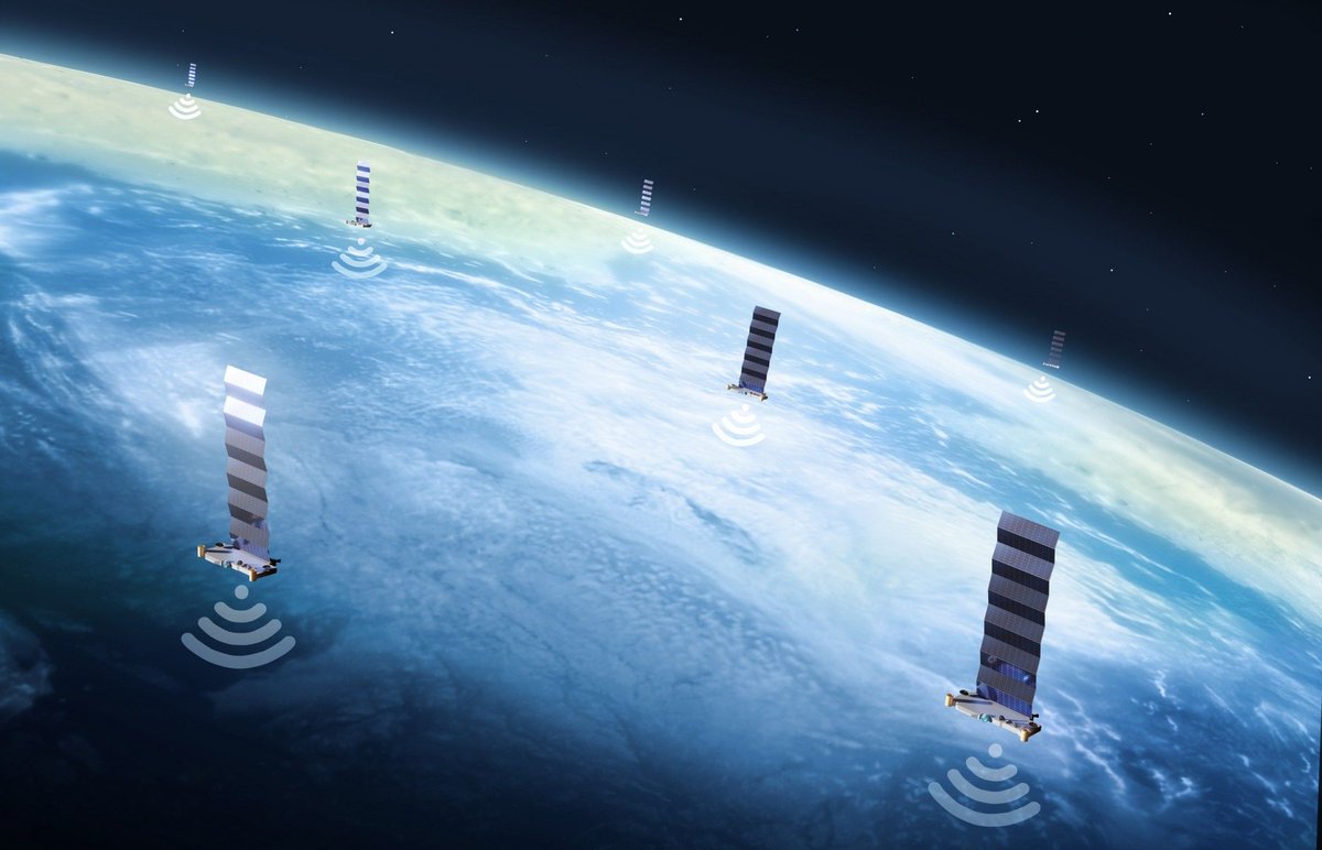
Starlink keeps growing, and so do its capabilities. Lately, even people outside of SpaceX have even been developing capabilities for it. A team of researchers from the Ohio State University (OSU) and the University of California Irvine (UCI) has developed a way to use Starlinks networked satellites as a basic navigation tool.
Image of the night sky taken at the European Southern Observatory’s Very Large Telescope in Chile. The Large and Small Magellanic Clouds are visible in the night sky. Credit: ESO, Y. Beletsky
The Magellanic Clouds are a pair of dwarf galaxies that are bound to the Milky Way. The Milky Way is slowly consuming them in Borg-like fashion, starting with the gas halo that surrounds both Clouds. They’re visible in the southern sky, and for centuries people have gazed up at them. They’re named after the Portuguese explorer Ferdinand Magellan, in our current times.
In our last episode, we talked about what it’ll take to navigate across the Solar System. In this episode we scale things up and speculate how future civilizations will navigate to other stars and even other galaxies.
We record Astronomy Cast as a live Google+ Hangout on Air every Monday at 12:00 pm Pacific / 3:00 pm Eastern. You can watch here on Universe Today or from the Astronomy Cast Google+ page.
It’s hard enough finding your way around planet Earth, but what do you do when you’re trying to find your way around the Solar System? Today we’ll talk about how spacecraft navigate from world to world.
We record Astronomy Cast as a live Google+ Hangout on Air every Monday at 12:00 pm Pacific / 3:00 pm Eastern. You can watch here on Universe Today or from the Astronomy Cast Google+ page.
Although the Zodiac is best known for astrology nonsense, it has a purpose in astronomy too. The constellations of the Zodiac define the plane of the ecliptic: the region where the Sun, Moon and planets appear to travel through the sky. What are the constellations of the Zodiac, and how do astronomers use them as way points?
We record Astronomy Cast as a live Google+ Hangout on Air every Monday at 12:00 pm Pacific / 3:00 pm Eastern. You can watch here on Universe Today or from the Astronomy Cast Google+ page.
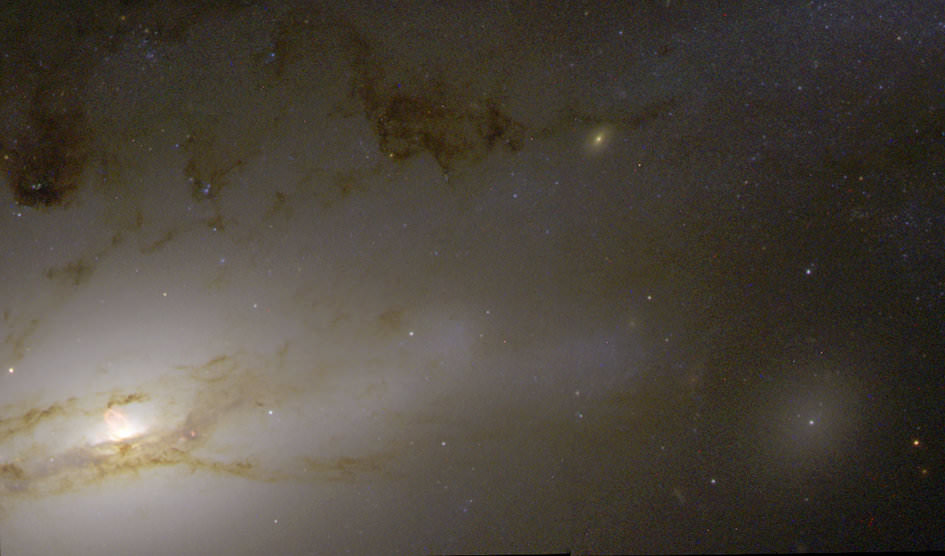
A quasar resides in the hub of the nearby galaxy NGC 4438. Credit: NASA/ESA, Jeffrey Kenney (Yale University), Elizabeth Yale (Yale University)
50 million light-years away a quasar resides in the hub of galaxy NGC 4438, an incredibly bright source of light and radiation that’s the result of a supermassive black hole actively feeding on nearby gas and dust (and pretty much anything else that ventures too closely.) Shining with the energy of 1,000 Milky Ways, this quasar — and others like it — are the brightest objects in the visible Universe… so bright, in fact, that they are used as beacons for interplanetary navigation by various exploration spacecraft.
“I must go down to the seas again, to the lonely sea and the sky,
And all I ask is a tall ship and a star to steer her by.”
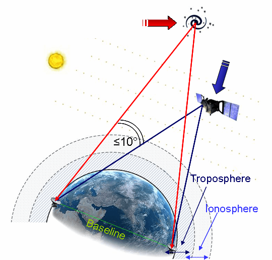
Deep-space missions require precise navigation, especially when approaching bodies such as Mars, Venus, or comets. It’s often necessary to pinpoint a spacecraft traveling 100 million km from Earth to within just 1 km. To achieve this level of accuracy, experts use quasars – the most luminous objects known in the Universe – as beacons in a technique known as Delta-Differential One-Way Ranging, or delta-DOR.
How delta-DOR works (ESA)
Delta-DOR uses two antennas in distant locations on Earth (such as Goldstone in California and Canberra in Australia) to simultaneously track a transmitting spacecraft in order to measure the time difference (delay) between signals arriving at the two stations.
Unfortunately the delay can be affected by several sources of error, such as the radio waves traveling through the troposphere, ionosphere, and solar plasma, as well as clock instabilities at the ground stations.
Delta-DOR corrects these errors by tracking a quasar that is located near the spacecraft for calibration — usually within ten degrees. The chosen quasar’s direction is already known extremely well through astronomical measurements, typically to closer than 50 billionths of a degree (one nanoradian, or 0.208533 milliarcsecond). The delay time of the quasar is subtracted from that of the spacecraft’s, providing the delta-DOR measurement and allowing for amazingly high-precision navigation across long distances.
“Quasar locations define a reference system. They enable engineers to improve the precision of the measurements taken by ground stations and improve the accuracy of the direction to the spacecraft to an order of a millionth of a degree.”
– Frank Budnik, ESA flight dynamics expert
So even though the quasar in NGC 4438 is located 50 million light-years from Earth, it can help engineers position a spacecraft located 100 million kilometers away to an accuracy of several hundred meters. Now that’s a star to steer her by!
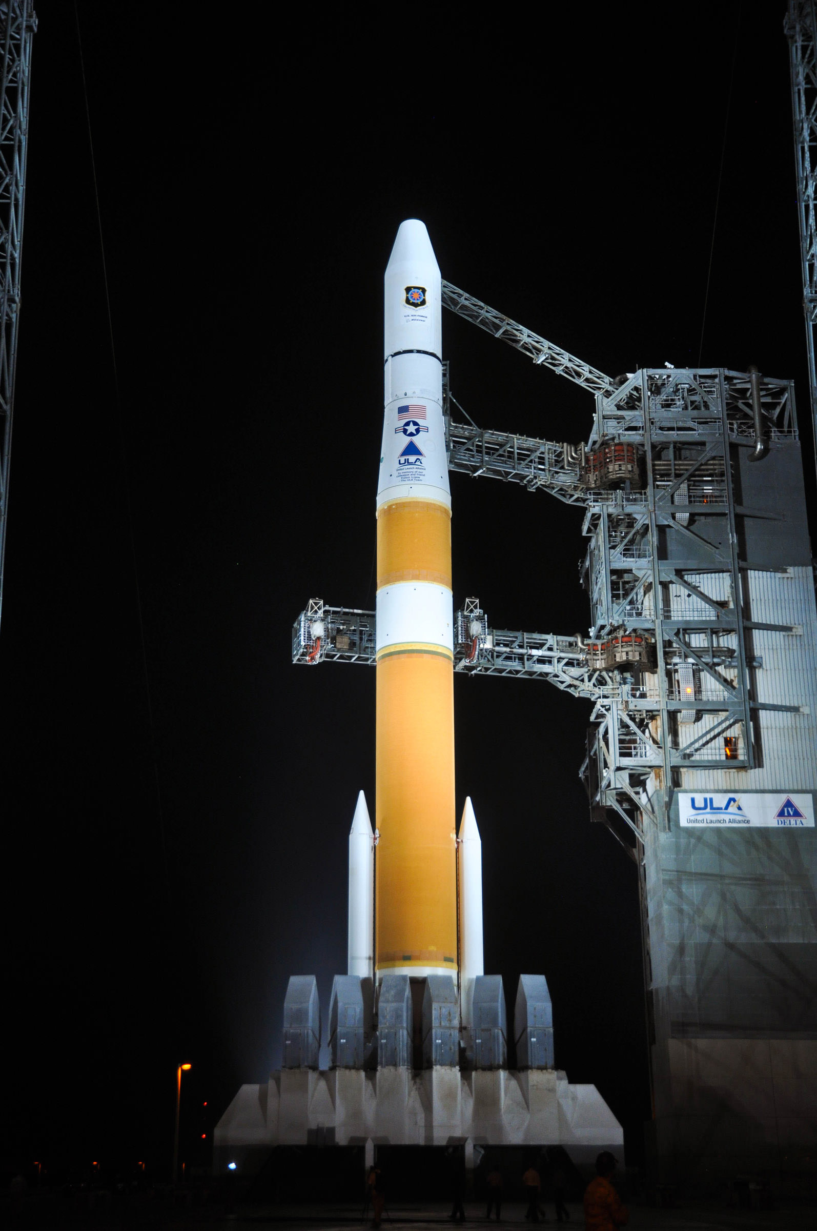
A Delta IV rocket launched from Florida today, sending a next-generation Global Positioning System satellite into orbit. The rocket lifted off at 12:10 UTC with the GPS IIF-3 satellite that will be part of the GPS system that is used by both civilians and the military. The new satellite will replace a 19-year-old navigation satellite in the global system that includes 31 operational satellites on-orbit which broadcast position, navigation and timing information to people around the world.
A United Launch Alliance Delta IV stands ready for launch at Space Launch complex 37 with the GPS IIF-3 satellite. Credit: ULA
The satellite, built by Boeing, is the third of 12 planned launches to provide improved GPS signals, featuring improved anti-jam technology, more precise atomic clocks, an upgraded civilian channel for commercial aviation and on-board processors that can be reprogrammed in flight, according to CBS News.
The new satellite should be operational by November.
The in previous podcast, we talked about the old way navigators used to find their way around the planet; by looking at objects in the sky, and doing some tricky math. The new navigation system, of course, is the Global Positioning System, and it helps you find your spot on the planet with amazing accuracy. Let’s see where the system came from, and how it works.