[/caption]
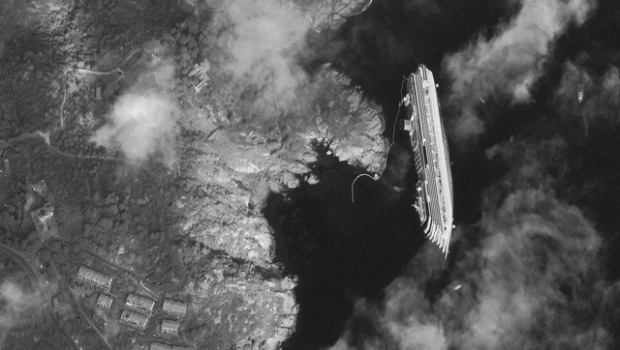
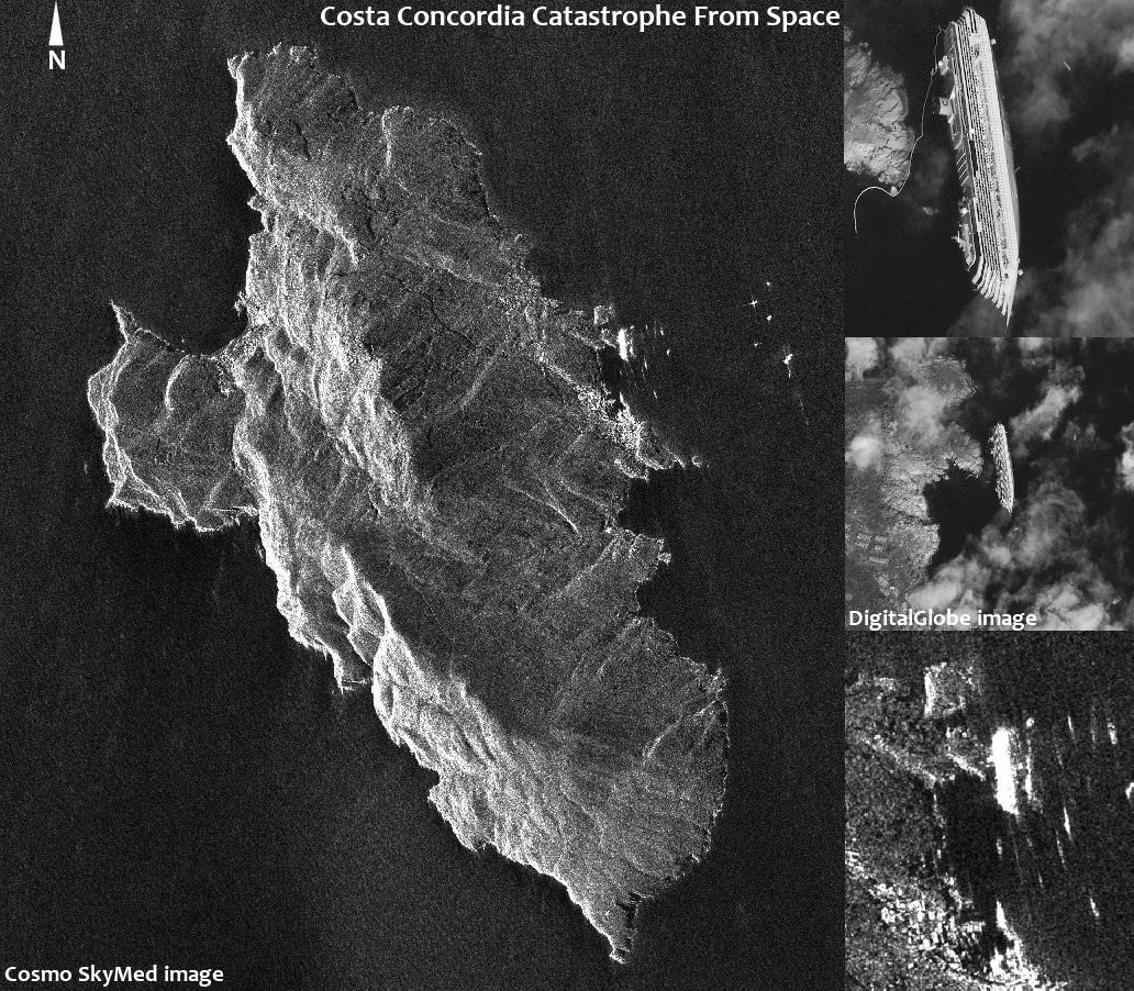
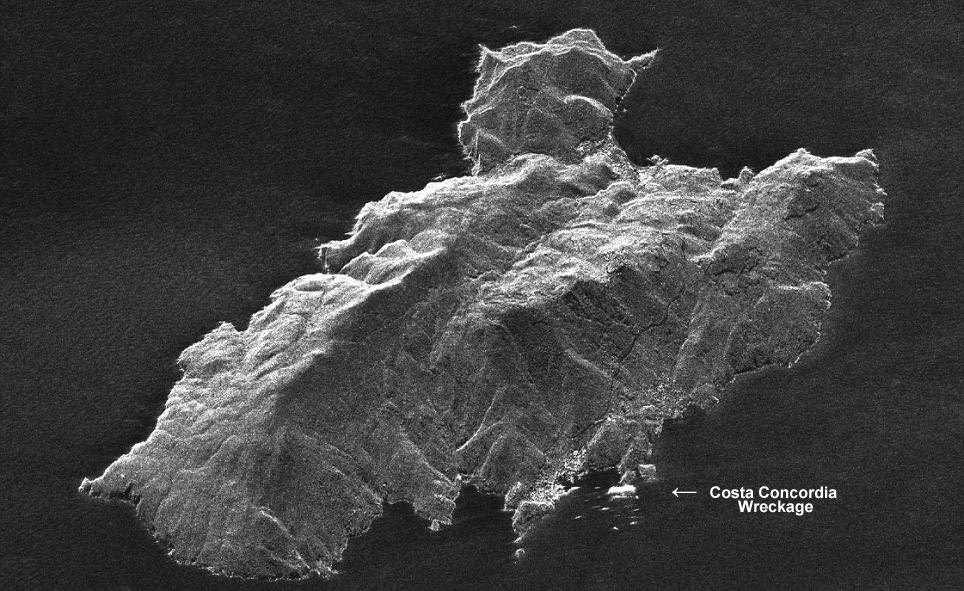
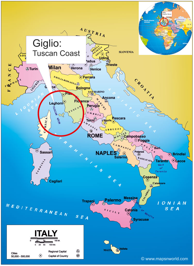
An amazing new radar image from space (above and below) shows the wreckage of the deadly Costa Concordia catastrophe just hours after the luxury cruise liner struck gigantic rocks jutting up from the shoreline of the Island of Giglio [Isola del Giglio] off the coast of Tuscany, Italy on Friday the 13th of January 2012, sending thousands of terrified tourists screaming for their very lives.
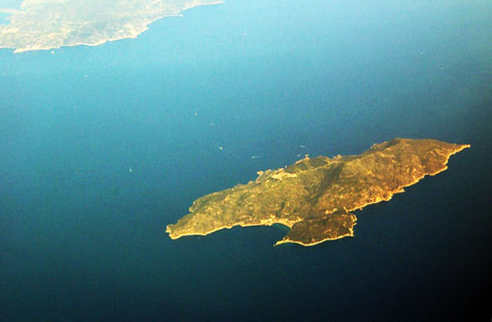
The radar image was snapped by chance during a routine reconnaissance survey by an Italian COSMO-SkyMed satellite orbiting above the Earth, according to the Italian Space Agency (ASI) and clearly shows the Costa Concordia wreckage and entire island of Giglio.
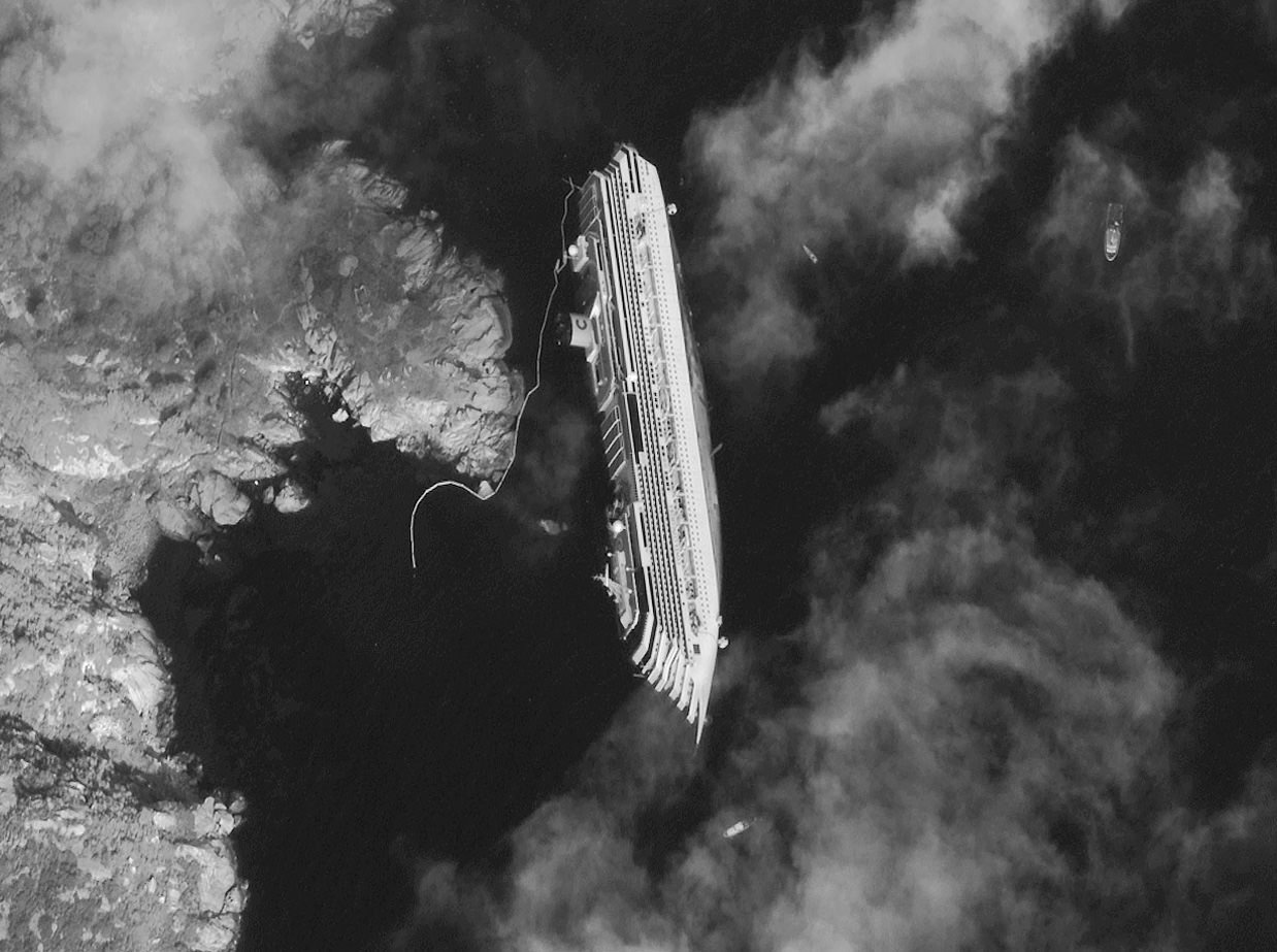
Our composite mosaic above combines the COSMO-SkyMed space radar image with the DigitalGlobe WorldView satellite photo, to provide a side-by-side comparison of the wreckage from the two different satellite systems which have different resolutions. Read my prior story with the stunning DigitalGlobe image – here at Universe Today.
At least 11 people were killed in the still unfolding tragedy and another two dozen people are still missing today, January 19.
Look at this dramatic new YouTube video of passengers scrambling to stay alive
The COSMO-SkyMed satellite normally takes repeat radar images every 16 days. In the case of an oil spill, the satellite would enter automatically an “emergency mode” and start taking very-high resolution images of the affected region, according to ASI.
Severe weather is approaching and could break the ship apart according to news reports.
COSMO-SkyMed space radar image taken just hours after Costa Concordia luxury cruise ship ran aground off the shoreline of Giglio, Italy on 13 Jan. 2012. Credit: COSMO-SkyMed
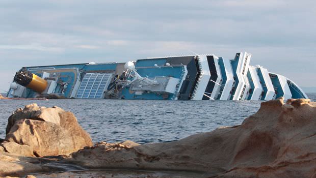
The Costa Concordia is loaded with several thousand gallons of diesel fuel oil and officials are concerned about the very real potential for a leak which could contaminate the beautiful surroundings and harm the local environment
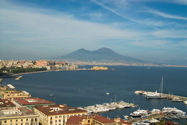
off the Tuscan coastline of Giglio, Italy
The deadly Jan. 13 collision tore a 70 meter long gash in the ship’s hull, causing the Costa Concordia cruise liner to begin listing. Ultimately the ship fell on its side as it was steered into shallow waters.
Rescue operations resumed today although the ship is still shifting and hazardous to the brave rescue teams.
Helicopters lowered emergency workers onto the top of the wreckage. Divers working below used explosives to blast open new holes in the hull to get to any survivors.
And still more Italian emergency personnel could be seen scaling up the sides – all in a desperate attempt to reach survivors from every possible angle.
But sadly, hopes are fading. A 5 year old Italian girl and her father are among the missing.

COSMO-SkyMed is a constellation of four Italian satellites that are equipped with Synthetic Aperture Radar (SAR) sensors that provide global coverage of the planet that serves both military and civilian uses such as seismic hazard analysis, environmental disaster monitoring, and agricultural mapping.
The COSMO-SkyMed space radar system provides all weather imagery and is funded by the Italian government and managed by the Italian Space Agency (ASI).

Credit: DIGITALGLOBE