Floating ice at the calving front of Greenland's Kangerdlugssuaq glacier, photographed in 2011 during Operation IceBridge (Credit: NASA/Michael Studinger)
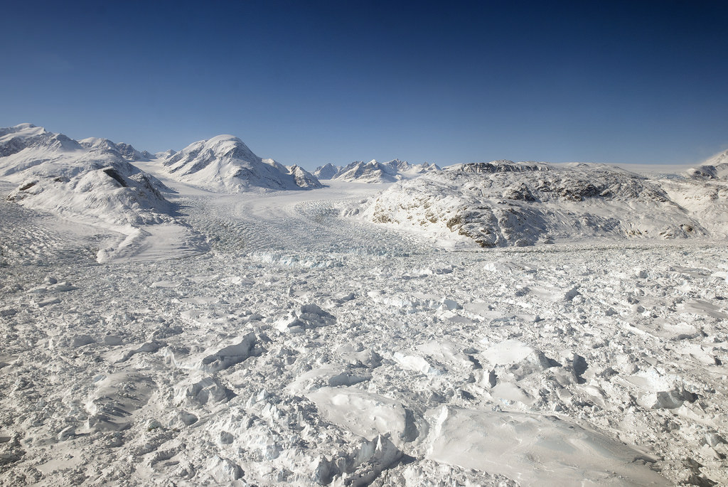
Many regions on Earth are temperate, nutrient-rich, stable environments where life seems to thrive effortlessly. But not all of Earth. Some parts, like Greenland’s ice sheet, are inhospitable.
In our nascent search for life elsewhere in the Solar System, it stands to reason that we’ll be looking at worlds that are marginal and inhospitable. Icy worlds like Jupiter’s moon Europa and Saturn’s moon Enceladus are our most likely targets. These frozen worlds have warm oceans under layers of ice.
What can Greenland’s cryo-ecosystems tell us about searching for life on icy bodies like Europa and Enceladus?
In early 2012, an international research team surveying parts of southwestern Greenland announced that they had discovered the oldest impact crater ever discovered on Earth, estimated at 3.3 billion years old. Now, new research shows that the strange geological feature – known as the Maniitsoq structure – is probably the result of Earthly geological processes, rather than a meteorite impact.
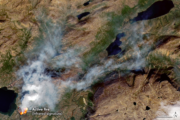
This fire in Greenland is near Sisimiut, in Western Greenland. It was likely caused by a hiker. Image Credit: NASA Earth Observatory
As global warming ramps up, expect to see Greenland in the news a lot. That’s because its ice sheet is under threat of melting. But that’s not the only reason. The other reason is fire.
The Greenland ice sheet could be gone in a thousand years. Don't buy waterfront property. Image Credit: NASA
Great news! Humankind’s greatest-ever engineering project is nearing completion. Soon we will have warmed the Earth enough to get rid of all those pesky ice sheets and other frozen areas. The finish line is in sight.
If we all work together for the next thousand years, we’ll finally reach our goal!
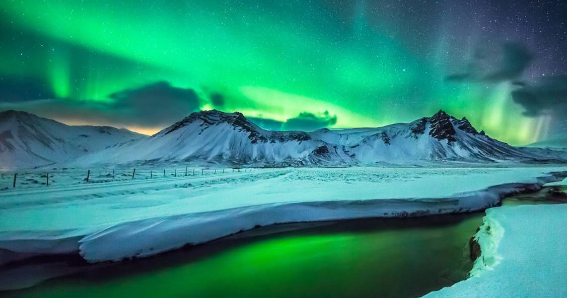
Screenshot from 'Two Lands: Greenland and Iceland' by Joe Capra.
Holy Northern Lights, Batman! This new timelapse is just beautiful! Photographer Joe Capra traveled to Greenland and Iceland to shoot 10 nights of the arctic Aurora. Not only was the aurora absolutely stunning, but the landscape is equally beautiful. Joe said that all the footage was shot in super high resolution 4K Ultra HD, and you can even see the bright aurora reflected in small rivers and streams.
Here are some of the locations Joe shot the footage: Greenland locations include the Kangerlussuaq, Ilulissat, Ilimanaq, Ilulissat Ice Fjord, Russell Glacier, Greenland Icecap, and Disko Bay. Iceland locations include the South Coast, Snæfellsnes Peninsula, Kirkjufell, and Grundarfjörður.
Floating ice at the calving front of Greenland's Kangerdlugssuaq glacier, photographed in 2011 during Operation IceBridge (Credit: NASA/Michael Studinger)
Greenland’s glaciers may contribute more to future sea level rise than once thought, despite earlier reports that their steady seaward advance is a bit slower than expected. This is just more sobering news on the current state of Earth’s ice from the same researchers that recently announced the “unstoppable” retreat of West Antarctic glaciers.
Using data collected by several international radar-mapping satellites and NASA’s airborne Operation IceBridge surveys, scientists at NASA and the University of California, Irvine have discovered deep canyons below the ice sheet along Greenland’s western coast. These canyons cut far inland, and are likely to drive ocean-feeding glaciers into the sea faster and for longer periods of time as Earth’s climate continues to warm.
Some previous models of Greenland’s glaciers expected their retreat to slow once they receded to higher altitudes, making their overall contribution to sea level increase uncertain. But with this new map of the terrain far below the ice, modeled with radar soundings and high-resolution ice motion data, it doesn’t seem that the ice sheets’ recession will halt any time soon.
According to the team’s paper, the findings “imply that the outlet glaciers of Greenland, and the ice sheet as a whole, are probably more vulnerable to ocean thermal forcing and peripheral thinning than inferred previously from existing numerical ice-sheet models.”
“The glaciers of Greenland are likely to retreat faster and farther inland than anticipated, and for much longer, according to this very different topography we have discovered. This has major implications, because the glacier melt will contribute much more to rising seas around the globe.”
– Mathieu Morlighem, project scientist, University of California, Irving
Many of the newly-discovered canyons descend below sea level and extend over 65 miles (100 kilometers) inland, making them vulnerable — like the glaciers in West Antarctica — to undercutting by warmer ocean currents.
The team’s findings were published on May 18 in a report titled Deeply Incised Submarine Glacial Valleys Beneath the Greenland Ice Sheet in the journal Nature Geoscience.
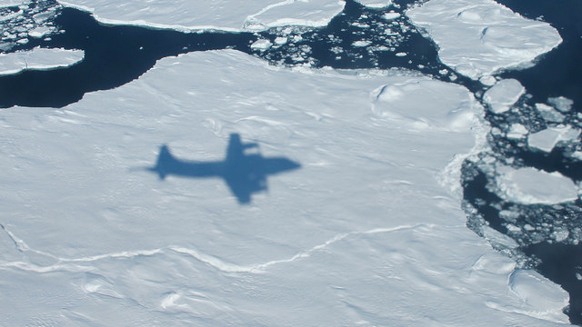
The NASA P-3B's shadow on sea ice off of southeast Greenland during an IceBridge survey on Apr. 9, 2013. Flying at a low altitude allows IceBridge researchers to gather detailed data. Credit: NASA / Jim Yungel
There’s a “Chuck Norris fact” that says Chuck once went skydiving but promised never to do it again, saying one Grand Canyon is enough. But Chuck must have taken another jump millions of years ago.
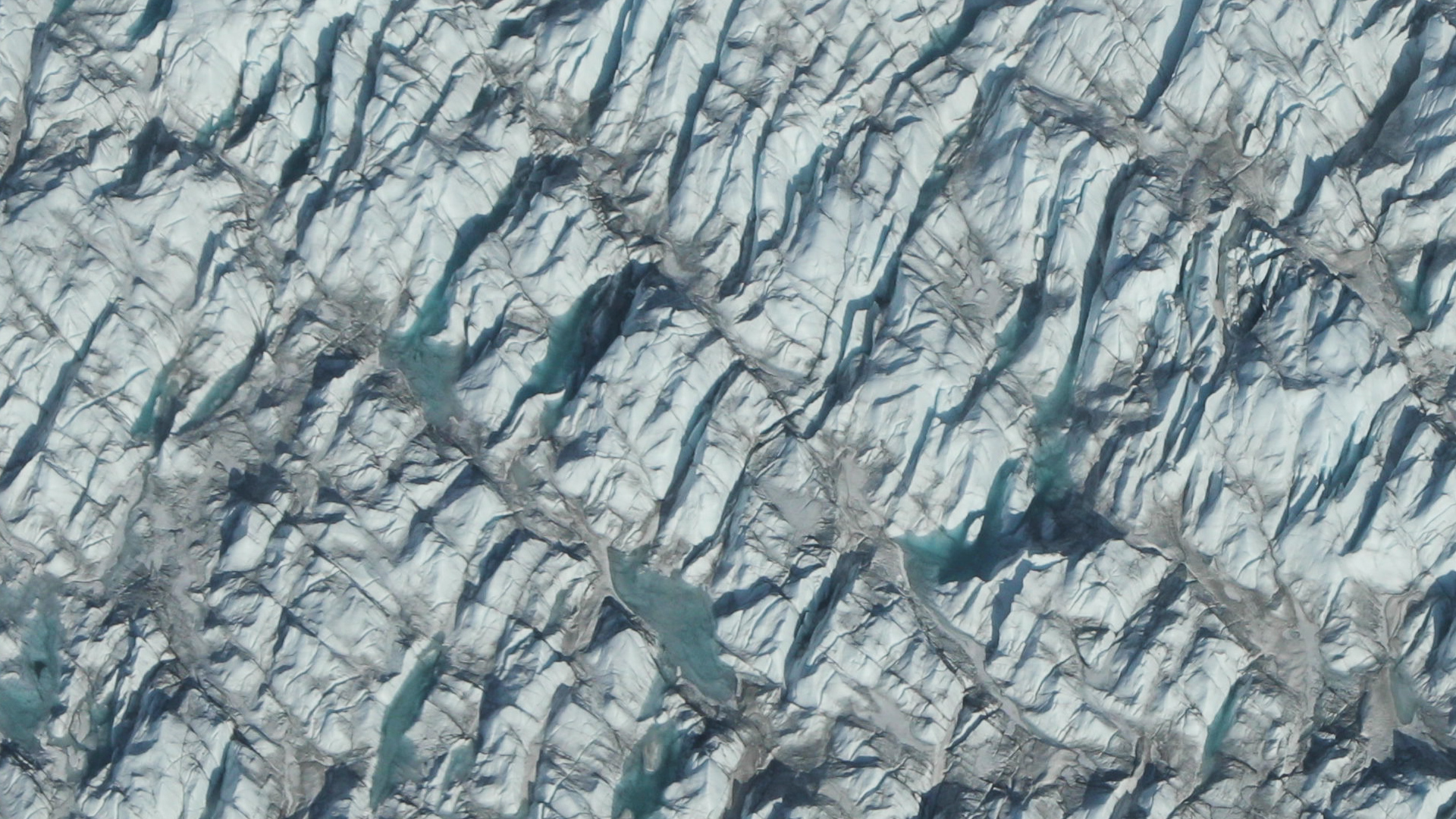
Data gathered by NASA’s Operation IceBridge, an aerial science observation mission, has uncovered a previously unknown massive canyon in Greenland, hidden under a kilometer of ice.
The canyon, found by airborne radar data, has the same characteristics of a winding river channel like the Grand Canyon in Arizona. It is at least 750 kilometers (460 miles) long, making it longer than the Grand Canyon. In some places, it is as deep as 800 meters (2,600 feet), on scale with parts of the Grand Canyon. This immense feature is thought to predate the ice sheet that has covered Greenland for the last few million years.
“One might assume that the landscape of the Earth has been fully explored and mapped,” said Jonathan Bamber, professor of physical geography at the University of Bristol in the United Kingdom, and lead author of the study. “Our research shows there’s still a lot left to discover.”
While additional airborne radar data was used, the majority of the data was collected by IceBridge flights over Greenland during flights from 2009 to 2013. IceBridge’s Multichannel Coherent Radar Depth Sounder can see through vast layers of ice to measure its thickness and the shape of bedrock below.
In their analysis of the radar data, Bamber and his team discovered a continuous bedrock canyon that extends from almost the center of the island and ends beneath the Petermann Glacier fjord in northern Greenland.
At certain frequencies, radio waves can travel through the ice and bounce off the bedrock underneath. The amount of time the radio waves took to bounce back helped researchers determine the depth of the canyon. The longer it took, the deeper the bedrock feature.
The researchers believe the canyon plays an important role in transporting sub-glacial meltwater from the interior of Greenland to the edge of the ice sheet into the ocean. Evidence suggests that before the presence of the ice sheet, as much as 4 million years ago, water flowed in the canyon from the interior to the coast and was a major river system.
“It is quite remarkable that a channel the size of the Grand Canyon is discovered in the 21st century below the Greenland ice sheet,” said Studinger. “It shows how little we still know about the bedrock below large continental ice sheets.”
The IceBridge campaign will return to Greenland in March 2014 to continue collecting data on land and sea ice in the Arctic using a suite of instruments that includes ice-penetrating radar.
Bamber and his team had their findings published in the journal Science.
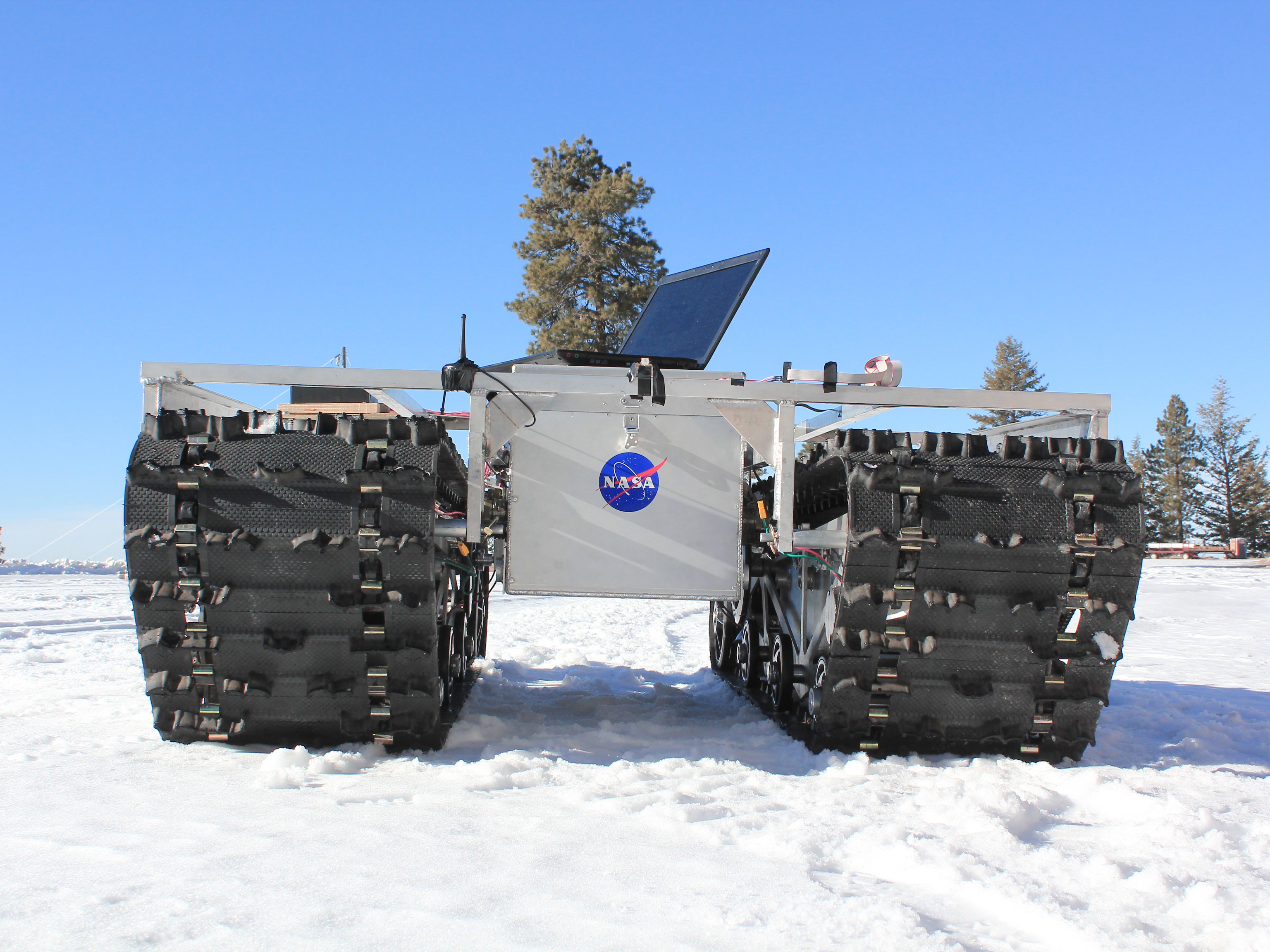
A GROVER prototype during testing in January 2013. Credit: Gabriel Trisca, Boise State University
How fast is Greenland’s ice sheet melting in response to climate change, and how is it recovering? A new NASA rover with the friendly name of GROVER (Greeland Rover and Goddard Remotely Operated Vehicle for Exploration and Research) is going to try to figure that out.
GROVER will rove across a small area of the massive ice sheet at a location called Summit Camp, which is a National Science Foundation outpost. On board it has ground-penetrating radar that is intended to figure out how the snow builds up in layers through time.
“Robots like GROVER will give us a new tool for glaciology studies,” stated Lora Koenig, a glaciologist at Goddard and science advisor on the project.
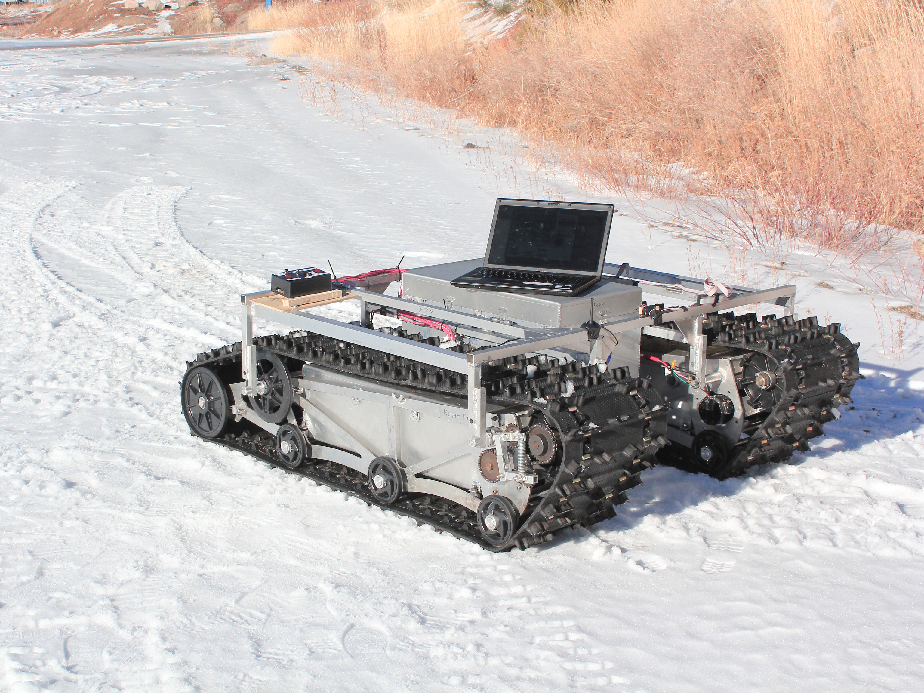
A prototype of GROVER during testing in January 2012. The rover does not have its solar panels attached here. The laptop was used as part of that specific test only. Credit: Gabriel Trisca, Boise State University
The student-designed project came to be during development phases in 2010 and 2011, principally at Boise State University in Idaho. At six feet tall, it’s way more massive than its Sesame Street namesake: it tips the scale at 800 pounds, including solar panels, and has two snowmobile tracks built in to move around.
“GROVER is just like a spacecraft but it has to operate on the ground,” stated Michael Comberiate, a retired NASA engineer and manager of Goddard’s Engineering Boot Camp.
“It has to survive unattended for months in a hostile environment, with just a few commands to interrogate it and find out its status and give it some directions for how to accommodate situations it finds itself in.”
Studies began on May 3 and will continue through June 8.
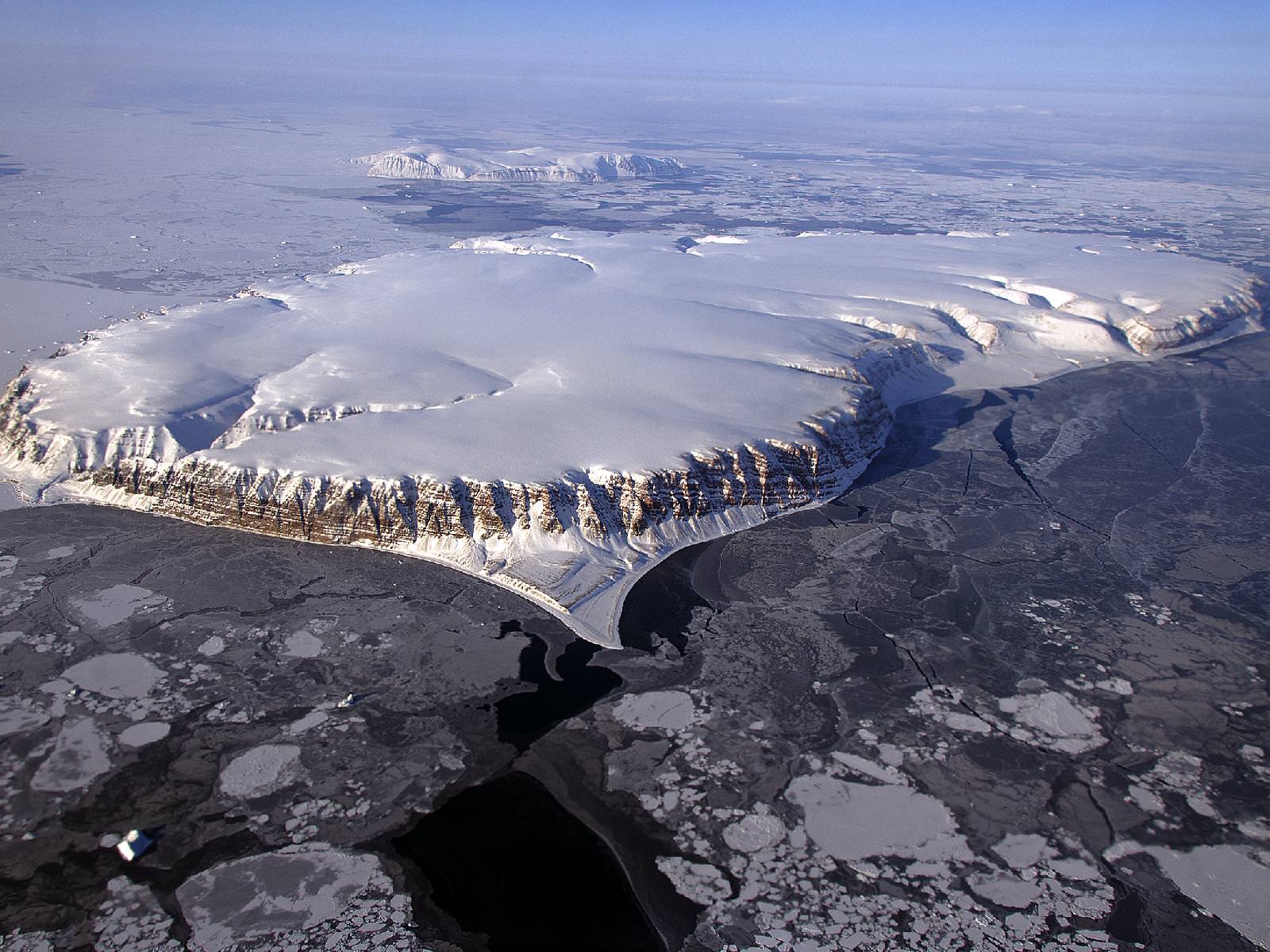
Saunders Island and Wolstenholme Fjord with Kap Atholl in the background photographed during a NASA IceBridge flight. (NASA/Michael Studinger)
It’s quite a long way from Mars, but I can’t help but be reminded of the Red Planet’s ice-covered north pole when looking at this photo taken by Michael Studinger earlier this month, during a recent IceBridge survey flight over Greenland.
Called Saunders Island (also Appat Island) the 82-square-mile frozen slab of rock rises from the sea off the coast of northwestern Greenland, one of many islands within the Wolstenholme (Uummannaq) Fjord on the shore of Baffin Bay. Operation IceBridge, a six-year aerial survey of the changing ice coverage at our planet’s poles, is run by NASA to provide valuable ground-level information to supplement satellite data.
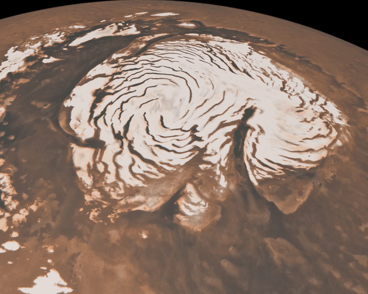
To me, the shape of the island’s steep rock faces and rugged inlets slice into its interior bear a striking resemblance to Mars’ ice cap.
Mars’ north polar ice cap
While Mars’ ice cap is shaped by very different processes — and obviously much bigger — you might see the connection too!
But rather than dark Martian dunes, sea ice can be seen surrounding the islands in varying thicknesses in the IceBridge photo above. Sea ice coverage in the fjord ranges from thicker, white ice in the background to thinner “grease” ice and leads with dark, open ocean water in the foreground.
The IceBridge P-3B airborne laboratory in a hangar at Wallops Flight Facility (NASA/George Hale)
As the amount of darker, ice-free water surfaces increase over the course of the year due to rising global temperatures, the more heat from solar radiation is collected in the ocean — thus speeding up the process of seasonal sea ice loss and overall Arctic warming.
Read more about the IceBridge mission here, and see a collection of more photos from this season’s flights here.
NASA’s Operation IceBridge images Earth’s polar ice in unprecedented detail to better understand processes that connect the polar regions with the global climate system. IceBridge utilizes a highly specialized fleet of research aircraft and the most sophisticated suite of innovative science instruments ever assembled to characterize annual changes in thickness of sea ice, glaciers, and ice sheets. In addition, IceBridge collects critical data used to predict the response of earth’s polar ice to climate change and resulting sea-level rise.
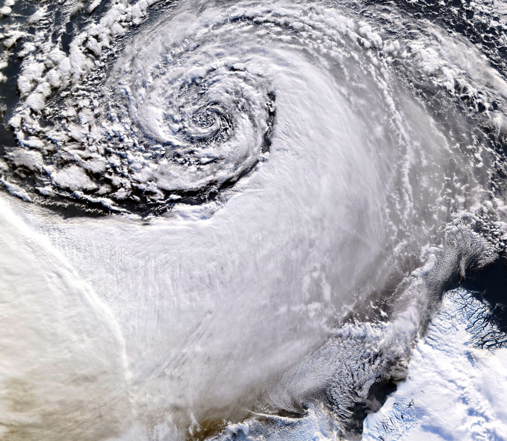
Satellite image of a cloud vortex off the coast of Greenland (NASA/MODIS/Chelys)
Looking south across the southern tip of Greenland, this satellite image shows an enormous cloud vortex spiraling over the northern Atlantic ocean on January 26, 2013. An example of the powerful convection currents in the upper latitudes, these polar low cyclones are created when the motion of cold air is energized by the warmer ocean water beneath.
Sometimes referred to as Arctic cyclones, these spiraling storms can bring gale-force winds and heavy snowfall over a wide area of ocean during their 12- to 36-hour lifespans. Hurricane-type storms don’t only form in the tropics!
This image was captured by the MODIS instrument on NASA’s Aqua satellite from its polar orbit 705 km (438 miles) above the Earth. The view has been rotated so south is up; the southernmost tip of Greenland can be seen at lower right. Click for an impressive high-resolution view.