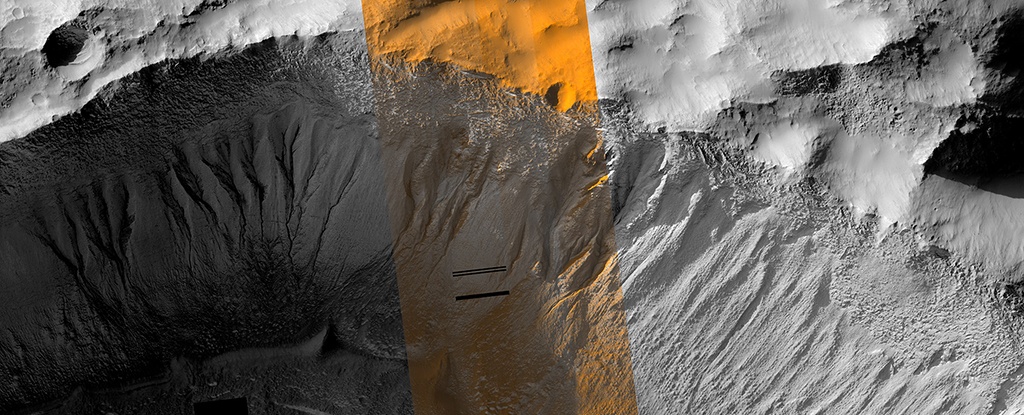
Image of gullies in Terra Sirenum on Mars taken by the High Resolution Imaging Science Experiment (HiRISE) camera onboard NASA's Mars Reconnaissance Orbiter. (Credit: NASA/JPL/University of Arizona)
A recent study published in Science examines how thin channels inside impact craters on Mars could have formed from Martian gullies, which share similar characteristics with gullies on Earth and are typically formed from cascading meltwater, despite the Martian atmosphere being incapable of supporting liquid water on its surface. However, the researchers hypothesize these gullies could have formed during periods of high obliquity, also known as axial tilt, on Mars, which could have resulted in a brief rise in surface temperatures that could have melted some surface and subsurface ice, leading to meltwater cascading down the sides of impact craters across the planet.
The Global CTX Mosaic of Mars allows scientists and the public to explore the planet like never before. It includes different layers of data that can be turned on or off, like these labels for named geographic features on the planet. Credits: NASA/JPL-Caltech/MSSS,
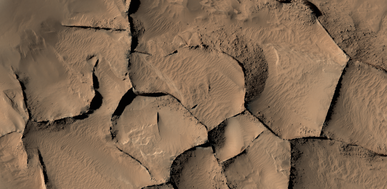
Using data from the Mars Reconnaissance Orbiter (MRO), planetary scientists have created one of the most unique and detailed maps of Mars ever. But fair warning, the biggest version of this is a could overload your computer.
Global CTX Mosaic of Mars is the highest-resolution global image of the Red Planet ever created and it even allows you see Mars in 3D.
Since the 1960s and 70s, scientists have come to view Mars as something of a “dead planet.” As the first close-up images from orbit and the surface came in, previous speculation about canals, water, and a Martian civilization were dispelled. Subsequent studies also revealed that the geological activity that created features like the Tharsis Mons region (especially Olympus Mons) and Valles Marineris had ceased long ago.
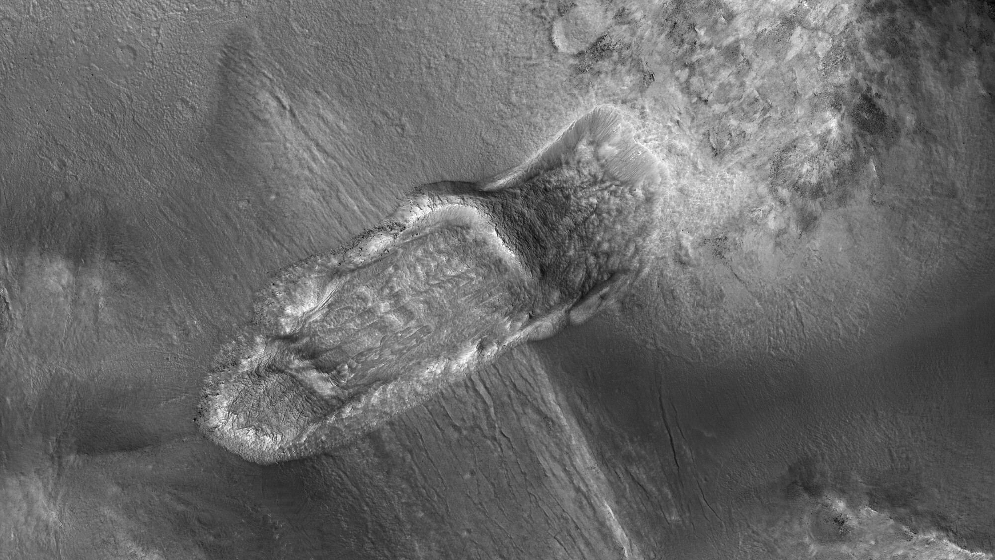
However, in the past few decades, robotic missions have found ample evidence that Mars is still an active place. A recent indication was an image taken by the Mars Reconnaissance Orbiter (MRO), which showed relatively fresh landslides in a crater near Nili Fossae. This area is part of the Syrtis Major region and is located just north of the Jezero Crater (where the Perseverance rover will be landing in six weeks!)
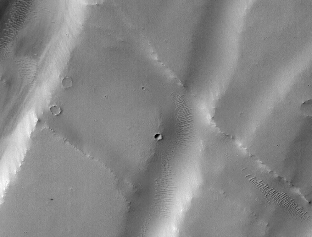
The tiny black speck in the lower left corner of this image within the red circle is a cluster of recently formed craters spotted on Mars using a new machine-learning algorithm. This image was taken by the Context Camera aboard NASA's Mars Reconnaissance Orbiter in a region called Noctis Fossae, located at latitude -3.213, longitude: 259.415. Image Credit: NASA/JPL-Caltech/MSSS
Does the life of an astronomer or planetary scientists seem exciting?
Sitting in an observatory, sipping warm cocoa, with high-tech tools at your disposal as you work diligently, surfing along on the wavefront of human knowledge, surrounded by fine, bright people. Then one day—Eureka!—all your hard work and the work of your colleagues pays off, and you deliver to humanity a critical piece of knowledge. A chunk of knowledge that settles a scientific debate, or that ties a nice bow on a burgeoning theory, bringing it all together. Conferences…tenure…Nobel Prize?
Well, maybe in your first year of university you might imagine something like that. But science is work. And as we all know, not every minute of one’s working life is super-exciting and gratifying.
Using its HiRISE camera, the MRO has noted existence of tall networks of ridges on Mars that have diverse origins. Credit: NASA/JPL-Caltech/Univ. of Arizona
Mars has some impressive geological features across its cold, desiccated surface, many of which are similar to featured found here on Earth. By studying them, scientists are able to learn more about the natural history of the Red Planet, what kinds of meteorological phenomena are responsible for shaping it, and how similar our two planets are. A perfect of example of this are the polygon-ridge networks that have been observed on its surface.
One such network was recently discovered by the Mars Reconnaissance Orbiter (MRO) in the Medusae Fossae region, which straddles the planet’s equator. Measuring some 16 story’s high, this ridge network is similar to others that have been spotted on Mars. But according to a survey produced by researchers from NASA’s Jet Propulsion Laboratory, these ridges likely have different origins.
This survey, which was recently published in the journal Icarus, examined both the network found in the Medusae Fossae region and similar-looking networks in other regions of the Red Planet. These ridges (sometimes called boxwork rides), are essentially blade-like walls that look like multiple adjoining polygons (i.e. rectangles, pentagons, triangles, and similar shapes).
Shiprock, a ridge-feature in northwestern New Mexico that is 10 meters (30 feet) tall, which formed from lava filling an underground fracture that resisted erosion better than the material around it did. Credit: NASA
While similar-looking ridges can be found in many places on Mars, they do not appear to be formed by any single process. As Laura Kerber, of NASA’s Jet Propulsion Laboratory and the lead author of the survey report, explained in a NASA press release:
“Finding these ridges in the Medusae Fossae region set me on a quest to find all the types of polygonal ridges on Mars… Polygonal ridges can be formed in several different ways, and some of them are really key to understanding the history of early Mars. Many of these ridges are mineral veins, and mineral veins tell us that water was circulating underground.”
Such ridges have also been found on Earth, and appear to be the result of various processes as well. One of the most common involves lava flowing into preexisting fractures in the ground, which then survived when erosion stripped the surrounding material away. A good example of this is the Shiprock (shown above), a monadrock located in San Juan County, New Mexico.
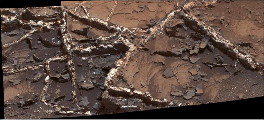
Examples of polygon ridges on Mars include the feature known as “Garden City“, which was discovered by the Curiosity rover mission. Measuring just a few centimeters in height, these ridges appeared to be the result of mineral-laden groundwater moving through underground fissures, which led to standing mineral veins once the surrounding soil eroded away.
Mineral veins at the “Garden City” site, examined by NASA’s Curiosity Mars rover. Credit: NASA/JPL
At the other end of the scale, ridges that measure around 2 kilometers (over a mile) high have also been found. A good example of this is “Inca City“, a feature observed by the Mars Global Surveyor near Mars’ south pole. In this case, the feature is believed to be the result of underground faults (which were formed from impacts) filling with lava over time. Here too, erosion gradually stripped away the surrounding rock, exposing the standing lava rock.
In short, these features are evidence of underground water and volcanic activity on Mars. And by finding more examples of these polygon-ridges, scientists will be able to study the geological record of Mars more closely. Hence why Kerber is seeking help from the public through a citizen-science project called Planet Four: Ridges.
Established earlier this month on Zooniverse – a volunteer-powered research platform – this project has made images obtained by the MRO’s Context Camera (CTX) available to the public. Currently, this and other projects using data from CTX and HiRISE have drawn the participation of more than 150,000 volunteers from around the world.
By getting volunteers to sort through the CTX images for ridge formations, Kerber and her team hopes that previously-unidentified ones will be identified and that their relationship with other Martian features will be better understood.