Pluto Has a Subsurface ‘Antifreeze’ Ocean

New Horizon's July 2015 flyby of Pluto captured this iconic image of the heart-shaped region called Tombaugh Regio. Credit: NASA/JHUAPL/SwRI.

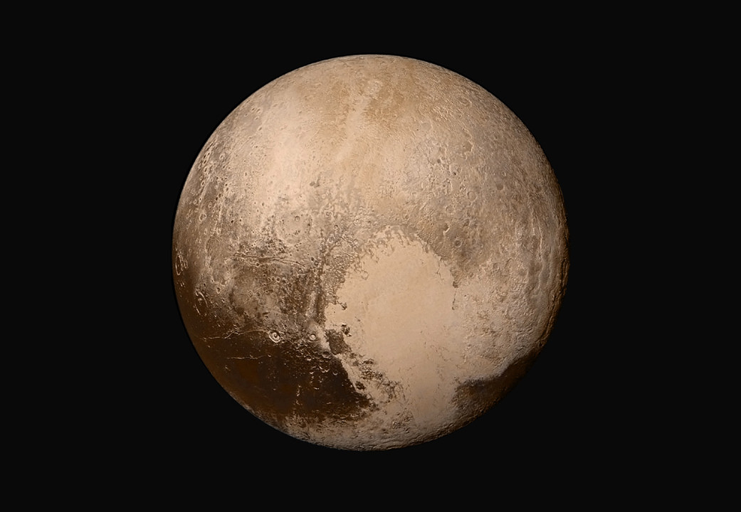
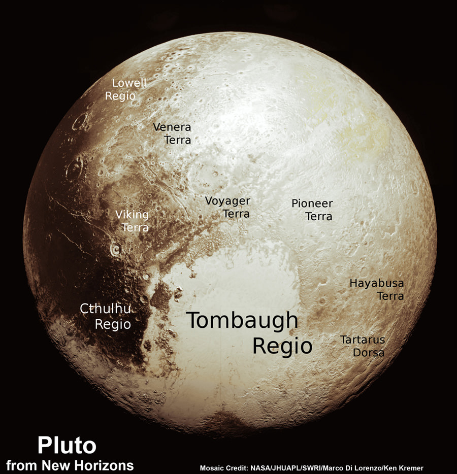
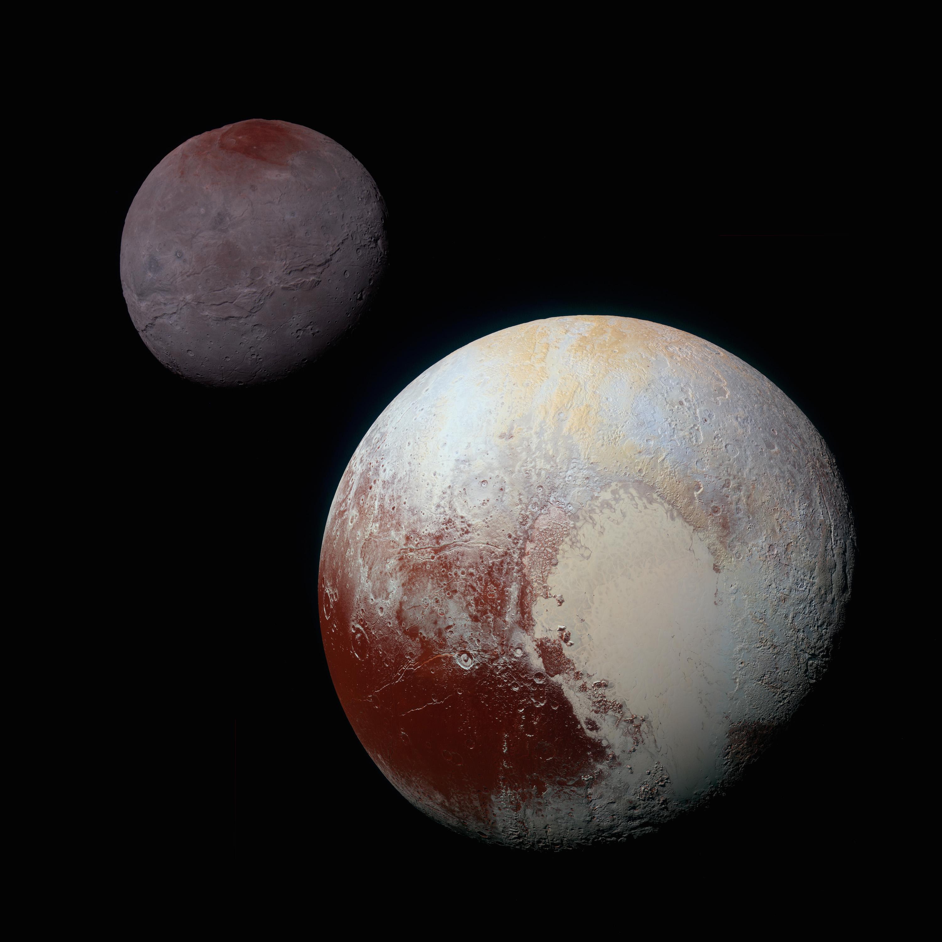
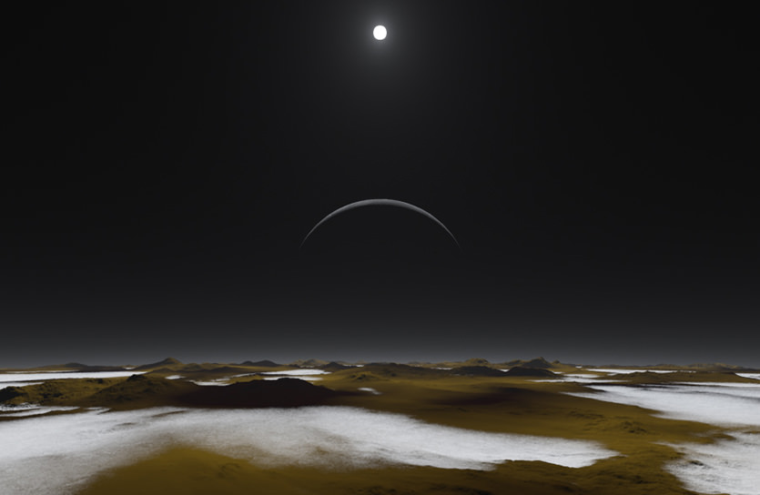
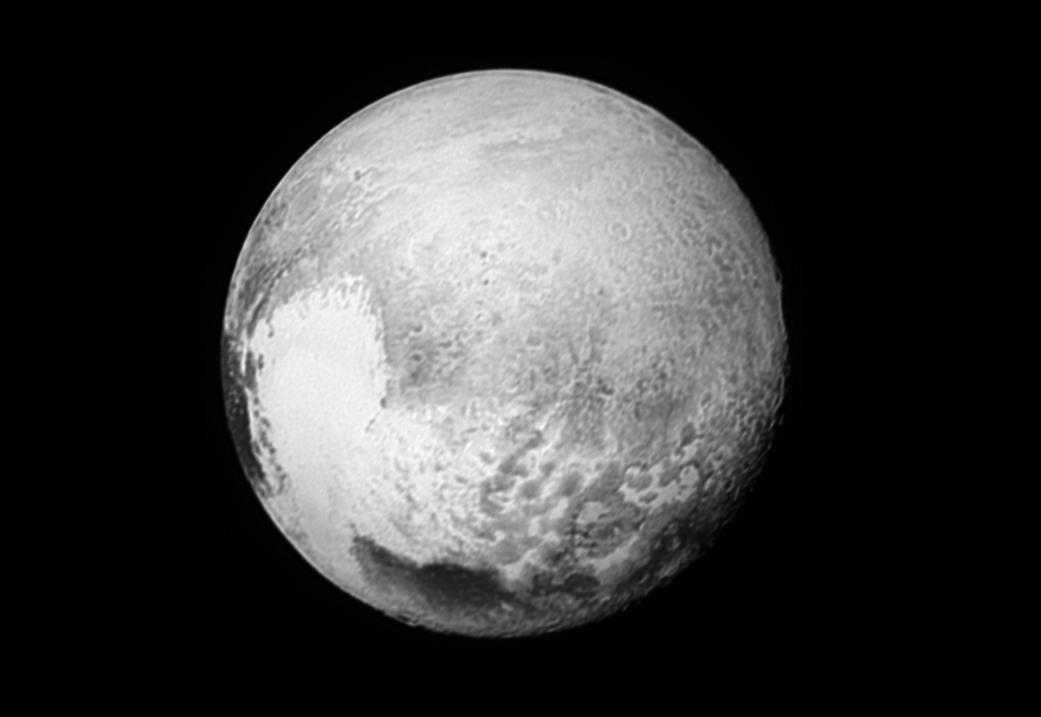
The evidence keeps growing for a large subsurface ocean at Pluto, which also provides clues how the iconic ‘heart’ of Pluto was formed.

We reported in early October that thermal models of Pluto’s interior and tectonic evidence suggest an ocean may exist beneath Pluto’s heart-shaped Sputnik Planitia. Now, new research on data from the New Horizons mission shows more indications of an ocean just below Pluto’s surface that consists of a slushy, viscous liquid, kept warm from Pluto’s interior and a hint of anti-freeze.

“As far as we can tell, there’s no tidal heating helping to keep the ocean liquid,” Francis Nimmo from UC Santa Cruz told Universe Today. He is the first author of a paper on the new findings published today in Nature. “The main heat source keeping the ocean liquid is radioactive decay in Pluto’s rocky interior, although it certainly helps if there is an ‘antifreeze’ present.”

This cutaway image of Pluto shows a section through the area of Sputnik Planitia, with dark blue representing a subsurface ocean and light blue for the frozen crust. Artwork by Pam Engebretson, courtesy of UC Santa Cruz.

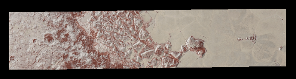
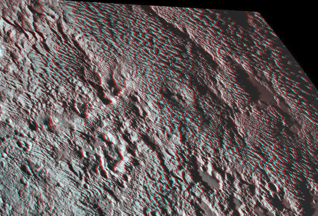
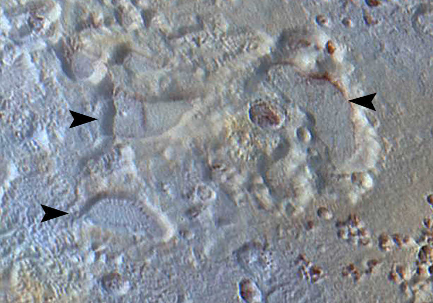
Nimmo said he suspects the ocean is mostly water with ammonia acting as an antifreeze. This subsurface ocean is also bulging, similar to the ‘mascons’ on the Moon, putting stress on Pluto’s icy outer shell, causing fractures consistent with features seen in the New Horizons images.

Another paper also published in Nature today from James Keane at the University of Arizona, also shows how a bulging subsurface ocean made Pluto’s heart ‘heavy,’ reorienting Pluto on its axis, so that Pluto’s heart is always pointing away from the moon Charon.

High-resolution images of Pluto taken by NASA’s New Horizons spacecraft just before closest approach on July 14, 2015, reveal features as small as 270 yards (250 meters) across, from craters to fractures and faulted mountain blocks, to the textured surface of the vast basin informally called Sputnik Planitia.  Credit: NASA/JHUAPL/SWRI
High-resolution images of Pluto taken by NASA’s New Horizons spacecraft just before closest approach on July 14, 2015, reveal features as small as 270 yards (250 meters) across, from craters to fractures and faulted mountain blocks, to the textured surface of the vast basin informally called Sputnik Planitia. Credit: NASA/JHUAPL/SWRI

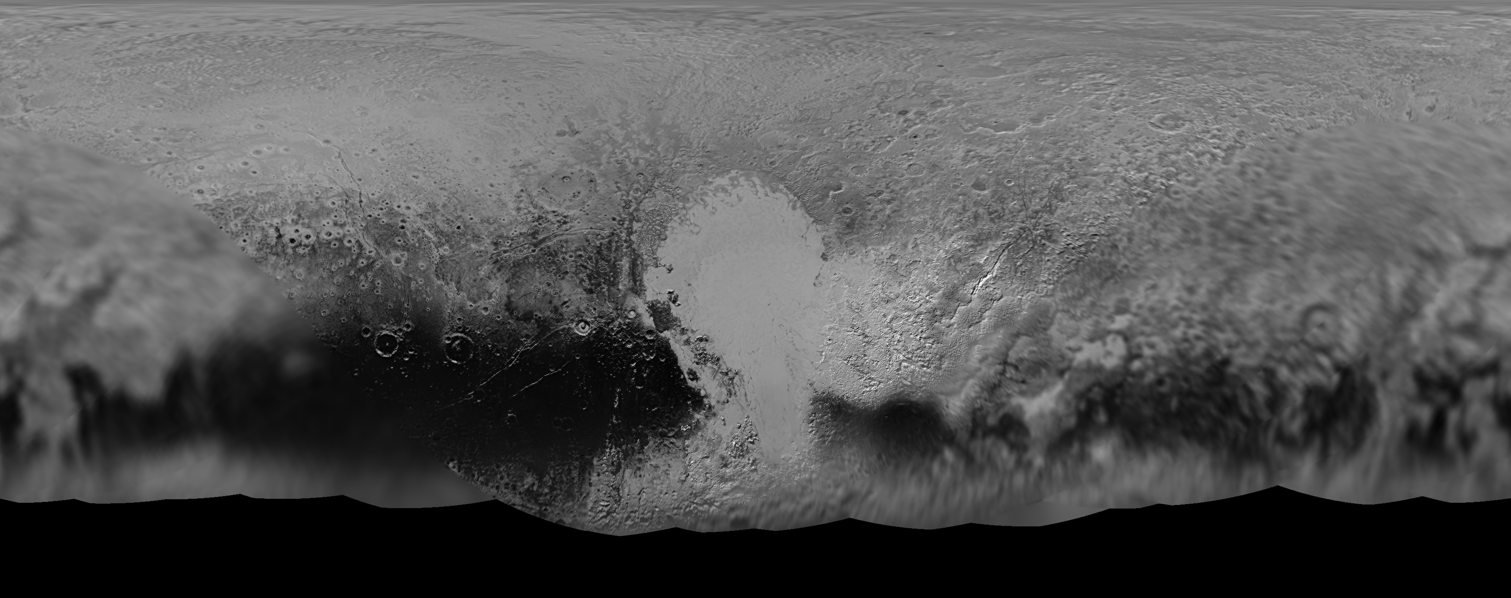
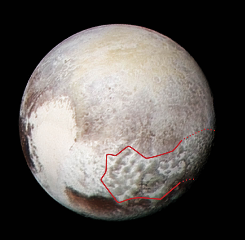
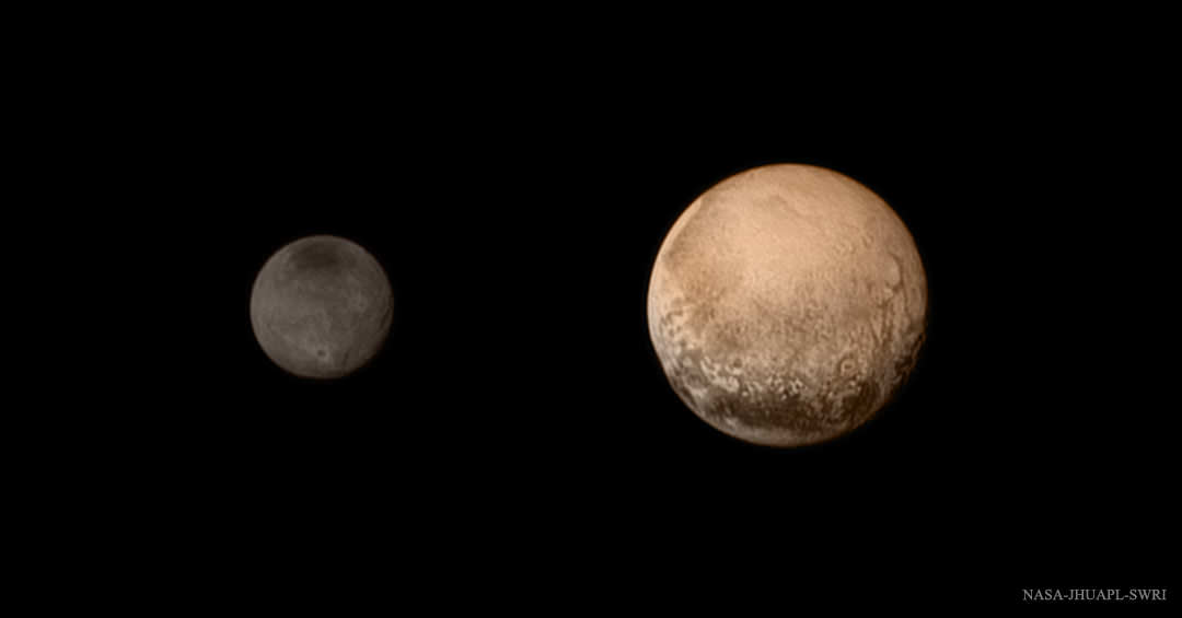
Sputnik Planitia forms one side of the prominent heart-shaped feature seen in some of the first close-up images from New Horizons July 2015 flyby. It was likely created by the impact of a giant meteorite, which would have blasted away a huge amount of Pluto’s icy crust.

But a deep basin is just a “big, elliptical hole in the ground,” Nimmo said, that would not provide the extra mass needed to cause that kind of reorientation. “So, the extra weight must be hiding somewhere beneath the surface. And an ocean is a natural way to get that.”

These schematic diagrams show how the gravity anomaly at Sputnik Planitia is affected by an uplifted ocean and the thickness of the nitrogen layer. Either a nitrogen layer more than 40 km thick (panel b) or an uplifted ocean (panel c) could result in a present-day positive gravity anomaly at Sputnik Planitia; otherwise, the gravity anomaly will be strongly negative (panel a). (Image from Nimmo et al., Nature, 2016)

But Pluto is cold, with temperatures ranging from -387 to -369 Fahrenheit (-233 to -223 Celsius). How could there be an ocean?

“Pluto is small enough that it’s just about almost cooled off but still has a little heat, and it’s about 2 percent the heat budget of the Earth, in terms of how much energy is coming out,” said co-author Richard Binzel, from MIT. “So we calculated Pluto’s size with its interior heat flow, and found that underneath Sputnik Planitia, at those temperatures and pressures, you could have a zone of water-ice that could be at least viscous. It’s not a liquid, flowing ocean, but maybe slushy. And we found this explanation was the only way to put the puzzle together that seems to make any sense.”

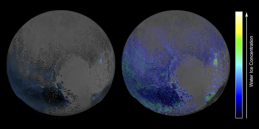
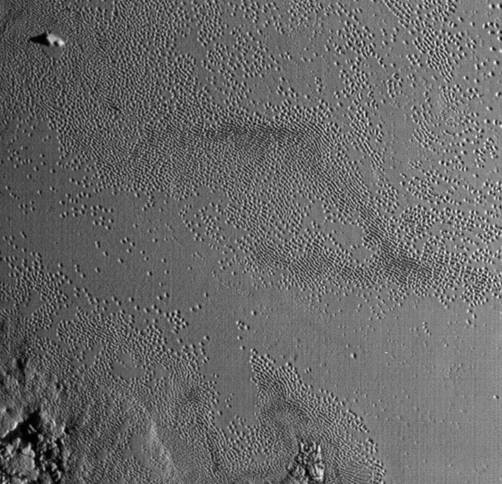
The massive basin also appears extremely bright relative to the rest of the planet, and the data from New Horizons suggest it is filled with frozen nitrogen ice.

Previous research from the the mission showed evidence that the liquid nitrogen may be constantly refreshing, or convecting, as a result of a weak spot at the bottom of the basin, and this weak spot may let heat rise through Pluto’s interior to continuously refresh the ice.

Additionally, the extra weight of an underground ocean could help explain the longstanding question of why Pluto’s heart aligns almost exactly opposite from Charon. Nimmo said this alignment is “suspicious” and that the likelihood of this being just a coincidence is only 5 percent. Therefore, the alignment suggests that extra mass in that location interacted with tidal forces between Pluto and Charon to reorient Pluto, putting Sputnik Planitia directly opposite the side facing Charon.

A thick, heavy ocean, the new data suggest, may have served as a “gravitational anomaly,” which would factor heavily in Pluto and Charon’s gravitational tug-of-war, the researchers said. Over millions of years, the planet would have spun around, aligning its subsurface ocean and the heart-shaped region above it, almost exactly opposite along the line connecting Pluto and Charon.

While scientists are still studying the data from New Horizons, it is safe to say that Pluto keeps surprising everyone, even the scientists who know it best.

“Pluto is hard to fathom on so many different levels,” said Binzel.

Further reading:
UC Santa Cruz
MIT
Nature Paper: Reorientation of Sputnik Planitia implies a subsurface ocean on Pluto
Nature Paper: Reorientation and faulting of Pluto due to volatile loading within Sputnik Planitia

Weekly Space Hangout – Sept 16, 2016: Universe Sandbox

Host: Fraser Cain (@fcain)

Special Guests:
This week’s guests will be the Universe Sandbox Developers Dan Dixon (Project Lead & Creator) and Jenn Seiler (Astrophysicist & Developer).

Guests:

Morgan Rehnberg (MorganRehnberg.com / @MorganRehnberg)
Dave Dickinson (www.astroguyz.com / @astroguyz)
Kimberly Cartier ( KimberlyCartier.org / @AstroKimCartier )
Paul M. Sutter (pmsutter.com / @PaulMattSutter)
Nicole Gugliucci (cosmoquest.org / @noisyastronomer)
Yoav Landsman (@MasaCritit)

Their stories this week:

What’s the deal with Proxima b?

dark matter galaxy

Enterprise nebula

Unexpected gas reservoirs around large stars

Juno’s first pass at Jupiter

Next Week’s Penumbral Eclipse

Two stars, three planets in an unusual system

Overview of OSIRIS-REx after launch

Status of the Israeli Space Program following the SpaceX Static Fire Test “anomaly”

Is Pluto the source of Charon’s red poles?

China launches its second space station

We’ve had an abundance of news stories for the past few months, and not enough time to get to them all. So we are now using a tool called Trello to submit and vote on stories we would like to see covered each week, and then Fraser will be selecting the stories from there. Here is the link to the Trello WSH page (http://bit.ly/WSHVote), which you can see without logging in. If you’d like to vote, just create a login and help us decide what to cover!

We record the Weekly Space Hangout every Friday at 12:00 pm Pacific / 3:00 pm Eastern. You can watch us live on Universe Today, or the Universe Today YouTube page.

Scientists Assemble Fresh Global Map of Pluto Comprising Sharpest Flyby Images

NASA’s New Horizons mission science team has produced this updated panchromatic (black-and-white) global map of Pluto. Credits: NASA/JHUAPL/SWRI
NASA’s New Horizons mission science team has produced this updated panchromatic (black-and-white) global map of Pluto. The map includes all resolved images of Pluto’s surface acquired at pixel resolutions ranging from 18 miles (30 kilometers) on the Charon-facing hemisphere (left and right edges of the map) to 770 feet (235 meters) on the hemisphere facing New Horizons during the closest approach on July 14, 2015 (map center).  Credits: NASA/JHUAPL/SWRI
NASA’s New Horizons mission science team has produced this updated panchromatic (black-and-white) global map of Pluto. Credits: NASA/JHUAPL/SWRI

The science team leading NASA’s New Horizons mission that unveiled the true nature of Pluto’s long hidden looks during the history making maiden close encounter last July, have published a fresh global map that offers the sharpest and most spectacular glimpse yet of the mysterious, icy world.

The newly updated global Pluto map is comprised of all the highest resolution images transmitted back to Earth thus far and provides the best perspective to date.

Click on the lead image above to enjoy Pluto revealed at its finest thus far. Click on this link to view the highest resolution version.

Prior to the our first ever flyby of the Pluto planetary system barely 8 months ago, the planet was nothing more than a fuzzy blob with very little in the way of identifiable surface features – even in the most powerful telescopic views lovingly obtained from the Hubble Space Telescope (HST).

Dead center in the new map is the mesmerizing heart shaped region informally known as Tombaugh Regio, unveiled in all its glory and dominating the diminutive world.

The panchromatic (black-and-white) global map of Pluto published by the team includes the latest images received as of less than one week ago on April 25.

The images were captured by New Horizons’ high resolution Long Range Reconnaissance Imager (LORRI).

The science team is working on assembling an updated color map.

During its closest approach at approximately 7:49 a.m. EDT (11:49 UTC) on July 14, 2015, the New Horizons spacecraft swoop to within about 12,500 kilometers (nearly 7,750 miles) of Pluto’s surface and about 17,900 miles (28,800 kilometers) from Charon, the largest moon.

The map includes all resolved images of Pluto’s surface acquired in the final week of the approach period ahead of the flyby starting on July 7, and continuing through to the day of closest approach on July 14, 2015 – and transmitted back so far.

The pixel resolutions are easily seen to vary widely across the map as you scan the global map from left to right – depending on which Plutonian hemisphere was closest to the spacecraft during the period of close flyby.
They range from the highest resolution of 770 feet (235 meters), at center, to 18 miles (30 kilometers) at the far left and right edges.

The Charon-facing hemisphere (left and right edges of the map) had a pixel resolution of 18 miles (30 kilometers).

“This non-encounter hemisphere was seen from much greater range and is, therefore, in far less detail,” noted the team.

However the hemisphere facing New Horizons during the spacecraft’s closest approach on July 14, 2015 (map center) had a far higher pixel resolution reaching to 770 feet (235 meters).

Coincidentally and fortuitously the spectacularly diverse terrain of Tombaugh Regio and the Sputnik Planum area of the hearts left ventricle with ice flows and volcanoes, mountains and river channels was in the region facing the camera and sports the highest resolution imagery.

See below a newly released shaded relief map of Sputnik Planum.

This new shaded relief view of the region surrounding the left side of Pluto’s heart-shaped feature – informally named Sputnik Planum – shows that the vast expanse of the icy surface is on average 2 miles (3 kilometers) lower than the surrounding terrain.  Angular blocks of water ice are “floating” in the bright deposits of softer, denser solid nitrogen.   Credits:  NASA/JHUAPL/SwRI
This new shaded relief view of the region surrounding the left side of Pluto’s heart-shaped feature – informally named Sputnik Planum – shows that the vast expanse of the icy surface is on average 2 miles (3 kilometers) lower than the surrounding terrain. Angular blocks of water ice are “floating” in the bright deposits of softer, denser solid nitrogen. Credits: NASA/JHUAPL/SwRI

“Sputnik Planum – shows that the vast expanse of the icy surface is on average 2 miles (3 kilometers) lower than the surrounding terrain. Angular blocks of water ice along the western edge of Sputnik Planum can be seen “floating” in the bright deposits of softer, denser solid nitrogen,” according to the team.

Even more stunning images and groundbreaking data will continue streaming back from New Horizons until early fall, across over 3 billion miles of interplanetary space.

Thus the global map of Pluto will be periodically updated.

Its taking over a year to receive the full complement of some 50 gigabits of data due to the limited bandwidth available from the transmitter on the piano-shaped probe as it hurtled past Pluto, its largest moon Charon and four smaller moons.

Pluto is the last planet in our solar system to be visited in the initial reconnaissance of planets by spacecraft from Earth since the dawn of the Space Age.

This new global mosaic view of Pluto was created from the latest high-resolution images to be downlinked from NASA’s New Horizons spacecraft and released on Sept. 11, 2015. The images were taken as New Horizons flew past Pluto on July 14, 2015, from a distance of 50,000 miles (80,000 kilometers). This new mosaic was stitched from over two dozen raw images captured by the LORRI imager and colorized. Annotated with informal place names. Credits: NASA/Johns Hopkins University Applied Physics Laboratory/Southwest Research Institute/Marco Di Lorenzo/Ken Kremer/kenkremer.com

New Horizons remains on target to fly by a second Kuiper Belt Object (KBO) on Jan. 1, 2019 – tentatively named PT1, for Potential Target 1. It is much smaller than Pluto and was recently selected based on images taken by NASA’s Hubble Space Telescope.

Stay tuned here for Ken’s continuing Earth and planetary science and human spaceflight news.

Ken Kremer

New Horizons Snaps Amazing 3-D View of Pluto’s Mysterious ‘Bladed’ Terrain

The amazing stereo view of a broad area informally named Tartarus Dorsa combines two images from the Ralph/Multispectral Visible Imaging Camera (MVIC) taken about 14 minutes apart on July 14, 2015. The first was taken when New Horizons was 16,000 miles (25,000 kilometers) away from Pluto, the second when the spacecraft was 10,000 miles (about 17,000 kilometers) away. Credits: NASA/JHUAPL/SwRI
The amazing stereo view of a broad area informally named Tartarus Dorsa combines two images from the Ralph/Multispectral Visible Imaging Camera (MVIC) taken about 14 minutes apart on July 14, 2015. The first was taken when New Horizons was 16,000 miles (25,000 kilometers) away from Pluto, the second when the spacecraft was 10,000 miles (about 17,000 kilometers) away.   Credits: NASA/JHUAPL/SwRI
The amazing stereo view of a broad area informally named Tartarus Dorsa combines two images from the Ralph/Multispectral Visible Imaging Camera (MVIC) taken about 14 minutes apart on July 14, 2015. The first was taken when New Horizons was 16,000 miles (25,000 kilometers) away from Pluto, the second when the spacecraft was 10,000 miles (about 17,000 kilometers) away. Credits: NASA/JHUAPL/SwRI

It’s time to whip out your 3-D glasses to enjoy and scrutinize the remarkable detail of spectacular terrain revealed in a new high resolution stereo image of Pluto – King of the Kuiper Belt! – taken by NASA’s New Horizons spacecraft.

The amazing new stereo Plutonian image focuses on an area dominated by a mysterious feature that geologists call ‘bladed’ terrain – seen above – and its unlike anything seen elsewhere in our solar system.

Its located in a broad region of rough highlands informally known as Tartarus Dorsa – situated to the east of the Pluto’s huge heart shaped feature called Tombaugh Regio. The best resolution is approximately 1,000 feet (310 meters).

The stereo view combines a pair of images captured by New Horizons Ralph/Multispectral Visible Imaging Camera (MVIC) science instruments. They were taken about 14 minutes apart on during history making first ever flyby of the Pluto planetary system on July 14, 2015.

The first was taken when New Horizons was 16,000 miles (25,000 kilometers) away from Pluto, the second when the spacecraft was 10,000 miles (about 17,000 kilometers) away.

The blades align from north to south, typically reach up to about 550 yards (500 meters) high and are spaced about 2-4 miles (3-5 kilometers). Thus they are among the planets steepest features. They are “perched on a much broader set of rounded ridges that are separated by flat valley floors,” according to descriptions from the New Horizons science team.

This color image of Pluto taken by NASA’s New Horizons spacecraft shows rounded and bizarrely textured mountains, informally named the Tartarus Dorsa, rise up along Pluto’s terminator and show intricate but puzzling patterns of blue-gray ridges and reddish material in between. This view, roughly 330 miles (530 kilometers) across, combines blue, red and infrared images taken by the Ralph/Multispectral Visual Imaging Camera (MVIC) on July 14, 2015, and resolves details and colors on scales as small as 0.8 miles (1.3 kilometers).   Credits: NASA/JHUAPL/SWRI
This color image of Pluto taken by NASA’s New Horizons spacecraft shows rounded and bizarrely textured mountains, informally named the Tartarus Dorsa, rise up along Pluto’s terminator and show intricate but puzzling patterns of blue-gray ridges and reddish material in between. This view, roughly 330 miles (530 kilometers) across, combines blue, red and infrared images taken by the Ralph/Multispectral Visual Imaging Camera (MVIC) on July 14, 2015, and resolves details and colors on scales as small as 0.8 miles (1.3 kilometers). Credits: NASA/JHUAPL/SWRI

Mission scientists have also noted that the bladed terrain has the texture of “snakeskin” owing to their “scaly raised relief.”

In the companion global image from NASA (below), the bladed terrain is outlined in red and shown to extend quite far to the east of Tombaugh Regio.

The composite image was taken on July 13, 2015, the day before the closest approach flyby, when the probe was farther away thus shows lower resolution. It combines a pair of images from two of the science instruments – a Ralph/Multispectral Visible Imaging Camera (MVIC) color scan and an image from the Long Range Reconnaissance Imager (LORRI).

This global view of Pluto combines a Ralph/Multispectral Visible Imaging Camera (MVIC) color scan and an image from the Long Range Reconnaissance Imager (LORRI), both obtained on July 13, 2015 – the day before New Horizons’ closest approach. The red outline marks the large area of mysterious, bladed terrain extending from the eastern section of the large feature informally named Tombaugh Regio.  Credits: NASA/JHUAPL/SwRI
This global view of Pluto combines a Ralph/Multispectral Visible Imaging Camera (MVIC) color scan and an image from the Long Range Reconnaissance Imager (LORRI), both obtained on July 13, 2015 – the day before New Horizons’ closest approach. The red outline marks the large area of mysterious, bladed terrain extending from the eastern section of the large feature informally named Tombaugh Regio.
Credits: NASA/JHUAPL/SwRI

The MVIC scan was taken from a range of 1 million miles (1.6 million kilometers), at a resolution of 20 miles (32 kilometers) per pixel. The corresponding LORRI image was obtained from roughly the same range, but has a higher spatial resolution of 5 miles (8 kilometers) per pixel, say officials.

Scientists have developed several possible theories about the origins of the bladed terrain, including erosion from evaporating ices or deposition of methane ices.

Measurements from the Linear Etalon Imaging Spectral Array (LEISA) instrument reveal that that this region “is composed of methane (CH4) ice with a smattering of water,” reports New Horizons researcher Orkan Umurhan.

He speculates that “the material making up the bladed terrain is a methane clathrate. A clathrate is a structure in which a primary molecular species (say water, or H2O) forms a crystalline ‘cage’ to contain a guest molecule (methane or CH4, for example).”

But the question of whether that methane ice is strong enough to maintain the steep walled snakeskin features, will take much more research to determine a conclusive answer.

Umurhan suggests that more research could help determine if the “methane clathrates in the icy moons of the outer solar system and also in the Kuiper Belt were formed way back before the solar system formed – i.e., within the protosolar nebula – potentially making them probably some of the oldest materials in our solar system.”

Pluto continues to amaze and surprise us as the data streams back to eagerly waiting scientists on Earth over many more months to come – followed by years and decades of painstaking analysis.

This new global mosaic view of Pluto was created from the latest high-resolution images to be downlinked from NASA’s New Horizons spacecraft and released on Sept. 11, 2015. The images were taken as New Horizons flew past Pluto on July 14, 2015, from a distance of 50,000 miles (80,000 kilometers). This new mosaic was stitched from over two dozen raw images captured by the LORRI imager and colorized. Annotated with informal place names. Credits: NASA/Johns Hopkins University Applied Physics Laboratory/Southwest Research Institute/Marco Di Lorenzo/Ken Kremer/kenkremer.com

During New Horizons flyby on July 14, 2015, it discovered that Pluto is the biggest object in the outer solar system and thus the ‘King of the Kuiper Belt.”

The Kuiper Belt comprises the third and outermost region of worlds in our solar system.

Pluto is the last planet in our solar system to be visited in the initial reconnaissance of planets by spacecraft from Earth since the dawn of the Space Age.

New Horizons remains on target to fly by a second Kuiper Belt Object (KBO) on Jan. 1, 2019 – tentatively named PT1, for Potential Target 1. It is much smaller than Pluto and was recently selected based on images taken by NASA’s Hubble Space Telescope.

Stay tuned here for Ken’s continuing Earth and planetary science and human spaceflight news.

Ken Kremer

………….

Learn more about NASA Mars rovers, Orion, SLS, ISS, Orbital ATK, ULA, SpaceX, Boeing, Space Taxis, NASA missions and more at Ken’s upcoming outreach events:

Apr 9/10: “NASA and the Road to Mars Human Spaceflight programs” and “Curiosity explores Mars” at NEAF (NorthEast Astronomy and Space Forum), 9 AM to 5 PM, Suffern, NY, Rockland Community College and Rockland Astronomy Club – http://rocklandastronomy.com/neaf.html

Apr 12: Hosting Dr. Jim Green, NASA, Director Planetary Science, for a Planetary sciences talk about “Ceres, Pluto and Planet X” at Princeton University; 7:30 PM, Amateur Astronomers Assoc of Princeton, Peyton Hall, Princeton, NJ – http://www.princetonastronomy.org/

Apr 17: “NASA and the Road to Mars Human Spaceflight programs”- 1:30 PM at Washington Crossing State Park, Nature Center, Titusville, NJ – http://www.state.nj.us/dep/parksandforests/parks/washcros.html

Spotlight On Pluto’s Frozen Polar Canyons

This enhanced color view Long canyons run vertically across the polar area—part of the informally named Lowell Regio, named for Percival Lowell, who founded Lowell Observatory and initiated the search that led to Pluto’s discovery. The widest of the canyons is about 45 miles (75 kilometers) wide and runs close to the north pole. Roughly parallel subsidiary canyons to the east and west are approximately 6 miles (10 kilometers) wide.
This enhanced color view shows long canyons running vertically across Pluto’s north polar region — part of the informally named Lowell Regio, named for Percival Lowell, who founded Lowell Observatory and initiated the search that led to Pluto’s discovery. The widest of the canyons is about 45 miles (75 km) wide and runs close to the north pole. Roughly parallel secondary canyons to the east and west are approximately 6 miles (10 km) wide. Click for a hi-res view. Credit: NASA/JHUAPL/SRI

Pluto’s frozen nitrogen custard “heart” has certainly received its share of attention. Dozens of wide and close-up photos homing on this fascinating region rimmed by mountains and badlands have been relayed back to Earth by NASA’s New Horizons probe after last July’s flyby. For being only 1,473 miles (2,370 km) in diameter, Pluto displays an incredible diversity of landscapes.

Annotated version of Pluto's north polar region.
Annotated version showing sinuous valleys, canyons and depressions and irregular-shaped pits. Credit: NASA/JHUAPL/SRI with additional annotations by the author

This week, the New Horizons team shifted its focus northward, re-releasing an enhanced color image of the north polar area that was originally part of a high-resolution full-disk photograph of Pluto. Inside of the widest canyon, you can trace the sinuous outline of a narrower valley similar in outward appearance to the Moon’s Alpine Valleycut by a narrow, curvy rill that once served as a conduit for lava.

A composite of enhanced color images of Pluto (lower right) and Charon (upper left), taken by NASA's New Horizons spacecraft as it passed through the Pluto system on July 14, 2015. This image highlights the striking differences between Pluto and Charon. The color and brightness of both Pluto and Charon have been processed identically to allow direct comparison of their surface properties, and to highlight the similarity between Charon's polar red terrain and Pluto's equatorial red terrain. Pluto and Charon are shown with approximately correct relative sizes, but their true separation is not to scale.
A composite of enhanced color images of Pluto (lower right) and Charon, taken by NASA’s New Horizons spacecraft on July 14, 2015. This image highlights the striking differences between Pluto and Charon. The color and brightness of both Pluto and Charon have been processed identically to allow direct comparison of their surface properties, and to highlight the similarity between Charon’s polar red terrain and Pluto’s equatorial red terrain. Pluto and Charon are shown with approximately correct relative sizes, but their separation is not to scale. Credit: NASA/JHUAPL/SRI

We see multiple canyons in Pluto’s polar region, their walls broken and degraded compared to canyons seen elsewhere on the planet. Signs that they may be older and made of weaker materials and likely formed in ancient times when Pluto was more tectonically active. Perhaps they’re related to that long-ago dance between Pluto and its largest moon Charon as the two transitioned into their current tidally-locked embrace.

Cropped version showing three, odd-shaped pits that may reflect sinking of Pluto's crust. Credit:
Cropped version with arrows pointing to three, odd-shaped pits that may reflect sinking of Pluto’s crust. Credit: NASA/JHUAPL/SRI

In the lower right corner of the image, check out those funky-shaped pits that resemble the melting outlines of boot prints in the snow. They reach 45 miles (70 km) across and 2.5 miles (4 km) deep and may indicate locations where subsurface ice has melted or sublimated (vaporized) from below, causing the ground to collapse.

Notice the variation in color across the landscape from yellow-orange to pale blue. High elevations show up in a distinctive yellow, not seen elsewhere on Pluto, with lower elevations and latitudes a bluish gray. New Horizons’ infrared measurements show abundant methane ice across the Lowell Region, with relatively little nitrogen ice. The yellow terrains may be older methane deposits that have been more processed by solar UV light than the bluer terrain. The color variations are especially striking in the area of the collapse pits.

The new map shows exposed water ice to be considerably more widespread across Pluto's surface than was previously known - an important discovery.
The new map shows exposed water ice at Pluto to be considerably more widespread across its surface than was previously known. Its greatest concentration lies in the red-hued regions (in visual light) to the west of Tombaugh Regio, the large, heart-shaped feature. Credit: NASA/JHUAPL/SRI

Pluto’s icy riches include not only methane and nitrogen but also water, which forms the planet’s bedrock. NASA poetically refers to the water ice as “the canvas on which (Pluto’s) more volatile ices paint their seasonally changing patterns”. Recent images made in infrared light shows little or no water ice in the informally named places called Sputnik Planum (the left or western region of Pluto’s “heart”) and Lowell Regio. This indicates that at least in these regions, Pluto’s bedrock remains well hidden beneath a thick blanket of other ices such as methane, nitrogen and carbon monoxide.

To delve more deeply into Pluto, visit the NASA’s photojournal archive, where you’ll find 130 photos (and counting!) of the dwarf planet and its satellites.

How Many Moons Does Mercury Have?

Planet Mercury as seen from the MESSENGER spacecraft in 2008. Credit: NASA/JPL

Virtually every planet in the Solar System has moons. Earth has The Moon, Mars has Phobos and Deimos, and Jupiter and Saturn have 67 and 62 officially named moons, respectively. Heck, even the recently-demoted dwarf planet Pluto has five confirmed moons – Charon, Nix, Hydra, Kerberos and Styx. And even asteroids like 243 Ida may have satellites orbiting them (in this case, Dactyl). But what about Mercury?

If moons are such a common feature in the Solar System, why is it that Mercury has none? Yes, if one were to ask how many satellites the planet closest to our Sun has, that would be the short answer. But answering it more thoroughly requires that we examine the process through which other planets acquired their moons, and seeing how these apply (or fail to apply) to Mercury.

Continue reading “How Many Moons Does Mercury Have?”

How Long is a Day on Pluto?

On approach in July 2015, the cameras on NASA's New Horizons spacecraft captured Pluto rotating over the course of a full "Pluto day." The best available images of each side of Pluto taken during approach have been combined to create this view of a full rotation. Credit: NASA/JHUAPL/SwRI.

Pluto takes 6.4 Earth days (6 days 9 hours and 36 minutes) to complete one rotation, so this is how long a day is on Pluto.

When the New Horizons spacecraft flew by Pluto and its moons in July of 2015, it took hundreds of images. The montage above shows Pluto rotating over the course of a full day. It provides our first close-up look at what a day on Pluto might be like.

What Makes a Day?

To clarify, one day on any planet is the time it takes for the planet to completely spin around and make one full rotation about its axis. Here on Earth that takes 24 hours, but each planet has a different rotational speed. Since Pluto rotates more slowly than Earth, its day is longer.

This artist's concept of the frosty surface of Pluto with Charon and our sun as backdrops illustrates that while sunlight is much weaker than it is here on Earth, it isn't as dark as you might expect. In fact, you could read a book on the surface of Pluto. Credit: NASA.
This artist’s concept of the frosty surface of Pluto with Charon and our sun as backdrops illustrates that while sunlight is much weaker than it is here on Earth, it isn’t as dark as you might expect. In fact, you could read a book on the surface of Pluto. Credit: NASA.

What is a Day on Pluto Like?

Since Pluto is so much farther from the Sun, the amount of sunlight that reaches Pluto is much less that what we receive on Earth. It has been estimated that the Sun would appear about 1,000 times dimmer than it appears on Earth. NASA has said that instead of a big yellow disc, the Sun would look more like other stars, although the Sun would be the brightest object in the sky.

However, it isn’t completely dark on Pluto. Since Pluto has a thin atmosphere, that atmosphere would scatter the light, but probably not enough to make a bright sky like we see on Earth or Mars. NASA says that at a certain time near dawn and dusk each day, the illumination on Earth matches that of high noon on Pluto. NASA has a “Pluto Time” website where you can plug in your location and find out what time of day you could experience the same amount of light (on a clear day) that Pluto is receiving.

A graphic depicting the Pluto system's orbital orientation. Credit: NASA.
A graphic depicting the Pluto system’s orbital orientation. Credit: NASA.

However, seasonal variations of daylight on Pluto can be extreme. Pluto’s year is 248 Earth years long, and so the seasons are very long. Plus, compared to most of the planets and their moons, the whole Pluto-Charon system is tipped on its side. Therefore, Pluto rotates on its “side” in its orbital plane, with an axial tilt of 122 degrees – very similar to the “sideways” planet Uranus. So at its solstices, one-fourth of Pluto’s surface is in continuous daylight, while another fourth is in continuous darkness.

Take a look at the Solar System from above, and you can see that the planets make nice circular orbits around the Sun. But dwarf planet’s Pluto’s orbit is very different. It’s highly elliptical, traveling around the Sun in a squashed circle. And Pluto’s orbit is highly inclined, traveling at an angle of 17-degrees. This strange orbit gives Pluto some unusual characteristics, sometimes bringing it within the orbit of Neptune. Credit: NASA

Also, Pluto travels around the Sun in a very elliptical orbit. At its closest point, or perihelion, Pluto gets as close as 4.4 billion km from the Sun. At its most distant point, or aphelion, Pluto is 7.4 billion km from the Sun. Therefore, the amount of sunlight varies throughout Pluto’s long year depending on how close or far it is to the Sun.

A portrait from the final approach of the New Horizons spacecraft to the Pluto system on July 11, 2015. Pluto and Charon display striking color and brightness contrast in this composite image. Credit: NASA-JHUAPL-SWRI.

One interesting note is that Pluto and Charon are a binary planet system, and the two worlds are in orbit around each other. Also, Pluto’s moon Charon is tidally locked around Pluto. This means that Charon takes 6 days and 9 hours to orbit around Pluto – the same amount of time it takes for a day on Pluto. This means that Charon is always at the same place in the sky when seen from Pluto.

You would have the same view from Charon as well. From some vantage points on Charon, Pluto would always hang at the same spot in the sky, and for other parts, you wouldn’t be able to see Pluto at all.

New Horizons also captured a full day rotation for Charon, too, which you can see below:

On approach to the Pluto system in July 2015, the cameras on NASA's New Horizons spacecraft captured images of the largest of Pluto's five moons, Charon, rotating over the course of a full day. The best currently available images of each side of Charon taken during approach have been combined to create this view of a full rotation of the moon. Credit: NASA/JHUAPL/SwRI.
On approach to the Pluto system in July 2015, the cameras on NASA’s New Horizons spacecraft captured images of the largest of Pluto’s five moons, Charon, rotating over the course of a full day. The best currently available images of each side of Charon taken during approach have been combined to create this view of a full rotation of the moon. Credit: NASA/JHUAPL/SwRI.

The images used in the Pluto and Charon “day” montages were taken by the Long Range Reconnaissance Imager (LORRI) and the Ralph/Multispectral Visible Imaging Camera as the New Horizons spacecraft zoomed toward the Pluto system, and in the various images the distance between New Horizons and Pluto decreased from 5 million miles (8 million kilometers) on July 7 to 400,000 miles (about 645,000 kilometers) on July 13, 2015. You can read more about these images here on Universe Today, and here on the New Horizons website.

See Daytime Views of Pluto and Charon’s Rotation

On approach in July 2015, the cameras on NASA's New Horizons spacecraft captured Pluto rotating over the course of a full "Pluto day." The best available images of each side of Pluto taken during approach have been combined to create this view of a full rotation. Credit: NASA/JHUAPL/SwRI.

A day on Pluto is 6.4 Earth days (6 days 9 hours and 36 minutes) long. That’s a lengthy, cold, and rather dark day. But this new image released by the New Horizons spacecraft team gives us a better idea of what a day on Pluto might be like. This montage of images shows Pluto rotating over the course of a full Pluto day.

It is interesting to note that Pluto’s moon Charon is tidally locked around Pluto, so this means that Charon takes 6.4 Earth days to orbit around Pluto – the same amount of time as a day on Pluto. If you were standing on Pluto, Charon would always be at the same place in the sky, or you wouldn’t be able to see it at all. And vise versa if you were on Charon.

New Horizons also captured a full day rotation for Charon, too, which you can see below.

On approach to the Pluto system in July 2015, the cameras on NASA's New Horizons spacecraft captured images of the largest of Pluto's five moons, Charon, rotating over the course of a full day. The best currently available images of each side of Charon taken during approach have been combined to create this view of a full rotation of the moon. Credit: NASA/JHUAPL/SwRI.
On approach to the Pluto system in July 2015, the cameras on NASA’s New Horizons spacecraft captured images of the largest of Pluto’s five moons, Charon, rotating over the course of a full day. The best currently available images of each side of Charon taken during approach have been combined to create this view of a full rotation of the moon. Credit: NASA/JHUAPL/SwRI.

The images were taken by the Long Range Reconnaissance Imager (LORRI) and the Ralph/Multispectral Visible Imaging Camera as New Horizons zoomed toward the Pluto system, and in the various images the distance between New Horizons and Pluto decreased from 5 million miles (8 million kilometers) on July 7 to 400,000 miles (about 645,000 kilometers) on July 13, 2015.

The science team explained that in the Pluto montage, the more distant images are at the 12 to 3 o’clock position, and so these are the best views we have of the peculiar “bumps” or impact craters on the far side. The side New Horizons saw in most detail – what the mission team calls the “encounter hemisphere” – is at the 6 o’clock position. The most prevalent feature there is the heart-shaped, “Tombaugh Regio” area that made us all love Pluto even more.

The odd shape of Pluto in the 12 and 1 o’clock position images aren’t lumps and deformities, but just artifacts from the way the images were combined to create these composites.

For the Charon montage, the images at the 9 o’clock position were taken from the greatest distance, with few of the signature surface features visible, such as the cratered uplands, canyons, or rolling plains of the region informally named Vulcan Planum. The side New Horizons saw in most detail, during closest approach on July 14, 2015, is at the 12 o’clock position.

As a comparison, below is a timelapse view of the Pluto-Charon orbital dance, which was taken by New Horizons back in January 2015. Pluto and Charon were observed for an entire rotation of each body, the same 6 days 9 hours and 36 minutes.

Pluto and Charon were observed by the New Horizons spacecraft for an entire rotation of each body; a “day” on Pluto and Charon is 6.4, which is  Earth days. The first of the images was taken when New Horizons was about 3 billion miles from Earth, but just 126 million miles (203 million kilometers) from Pluto, on Jan. 25-31, 2015. NASA/APL/Southwest Research Institute.
Pluto and Charon were observed by the New Horizons spacecraft for an entire rotation of each body; a “day” on Pluto and Charon is 6.4, which is Earth days. The first of the images was taken when New Horizons was about 3 billion miles from Earth, but just 126 million miles (203 million kilometers) from Pluto, on Jan. 25-31, 2015. NASA/APL/Southwest Research Institute.

Source: New Horizons

Charon’s Twin ‘Star Wars’ Craters Are Distinctly Different; New Horizons Continues Toward KBO

This composite image is based on observations from the New Horizons Ralph/LEISA instrument made at 10:25 UT (6:25 a.m. EDT) on July 14, 2015, when New Horizons was 50,000 miles (81,000 kilometers) from Charon. Credit: NASA/Johns Hopkins University Applied Physics Laboratory/Southwest Research Institute.

Just like Luke and Leia, two craters named for the Star Wars twins (Skywalker and Organa) have many similarities. They look about the same size and shape, and appear to have been created at the same time, and therefore are about the same age. But instruments on the New Horizons spacecraft detected one major difference: Organa and its surrounding area are laced with ammonia.

“Why are these two similar-looking and similar-sized craters, so near to each other, so compositionally distinct?” asked Will Grundy, who leads the New Horizons Composition team. “We have various ideas when it comes to the ammonia in Organa. The crater could be younger, or perhaps the impact that created it hit a pocket of ammonia-rich subsurface ice. Alternatively, maybe Organa’s impactor delivered its own ammonia.”

Both craters are roughly 5 kilometers (3 miles) in diameter, with similar appearances, such as bright rays of ejecta. One apparent difference is that Organa has a central region of darker ejecta, though from the map created with data from New Horizons’ Ralph/LEISA instrument, it appears that the ammonia-rich material extends beyond this dark area.

The nearby Skywalker crater, however, shows an infrared spectrum that is similar to the rest of Charon’s craters and surface, with features mostly dominated by ordinary water ice.

“This is a fantastic discovery,” said Bill McKinnon, deputy lead for the New Horizons Geology, Geophysics and Imaging team. “Concentrated ammonia is a powerful antifreeze on icy worlds, and if the ammonia really is from Charon’s interior, it could help explain the formation of Charon’s surface by cryovolcanism, via the eruption of cold, ammonia-water magmas.”

The New Horizons team is informally naming features after various sci-fi characters. So maybe – like their Star Wars namesakes – the craters Skywalker and Organa actually are different ages, as students at the University of Leicester calculated in a paper published earlier this year. The students said that Leia would be about 2 years old than Luke because of relative velocity time dilation – which describes the bending of spacetime due to differences in speed. Their different journeys through space in various craft would change how fast they are aging.

But we digress…

A new map of Pluto's 'heart.' This image released on October 29, 2015, provides fascinating new details to help the science team map the informally named Krun Macula (the prominent dark spot at the bottom of the image) and the complex terrain east and northeast of Pluto's "heart" (Tombaugh Regio). Pluto's north pole is on the planet's disk at the 12 o'clock position of this image. Credit: NASA/Johns Hopkins University Applied Physics Laboratory/Southwest Research Institute
A new map of Pluto’s ‘heart.’ This image released on October 29, 2015, provides fascinating new details to help the science team map the informally named Krun Macula (the prominent dark spot at the bottom of the image) and the complex terrain east and northeast of Pluto’s “heart” (Tombaugh Regio). Pluto’s north pole is on the planet’s disk at the 12 o’clock position of this image. Credit: NASA/Johns Hopkins University Applied Physics Laboratory/Southwest Research Institute

Meanwhile, as New Horizons continues to send back more imagery and data, the spacecraft’s hydrazine-fueled thrusters completed the third of four maneuvers to direct the spacecraft towards an ancient and distant Kuiper Belt Object named 2014 MU69.

As we explained in our previous article, the four maneuvers are designed change New Horizons’ path to send it toward a close encounter with the KBO on Jan. 1, 2019. Even though the New Horizons spacecraft hasn’t officially been approved to do this flyby as an extended mission, the team is taking advantage of being able to do the maneuvers early, thereby saving fuel.

The science team hopes to bring the spacecraft even closer to MU69 than it came to Pluto this summer, which was approximately 7,750 miles (12,500 kilometers)

The fourth and final KBO targeting maneuver is scheduled for next week, Nov. 4, 2015.

Another image released this week from the New Horizons team:

This image was made just 15 minutes after New Horizons' closest approach to Pluto on July 14, 2015, as the spacecraft looked back at Pluto toward the sun. The wide-angle perspective of this view shows the deep haze layers of Pluto's atmosphere extending all the way around Pluto, revealing the silhouetted profiles of rugged plateaus on the night (left) side. The image was taken with New Horizons' Multi-spectral Visible Imaging Camera (MVIC) from a distance of 11,000 miles (18,000 kilometers) to Pluto. Credit: NASA/Johns Hopkins University Applied Physics Laboratory/Southwest Research Institute
This image was made just 15 minutes after New Horizons’ closest approach to Pluto on July 14, 2015, as the spacecraft looked back at Pluto toward the sun. The wide-angle perspective of this view shows the deep haze layers of Pluto’s atmosphere extending all the way around Pluto, revealing the silhouetted profiles of rugged plateaus on the night (left) side. The image was taken with New Horizons’ Multi-spectral Visible Imaging Camera (MVIC) from a distance of 11,000 miles (18,000 kilometers) to Pluto. Credit: NASA/Johns Hopkins University Applied Physics Laboratory/Southwest Research Institute

In September, the New Horizons team released a stunning but incomplete image of Pluto’s crescent. Thanks to new processing work by the science team, New Horizons is releasing the entire, breathtaking image of Pluto.

Alex Parker, one of the science team members who worked on the image said on Twitter, “The haze over Pluto’s dark limb were frustratingly run through with instrumental artifacts. This version is my latest destripe and denoise.” He also noted a few things: look closely, and you can see background stars behind Pluto. Additionally, look at Pluto’s shadowed limb:

Sources: NASA, Johns Hopkins U.

Thousands of Pits Punctuate Pluto’s Forbidding Plains in Latest Photos

This image was taken by the Long Range Reconnaissance Imager (LORRI) on NASA's New Horizons spacecraft shortly before closest approach to Pluto on July 14, 2015; it resolves details as small as 270 yards (250 meters). The scene shown is about 130 miles (210 kilometers) across. The sun illuminates the scene from the left, and north is to the upper left. Credits: NASA/JHUAPL/SwRI

A brand new batch of Pluto and Charon photos showed up today on the New Horizons LORRI (LOng-Range Reconnaissance Imager) site. The photos were taken during the close flyby of the system on July 14, 2015 and show rich detail including craters and parallel cracks on Charon and thousands of small pits punctuating Pluto’s nitrogen ice landscape. Have at ’em!

This wider view shows the textured surface of Pluto's icy plains riddled with small pits. It almost looks like the dark areas in the sinuous channels between the mounds were once covered with frost or ice that has since sublimated away. They look similar to the polar regions on Mars where carbon dioxide frost burns off in the spring to reveal darker material beneath. Credit: NASA/JHUAPL/SwRI
This wider view shows the snakeskin-like textured surface of Pluto’s icy plains riddled with small pits. It almost looks like the dark areas in the sinuous channels between the mounds were once covered with frost or ice that has since sublimated away. They look similar to the polar regions on Mars where carbon dioxide frost burns off in the spring to reveal darker material beneath. Credit: NASA/JHUAPL/SwRI

The first couple images feature the region informally known as Sputnik Planum. According to a release from NASA today, scientists think the region is composed of volatile ices such as solid nitrogen. They theorize that the pits and troughs – typically hundreds of meters across and tens of meters deep – are possibly formed by sublimation or evaporation of these ices in Pluto’s thin atmosphere. Still, their curious shapes and alignments remain a mystery. Adding to the intrigue is that even when seen up close, no impact craters are visible, testifying to the icy plain’s extreme geologic youth.

By the way, there are more images at the LORRI link at top. I picked a representative selection but I encourage you to visit and explore.

Now that's what I call getting a photo in low light. Sunlight scrapes across rugged mountains as well as highlight the ubiquitous pits. Credit:
Now that’s what I call getting a photo in low light. Sunlight scrapes across rugged mountains as well as highlight the ubiquitous pitted terrain. Credit: NASA/JHUAPL/SwRI
Life's definitely the pits on Pluto's Tombaugh Regio. This photo shows the fainter "ghost" pits well. Is ice filling them in or are we seeing the start of a pit's formation? Credit:
Life’s definitely the pits on Pluto’s Tombaugh Regio. This photo shows the fainter “ghost” pits well. Is ice filling them in or are we seeing the beginning of a pit’s formation? Credit: NASA/JHUAPL/SwRI
A fine view of Pluto's largest moon Charon and its vast canyon system. Credit:
A fine view of Pluto’s largest moon Charon and its vast canyon system. Credit: NASA/JHUAPL/SwRI
Looking over Charon's dark north polar region, the border of which is highlighted by several beautiful rayed craters. Not that it's necessarily related, but the dark spot reminds me of a lunar mare or sea. On the moon, cracks in the crust allowed lava to fill gigantic basins to create the maria. Could material from beneath Charon have bubbled up to fill an ancient impact? Credit: NASA/Johns Hopkins University Applied Physics Laboratory/Southwest Research Institute
Looking over Charon’s dark north polar region, the border of which is highlighted by several beautiful rayed craters. Not that it’s necessarily related, but the dark spot reminds me of a lunar mare or sea. On the moon, cracks in the crust allowed lava to fill gigantic basins to create the maria. Could material from beneath Charon have bubbled up to fill an ancient impact? Credit: NASA/JHUAPL/SwRI
Speaking of the Moon, these cracks resembles lunar rills, some of which formed through faulting / fracturing and others as conduits for lava flows. Credit: NASA/Johns Hopkins University Applied Physics Laboratory/Southwest Research Institute
Speaking of the Moon, the large cracks at left resemble lunar rills, some of which formed through faulting / fracturing and others as conduits for lava flows. The multiple, fine cracks  are interesting. Credit: NASA/JHUAPL/SwRI
Splendid rayed crater, each with its own set of tones. Credit: NASA/Johns Hopkins University Applied Physics Laboratory/Southwest Research Institute
Splendid rayed crater with an interesting contrast between dark and light ejecta. Credit: NASA/JHUAPL/SwRI
A busy region on Charon, the meeting place of different terrains. Credit: NASA/Johns Hopkins University Applied Physics Laboratory/Southwest Research Institute
A busy region on Charon, the meeting place of different terrains. Credit: NASA/JHUAPL/SwRI