
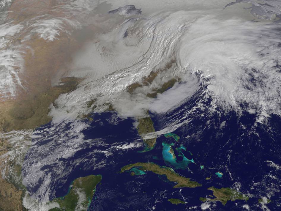
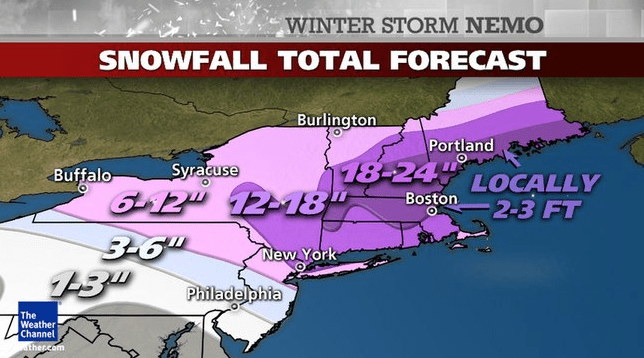
Captured by NASA’s GOES-13 weather satellite on Friday, Feb. 8, this image shows the convergence of two massive low-pressure systems that are expected to bring high winds and up to 2–3 feet of snowfall across much of New England over the next 24 hours. This is the second and most powerful “nor’easter” of the season, and states in the region are preparing for the worst.
Acquired at 9:01 a.m. EST, the GOES image shows clouds associated with the western frontal system stretching from Canada through the Ohio and Tennessee valleys and down into the Gulf of Mexico. The comma-shaped low pressure system located over the Atlantic, east of Virginia, is forecast to merge with the front and create a powerful nor’easter, which The Weather Channel (in a recent move to name winter storms) has dubbed “Nemo.”
Watch a video of this process in action below.
At the time of this writing, the snow has begun to fall outside this writer’s house. Accumulations are less than an inch — but that’s soon to change! Many cancellations and closings have already been announced across the region, with people making apprehensive associations with the infamous Blizzard of ’78. It’s unlikely that as many people will be caught unprepared, though, especially since modern forecasting methods have dramatically improved over the past 35 years — due in no small part to space technology like NASA’s GOES (Geostationary Operational Environment Program) satellites.
Orbiting Earth at an altitude of 35,790 km (22,240 miles) the 4 operational GOES satellites keep a constant eye on the globe, providing the NOAA with accurate, real-time measurements of water vapor and land and sea temperature variations. See more GOES image data here.
In the path of Nemo? Here’s some tips on how to be prepared.