Antarctica has a Huge Mantle Plume Beneath it, Which Might Explain Why its Ice Sheet is so Unstable

Illustration of flowing water under the Antarctic ice sheet. Blue dots indicate lakes, lines show rivers. Marie Byrd Land is part of the bulging "elbow" leading to the Antarctic Peninsula, left center. Credits: NSF/Zina Deretsky

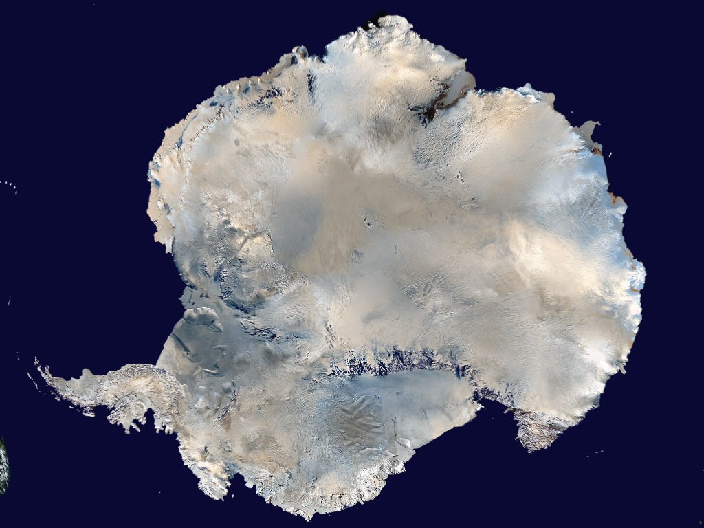
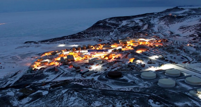
Beneath the Antarctic ice sheet, there lies a continent that is covered by rivers and lakes, the largest of which is the size of Lake Erie. Over the course of a regular year, the ice sheet melts and refreezes, causing the lakes and rivers to periodically fill and drain rapidly from the melt water. This process makes it easier for Antarctica’s frozen surface to slide around, and to rise and fall in some places by as much as 6 meters (20 feet).

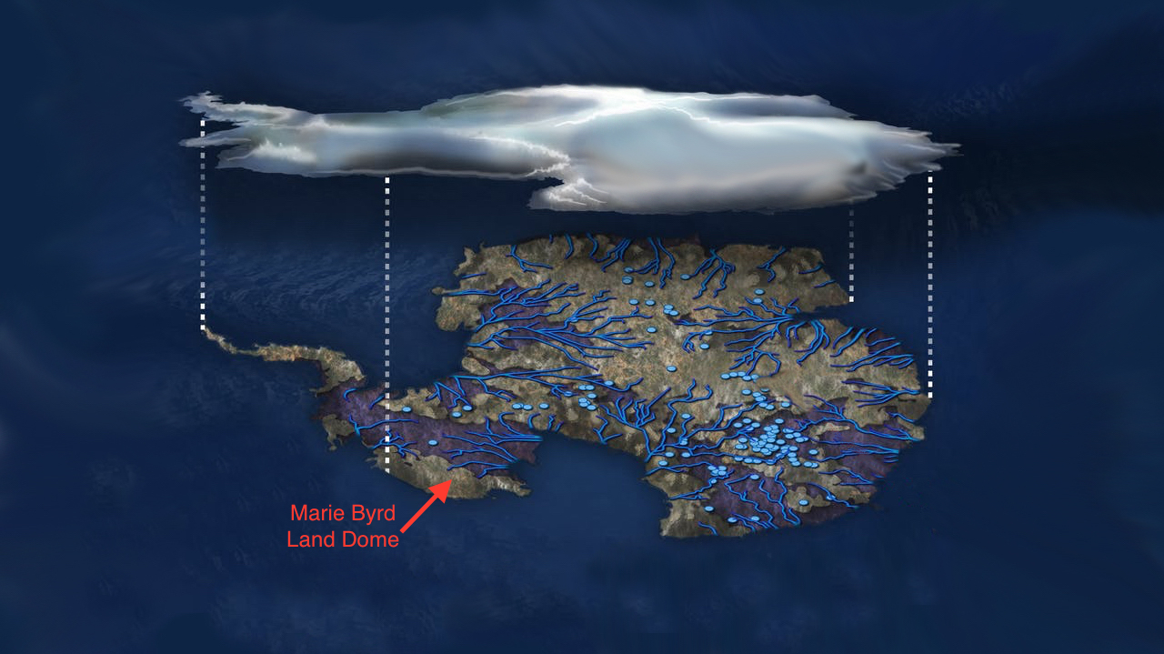
According to a new study led by researchers from NASA’s Jet Propulsion Laboratory, there may be a mantle plume beneath the area known as Marie Byrd Land. The presence of this geothermal heat source could explain some of the melting that takes place beneath the sheet and why it is unstable today. It could also help explain how the sheet collapsed rapidly in the past during previous periods of climate change.

The study, titled “Influence of a West Antarctic mantle plume on ice sheet basal conditions“, recently appeared in the Journal of Geophysical Research: Solid Earth. The research team was led by Helene Seroussi of the Jet Propulsion Laboratory, with support from researchers from the Department of Earth and Planetary Sciences at Washington University and the Alfred Wegener Institute, Helmholtz Center for Polar and Marine Research in Germany.

Glaciers seen during NASA’s Operation IceBridge research flight to West Antarctica on Oct. 29, 2014. Credit: NASA/Michael Studinger

The motion of Antarctica’s ice sheet over time has always been a source of interest to Earth scientists. By measuring the rate at which the ice sheet rises and falls, scientists are able to estimate where and how much water is melting at the base. It is because of these measurements that scientists first began to speculate about the presence of heat sources beneath Antarctica’s frozen surface.

The proposal that a mantle plume exists under Marie Byrd Land was first made 30 years ago by Wesley E. LeMasurier, a scientist from the University of Colorado Denver. According to the research he conducted, this constituted a possible explanation for regional volcanic activity and a topographic dome feature. But it was only more recently that seismic imaging surveys offered supporting evidence for this mantle plume.

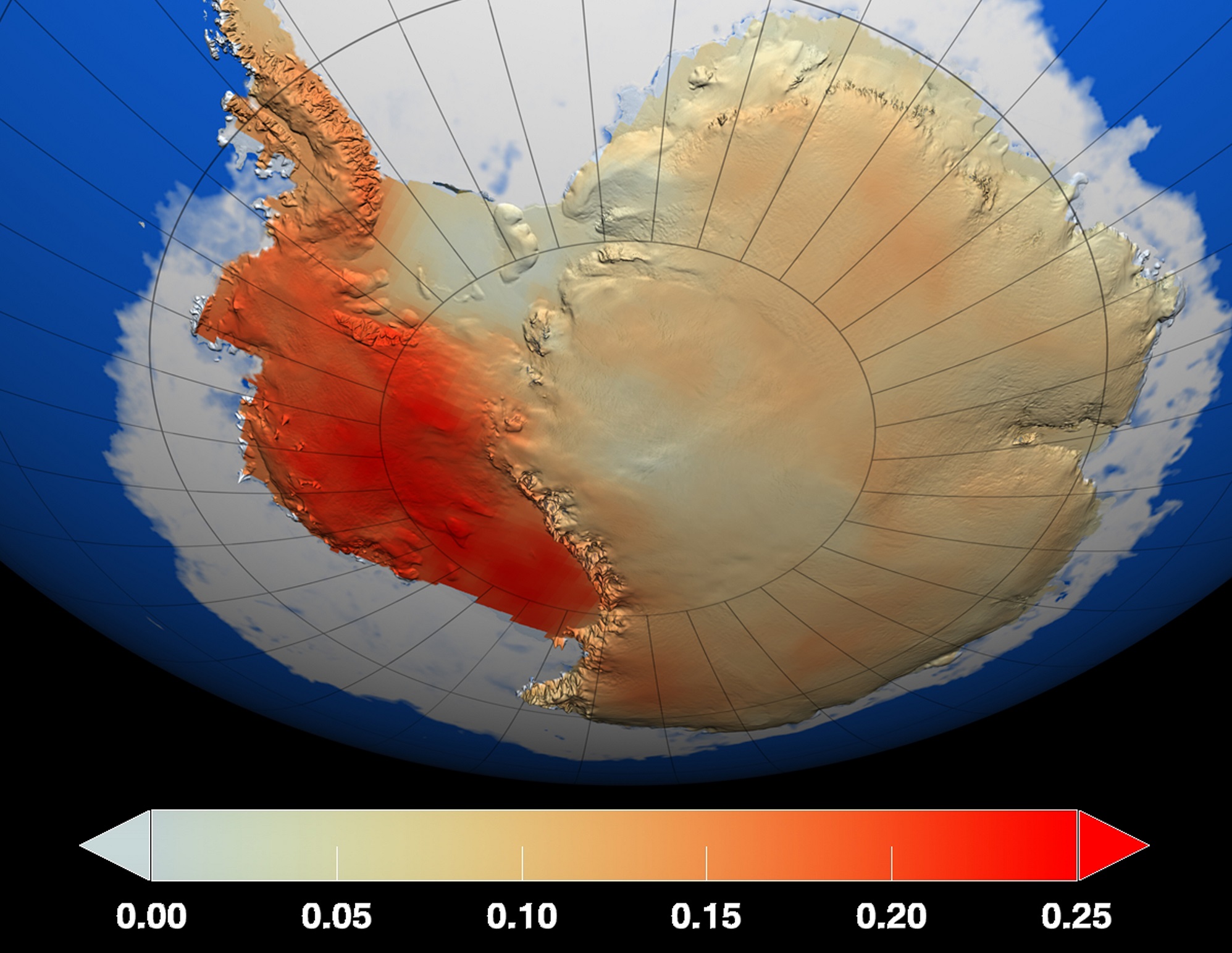
However, direct measurements of the region beneath Marie Byrd Land is not currently possible. Hence why Seroussi and Erik Ivins of the JPL relied on the Ice Sheet System Model (ISSM) to confirm the existence of the plume. This model is essentially a numerical depiction of the physics of the ice sheet, which was developed by scientists at the JPL and the University of California, Irvine.

To ensure that the model was realistic, Seroussi and her team drew on observations of changes in altitude of the ice sheet made over the course of many years. These were conducted by NASA’s Ice, Clouds, and Land Elevation Satellite (ICESat) and their airborne Operation IceBridge campaign. These missions have been measuring the Antarctic ice sheet for years, which have led tot he creation of very accurate three-dimensional elevation maps.

A view of mountains and glaciers in Antarctica’s Marie Byrd Land seen during the Nov. 2nd, 2014, IceBridge survey flight. Credit: NASA / Michael Studinger

Seroussi also enhanced the ISSM to include natural sources of heating and heat transport that result in freezing, melting, liquid water, friction, and other processes. This combined data placed powerful constrains on the allowable melt rates in Antarctica, and allowed the team to run dozens of simulations and test a wide range of possible locations for the mantle plume.

What they found was that the heat flux caused by the mantle plume would not exceed more than 150 milliwatts per square meter. By comparison, regions where there is no volcanic activity typically experience a feat flux of between 40 and 60 milliwatts, whereas geothermal hotspots – like the one under Yellowstone National Park – experience an average of about 200 milliwatts per square meter.

Where they conducted simulations that exceeded 150 millwatts per square meter, the melt rate was too high compared to the space-based data. Except in one location, which was an area inland of the Ross Sea, which is known to experience intense flows of water. This region required a heat flow of at least 150 to 180 milliwatts per square meter to align with its observed melt rates.

In this region, seismic imaging has also shown that heating might reach the ice sheet through a rift in the Earth’s mantle. This too is consistent with a mantle plume, which are thought to be narrow streams of hot magma rising through the Earth’s mantle and spreading out under the crust. This viscous magma then balloons under the crust and causes it to bulge upward.

Temperature changes in the Antarctic ice sheet over the last 50 years, measured in degrees Celsius. Credit: NASA/GSFC Scientific Visualization Studio

Where ice lies over top of the plume, this process transfers heat into the ice sheet, triggering significant melting and runoff. In the end, Seroussi and her colleagues provide compelling evidence – based on a combination of surface and seismic data – for a surface plume beneath the ice sheet of West Antarctica. They also estimate that this mantle plume formed roughly 50 to 110 million years ago, long before the West Antarctic ice sheet came into existence.

Roughly 11,000 years ago, when the last ice age ended, the ice sheet experienced a period of rapid, sustained ice loss. As global weather patterns and rising sea levels began to change, warm water was pushed closer to the ice sheet. Seroussi and Irvins study suggests that the mantle plume could be facilitating this kind of rapid loss today, much as it did during the last onset of an inter-glacial period.

Understanding the sources of ice sheet loss under West Antarctica is important as far as estimating the rate at which ice may be lost there, which is essentially to predicting the effects of climate change. Given that Earth is once again going through global temperature changes  – this time, due to human activity – it is essential to creating accurate climate models that will let us know how rapidly polar ice will melt and sea levels will rise.

It also informs our understanding of how our planet’s history and climate shifts are linked, and what effect these had on its geological evolution.

Further Reading: NASA, Journal of Geophysical Research

NASA’s OSIRIS-REx Asteroid Sampler Slingshots Around Earth Friday, Sept. 22 – Catch It If You Can!

Artist's concept shows the OSIRIS-REx spacecraft passing by Earth on Sept. 22, 2017. Credits: NASA's Goddard Space Flight Center/University of Arizona
Artist’s concept shows the OSIRIS-REx spacecraft passing by Earth on Sept. 22, 2017. Credits: NASA’s Goddard Space Flight Center/University of Arizona

KENNEDY SPACE CENTER, FL – Barely a year after NASA’s OSIRIS-REx robotic asteroid sampler launched on a trailblazing mission to snatch a soil sample from a pristine asteroid and return it to Earth for research analysis, the probe is speeding back home for a swift slingshot around our home planet on Friday Sept. 22 to gain a gravity assist speed boost required to complete its journey to the carbon rich asteroid Bennu and back.

As it swings by Earth NASA’s first ever asteroid sample return mission, OSIRIS-REx (Origins, Spectral Interpretation, Resource Identification, and Security – Regolith Explorer), will pass only 11,000 miles (17,000 kilometers) above Earth just before 12:52 p.m. EDT on Friday.

And NASA is asking the public to try and ‘Catch It If You Can’ – by waving hello and/or taking snapshots during and after the probes high speed flyby.

Plus you can watch NASA Facebook Live event at Noon Friday: https://www.facebook.com/NASAGoddard/

OSIRIS-REx will be approaching Earth at a velocity of about 19,000 mph on Friday as it begins flying over Australia during the Earth Gravity Assist (EGA) maneuver.

Since blastoff from the Florida Space Coast on Sept. 8, 2016 the probe has already racked up almost 600 million miles on its round trip journey from Earth and back to set up Friday’s critical gravity assist maneuver to Bennu and back.

As OSIRIS-REx continues along its flight path the spacecraft will reach its closest point to Earth over Antarctica, just south of Cape Horn, Chile. It will gain a velocity boost of about 8400 mph.

The spacecraft will also conduct a post flyby science campaign by collecting images and science observations of Earth and the Moon four hours after closest approach to calibrate its five science instruments.

NASA’s OSIRIS-REx asteroid sampling spacecraft, return capsule and payload fairings inside the Payloads Hazardous Servicing Facility high bay at NASA’s Kennedy Space Center is being processed for Sep. 8, 2016 launch to asteroid Bennu from Cape Canaveral, FL. Credit: Ken Kremer/kenkremer.com

The allure of Bennu is that it is a carbon rich asteroid – thus OSIRIS-REx could potentially bring back samples infused with the organic chemicals like amino acids that are the building blocks of life as we know it.

“We are interested in that material because it is a time capsule from the earliest stages of solar system formation,” OSIRIS-Rex Principal Investigator Dante Lauretta told Universe Today in a prelaunch interview with the spacecraft in the cleanroom at NASA’s Kennedy Space Center.

The do or die gravity assist plunge is absolutely essential to set OSIRIS-REx on course to match the asteroid’s path and speed when it reaches the vicinity of asteroid Bennu a year from now in October 2018.

“The Earth Gravity Assist is a clever way to move the spacecraft onto Bennu’s orbital plane using Earth’s own gravity instead of expending fuel,” says Lauretta, of the University of Arizona, Tucson.

Just how close to Earth will OSIRIS-REx be during its flyby on Friday? The spacecraft will come within 11,000 miles (17,000 km) of the Earth’s surface as it passes over Antarctica at 12:52 a.m. EDT. on Sept. 22, 2017. Credits: NASA’s Goddard Space Flight Center/University of Arizona

Bennu’s orbit around the Sun is tilted at a six-degree inclination with respect to Earth’s orbital plane.

The asteroid is 1,614-foot (500 m) in diameter and crosses Earth’s orbit around the sun every six years.

Numerous NASA spacecraft – including NASA’s just completed Cassini mission to Saturn – utilize gravity assists around a variety of celestial bodies to gain speed and change course to save vast amounts of propellant and time in order to accomplish science missions and visit additional target objects that would otherwise be impossible.

The flyby will be a nail-biting time for NASA and the science team because right afterwards the refrigerator sized probe will be out of contact with engineers – unable to receive telemetry for about an hour.

“For about an hour, NASA will be out of contact with the spacecraft as it passes over Antarctica,” said Mike Moreau, the flight dynamics system lead at Goddard, in a statement.

“OSIRIS-REx uses the Deep Space Network to communicate with Earth, and the spacecraft will be too low relative to the southern horizon to be in view with either the Deep Space tracking station at Canberra, Australia, or Goldstone, California.”

NASA says the team will regain communication with OSIRIS-REx roughly 50 minutes after closest approach over Antarctica at about 1:40 p.m. EDT.

The post flyby science campaign is set to begin at 4:52 p.m. EDT, Friday, Sept. 22.

United Launch Alliance Atlas V rocket lifts off from Space Launch Complex 41 at Cape Canaveral Air Force Station carrying NASA’s Origins, Spectral Interpretation, Resource Identification, Security-Regolith Explorer, or OSIRIS-REx spacecraft on the first U.S. mission to sample an asteroid, retrieve at least two ounces of surface material and return it to Earth for study. Liftoff was at 7:05 p.m. EDT on September 8, 2016 in this remote camera view taken from inside the launch pad perimeter. Note the newly install crew access arm and white room for astronaut flights atop Atlas starting in early 2018. Credit: Ken Kremer/kenkremer.com

The OSIRIS-Rex spacecraft originally departed Earth atop a United Launch Alliance Atlas V rocket under crystal clear skies on September 8, 2016 at 7:05 p.m. EDT from Space Launch Complex 41 at Cape Canaveral Air Force Station, Florida.

Everything with the launch went exactly according to plan for the daring mission boldly seeking to gather rocks and soil from carbon rich Bennu.

View of science instrument suite and TAGSAM robotic sample return arm on NASA’s OSIRIS-REx asteroid sampling spacecraft inside the Payloads Hazardous Servicing Facility at NASA’s Kennedy Space Center. Probe is slated for Sep. 8, 2016 launch to asteroid Bennu from Cape Canaveral Air Force Station, FL. Credit: Ken Kremer/kenkremer.com

OSIRIS-Rex is equipped with an ingenious robotic arm named TAGSAM designed to collect at least a 60-gram (2.1-ounce) sample and bring it back to Earth in 2023 for study by scientists using the world’s most advanced research instruments.

“The primary objective of the OSIRIS-Rex mission is to bring back pristine material from the surface of the carbonaceous asteroid Bennu,” OSIRIS-Rex Principal Investigator Dante Lauretta told me in the prelaunch interview in the KSC cleanroom with the spacecraft as the probe was undergoing final launch preparations.

“We are interested in that material because it is a time capsule from the earliest stages of solar system formation.”

“It records the very first material that formed from the earliest stages of solar system formation. And we are really interested in the evolution of carbon during that phase. Particularly the key prebiotic molecules like amino acids, nucleic acids, phosphates and sugars that build up. These are basically the biomolecules for all of life.”

1 day to Earth flyby for OSIRIS-Rex

NASA and the mission team is also inviting the public to get engaged by participating in the Wave to OSIRIS-REx social media campaign.

“Individuals and groups from anywhere in the world are encouraged to take photos of themselves waving to OSIRIS-REx, share them using the hashtag #HelloOSIRISREx and tag the mission account in their posts on Twitter (@OSIRISREx) or Instagram (@OSIRIS_REx).

Participants may begin taking and sharing photos at any time—or wait until the OSIRIS-REx spacecraft makes its closest approach to Earth at 12:52p.m. EDT on Friday, Sept. 22.”

The probe’s flight path during the flyby will pass through the ring of numerous satellites orbiting in geosynchronous orbit, but none are expected to be within close range.

Members of the OSIRIS-REx mission team celebrate the successful spacecraft launch on Sept. 8, 2016 atop ULA Atlas V at the post-launch briefing at the Kennedy Space Center, FL. Principal Investigator Dante Lauretta is 4th from right, NASA Planetary Science Director Jim Green is center, 5th from left. Credit: Ken Kremer/kenkremer.com

Watch for Ken’s continuing onsite NASA mission and launch reports direct from the Kennedy Space Center and Cape Canaveral Air Force Station, Florida.

Stay tuned here for Ken’s continuing Earth and Planetary science and human spaceflight news.

Ken Kremer

Dr Dante Lauretta, principal investigator for OSIRIS-REx at the University of Arizona, Tucson, and Dr. Ken Kremer, Universe Today point to NASA’s OSIRIS-REx asteroid sampling spacecraft inside the Payloads Hazardous Servicing Facility at the Kennedy Space Center on Aug. 20, 2016. Credit: Ken Kremer/kenkremer.com

Satellite Images Show a Trillion Ton Iceberg Broke Off Antarctica

The Moderate Resolution Imaging Spectroradiometer (MODIS) on NASA’s Aqua satellite captured this image of the gigantic new iceberg on July 12, 2017. NASA Earth Observatory image by Joshua Stevens, using MODIS data from LANCE/EOSDIS Rapid Response.

For several months, scientists have been keeping an eye on a piece of Antarctica’s Larsen C ice shelf, waiting for the inevitable. And now it has happened.

Sometime between July 10 and July 12, 2017 a trillion ton iceberg split off, “changing the outline of the Antarctic Peninsula forever,” said one scientist.

The new iceberg is now called A68, and at 2,240 square miles (5,800 square km) it is one of the biggest ever recorded, about the size of Delaware in the US, or twice the size of Luxembourg.

A fissure on the ice shelf first appeared several years ago, but seemed relatively stable until January 2016, when it began to lengthen. In January 2017 alone, the crack grew by 20 km, reaching a total length of about 175 km.

Witnessed by the Copernicus Sentinel-1 mission on 12 July 2017, a large iceberg has broken off the Larsen-C ice shelf, one of the largest icebergs on record. Credit: Modified Copernicus Sentinel data (2017), processed by ESA.

The calving of the iceberg was confirmed by the Visible Infrared Imaging Radiometer Suite (VIIRS) on the Suomi NPP satellite and was reported this morning by Project MIDAS, an Antarctic research project based in the UK.

The MODIS instrument on NASA’s Aqua satellite also confirmed the complete separation of the iceberg.

Larsen C is a floating platform of glacial ice on the east side of the Antarctic Peninsula, is the fourth largest ice shelf ringing Earth’s southernmost continent. With the break-off of this iceberg, the Larsen C shelf area has shrunk by approximately 10 percent.

Some scientists say the Larsen C rift and iceberg calving is not a warning of imminent sea level rise, and linking climate change to this specific event is complicated. Adrian Luckman, Professor of Glaciology and Remote Sensing from Swansea University wrote a detailed explanation of this for The Conversation.

The new iceberg would barely fit inside Wales. Credit: Adrian Luckman / MIDAS

David Vaughan, glaciologist and Director of Science at British Antarctic Survey (BAS), said, “Larsen C itself might be a result of climate change, but, in other ice shelves we see cracks forming, which we don’t believe have any connection to climate change. For instance on the Brunt Ice Shelf where BAS has its Halley Station, there those cracks are a very different kind which we don’t believe have any connection to climate change.”

While Vaughan said they see no obvious signal that climate warming is causing the whole of Antarctica to break up, he added that there is little doubt that climate change is causing ice shelves to disappear in some parts of Antarctica at the moment.

“Around the Antarctic Peninsula, where we saw several decades of warming through the latter half of the 20th century, we have seen these ice shelves collapsing and ice loss increasing,” he said. “There are other parts of the Antarctica that which are losing ice to the oceans but those are affected less by atmospheric warming and more by ocean change.

Scientists said the loss of such a large piece is of interest because ice shelves along the peninsula play an important role in ‘buttressing’ glaciers that feed ice seaward, effectively slowing their flow.

“The interesting thing is what happens next, how the remaining ice shelf responds,” said Kelly Brunt, a glaciologist with NASA’s Goddard Space Flight Center in Greenbelt, Maryland, and the University of Maryland in College Park. “Will the ice shelf weaken? Or possibly collapse, like its neighbors Larsen A and B? Will the glaciers behind the ice shelf accelerate and have a direct contribution to sea level rise? Or is this just a normal calving event?”

The U.S. National Ice Center will monitor the trajectory of the new iceberg, but they don’t expect it to travel far very fast, and it shouldn’t cause any immediate problems for navigation of ships.

See additional imagery and animations from Goddard Space Flight Center.

Sources and additional reading:
ESA, British Antarctic Survey, NASA.

Here’s an Aerial View of a Massive Iceberg Shearing away from Antarctica

The rift in the Larsen C Ice Shelf. Credit: NASA/John Sonntag

Located along the east coast of the Antarctic Peninsula is the Larsen Ice Shelf. Named after the Norwegian Captain who explored the ice front back in 1893, this ice shelf has been monitored for decades due to its close connection with rising global temperatures. Essentially, since the 1990s, the shelf has been breaking apart, causing collapses of considerable intensity.

According to the British Antarctic Survey (BAS), the section of the ice sheet known as the Larsen C Ice Shelf could be experiencing a collapse of its own soon enough. Based on video footage and satellite evidence of the sizeable rift (which is 457 m or 15oo ft across) in the shelf, it is believed that an ice berg that is roughly 5,000 km² (1930.5 mi²) in size could be breaking off and calving into the ocean in the near future.

An ice shelf is essentially a floating extension of a land-based glacier. In this case, the Larsen Ice Shelf is seaborne section of the larger Larsen Glacier, which flows southeast past Mount Larsen and enters the Ross Sea just south of Victoria Land. These shelves often act as buttresses, holding back glaciers that flow down to the coast, thus preventing them from entering the ocean and contributing to rising sea levels.

In the past twenty-two years, the Larsen A and B ice shelves (which were situated further north along the Antarctic Peninsula) both collapsed into the sea. This resulted in the dramatic acceleration of glaciers behind them, as larger volumes of ice were able to flow down the coast and drop into the ocean. While Larsen C appeared to still be stable, in November of 2016, NASA noted the presence of a large crack in its surface.

This crack was about 110 kilometers (68 mi) long and was more than 91 m (299 ft) wide, reaching a depth of about 500 m (1,600 ft). By December, the rift had extended another 21 km (13 mi), which raised concerns about calving. In February of 2017, satellite observations of the shelf noted that the crack appeared to have grown further, which confirmed what researches from the MIDAS project had previously reported.

This UK-based Antarctic research project – which is based at Swansea University and Aberystwyth University in Wales and supported by the BAS and various international partners – is dedicated to monitoring the Larsen C ice shelf in Antarctica. Through a combination of field work, satellite observations, and computer simulations, they have catalogued how recent warming trends has caused seasonal melts of the ice shelf and affected its structure.

And in recent years, they have been monitoring the large crack, which has been fast-moving, and noted the appearance of several elongations. It was during the current Antarctic field season that members of the project filmed what the crack looked like from the air. In previous surveys, the glaciology research team has conducted research on the ice shelf using seismic techniques to survey the seafloor beneath it.

However, this past season, they did not set up on the ice shelf itself for fear of a calving event. Instead, they made a series of trips to and from the UK’s Rothera Research Station aboard twin otter aircraft. During an outing to retrieve some of their science equipment, the crew noted how the crack looked from above and started filming. As you can see from the footage, the rift is very wide and extremely long.

What’s more, the team estimates that if an iceberg from this shelf breaks off and falls into the ocean, it will likely be over three times the size of cities like London or New York City. And while this sort of thing is common with glaciers, the collapse of a large section of Larsen C could speed the flow of the Larsen Glacier towards the Antarctic Ocean.

As Dr Paul Holland, an ice and ocean modeller at the British Antarctic Survey, said in a recent press release:

“Iceberg calving is a normal part of the glacier life cycle, and there is every chance that Larsen C will remain stable and this ice will regrow.  However, it is also possible that this iceberg calving will leave Larsen C in an unstable configuration.  If that happens, further iceberg calving could cause a retreat of Larsen C. We won’t be able to tell whether Larsen C is unstable until the iceberg has calved and we are able to understand the behavior of the remaining ice. The stability of ice shelves is important because they resist the flow of the grounded ice inland.  After the collapse of Larsen B, its tributary glaciers accelerated, contributing to sea-level rise.”

One of the greatest concerns about climate change is the feedback mechanisms it creates. In addition to increased warming trends caused by rising levels of CO² in the atmosphere, the melting of glaciers and the breakup of ice shelves can have a pronounced effect on sea levels. In the end, the depletion of glaciers in Antarctica could have dramatic consequences for the rest of the planet.

Further Reading: British Antarctic Survey

‘Insufferable’ Moonwalker Buzz Aldrin Recovering From ‘Record Setting’ Antarctic Expedition Emergency Evacuation

Apollo 11 moonwalker Buzz Aldrin trekking across Antarctica as the oldest man to reach the South Pole, prior to emergency medical evacuation on Dec. 1, 2016. Credit: Team Buzz
Apollo 11 moonwalker Buzz Aldrin trekking across Antarctica as the oldest man to reach the South Pole. Credit: Team Buzz
Apollo 11 moonwalker Buzz Aldrin trekking across Antarctica as the oldest man to reach the South Pole, prior to emergency medical evacuation on Dec. 1, 2016. Credit: Team Buzz

Buzz Aldrin – the second man to walk on the Moon – is recovering nicely today in a New Zealand hospital after an emergency medical evacuation cut short his record setting Antarctic expedition as the oldest man to reach the South Pole – which Team Buzz lightheartly noted would make him “insufferable”!

“He’s recovering well in NZ [New Zealand],” Team Buzz said in an official statement about his evacuation from the South Pole.

Apollo 11 moonwalker Buzz Aldrin, who followed Neil Armstrong in descending to the lunar surface in 1969 on America’s first Moon landing mission, had to be suddenly flown out of the Admunsen-Scott Science Station late last week per doctors orders after suffering from shortness of breath and lung congestion during his all too brief foray to the bottom of the world.

He was flown to a hospital in Christchurch, New Zealand for emergency medical treatment on Dec. 1.

Upon learning from the National Science Foundation (NSF) that Aldrin “now holds the record as the oldest person to reach the South Pole at the age of 86,” his Mission Director Christina Korp jokingly said: ‘He’ll be insufferable now.”

“Buzz Aldrin is resting in hospital in Christchurch, New Zealand. He still has some congestion in his lungs so has been advised not to take the long flight home to the States and to rest in New Zealand until it clears up,” Team Buzz said in an official statement on Dec. 3.

Buzz had been at the South Pole for only a few hours when he took ill, apparently from low oxygen levels and symptoms of altitude sickness.

“I’m extremely grateful to the National Science Foundation (NSF) for their swift response and help in evacuating me from the Admunsen-Scott Science Station to McMurdo Station and on to New Zealand. I had been having a great time with the group at White Desert’s camp before we ventured further south. I really enjoyed the time I spent talking with the Science Station’s staff too,” said Aldrin from his hospital room in a statement.

Apollo 11 moonwalker Buzz Aldrin being evacuated from Antarctica for emergency medical treatment on Dec. 1, 2016. Credit: Team Buzz

Prior to the planned Antarctic journey, his doctors had cleared him to take the long trip – which he views as “the capstone of his personal exploration achievements”.

Apollo 11 moonwalker Buzz Aldrin is seen recovering well in New Zealand hospital on Dec. 2 after medical emergency evacuation from expedition to the South Pole on Dec. 1, 2016. Credit: Team Buzz

Buzz’s goal in visiting the South Pole was to see “what life could be like on Mars” – which he has been avidly advocating as the next goal for a daring human spaceflight journey to deep space.

“His primary interest in coming to Antarctica was to experience and study conditions akin to Mars that are more similar there than any other place on earth,” Team Buzz elaborated.

He had hoped to speak more to the resident scientists about their research but it was all cut short by his sudden illness.

“I started to feel a bit short of breath so the staff decided to check my vitals. After some examination they noticed congestion in my lungs and that my oxygen levels were low which indicated symptoms of altitude sickness. This prompted them to get me out on the next flight to McMurdo and once I was at sea level I began to feel much better. I didn’t get as much time to spend with the scientists as I would have liked to discuss the research they’re doing in relation to Mars. My visit was cut short and I had to leave after a couple of hours. I really enjoyed my short time in Antarctica and seeing what life could be like on Mars,” Aldrin explained.

Buzz also thanked everyone who sent him well wishes.

“Finally, thanks to everyone from around the world for their well wishes and support. I’m being very well looked after in Christchurch. I’m looking forward to getting home soon to spend Christmas with my family and to continue my quest for Cycling Pathways and a permanent settlement on Mars. You ain’t seen nothing yet!”, concluded Aldrin.

I recently met Buzz Aldrin at the Kennedy Space Center Visitor Complex in Florida, as part of the Grand Opening of the new ‘Destination Mars’ attraction.

Destination Mars is a holographic exhibit at the Kennedy Space Center visitor complex in Florida. Be sure to catch it soon because the limited time run end on New Year’s Day 2017.

Apollo 11 moonwalker Buzz Aldrin discusses the human ‘Journey to Mars with Universe Today at newly opened ‘Destination Mars’ holographic experience during media preview at the Kennedy Space Center visitor complex in Florida on Sept. 18, 2016.  Credit: Ken Kremer/kenkremer.com
Apollo 11 moonwalker Buzz Aldrin discusses the human ‘Journey to Mars with Universe Today at newly opened ‘Destination Mars’ holographic experience during media preview at the Kennedy Space Center visitor complex in Florida on Sept. 18, 2016. Credit: Ken Kremer/kenkremer.com

The new ‘Destination Mars’ limited engagement exhibit magically transports you to the surface of the Red Planet via Microsoft HoloLens technology.

It literally allows you to ‘Walk on Mars’ using real imagery taken by NASA’s Mars Curiosity rover and explore the alien terrain, just like real life scientists on a geology research expedition – with Buzz Aldrin as your guide.

Here’s my Q & A with moonwalker Buzz Aldrin speaking to Universe Today at Destination Mars:

Video Caption: Buzz Aldrin at ‘Destination Mars’ Grand Opening at KSCVC. Apollo 11 moonwalker Buzz Aldrin talks to Universe Today/Ken Kremer during Q&A at ‘Destination Mars’ Holographic Exhibit Grand Opening ceremony at Kennedy Space Center Visitor Complex (KSCVC) in Florida on 9/18/16. Credit: Ken Kremer/kenkremer.com

And Buzz seemed quite healthy for the very recent Grand Opening of the new ‘Heroes and Legends’ exhibit on Nov. 11 at the Kennedy Space Center Visitor Complex.

Stay tuned here for Ken’s continuing Earth and Planetary science and human spaceflight news.

Ken Kremer

………….

Learn more about ULA Delta 4 launch on Dec 7, GOES-R weather satellite, Heroes and Legends at KSCVC, OSIRIS-REx, InSight Mars lander, ULA, SpaceX and Orbital ATK missions, Juno at Jupiter, SpaceX AMOS-6 & CRS-9 rocket launch, ISS, ULA Atlas and Delta rockets, Orbital ATK Cygnus, Boeing, Space Taxis, Mars rovers, Orion, SLS, Antares, NASA missions and more at Ken’s upcoming outreach events:

Dec 5-7: “ULA Delta 4 Dec 7 launch, GOES-R weather satellite launch, OSIRIS-Rex, SpaceX and Orbital ATK missions to the ISS, Juno at Jupiter, ULA Delta 4 Heavy spy satellite, SLS, Orion, Commercial crew, Curiosity explores Mars, Pluto and more,” Kennedy Space Center Quality Inn, Titusville, FL, evenings

What is the Largest Desert on Earth?

Antarctica
Composite satellite image of Antarctica, the location of the largest desert on Earth. Credit: NASA/Dave Pape

When you hear the word desert, what comes to mind? Chances are, you’d think of sun, sand, and very little in the way of rain. Perhaps cacti, vultures, mesas, and scorpions come to mind as well, or possibly camels and oases? But in truth, deserts come in all shapes and sizes, and vary considerably from one part of the world to the next.

Like all of Earth’s climates, it all comes down to some basic characteristics that they share – which in this case, involves being barren, dry, and hostile to life. For this reason, you might be surprised to learn that the largest desert in the world is actually in Antarctica. How’s that for a curveball?

Definition:

To break it down, a desert is a region that is simply very dry because its receives little to no water. To be considered a desert, an area must receive than 250 millimeters of annual precipitation. But precipitation can take the form of rain, snow, mist or fog – literally any form of water being transferred from the atmosphere to the earth.

The Lut Desert of Iran, as observed from space by NASA's Earth Observatory. Credit: NASA
The Lut Desert of Iran, as observed by NASA’s Earth Observatory. It was here that the hottest temperature ever was recorded between 2003-9. Credit: NASA

Deserts can also be described as areas where more water is lost by evaporation than falls as precipitation. This certainly applies in regions that are subject to “desertification”, where increasing temperatures (i.e. climate change) result in river beds drying up, precipitation patterns changing, and vegetation dying off.

Deserts are often some of the hottest and most inhospitable places on Earth, as exemplified by the Sahara Desert in Africa, the Gobi desert in northern China and Mongolia, and Death Valley in California. But they can also be cold, windswept landscapes where little to no snow ever falls – like in the Antarctic and Arctic.

So in the end, being hot has little to do with it. In fact, it would be more accurate to say that deserts are characterized by little to no moisture and extremes in temperature. All told, deserts make up one-third of the surface of the Earth. But most of that is found in the polar regions.

Antarctica:

In terms of sheer size, the Antarctic Desert is the largest desert on Earth, measuring a total of 13.8 million square kilometers. Antarctica is the coldest, windiest, and most isolated continent on Earth, and is considered a desert because its annual precipitation can be less than 51 mm in the interior.

A Sun halo seen among the the landscape and ice flows of Antarctica. Credit and copyright: Alex Cornell.
A Sun halo seen among the the landscape and ice flows of Antarctica. Credit and copyright: Alex Cornell

It’s covered by a permanent ice sheet that contains 90% of the Earth’s fresh water. Only 2% of the continent isn’t covered by ice, and this land is strictly along the coasts, where all the life that is associated with the land mass (i.e. penguins, seals and various species of birds) reside. The other 98% of Antarctica is covered by ice which averages 1.6 km in thickness.

There are no permanent human residents, but anywhere from 1,000 to 5,000 researchers inhabit the research stations scattered across the continent – the largest being McMurdo Station, located on the tip of Ross Island. Beyond a limited range of mammals, only certain cold-adapted species of mites, algaes, and tundra vegetation can survive there.

Despite having very little precipitation, Antarctica still experiences massive windstorms. Much like sandstorms in the desert, the high winds pick up snow and turn into blizzards. These storms can reach speeds of up to 320 km an hour (200 mph) and are one of the reasons the continent is so cold.

In fact, the coldest temperature ever recorded was taken at the Soviet Vostok Station on the Antarctic Plateau. Using ground-based measurements, the temperature reached a historic low of -89.2°C (-129°F) on July 21st, 1983. Analysis of satellite data indicated a probable temperature of around -93.2 °C (-135.8 °F; 180.0 K), also in Antarctica, on August 10th, 2010. However, this reading was not confirmed.

McMurdo station at night. Credit: m.earthtripper.com
Antarctica’s McMurdo Station at night. Credit: m.earthtripper.com

Other Deserts:

Interestingly, the second-largest desert in the world is also notoriously cold – The Arctic Desert. Located above 75 degrees north latitude, the Arctic Desert covers a total area of about 13.7 million square km (5.29 million square mi). Here, the total amount of precipitation is below 250mm (10 inches), which is predominantly in the form of snow.

The average temperature in the Arctic Desert is -20 °C, reaching as low as -50 °C in the winter. But perhaps the most interesting aspect of the Arctic Desert is its sunshine patterns. During the summer months, the sun doesn’t set for a period of 60 days. These are then followed in the winter by a period of prolonged darkness.

The third largest desert in the world is the more familiar Sahara, with a total size of 9.4 million square km. The average annual rainfall ranges from very low (in the northern and southern fringes of the desert) to nearly non-existent over the central and the eastern part. All told, most of the Saraha receives less than 20 mm (0.79 in).

However, in northern fringe of the desert, low pressure systems from the Mediterranean Sea result in an annual rainfall of between 100 to 250 mm (3.93 – 9.84 in). The southern fringe of the desert – which extends from coastal Mauritania to the Sudan and Eritrea – receives the same amount of rainfall from the south. The central core of the desert, which is extremely arid, experiences an annual rainfall of less than 1 mm (0.04 in).

Temperatures are also quite intense in the Sahara, and can rise to more than 50 °C. Interestingly, this is not the hottest desert on the planet though. The hottest temperature ever recorded on Earth was 70.7 °C (159 °F), which was taken in the Lut Desert of Iran. These measurements were part of a global temperature survey conducted by scientists at NASA’s Earth Observatory during the summers of 2003 to 2009.

In short, deserts are not just sand dunes and places where you might come across Bedouins and Berbers, or a place you have to drive through to get to Napa Valley. They are common to every continent of the world, and can take the form of sandy deserts or icy deserts. In the end, the defining characteristic is their pronounced lack of moisture.

In that respect, the polar regions are the largest deserts in the world, with Antarctica narrowly beating out the Arctic for first place. And going by this definition – i.e. cold, arid, and with little to no precipitation – we’re sure to find some particularly big deserts elsewhere in Solar System. After all, what is Mars if not one big, cold, arid, and extremely dry climate?

We have written many articles about the Earth for Universe Today. Here is What Percent of the Earth’s Land Surface is Desert?, What is the Driest Place on Earth?, What is the Hottest Place on Earth?, What is the Earths’ Average Temperature?

Want more resources on the Earth? Here’s a link to NASA’s What is Antarctica?, and here’s NASA’s Visible Earth.

We have also recorded an episode of Astronomy Cast about Earth, as part of our tour through the Solar System – Episode 51: Earth.

Sources:

Does Antarctica Have A Hidden Layer Of Meteorites Below Its Surface?

Dr. Barbara Cohen is seen with a large meteorite from the Antarctic's Miller Range. Credit: Antarctic Search for Meteorites

ANSMET 2012-2013 team collecting a meteorite sample (Image: Antarctic Search for Meteorites Program / Katherine Joy)
Two members of the Antarctic Search for Meteorites 2012-2013 team use tongs to collect a meteorite near the Transantarctic Mountains. Credit: Katherine Joy, University of Manchester / Antarctic Search for Meteorites Program

In the category of why-didn’t-I think-of-that ideas, Dr. Geoffrey Evatt and colleagues from the University of Manchester struck upon a brilliant hypothesis: that a layer of iron meteories might lurk just below the surface of the Antarctic ice. He’s the lead  author of a recent paper on the topic published in the open-access journal, Nature Communications.

A likely stony meteorite found during the ANSMET 2014-15 expedition in Antarctica. Credit: JSC Curation / NASA
A possible stony meteorite found during the ANSMET 2014-15 expedition in Antarctica. Credit: Antarctic Search for Meteorites Program

Remote Antarctica makes one of the best meteorite collecting regions on the planet. Space rocks have been accumulating there for millennia preserved in the continent’s cold, desert-like climate. While you might think it’s a long and expensive way to go to hunt for meteorites, it’s still a lot cheaper than a sample return mission to the asteroid belt. Meteorites fall and become embedded in ice sheets within the continent’s interior. As that ice flows outward toward the Antarctic coastlines, it pushes up against the Transantarctic Mountains, where powerful, dry winds ablate away the ice and expose their otherworldly cargo.

Meteorite recovery sites in the Transantarctic Mountains. Credit: NASA

Layer after layer, century after century, the ice gets stripped away, leaving rich “meteorite stranding zones” where hundreds of space rocks can be found within an area the size of a soccer field. Since most meteorites arrive on Earth coated in a black or brown fusion crust from their searing fall through the atmosphere, they contrast well against the white glare of snow and ice. Scientists liken it to a conveyor belt that’s been operating for the past couple million years.

Scientists form snowmobile posses and buzz around the ice fields picking them up like candy eggs on Easter morning. OK, it’s not that easy. There’s much planning and prep followed by days and nights of camping in bitter cold with high winds tearing at your tent. Expeditions take place from October through early January when the Sun never sets.

The U.S. under ANSMET (Antarctic Search for Meteorites, a Case Western Reserve University project funded by NASA), China, Japan and other nations run programs to hunt and collect the precious from the earliest days of the Solar System before they find their way to the ocean or are turned to dust by the very winds that revealed them in the first place. Since systematic collecting began in 1976, some 34,927 meteorites have been recovered from Antarctica as of December 2015.

A team of scientists document the find of a small meteorite found among rocks on the Antarctic ice during the ANSMET 2014-15 hunt. Credit: JSC Curation / NASA
A team of scientists document the find of a small meteorite found among rocks on the Antarctic ice during the ANSMET 2014-15 expedition. Credit: Antarctic Search for Meteorites Program / Vinciane Debaille

Meteorites come in three basic types: those made primarily of rock; stony-irons comprised of a mixture of iron and rock; and iron-rich. Since collection programs have been underway, Antarctic researchers have uncovered lots of stony meteorites, but meteorites either partly or wholly made of metal are scarce compared to what’s found in other collecting sites around the world, notably the deserts of Africa and Oman. What gives?

A fragment of the Sikhote-Alin iron meteorite that fell over eastern Russia (then the Soviet Union) on Feb. 12, 1947. Some of the dimpling are pockets on the meteorite's surface called regmeglypts. Credit: Bob King
This fragment of the massive Sikhote-Alin meteorite that fell over eastern Russia (then the Soviet Union) on Feb. 12, 1947 is a typical iron-nickel meteorite. Another specimen of this meteorite was used in the experiment to determine how quickly it burrowed into the ice when heated.  Credit: Bob King

Dr. Evatt and colleagues had a hunch and performed a simple experiment to arrive at their hypothesis. They froze two meteorites of similar size and shape — a specimen of the Russian Sikhote-Alin iron and NWA 869, an ordinary (stony) chondrite  — inside blocks of ice and heated them using a solar-simulator lamp. As expected, both meteorites melted their way down through the ice in time, but the iron meteorite sank further and  faster. I bet you can guess why. Iron or metal conducts heat more efficiently than rock. Grab a metal camera tripod leg or telescope tube on a bitter cold night and you’ll know exactly what I mean. Metal conducts the heat away from your hand far better and faster than say, a piece of wood or plastic.

Antarctic researchers carefully pack meteorites into collection boxes. Looks cold! Credit: JSC Curation / NASA
Antarctic researchers carefully pack meteorites found along the Transantarctic Range into collection boxes. Looks cold! Credit: Antarctic Search for Meteorites Program / Vinciane Debaille

The researchers performed many trials with the same results and created a mathematical model showing that Sun-driven burrowing during the six months of Antarctic summer accounted nicely for the lack of iron meteorites seen in the stranding zones. Co-author Dr. Katherine Joy estimates that the fugitive meteorites are trapped between about 20-40 inches (50-100 cm) beneath the ice.

Who wouldn’t be happy to find this treasure? Dr. Barbara Cohen is seen with a large meteorite from the Antarctic’s Miller Range. Credit: Antarctic Search for Meteorites Program

You can imagine how hard it would be to dig meteorites out of Antarctic ice. It’s work enough to mount an expedition to pick up just what’s on the surface.

With the gauntlet now thrown down, who will take up the challenge? The researchers suggests metal detectors and radar to help locate the hidden irons. Every rock delivered to Earth from outer space represents a tiny piece of a great puzzle astronomers, chemists and geologist have been assembling since 1794 when German physicist Ernst Chladni published a small book asserting that rocks from space really do fall from the sky.

Like the puzzle we leave unfinished on the tabletop, we have a picture, still incomplete, of a Solar System fashioned from the tiniest of dust motes in the crucible of gravity and time.


What Could Explain the Mysterious Ring in Antarctica?

Aerial photo of the crater site, taken with the Polar 6 board camera, while the aircraft was flying 7000 feet above the ice shelf. Credit: Alfred-Wegener-Institut

Ever since its discovery was announced earlier this year, the 3 km-wide ring structure discovered on the of Antarctica has been a source of significant interest and speculation. Initially, the discovery was seen as little more than a happy accident that occurred during a survey of East Antarctica by a WEGAS (West-East Gondwana Amalgamation and its Separation) team from the Alfred Wegener Institute.

However, after the team was interviewed by the Brussels-based International Polar Foundation, news of the find and its possible implication spread like wildfire. Initial theories for the possible origin of the ring indicated that it could be the result of the impact of a large meteor. However, since the news broke, team leader Olaf Eisen has offered an alternative explanation: that the ring structure is in fact the result of other ice-shelf processes.

As Eisen indicated in a new entry on the AWI Ice Blog: “Doug MacAyeal, glaciologist from the University of Chicago, put forward the suggestion that the ring structure could be an ice doline.” Ice dolines are round sinkholes that are caused by a pool of melt water formed within the shelf ice. They are formed by the caving in of ice sheets or glaciers, much in the same way that sinkholes form over caves.

“If the melt water drains suddenly,” he wrote, “like it often does, the surface of the glacier is destabilised and does collapse, forming a round crater. Ice depressions like this have been observed in Greenland and on ice shelves of the Antarctic Peninsula since the 1930s.”

A discovery photo of the ringed formation, 2km (1.24 miles) that AWI researchers are proposing is a meteorite impact site. (Credit:Tobias Binder, AWI)
Aerial photo of the ringed formation that the AWI researchers found on the Antarctic ice shelf. Credit: Tobias Binder, AWI

However, in glaciers, these cavities form much more rapidly, as the meltwater created by temperature variations causes englacial lakes or water pockets to from which then drains through the ice sheet. Such dolines have been observed for decades, particularly in Greenland and the Antarctic Peninsula where the ice melts during the summertime.

Initial analysis of satellite images appear to confirm this, as they indicate that the feature could have been present before the supposed impact took place around 25 years ago. In addition, relying on data from Google Maps and Google Earth, the WEGAS (West-East Gondwana Amalgamation and its Separation) team observed that the 3 km ring is accompanied by other, smaller rings.

Such formations are inconsistent with meteorite impacts, which generally leave a single crater with a raised center. And as a general rule, these craters also measure between ten to twenty times the size of the meteorite itself – in this case, that would mean a meteorite 200 meters in diameter. This would mean that, had the ring structure been caused by a meteorite, it would have been the largest Antarctic meteor impact on record.

It is therefore understandable why the announcement of this ring structure triggered such speculation and interest. Meteorite impacts, especially record-breaking ones are nothing if not a hot news item. Too bad this does not appear to be the case.

Location of the ring formation on the ice shelf off the Antarctic continent. The site is on the King Baudouin Ice Shelf. (Map Credits: Google Maps, NOAA)
Location of the ring formation on the King Baudouin Ice Shelf off the Antarctic continent. Credit: Google Maps, NOAA

However, the possibility that the ring structure is the result of an ice doline raises a new host of interesting questions. For one, it would indicate that dolines are much more common in East Antarctica than previously thought. Ice dolines were first noticed in the regions of West Antarctica and the Antarctic Peninsula, where rapid warming is known to take place.

East Antarctica, by contrast, has long been understood to be the coldest, windiest and driest landmass on the planet. Knowing that such a place could produce rapid warming that would lead to the creation of a significant englacial lake would certainly force scientists to rethink what they know about this continent.

“To form an ice doline this size, it would need a considerable reservoir of melt water,” Eisen said. “Therefore we would need to ask, where did all this melt water come from? Which melting processes have caused such an amount of water and how does the melting fit into the climate pattern of East Antarctica?”

In the coming months, Eisen and the AWI scientists plant to analyze the data from the Polar 6 (Eisen’s mission) measurements thoroughly, in the hopes of getting all the facts straight. Also, Jan Lenaerts – a Belgian glaciologist with AWI – is planning an land-based expedition to the site; which unfortunately due to the short Antarctic summer season and the preparation time needed won’t be taking place until the end of 2015.

AWI's Polar 6 aircraft takes off from the runway at the Princess Elisabeth Antarctica research station. © International Polar Foundation / Jos Van Hemelrijck
AWI’s Polar 6 aircraft takes off from the runway at the Princess Elisabeth Antarctica research station.
Credit: International Polar Foundation / Jos Van Hemelrijck

But what is especially interesting, according to Eisen, is the rapid pace at which the debate surrounding the ring structure occurred. Within days of their announcement, the WEGAS team was astounded by the nature of the debate taking place in the media and on the internet (particularly Facebook), bringing together glaciologists from all around the world.

As Eisen put it in his blog entry, “For the WEGAS team, however, our experience of the last few days has shown that modern scientific discussion is not confined to the ivory towers of learned meetings, technical papers, and lecture halls, but that the public and social media play a tremendous role. For us, cut off from the modern world amongst the eternal ice, this new science seems to have happened at an almost breathtaking pace.”

This activity brought the discussion about the nature of the ring structure forward by several weeks, he claims, focusing attention on the true causes of the surprise discovery itself and comparing and contrasting possible theories.

Further Reading: Helmholtz Gemeinschaft, AWI

Did a House-Sized Meteorite Create This Mysterious Circle in Antarctica?

A discovery photo of the ringed formation, 2km (1.24 miles) that AWI researchers are proposing is a meteorite impact site. (Credit:Tobias Binder, AWI)

Endless blinding white ice as far as the eye can see. This is the common scene from the window of planes delivering researchers to Antarctica. However, this is not always the case. While there are mountain ranges and valleys, for a recent research expedition, a large ringed structure came into view on the King Baudouin ice shelf as they were beginning aerial surveys.

Geophysicist Christian Mueller with the Wegener Institute, Helmholtz Centre for Polar and Marine Research (AWI) in Germany, was looking out the window of an instrument laden plane when the previously unknown ringed formation, 2000 meters (1.24 miles) in diameter, came into view. Looking into research publications, he found evidence that this may be a meteorite impact event from 2004.

Research team members from Alfred Wegener Institute in Germany embark from a landing site at Princess Elisabeth, Antarctica. They discovered something totally unexpected - a large ringed formation on a nearby ice shelf.  (Credit: AWI)
Research team members from Alfred Wegener Institute in Germany embark from a landing site at Princess Elisabeth, Antarctica. They discovered something totally unexpected – a large ringed formation on a nearby ice shelf. (Credit: AWI)

The discovery occurred on December 20th from the AWI Polar 6 aircraft as they were flying over the Princess Ragnhild Coast. The formation is located on the King Baudouin Ice Shelf not far from their landing site at Princess Elizabeth station.

Two studies were found in the literature by the researchers which pointed to a possible impact event over east Antarctica in 2004. Triangulation of infrasound monitoring data pointed to the area where the ringed formation is located. The infrasound monitoring sites are located worldwide and primarily used to detect nuclear testing events. On February 15, 2013, the same type of data was used to better understand the asteroid explosion over Chelyabinsk, Russia.

Location of the ring formation on the ice shelf off the Antarctic continent. The site is on the King Baudouin Ice Shelf. (Map Credits: Google Maps, NOAA)

The second study involved local observations. A separate set of researchers, located at Davis Station, an Australian base off the coast of east Antarctica, reported seeing a dust trail in the upper atmosphere during the same time.

Researcher Mueller stated in the AWI provided video, “I looked out of the window, and I saw an unusual structure on the surface of the ice. There was some broken ice looking like icebergs, which is very unusual on a normally flat ice shelf, surrounded by a large, wing-shaped, circular structure.” Altogether, the AWI researchers said that they make the claim “without any confidence.” They intend to request funding to make followup studies to determine its origin.

Cheryl Santa Maria, of the Digital Reporter, also reported that there are survey images showing this structure that date back 25 years. Furthermore, a story by LiveScience quoted Dr. Peter Brown of Centre of Planetary Science and Exploration at the University of Western Ontario as stating that the size of a meteorite is roughly 5 to 10% of the impact crater’s diameter. This would indicate an impactor about 100 meters in size and much larger than the estimated size of the event as estimated by infrasound data from 2004.

The infrasound data estimated that the asteroid was probably the size of a house, about 10 meters (33 feet) across. In contrast, the asteroid that exploded over Chelyabinsk, Russia, had an estimated size of 20 meters. Dr. Brown was quoted as expressing doubt that the formation is an impact site. The effects of a 100 meter object would have been much more distinctive and likely more readily detected by researchers located in eastern Antarctica. Thus, reporting of the ring formation by the AWI researchers is bringing to light additional information and comments from experts that raises doubts. Follow up studies will be necessary to determine the true origins of the ringed structured.

Martian Meteorite Could Have Contained Ancient Water And Life, NASA Paper Says

A scanning electron microscope image of a small section of a meteorite found evidence of past water in a Martian meteorite (specifically, in the form of tunnels and microtunnels). The meteorite is called Yamato 000593. The rock was originally recovered in Antarctica in 2000 and is believed to have come from Mars. Credit: NASA

Could this meteorite show evidence of ancient water and life on Mars? That’s one possibility raised in a new paper led by NASA and including members of a team who made a contentious claim about Martian microfossils in another meteorite 18 years ago.

“This is no smoking gun,” stated lead author Lauren White, who is based at NASA’s Jet Propulsion Laboratory, of the findings released this week. “We can never eliminate the possibility of contamination in any meteorite. But these features are nonetheless interesting and show that further studies of these meteorites should continue.”

The new, peer-reviewed work focuses on tunnels and microtunnels the scientists said they found in a meteorite called Yamato 00593. The meteorite is about 30 pounds (13.7 kilograms) and was discovered in Antarctica in 2000. The structures were found deep within the rock, NASA stated, and “suggest biological processes might have been at work on Mars hundreds of millions of years ago.”

Scientists believe the 1.3-billion-year-old rock left Mars about 12 million years ago after an impact threw it off the surface. It reached Antarctica 50,000 years ago and after it was found in 2000, was analyzed and believed to be a “nakhlite”, or a kind of Martian meteorite. “Martian meteoritic material is distinguished from other meteorites and materials from Earth and the moon by the composition of the oxygen atoms within the silicate minerals and trapped Martian atmospheric gases,” NASA stated.

An asteroid impacts ancient Mars and send rocks hurtling to space - some reach Earth
An asteroid impacts ancient Mars and send rocks hurtling to space – some reach Earth

There are two things in the meteorite that caught the attention of scientists. One is the aforementioned tunnels and microtunnels, which they say are similar to those altered by bacteria in basalt on Earth. The second is tiny, carbon-enriched spherules (in the nanometer to micrometer range) between layers in the rock — structures similar to another Martian meteorite (Nakhla) that struck Egypt in 1911. In that case, the rock was recovered quickly after landing and still had the same spherules, the researchers noted.

The authors said it’s possible that these structures could be explained by other mechanisms besides life, but said the similarities to what they have found on Earth “imply the intriguing possibility that the Martian features were formed by biotic activity.”

The research team includes NASA’s David McKay (who died a year ago), Everett Gibson and Kathie Thomas-Keptra. In 1996, these same scientists (then led by McKay) found “biogenic evidence” in a meteorite called Allen Hills 84001, but other science teams have disagreed with the findings. There have been a lot of papers about this particular meteorite, and you can read more about the controversy in this 2011 Universe Today article.

Of note, since 1996 NASA and other agencies have found plenty of evidence for past water on Mars, which might throw the findings in a different light. What do you think? You can read the full paper on the new research in the journal Astrobiology.

Source: NASA