[/caption]
Mount Tambora is an active stratovolcano on Sumbawa island in Indonesia. It once measured 4,300 meters tall, making it one of the tallest mountains in Indonesia. It’s most famous for an enormous eruption in 1815, when the volcano detonated in the most powerful eruption in recorded history. After 150 cubic kilometers were blasted out of the volcano, and the caldera collapsed, Tambora had dropped down to 2,700 meters.
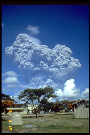
Tambora had only 3 eruptions over the previous 5,000 years, and none were very severe. But in 1812, Mount Tambora became much more active, culminating in a series of eruptions in April, 1815. On the evening of April 10th, 1815, witnesses saw three huge columns of flame rising up from the volcano. Pumice rocks rained down around the volcano, followed by clouds of ash a few hours later.
Geologists have estimated that Mount Tambora erupted with a force of 7 on the Volcanic Explosivity Index; that’s 4 times more powerful than the 1883 Krakatoa eruption. The ash cloud reached Borneo and Sulawasi islands, located 1,300 kilometers away. Historians argue how many deaths caused by the eruption itself, but estimates range from 10,000 killed by the eruption outright to almost 100,000 when you include the disease and starvation after the eruption.
The effects from the Mount Tambora eruption were felt around the world. It released so much sulphur into the atmosphere that the entire planet was cooled. The following year was known as the year without a summer. Snow fell in Quebec in the middle of summer, and persistent fog obscured much of the Northeastern US. Average annual temperatures dropped by 0.4 to 0.7 degrees C. It created the worst famine in the 19th century.
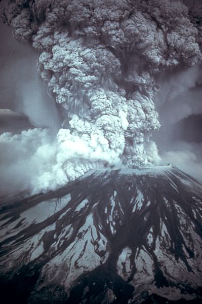
We have written many articles about volcanoes for Universe Today. Here’s an article about Mount St. Helens, and here’s another about Mount Pinatubo.
Want more resources on the Earth? Here’s a link to NASA’s Human Spaceflight page, and here’s NASA’s Visible Earth.
We have also recorded an episode of Astronomy Cast about Earth, as part of our tour through the Solar System – Episode 51: Earth.