New Satellite Will Monitor Rising Oceans

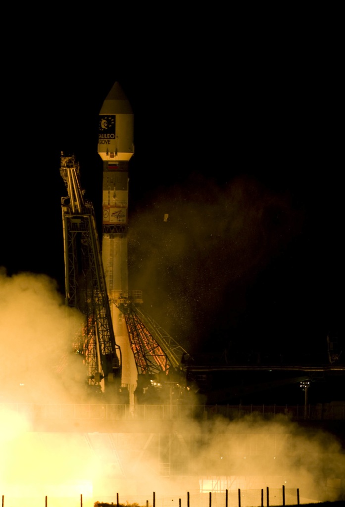
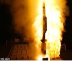
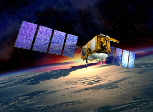
A Delta 2 rocket blasted off early this morning at 3:46 a.m. EDT bringing the Ocean Surface Topography Mission-Jason 2 into Earth orbit. The satellite will use a radar altimeter to precisely measure the height of ocean surfaces, which have been rising in recent years because of increasing temperatures. The data will be used to monitor effects of climate change on sea level and to improve global weather, climate and ocean forecasts. NASA said the new satellite, which is a cooperative effort between the US and France, will also improve hurricane forecasting.

“Global warming is causing the oceans to rise at a rate of about 3 millimeters per year, and this is a direct result of increasing the temperature of the atmosphere,” said Josh Willis an oceanographer from JPL. “That causes glaciers and ice sheets to melt, raising the levels of the ocean. But also, the ocean itself absorbs heat. And when that happens, again the water expands, stands a little taller, and this causes sea level rise as well, so the altimeter on OSTM, or Jason 2, will see both of these effects at it circles the Earth.”

Similar observations began in 1992 with a spacecraft dubbed TOPEX/Poseidon and have continued with the current Jason 1 satellite. The two Jasons will fly in tandem.

Together with Jason 1, the two spacecraft will double global data coverage. This tandem mission will improve our knowledge of tides in coastal and shallow seas and internal tides in the open ocean, while improving our understanding of ocean currents and eddies.

Jason 2 will map the sea surface highs and lows every 10 days, tracking changes and helping scientists keep tabs on climate, and even weather.

Measurements of sea-surface height, or ocean surface topography, reveal the speed and direction of ocean currents and tell scientists how much of the sun’s energy is stored by the ocean. Combining ocean current and heat storage data is key to understanding global climate variations.

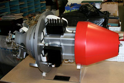
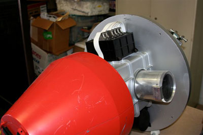
OSTM/Jason 2’s five primary instruments are improved versions of those flying on Jason 1. These technological advances will allow scientists to monitor conditions in ocean coastal regions — home to about half of Earth’s population. Compared with Jason 1 measurements, OSTM/Jason 2 will have substantially increased accuracy and provide data to within 25 kilometers (15 miles) of coastlines, nearly 50 percent closer to shore than in the past. Such improvements will be welcome news for all those making their living on the sea, from sailors and fishermen to workers in offshore industries. NOAA will use the improved data to better predict hurricane intensity, which is directly affected by the amount of heat stored in the upper ocean.

Sources: NASA, JPL

Possible Solution to Solar Flare Damage to Satellites

Powerful solar flares can cause charge build-up on satellites (NASA)

When a solar flare blasts energetic particles and magnetic flux at Earth, our satellites are on the front line. As coronal mass ejections (CMEs) interact with the Earth’s magnetosphere, there is a huge injection of energetic electrons into the Earth’s radiation belts. This can have dire consequences for the satellites that we depend on for communications around the globe. All is not lost however. An international team of scientists have stumbled upon a possible, innovative solution to discharge these troublesome electrons into the atmosphere: bathe the skies in radio waves.

The magnetosphere (protective layers of geomagnetic field lines) traps energetic particles in a volume of space known as the Van Allen belt. Our satellites are constantly travelling through this high radiation environment. Most satellites are shielded from all but the worst the Van Allen belt can throw at them, but should the Sun send a high concentration of energetic particles at the Earth after a solar flare, the environment in the magnetosphere becomes a very dangerous place. Should the delicate circuitry on board the spacecraft be hit by energetic particles (a situation that possibly caused Mars Odyssey to be switched to “safe-mode”), the satellite could be irreversibly damaged.

Now, a chance discovery by French and New Zealand scientists indicate that magnetospheric electrons can be discharged into the atmosphere by using ground-based radio transmitters. This finding comes from a new paper to be published in the journal Geophysical Research Letters. Rory Gamble, a PhD student of the University of Otago in Dunedin, New Zealand, and his colleagues were analysing the data from DEMETER (Detection of Electro-Magnetic Emissions Transmitted from Earthquake Regions), a satellite sensitive to radiation changes in the magnetosphere. As the satellite passed over a military transmitter in Western Australia, they noticed that magnetospheric electrons were discharged into the atmosphere, thereby removing them from the magnetosphere.

We were able to determine that this transmitter has a direct effect on the electrons in the radiation belts [in the magnetosphere], it caused those electrons to crash into the top of the atmosphere and be removed from the radiation belts.” – Rory Gamble

This finding is a very exciting development for the human-influenced manipulation of the levels of radiation in the magnetosphere. During periods of high solar activity, when energetic electrons are expected to populate the radiation belts in higher densities, there could be a system in place to bathe the sky in radio waves, allowing safer passage for satellites. This phenomenon has been known to exist when transmitting radio waves in space, but this is the first example of electron discharge from a ground-based transmitter.

Source: ABC

Harvesting Solar Power from Space

Artist's concept of a space-based solar array. Credit NASA/SAIC

In a new report, the viability of sending solar panels into space to collect a vast quantity of uninterrupted energy has been re-investigated. Although the idea has been around since the 1970’s, space solar power has always been viewed as prohibitively expensive. In the current energy climate down here on Earth with spiralling oil prices and a massive push toward green energy sources, sending massive solar arrays into geosynchronous orbit doesn’t seem like such a strange (or expensive) idea. There are many obstacles in the way of this plan, but the international community is becoming more interested, and whoever is first to set up an orbital array will have a flexible and unlimited energy resource…

It sounds like the perfect plan: build a vast array of solar panels in space. This avoids many of the practical problems we have when building them on Earth such as land availability, poor light conditions and night time, but sending a sunlight farm into space will be expensive to set up. In the 1970’s a plan was drawn up by NASA for the possibility of orbital sunlight “harvesting”, but it was deemed too expensive with a hefty price tag of at least $1 trillion. There was no country in the world that could commit to such a plan. But as we slowly approach an era of cheaper space travel, this cost has been slashed, and the orbital solar energy case file has been re-opened. Surprisingly, it isn’t the most developed nations in the world that are pushing for this ultimate renewable energy source. India and China, with their ballooning populations are reaching a critical point for energy consumption and they are beginning to realise their energy crisis may be answered by pushing into space.

A single kilometer-wide band of geosynchronous Earth orbit experiences enough solar flux in one year to nearly equal the amount of energy contained within all known recoverable conventional oil reserves on Earth today.” – Pentagon’s National Security Space Office 2007 report.

So how could this plan work? Construction will clearly be the biggest expense, but the nation who leads the way in solar power satellites will bolster their economy for decades through energy trading. The energy collected by highly efficient solar panels could be beamed down to Earth (although it is not clear from the source what technology will go into “beaming” energy to Earth) where it is fed into the national grid of the country maintaining the system. Ground based receivers would distribute gigawatts of energy from the uninterrupted orbital supply. This will have obvious implications for the future high demand for electricity in the huge nations in Asia and will wean the international community off carbon-rich non-renewable resources such as oil and coal. There is also the benefit of the flexible nature of this system being able to supply emergency energy to disaster (and war-) zones.

It will take a great deal of effort, a great deal of thought and unfortunately a great deal of money, but it is certainly possible.” – Jeff Keuter, president of the George C. Marshall Institute, a Washington-based research organization.

The most optimistic time frame for a fully operational space-based sunlight collection satellite would be 2020, but that is if we started work now. Indeed some research is being done (Japan is investing millions of dollars into a potential prototype to be put into space in the near future), but this is a far cry from planning to get full-scale operations underway in a little over a decade…

Source: CNN International

US Wants to Defend Satellites From Laser Attack

In 2006 the US carried out space laser tests (Starfire Optical Range)

So what do you do if someone fires a powerful laser at your satellite? The optics on the satellite will probably be fried, so you couldn’t see who did it. The US military appears to be concerned that this possibility may become a reality. As the US depends more and more on space for communications, GPS and military applications, the US government has announced the development of a defence method intended to detect a ground-based laser attack on a satellite, and pin point the laser’s location. However, some experts have warned against taking this kind of action as there is little evidence other nations are developing anti-satellite laser technology. Also, it may be defence system but it could push further development of the militarization of space…

Satellites can be a pretty vulnerable technology. As showcased by both China and the US in the last year, satellites are well within the scope for anti-satellite missiles. Although both nations contest that the satellite shoot downs were not intended to demonstrate their military prowess in space, many observers have become concerned about the acceleration of research into space weaponry. Pentagon officials have even voiced their concern that their spy satellites may fall fowl of “illumination” by Chinese ground-based lasers. There is however little evidence that China is pursuing this technology.

Even so, the US Air Force has called on contractors to develop a system that will “sense and attribute” a laser attack. This means the technology must have the ability to sense laser emission aimed at a satellite and attribute it to a location on the surface. This development program has become known as Self Awareness/Space Situation Awareness (SASSA). The SASSA system will need to be sensitive to a wide range of laser and radio wavelengths, but the tough part will be to accurately pin-point where the laser is being fired from.

This month, both Lockheed Martin and Boeing have presented their proposals for the SASSA system and the Air Force hopes to fly the winning bid on board an experimental satellite (TacSat-5) in 2011.

Although this is a defensive measure, military analysts are worried that the SASSA could increase tensions around the use of space weapons. As Rob Hewson, analyst and editor for Jane’s Air Launched Weapons, points out, “It’s a defensive step but one that assumes an attack, it is a baby step in the preparation for fighting in space.”

Source: New Scientist Tech

The A-Train: Using Five Satellites as One to Analyze Polluted Clouds

The A-Train - 5 satellites collaborate to scan polluted clouds (NASA)

This is one of the finest examples of satellite collaboration. Five Earth-observing orbiters, four from NASA and one from France, are working together to provide the deepest analysis of cloud cover ever carried out. The satellites orbit in a close formation, only eight minutes apart, and create what is known as the “Afternoon Constellation” (or “A-Train” for short). They are so close in fact, that they can be considered to act as one satellite, capable of carrying out a vast suite of measurements on the pollution content of clouds. This work is shedding new light on the link between clouds, pollution and rainfall, a study that could never be achieved with one satellite alone…

Pollution in clouds is a critical problem for the international community. These rogue particles can seriously change the natural behaviour of clouds and entire weather systems, but until now, scientists have been uncertain about the difference in rainfall from polluted and unpolluted cloud cover. This is primarily because no single environmental satellite has been able to probe deep into clouds with the limited number of instruments it can carry. But using the collective power of five independent satellites, scientists are beginning to unlock the secrets polluted clouds have been hiding.

Particulates from pollution mixing with clouds above the US (NASA)

Researchers at NASA’s Jet Propulsion Labs (JPL) in Pasadena have recently discovered that clouds peppered with pollutant particles do not produce as much rain as their unpolluted counterparts. This finding was only possible after analysing data from the near-simultaneous measurements made by the five A-Train satellites. The constellation includes NASA’s Aqua, Aura, CloudSat and CALIPSO and the French Space Agency’s PARASOL.

Typically, it is very hard to get a sense of how important the effect of pollution on clouds is. With the A-Train, we can see the clouds every day and we’re getting confirmation on a global scale that we have an issue here.” – Anne Douglass, project scientist at Goddard for NASA’s Aura satellite.

The A-Train is turning up some interesting, if alarming, results. When focusing on the skies above South America during the June-October dry season, the JPL team found that the increased level of agricultural burning during this period injected more aerosols into the clouds. This had the effect of shrinking the size of ice crystals in the clouds, preventing the crystals from getting large enough to fall as rain. This direct effect of burning and ice crystal formation has never been connected before the use of the A-Train. However, during wet seasons, the aerosol content in clouds appeared not to be a critical factor on the amount of rainfall.

How is it possible to distinguish between polluted and unpolluted clouds? Firstly, the A-Train’s Aura satellite measures the concentration of carbon monoxide in the clouds. This is a strong indicator for the presence of smoke and other aerosols originating from a power plant or agricultural activities. When the polluted clouds are identified, the A-Train’s Aqua satellite can be called into use. Using its Moderate Resolution Imaging Spectroradiometer instrument, the size of ice crystals in polluted and unpolluted clouds can be measured. Next up is NASA’s Tropical Rainfall Measuring Mission satellite that can measure the amount of precipitation (rain) from polluted and unpolluted clouds.

Through this combination of satellites, scientists are able to link pollution with clouds with precipitation. This is only one example of the flexibility behind collaborations such as A-Train, so cloud science can only go from strength to strength.

Source: Physorg.com

China Launches Second Olympic Satellite; Will Help Earthquake Zone

Fengyun-3 launched on a Long March-4C rocket from Taiyuan Satellite Launch Center in the Shanxi province (chinanews.com)

China is stepping up its preparations for this year’s Olympics to be held in the Chinese capital, Beijing. Concern is growing for the start of the games this summer as early August is known to be a wet period in the region. More advanced weather satellites are therefore being sent into orbit to aid the forecasting effort. This is good timing for improved weather satellite technology as the earthquake-striken Sichuan province recovery effort has been hampered by poor weather conditions. Aid and search operations will greatly benefit from better weather forecasting…

At 11:02 Beijing Time (03:02 GMT) today, one of the most advanced weather satellites to be sent into space by China was launched from Taiyuan Satellite Launch Center in northern Shanxi Province. The satellite, called Fengyun-3, was launched by a Long March-4C carrier rocket. The ascent took 27 minutes from launch to orbital insertion.

This is the next generation in weather satellite technology for the nation. Fengyun-3 is carrying three-dimensional sensors that will measure the dynamics in the Earth’s atmosphere and climate. It will also monitor Polar Regions and ocean conditions. The sensors can measure temperature changes of 0.1F and has a spatial resolution of 250 meters (0.15 miles). This is a vast improvement on the resolution of its predecessors of only 1 kilometer (0.62 miles).

The 250-m resolution images will be of vital significance for censoring global climate changes and possible subsequent natural disasters.” – Gao Huoshan, general director of the FY-3 research team.

Gao also describes Fengyun-3 as a key contributor to acquiring geographical data for aviation, navigation, agriculture, forestry and oceanography research. This impressive 2,295 kg (5,060 lb) satellite will be used extensively to aid weather predictions for the Olympics and will help disaster zones (such as the recent sequence of major earthquakes in the Sichuan province).

This is another Chinese success in space as the proud nation pushes for more development of homemade satellite technology. Since US rules barred the export of satellite components to China, there is a sense of urgency to develop their own direction in space. US rules do not seem to be restricting Chinese aspirations in space, China is planning for a manned Moon mission to launch soon after 2017.

Sources: China Daily, Physorg.com

Europe Launches the Most Accurate Clock in Space

Where you want to go depends on where you are. And if you’ve got a GPS system in your hands, and the most accurate clock ever sent into space overhead, you’ll always know exactly where you are. ESA’s GIOVE-B satellite blasted into space on Sunday, taking the next step for the deployment of a European satellite navigation system.

The GIOVE-B satellite lifted off from the Baikonur Cosmodrome on April 27th at 4:16 am local time (22:13 UTC Saturday), and placed the Galileo In-Orbit Validation Element B (GIOVE-B) satellite into a 23,200 km orbit.

Ground controllers confirmed that the satellite deployed its twin solar panels, and it was generating electricity within about 5 hours of launch.

On board GIOVE-B are two redundant rubidium atomic clocks, but these are just backups. The really accurate timepiece is the Passive Hydrogen Maser, which has a stability of better than 1 nanosecond a day. There’s no risk of losing track of time with this – it’s the most stable clock operating in Earth orbit.

GIOVE-B is still just a technology demonstration. It will be followed in 2010 by the launch of the first 4 operational satellites that make up the Galileo navigation system. The European plan to eventually have a constellation of 30 identical satellites operating in a constellation.

Original Source: ESA News Release

Space Debris Illustrated: The Problem in Pictures

Trackable objects in Earth ORbit. Image Credit: ESA

Space junk, space debris, space waste — call it what you want, but just as junk and waste cause problems here on Earth, in space spent booster stages, nuts and bolts from ISS construction, various accidental discards such as spacesuit gloves and cameras, and fragments from exploded spacecraft could turn into a serious problem for the future of spaceflight if actions to mitigate the threat are not taken now. The European Space Operations Centre has put together some startling images highlighting this issue. Above is a depiction of the trackable objects in orbit around Earth in low Earth orbit (LEO–the fuzzy cloud around Earth), geostationary Earth orbit (GEO — farther out, approximately 35,786 km (22,240 miles) above Earth) and all points in between.

Trackable objects in Low Earth Orbit.  Image Credit:  ESA
Between the launch of Sputnik on 4 October 1957 and 1 January 2008, approximately 4600 launches have placed some 6000 satellites into orbit; about 400 are now travelling beyond Earth on interplanetary trajectories, but of the remaining 5600 only about 800 satellites are operational – roughly 45 percent of these are both in LEO and GEO. Space debris comprise the ever-increasing amount of inactive space hardware in orbit around the Earth as well as fragments of spacecraft that have broken up, exploded or otherwise become abandoned. About 50 percent of all trackable objects are due to in-orbit explosion events (about 200) or collision events (less than 10).
Impact from space debris on shuttle window
Officials from the space shuttle program have said the shuttle regularly takes hits from space debris, and over 80 windows had to be replaced over the years. The ISS occasionally has to take evasive maneuvers to avoid collisions with space junk. And of course, this debris is not just sitting stationary: in orbit, relative velocities can be quite large, ranging in the tens of thousands of kilometers per hour.

For the Envisat satellite, for example, the ESA says the most probable relative velocity between the satellite and a debris object is 52,000 kilometers per hour. If a debris objects hits a satellite, the ISS or the Shuttle, at those speeds it could cause severe damage or catastrophe.

Space Debris in polar orbit.  Image Credit:  ESA

Above is a depiction of debris in polar orbit around Earth. From the image below, it’s evident how explosions of spacecraft causes even more scattered debris. Even after the end of the mission, batteries and pressurised systems as well as fuel tanks explode. This generates debris objects, which contribute to the growing population of materials in orbit, ranging from less than a micrometer to 10 centimeters or more in size.
An upper stage of a spacecraft exploding.  Image Credit:  ESA

About 40% of ground-trackable space debris come from explosions, now running at four to five per year. In 1961, the first explosion tripled the amount of trackable space debris. In the past decade, most operators have started employing on-board passive measures to eliminate latent sources of energy related to batteries, fuel tanks, propulsion systems and pyrotechnics. But this alone is insufficient. At present rates, in 20 or 30 years, collisions would exceed explosions as a source of new debris.

2112 future simulation.  Image credit: ESA
The ESA says it is crucial to start immediately to implement mitigation measures. This image shows a simulation of the the 2112 GEO environment in the case when no measures are taken. In the top panel, with mitigation measures, a much cleaner space environment can be observed if the number of explosions is reduced drastically and if no mission-related objects are ejected. The bottom panel shows the “business-as-usual” scenario, without any mitigation measures taken. However, to stop the ever-increasing amount of debris, more ambitious mitigation measures must be taken. Most importantly, spacecraft and rocket stages have to de-orbited and returned to Earth after the completion of their mission.

They’ll burn up in the atmosphere, or splash down in uninhabited ocean areas. In the case of telecommunication and other satellites operating in the commercially valuable geostationary zone, they should boost their satellites to a safe disposal orbit, as shown below.
Graveyard orbit.  Image credit:  ESA

There are other measures, like reducing the number of mission-related objects and controlling the risk for reentry, but these are the basics. The issue is that such mitigation measures cost fuel and operational time, and therefore they increase cost. In the commercial world, this may competitiveness, unless there is an international consensus to accept such costs.

Original News Source: ESA

So, What Does an Anti-Satellite Weapon Actually Look Like?

satmissile.thumbnail.jpg

In February, the Universe Today followed the sad tale about a dead US satellite called US-193, lifelessly floating around in orbit, possibly threatening the world by dumping hazardous fuel onto a city somewhere. This was the perfect time for the US Navy to launch their Standard Missile-3 (SM-3) into space, smashing US-193 to tiny bits. It worked and it worked well.

Although we’ve seen loads of pictures of the rocket being launched, and the pinpoint accuracy it accomplished by detonating in low Earth orbit, but what technology goes into the actual warhead that takes out the satellite? Well, in an article just published, images of an older generation “Kinetic Energy” anti-satellite weapon are on display. And to be honest, it doesn’t look that scary…

There’s more than one way to kill a satellite. You can make it self destruct by firing its thrusters, sending it in a deadly descent through the atmosphere. But say if you don’t have communication with the craft? You could capture it in orbit using a robotic or manned spaceship. But this would be prohibitively expensive and dangerous. You could simply shoot it down… now this idea (although far from being “simple”) is the most popular and effective method to get rid of a satellite from orbit.

The anti-satellite (ASAT) idea has been around since the Cold War, as far back as the 1960’s, but very little information is available. In fact, according to Dwayne Day’s article in The Space Review on the 31st March, since the Cold War nobody has been bothered to write much about American ASAT technology development, policy, and doctrine. It is unclear if this is down to the military being (understandably) secretive, or whether people simply lost interest in the “Star Wars” program proposed by U.S. President Ronald Reagan in 1983.

A Lockheed KE-ASAT mock-up (credit: Dwayne Day)

But there are some clues as to the US anti-satellite capabilities back in the 1990’s, namely a cool-looking mock-up of one of Lockheed’s proposals for a kinetic energy anti-satellite warhead (or KE-ASAT, pictured left), the author discovered at the Aerospace Legacy Foundation’s offices located at the former North American Aviation Downey factory. The owner, a Dr. Jim Busby showed off a low fidelity mock-up of a Lockheed KE-ASAT, which he acquired in the early 1990s, when a previous owner discarded it.

The rear of the KE-ASAT (credit: Dwayne Day)

It’s a strange-looking device, resembling a mini-spaceship capsule (although, from the images and description, it is unclear how big it is) that would have sat on top of a rocket booster to send it from the ground and into space to hit its satellite target. This type of anti-satellite does not explode on impact; it relies on huge velocities and a high mass to generate enough kinetic energy to destroy the target on impact.

Some variations on this theme may have included a Kevlar “fly swatter” that would expand on impact, making it easier to hit the satellite and destroy it.

The side of the KE-ASAT (credit: Dwayne Day)

It is obvious from the images that the mass of the warhead is packed in the red cone at the front of the weapon; the infrared heat-seeker targeting system would also be housed there. There is also a main thruster (that would fire to life once the rocket boosters had carried it into space), and attitude controls at the rear to guide the high velocity projectile to its target. A similar method was used by the February 20th US spy satellite intercept, so the proposed technology this KE-ASAT is built on is not far from the current method employed by the US Navy.

Alas, the KE-ASAT never made it to the production line as Lockheed’s bid for use in an anti-satellite program was beaten by the Rockwell company in July 1990, the US Army opted for a far different-looking design, not dissimilar to the ASAT used today. Personally I think the Lockheed concept looked better, but would have been very scary, causing a huge mess

Source: The Space Review

The Mysterious Case of Two Spheres Falling to Earth in Australia and Brazil

On the March 24th, a story hit the web from Brazil asking for help identifying a mysterious-looking sphere found in farmland. The black, shiny object appeared to be wrapped in fibrous material and it was hot to the touch. Immediately thoughts of extra-terrestrial origin came to mind…

Today, several news sources covered the discovery of a mysterious spherical object found in the Australian outback last year. The farmer who made the discovery has only just started to make enquiries into what the object actually is.

So are the two objects connected in some way? Are they indeed from outer space?

The answer is “yes”, and “yes”. But don’t go getting too excited, they’re not bits from a broken alien spacecraft.

The orb in Brazilian farmland (credit: Daniel Drehmer)

Before their origins are explained, a bit of background: The first story to be released was from Brazil on Monday. Just a small story on Daniel Drehmer’s blog, asking “a space geek from Digg” (Digg.com being the social bookmarking site) for help to identify this strange object found by Sebastião Marques da Costa who described the orb as being hot to the touch. Either it has been heated by the Sun, or it had just crashed to Earth. On seeing the object, it does make for good science fiction material. It’s a very strange looking thing, one meter in diameter, contrasting with the green countryside.

A COPV containing helium on board the Shuttle (credit: NASA)

I was so intrigued by the story, I kept an eye on the blog. The following day, the Second Wave reported that an answer had been found. Obviously the geeks on Digg had been paying attention and identified the object as a Composite Overwrapped Pressure Vessel (or COPV). Put very basically, it’s a high pressure container for inert gases. The space shuttle carries COPVs and it seems likely that these containers will be used for a variety of space missions. They are built with a carbon fibre or Kevlar overcoat to provide reinforcement against the vast pressure gradient between the inside and outside of the container.

If the COPVs are so reinforced, it seems reasonable that they may survive re-entry through the Earth’s atmosphere.

The Australian mystery orb (credit: Reuters)

So what about our Australian farmer? Looking at the picture, the strange object in the Australian outback has some striking similarities to the Brazilian orb (only a lot more damaged).

Today many news sites picked up on the Australian find (well, last year’s find), and call me suspicious, but the timing couldn’t be better. The Australian farmer, James Stirton, who found the object made the surprising statement to the Reuters news agency:

I know a lot of about sheep and cattle but I don’t know much about satellites. But I would say it is a fuel cell off some stage of a rocket.”

That’s one very well informed guess. Perhaps he’s a Digg reader…?

Either way, it would be interesting to find out to what space mission these COPVs belonged to, as it appears they are highly efficient at not only storing fuels being flown into space, they also crash to Earth pretty much intact.

Sources: Reuters, The Second Wave