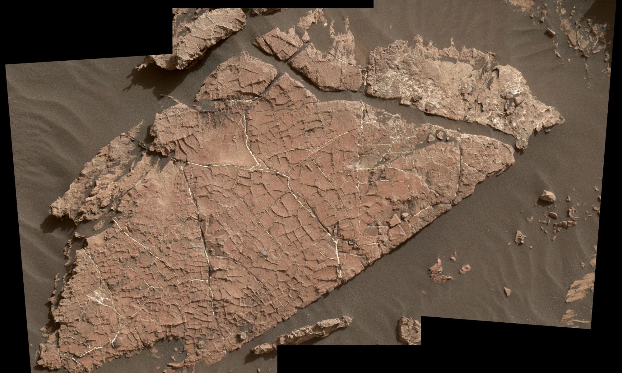
This Martian rock slab is called "Old Soaker." It may have formed more than 3 billion years ago when a mud layer dried out. The cracks indicate alternating periods of dryness and wetness. Image Credit: NASA/JPL-Caltech/MSSS
What happened to Mars? If Mars and Earth were once similar, as scientists think, what happened to all the water? Did there used to be enough to support life?
Thanks to the Mars Science Laboratory (MSL) Curiosity, we’re getting a better picture of ancient Mars and what it went through billions of years ago. A new study published in Nature Geoscience says that Mars likely underwent alternating periods of wet and dry, before becoming the frigid, dry desert it is now. Or at least, Gale Crater did.
A view from the "Kimberley" formation on Mars taken by NASA's Curiosity rover. The strata in the foreground dip towards the base of Mount Sharp, indicating flow of water toward a basin that existed before the larger bulk of the mountain formed. This image was taken by the Mast Camera (Mastcam) on Curiosity on Sol 580 of the mission and has been “white balanced” to adjust for the lighting on Mars make the sky appear light blue. Credits: NASA/JPL-Caltech/MSSS
It’s all about the detail.
In a way, Mars looks like a dusty, dead, dry, boring planet. But science says otherwise. Science says that Mars used to be wet and warm, with an atmosphere. And science says that it was wet and warm for billions of years, easily long enough for life to appear and develop.
But we still don’t know for sure if any life did happen there.
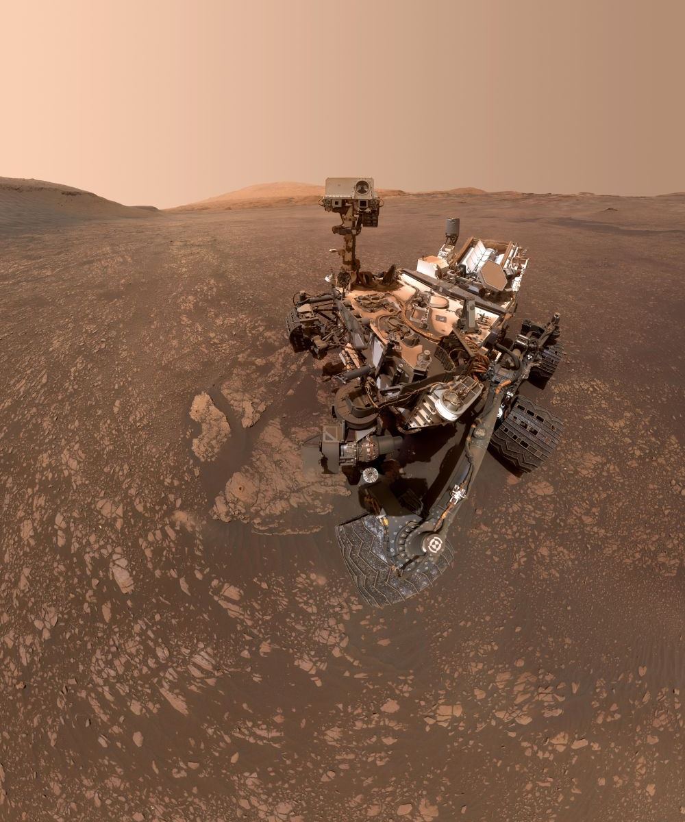
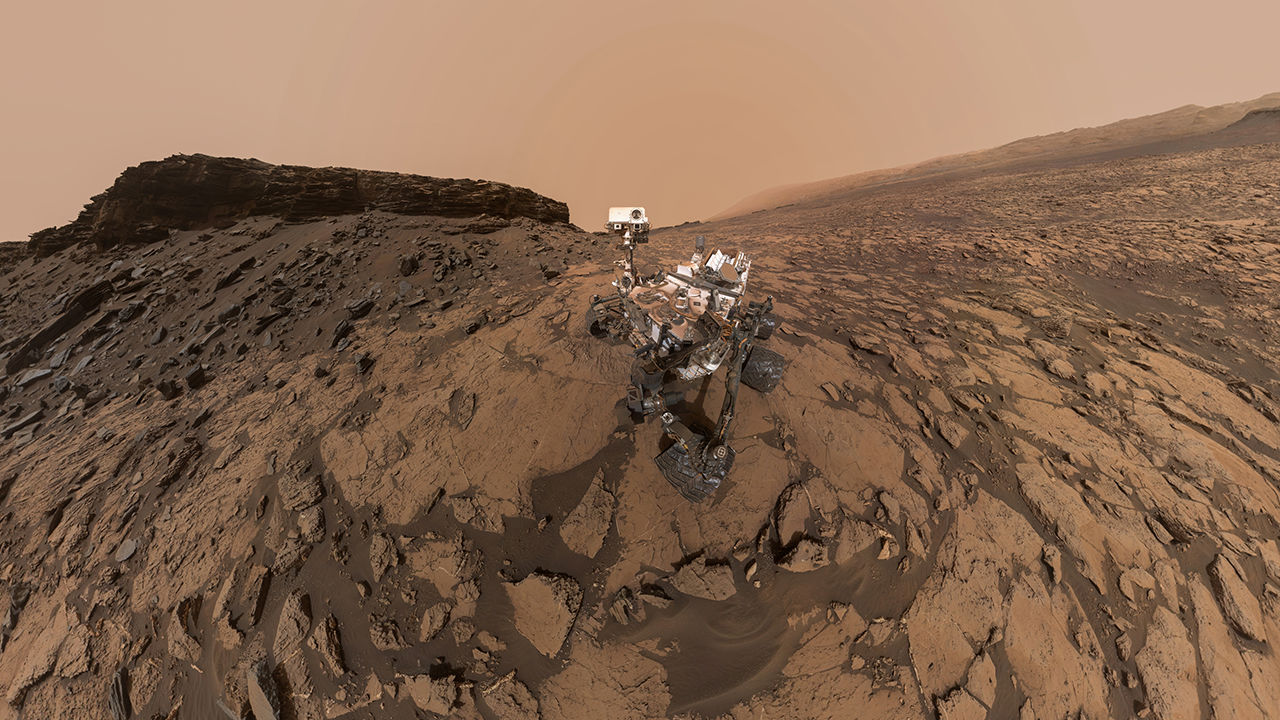
This low-angle self-portrait of NASA's Curiosity Mars rover shows the vehicle at the site from which it reached down to drill into a rock target called "Buckskin" on lower Mount Sharp. Credits: NASA/JPL-Caltech/MSSS
Since it landed on Mars in 2012, one of the main scientific objectives of the Curiosity rover has been finding evidence of past (or even present) life on the Red Planet. In 2014, the rover may have accomplished this very thing when it detected a tenfold increase in atmospheric methane in its vicinity and found traces of complex organic molecules in drill samples while poking around in the Gale Crater.
About a year ago, Curiosity struck pay dirt again when it found organic molecules in three-billion-year-old sedimentary rocks located near the surface of lower Mount Sharp. But last week, the Curiosity rover made an even more profound discovery when it detected the largest amount of methane ever measured on the surface of Mars – about 21 parts per billion units by volume (ppbv).
Curiosity at Mt. Sharp, Gale Crater, Mars. To the left of the rover are two drill holes into the rocks "Aberlady" and "Kilmarie." Curiosity found high concentrations of clay in both rocks. Image Credit: NASA/JPL-Caltech/MSSS
Clay is a big deal on Mars because it often forms in contact with water. Find clay, and you’ve usually found evidence of water. And the nature, history, and current water budget on Mars are all important to understanding that planet, and if it ever supported life.
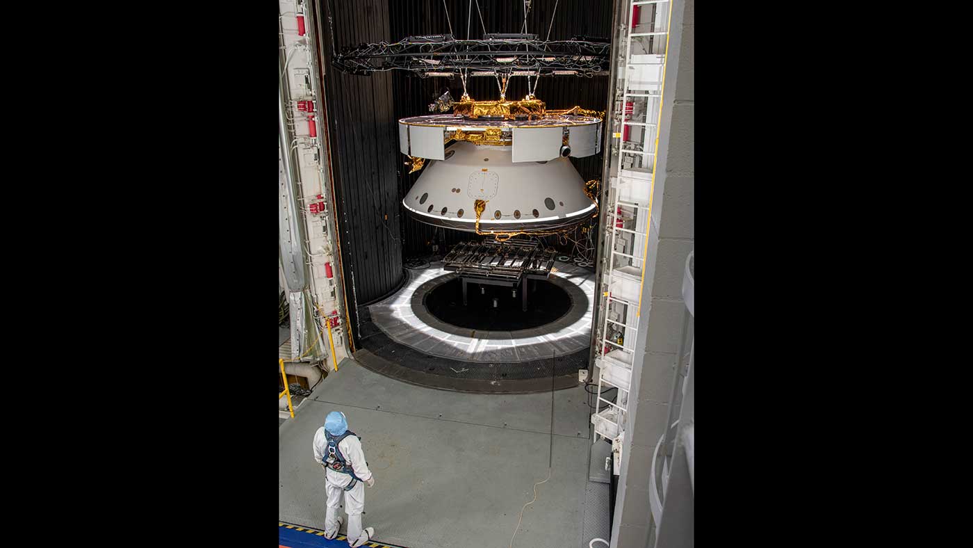
Engineers testing the spacecraft that will carry the Mars 2020 rover to the Red Planet. Credit: NASA/JPL-Caltech
Next summer, NASA will be sending it’s Mars 2020 rover to the Red Planet. In addition to being the second rover to go as part of the Mars Exploration Program, it will be one of eight functioning missions exploring the atmosphere and surface of the planet. These include the recently-arrived InSightlander, the Curiosityrover – Mars 2020s sister-mission – and the Opportunityrover (which NASA recently lost contact with and retired).
As the launch date gets closer and closer, NASA is busily making all the final preparations for this latest member of the Mars exploration team. In addition to selecting a name (which will be selected from an essay contest), this includes finalizing the spacecraft that will take the rover on its seven-month journey to Mars. Recently, NASA posted images of the spacecraft being inspected at NASA JPL’s Space Simulator Facility (SFF) in Pasadena, California.
A mast-cam mosaic image of the so-called "clay-bearing unit". After almost seven years on Mars, MSL Curiosity has finally been able to drill into the clay-rich region. Image Credit: NASA/JPL-Caltech/MSSS
It’s hard to believe that MSL Curiosity has been on Mars for almost seven years. But it has, and during that time, the rover has explored Gale Crater and Mt. Sharp, the central peak inside the crater. And while it has used its drill multiple times to take rock samples, this is the first sample it’s gathered from the so-called ‘clay unit.’
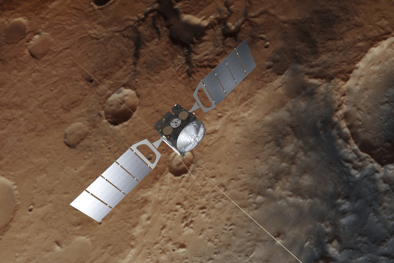
An artist's illustration of the Mars Express Orbiter above Mars. Its MARSIS instrument has been updated so it can study the moon Phobos. Image Credit: Spacecraft: ESA/ATG medialab; Mars: ESA/DLR/FU Berlin, CC BY-SA 3.0 IGO
If you’re not a chemist, an astrobiologist, or a scientist of any sort, and that includes most of us, then a tiny, almost imperceptible whiff of methane in the Martian atmosphere might seem like no big deal. But it is, gentle humans. It is.
Why?
Because it could be a signal that some living process is at work. And even we non-scientists have wondered at some point if the only life in the Solar System, or maybe in the entire Universe, is confined here on Earth.
Panoramic image of the Curiosity rover, from September 2016. The pale outline of Aeolis Mons can be seen in the distance. Credit: NASA/JPL-Caltech/MSSS
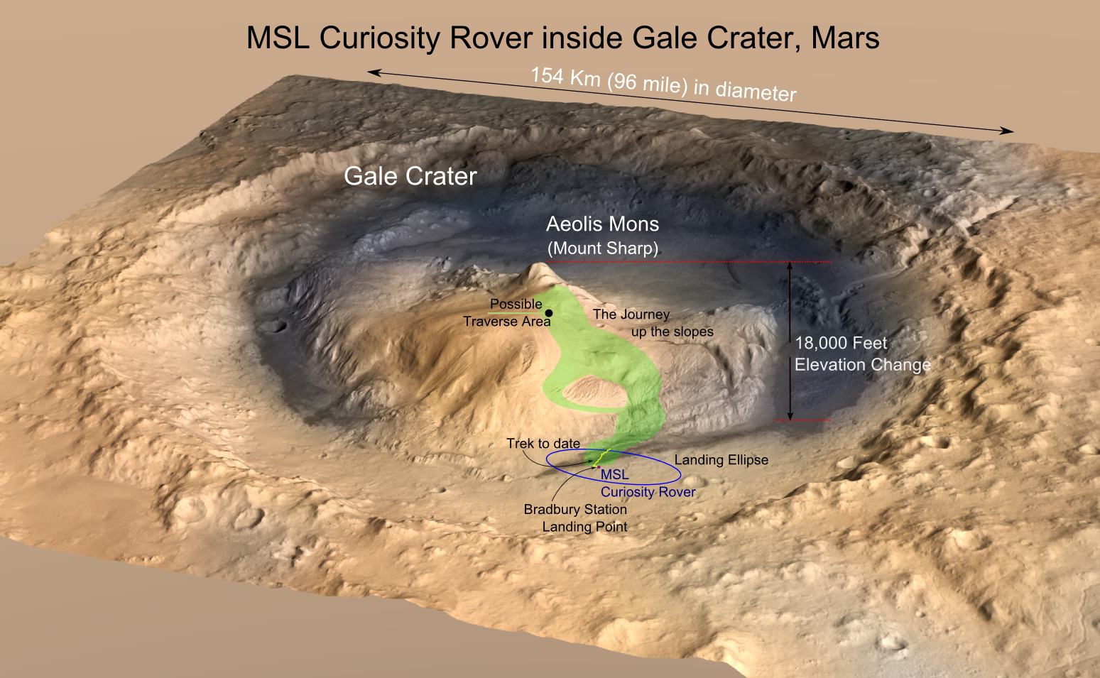
Some very clever people have figured out how to use MSL Curiosity’s navigation sensors to measure the gravity of a Martian mountain. What they’ve found contradicts previous thinking about Aeolis Mons, aka Mt. Sharp. Aeolis Mons is a mountain in the center of Gale Crater, Curiosity’s landing site in 2012.
Gale Crater is a huge impact crater that’s 154 km (96 mi) in diameter and about 3.5 billion years old. In the center is Aeolis Mons, a mountain about 5.5 km (18,000 ft) high. Over an approximately 2 billion year period, sediments were deposited either by water, wind, or both, creating the mountain. Subsequent erosion reduced the mountain to its current form.
Now a new paper published in Science, based on gravity measurements from Curiosity, shows that Aeolis Mons’ bedrock layers are not as dense as once thought.
Mosaic image of the Curiosity rover on Mars, which recently turned up more evidence that supports the idea that the planet was once habitability. Credit: NASA/JPL-Caltech/MSSS.
On August 5th, 2012, after spending over 8 months in space, NASA’s Curiosity rover landed on Mars. As part of the NASA Mars Science Laboratory (MSL) mission, and the latest in a series of rovers deployed to the Martian surface, Curiosity had some rather ambitious research goals. In addition to investigating Mars’ climate and geology, the rover was also tasked with revealing more about Mars’ past and determining if it ever supported microbial life.
And recently, the Curiosity rover hit another major milestone in its exploration of the Red Planet. As of January 26th, 2018 the rover has spent a total of 2,000 days on Mars, which works out to 5 years, 5 months and 21 days – or 1947 Martian days (sols). That’s especially impressive when you consider that the mission was only meant to last 687 days (668 sols), or just little under 2 years.
In all that time, the Curiosity rover has accomplished some major feats and has the scars to prove it! Some of it’s wheels have become teared, holed and cracked and its drill has been pushed almost to the point of breaking. And yet, Curiosity is still hard at work pushing itself up a mountain – both literally and figuratively! The rover has also managed to exceed everyone’s expectations.
MRO image of Gale Crater illustrating the landing location and trek of the Rover Curiosity. Credits: NASA/JPL, illustration, T.Reyes
As Ashwin Vasavada, the MSL Project Scientist, told Universe Today via email:
“In terms of challenges, the first 2000 days of Curiosity’s mission went better than I could have hoped. For much of the time, the rover remained as capable as the day it landed. We had a scare in the first year when a memory fault triggered additional problems and nearly resulted in the loss of the mission. We famously wore down our wheels pretty early, as well, but since then we’ve kept that under control. In the last year, we’ve had a major problem with our drill. That’s the only major issue currently, but we believe we’ll be back to drilling in a month or so. If that works out, we’ll amazingly be back to having all systems ready for science!”
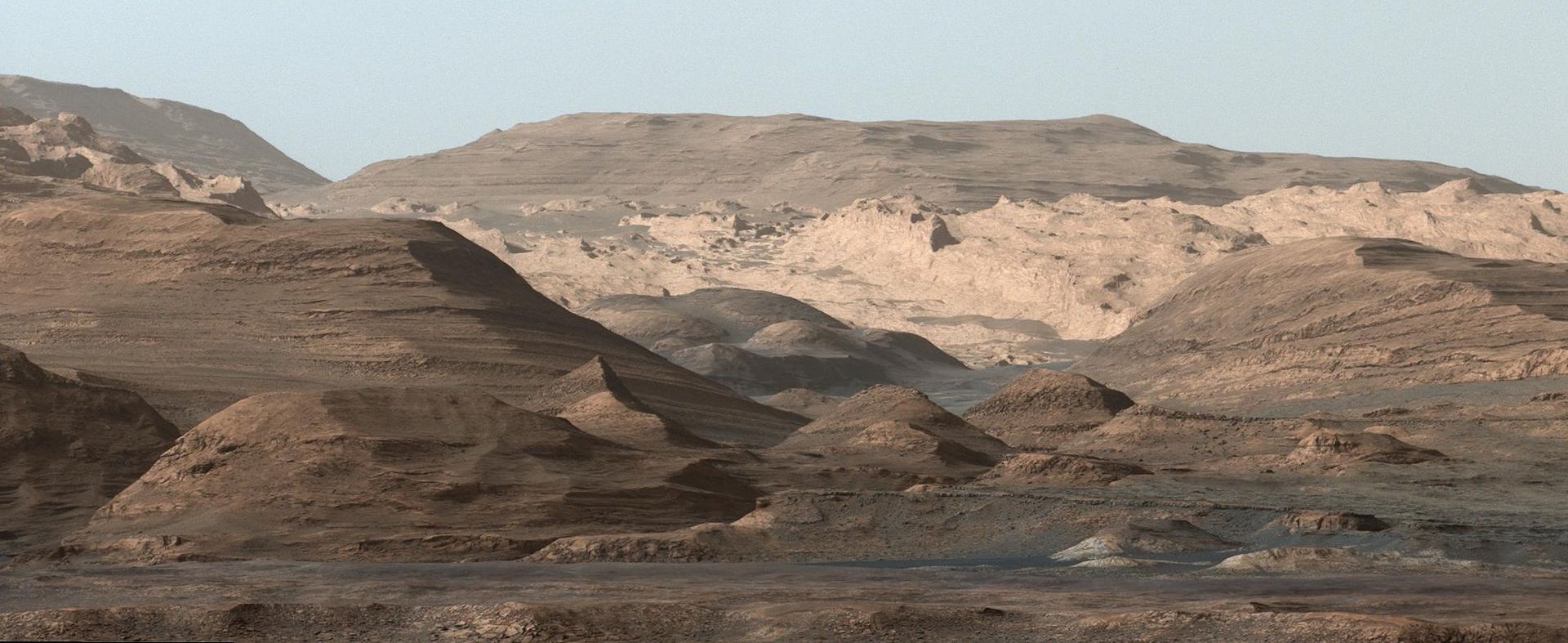
As of the penning of this article, the rover is climbing Mount Sharp in order to collect further samples from Mars’ past. Also known as Aeolis Mons, this mountain resides in the center of the Gale Crater where Curiosity landed in 2012 and has been central to Curiosity’s mission. Standing 5,500 meters (18,000 ft) above the valley floor, Mount Sharp is believed to have formed from sediment that was slowly deposited by flowing water over billions of years.
This is all in keeping with current theories about how Mars once had a denser atmosphere and was able to sustain liquid water on its surface. But between 4.2 and 3.7 billion years ago, this atmosphere was slowly stripped away by solar wind, thus turning Mars into the cold and desiccated place that we know today. As a result, the study of Mount Sharp was always expected to reveal a great deal about Mars’ geological evolution.
Image of Mount Sharp taken by the Curiosity rover on Aug. 23rd, 2012. The layers at the base of Mt. Sharp show the geological history of Mars. Credit: NASA/JPL-Caltech/MSSS.
In it’s first year, Curiosity achieved a major milestone when the rover obtained drill samples from low-lying areas that indicated that lakes and streams existed in the Gale Crater between 3.3 to 3.8 billion years ago. In addition, the rover has also obtained ample evidence that the crater once had all the chemical elements and even a chemical source of energy needed for microbial life to exist.
“NASA’s charge to our mission was to determine whether Mars ever had conditions suitable for life,” said Vasavada. “Success was not a foregone conclusion. Would we arrive safely? Would the scientific instruments work? Would the area we chose for the landing site hold the clues we were looking for? For me, meeting each of these objectives are the highlights of the mission. I’ll never forget witnessing the launch, or nervously waiting for a safe touchdown. Discovering an ancient, freshwater lake environment at Gale crater was profound scientifically, but also was the moment that I knew that our team had delivered what we promised to NASA.”
Basically, by scaling Mount Sharp and examining the layers that were deposited over the course of billions of years, Curiosity is able to examine a living geological record of how the planet has evolved since then. Essentially, the lower layers of the mountain are believed to have been deposited 3.5 billion years ago when the Gale Crater was still a lakebed, as evidenced by the fact that they are rich in clay minerals.
The upper layers, meanwhile, are believed to have been deposited over the ensuing millions of years, during which time the lake in the Gale Crater appears to have grown, shrunk, disappeared and then reappeared. Basically, by scaling the mountain and obtaining samples, Curiosity will be able to illustrate how Mars underwent the transition from being a warmer, wetter place to a frozen and dry one.
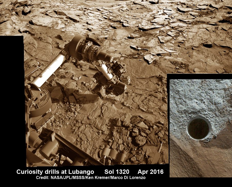
Image taken of drill sample obtained at the ‘Lubango’ outcrop target on Sol 1320, Apr. 23, 2016. Lubango is located in the Stimson unit on the lower slopes of Mount Sharp inside Gale Crater. Credit: NASA/JPL/MSSS/Ken Kremer/kenkremer.com/Marco Di Lorenzo
As Vasavada explained, this exploration is also key to answering a number of foundational questions about the search for life beyond Earth:
“Curiosity established that Mars was once a suitable home for life; it had liquid water, key chemical building blocks, and energy sources required by life in the lake and groundwater environment within Gale crater. Curiosity also has detected organic molecules in ancient rocks, in spite of all the degradation that could have occurred in three billion years. While Curiosity cannot detect life itself, knowing that Mars can preserve organic molecules bodes well for missions that will explore ancient rocks, looking for signs of past life.”
At this juncture, its not clear how much longer Curiosity will last. Considering that it has already lasted over twice as long as originally intended, it is possible the rover will remain in operation for years to come. However, unlike the Opportunity rover – who’s mission was intended to last for 90 days, but has remained in operation for 5121 days (4984 sols) – Curiosity has a shelf life.
Whereas Opportunity is powered by solar cells, Curiosity is dependent on its Multi-Mission Radioisotope Thermoelectric Generator (MMRTG). Eventually, this slow-fission reactor will exhaust its supply of nuclear fuel and the rover will be forced to come to a halt. And considering how the rover has been put through its paces in the past 5 years, there’s also the chance that it will suffer a mechanical failure.
But in the meantime, there’s plenty of work to be done and lots of opportunities for vital research. As Vasavada put it:
“Curiosity won’t last forever, but in the years we have left, I hope we can complete our traverse through the lowermost strata on Mount Sharp. We’re well over halfway through. There are changes in the composition of the rocks ahead that might tell us how the climate of Mars changed over time, perhaps ending the era of habitability. Every day on Mars still counts, perhaps even more than before. Now every new discovery adds a piece to a puzzle that’s more than halfway done; it reveals more given all the other pieces already around it.”
And be sure to check out this retrospective of the Curiosity rover’s mission, courtesy of NASA:
NASA’s Curiosity rover raised robotic arm with drill pointed skyward while exploring Vera Rubin Ridge at the base of Mount Sharp inside Gale Crater - backdropped by distant crater rim. This navcam camera mosaic was stitched from raw images taken on Sol 1833, Oct. 2, 2017 and colorized. Credit: NASA/JPL/Ken Kremer/kenkremer.com/Marco Di Lorenzo
NASA’s Curiosity rover raised robotic arm with drill pointed skyward while exploring Vera Rubin Ridge at the base of Mount Sharp inside Gale Crater – backdropped by distant crater rim. This navcam camera mosaic was stitched from raw images taken on Sol 1833, Oct. 2, 2017 and colorized. Credit: NASA/JPL/Ken Kremer/kenkremer.com/Marco Di Lorenzo
5 years after a heart throbbing Martian touchdown, Curiosity is climbing Vera Rubin Ridge in search of “aqueous minerals” and “clays” for clues to possible past life while capturing “truly breathtaking” vistas of humongous Mount Sharp – her primary destination – and the stark eroded rim of the Gale Crater landing zone from ever higher elevations, NASA scientists tell Universe Today in a new mission update.
“Curiosity is doing well, over five years into the mission,” Michael Meyer, NASA Lead Scientist, Mars Exploration Program, NASA Headquarters told Universe Today in an interview.
“A key finding is the discovery of an extended period of habitability on ancient Mars.”
The car-sized rover soft landed on Mars inside Gale Crater on August 6, 2012 using the ingenious and never before tried “sky crane” system.
A rare glimpse of Curiosity’s arm and turret mounted skyward pointing drill is illustrated with our lead mosaic from Sol 1833 of the robot’s life on Mars – showing a panoramic view around the alien terrain from her current location in October 2017 while actively at work analyzing soil samples.
“Your mosaic is absolutely gorgeous!’ Jim Green, NASA Director Planetary Science Division, NASA Headquarters, Washington D.C., told Universe Today
“We are at such a height on Mt Sharp to see the rim of Gale Crater and the top of the mountain. Truly breathtaking.”
The rover has ascended more than 300 meters in elevation over the past 5 years of exploration and discovery from the crater floor to the mountain ridge. She is driving to the top of Vera Rubin Ridge at this moment and always on the lookout for research worthy targets of opportunity.
Additionally, the Sol 1833 Vera Rubin Ridge mosaic, stitched by the imaging team of Ken Kremer and Marco Di Lorenzo, shows portions of the trek ahead to the priceless scientific bounty of aqueous mineral signatures detected by spectrometers years earlier from orbit by NASA’s fleet of Red Planet orbiters.
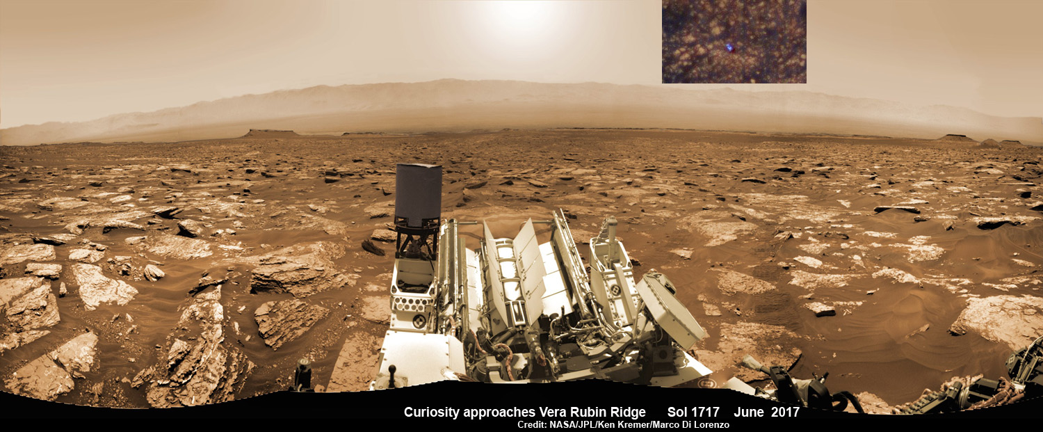
NASA’s Curiosity rover as seen simultaneously on Mars surface and from orbit on Sol 1717, June 5, 2017. The robot snapped this self portrait mosaic view while approaching Vera Rubin Ridge at the base of Mount Sharp inside Gale Crater – backdropped by distant crater rim. This navcam camera mosaic was stitched from raw images and colorized. Inset shows overhead orbital view of Curiosity (blue feature) amid rocky mountainside terrain taken the same day by NASA’s Mars Reconnaissance Orbiter. Credit: NASA/JPL/Ken Kremer/kenkremer.com/Marco Di Lorenzo
“Curiosity is on Vera Rubin Ridge (aka Hematite Ridge) – it is the first aqueous mineral signature that we have seen from space, a driver for selecting Gale Crater,” NASA HQ Mars Lead Scientist Meyer elaborated.
“And now we have access to it.”
The Sol 1833 photomosaic illustrates Curiosity maneuvering her 7 foot long (2 meter) robotic arm during a period when she was processing and delivering a sample of the “Ogunquit Beach” for drop off to the inlet of the CheMin instrument earlier in October. The “Ogunquit Beach” sample is dune material that was collected at Bagnold Dune II this past spring.
The sample drop is significant because the drill has not been operational for some time.
“Ogunquit Beach” sediment materials were successfully delivered to the CheMin and SAM instruments over the following sols and multiple analyses are in progress.
To date three CheMin integrations of “Ogunquit Beach” have been completed. Each one brings the mineralogy into sharper focus.
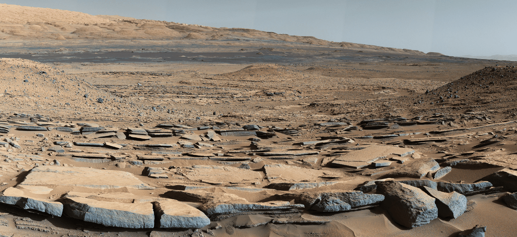
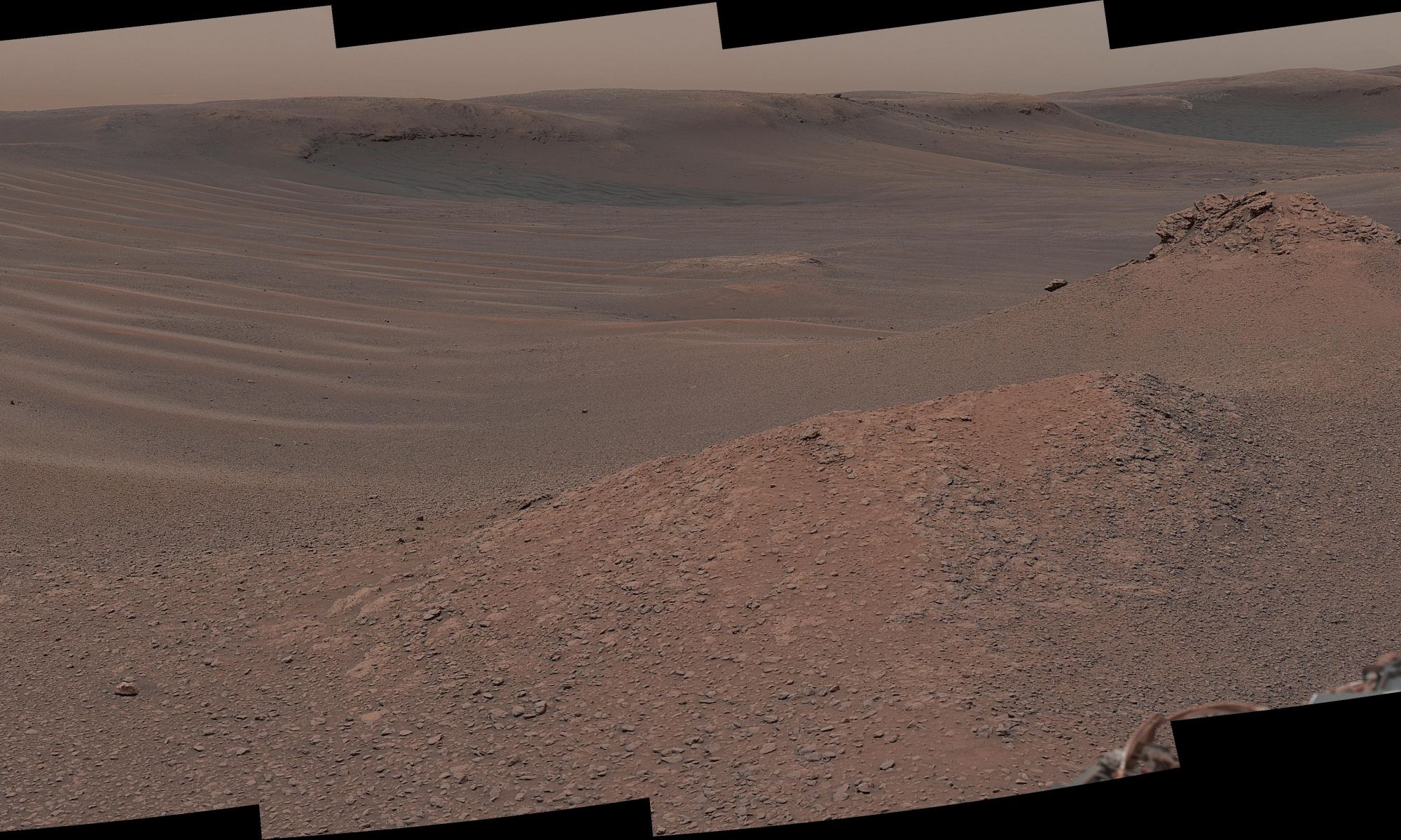
Researchers used the Mastcam on NASA’s Curiosity Mars rover to gain this detailed view of layers in “Vera Rubin Ridge” from just below the ridge. The scene combines 70 images taken with the Mastcam’s right-eye, telephoto-lens camera, on Aug. 13, 2017. Credit: NASA/JPL-Caltech/MSSS
What’s the status of the rover health at 5 years, the wheels and the drill?
“All the instruments are doing great and the wheels are holding up,” Meyer explained.
“When 3 grousers break, 60% life has been used – this has not happened yet and they are being periodically monitored. The one exception is the drill feed (see detailed update below).”
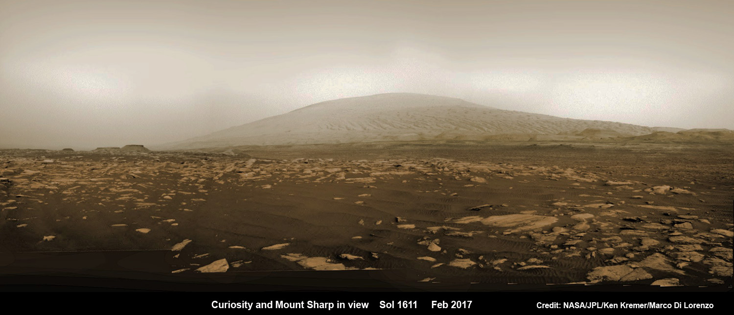
NASA’s Curiosity rover explores sand dunes inside Gale Crater with Mount Sharp in view on Mars on Sol 1611, Feb. 16, 2017, in this navcam camera mosaic, stitched from raw images and colorized. Credit: NASA/JPL/Ken Kremer/kenkremer.com/Marco Di Lorenzo
NASA’s 1 ton Curiosity Mars Science Laboratory (MSL) rover is now closer than ever to the mineral signatures that were the key reason why Mount Sharp was chosen as the robots landing site years ago by the scientists leading the unprecedented mission.
Along the way from the ‘Bradbury Landing’ zone to Mount Sharp, six wheeled Curiosity has often been climbing. To date she has gained over 313 meters (1027 feet) in elevation – from minus 4490 meters to minus 4177 meters today, Oct. 19, 2017, said Meyer.
The low point was inside Yellowknife Bay at approx. minus 4521 meters.
VRR alone stands about 20 stories tall and gains Curiosity approx. 65 meters (213 feet) of elevation to the top of the ridge. Overall the VRR traverse is estimated by NASA to take drives totaling more than a third of a mile (570 m).
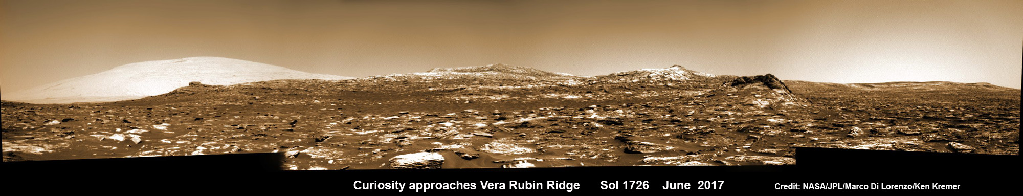
Curiosity images Vera Rubin Ridge during approach backdropped by Mount Sharp. This navcam camera mosaic was stitched from raw images taken on Sol 1726, June 14, 2017 and colorized. Credit: NASA/JPL/Marco Di Lorenzo/Ken Kremer/kenkremer.com
“Vera Rubin Ridge” or VRR is also called “Hematite Ridge.” It’s a narrow and winding ridge located on the northwestern flank of Mount Sharp. It was informally named earlier this year in honor of pioneering astrophysicist Vera Rubin.
The intrepid robot reached the base of the ridge in early September.
The ridge possesses steep cliffs exposing stratifications of large vertical sedimentary rock layers and fracture filling mineral deposits, including the iron-oxide mineral hematite, with extensive bright veins.
VRR resists erosion better than the less-steep portions of the mountain below and above it, say mission scientists.
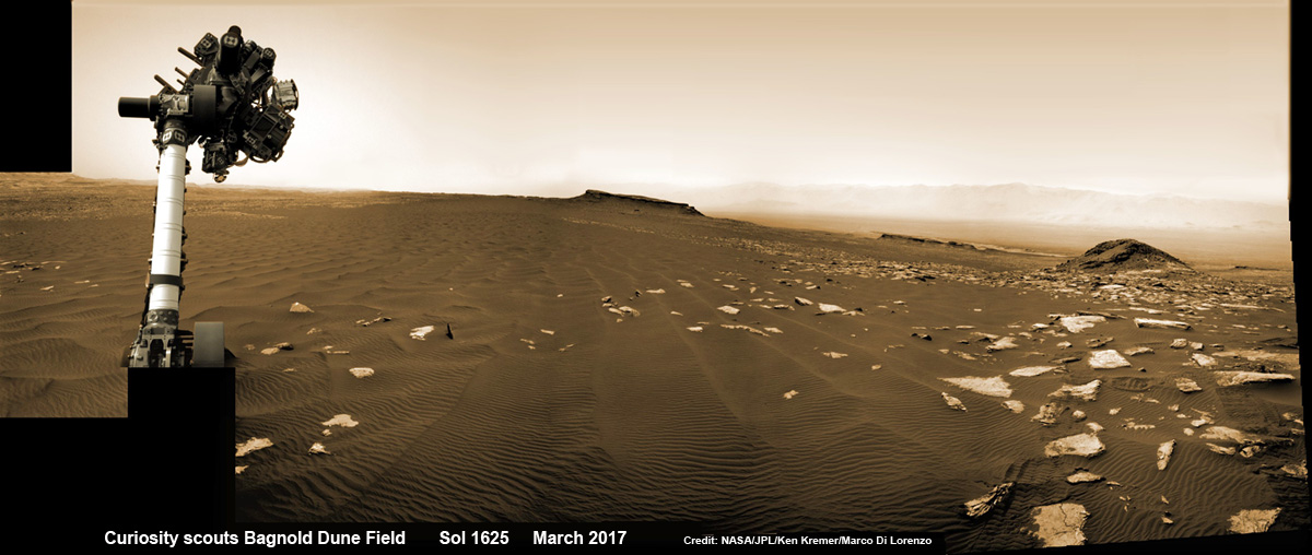
Curiosity rover raises robotic arm high while scouting the Bagnold Dune Field and observing dust devils inside Gale Crater on Mars on Sol 1625, Mar. 2, 2017, in this navcam camera mosaic stitched from raw images and colorized. Note: Wheel tracks at right, distant crater rim in background. Credit: NASA/JPL/Ken Kremer/kenkremer.com/Marco Di Lorenzo
What’s ahead for Curiosity in the coming weeks and months exploring VRR before moving onward and upwards to higher elevation?
“Over the next several months, Curiosity will explore Vera Rubin Ridge,” Meyer replied.
“This will be a big opportunity to ground-truth orbital observations. Of interest, so far, the hematite of VRR does not look that different from what we have been seeing all along the Murray formation. So, big question is why?”
“The view from VRR also provides better access to what’s ahead in exploring the next aqueous mineral feature – the clay, or phyllosilicates, which can be indicators of specific environments, putting constraints on variables such as pH and temperature,” Meyer explained.
The clay minerals or phyllosilicates form in more neutral water, and are thus extremely scientifically interesting since pH neutral water is more conducive to the origin and evolution of Martian microbial life forms, if they ever existed.
How far away are the clays ahead and when might Curiosity reach them?
“As the crow flies, the clays are about 0.5 km,” Meyer replied. “However, the actual odometer distance and whether the clays are where we think they are – area vs. a particular location – can add a fair degree of variability.”
The clay rich area is located beyond the ridge.
Over the past few months Curiosity make rapid progress towards the hematite-bearing location of Vera Rubin Ridge after conducting in-depth exploration of the Bagnold Dunes earlier this year.
“Vera Rubin Ridge is a high-standing unit that runs parallel to and along the eastern side of the Bagnold Dunes,” said Mark Salvatore, an MSL Participating Scientist and a faculty member at Northern Arizona University, in a mission update.
“From orbit, Vera Rubin Ridge has been shown to exhibit signatures of hematite, an oxidized iron phase whose presence can help us to better understand the environmental conditions present when this mineral assemblage formed.”
Curiosity is using the science instruments on the mast, deck and robotic arm turret to gather detailed research measurements with the cameras and spectrometers. The pair of miniaturized chemistry lab instruments inside the belly – CheMin and SAM – are used to analyze the chemical and elemental composition of pulverized rock and soil gathered by drilling and scooping selected targets during the traverse.
A key instrument is the drill which has not been operational. I asked Meyer for a drill update.
“The drill feed developed problems retracting (two stabilizer prongs on either side of the drill retract, controlling the rate of drill penetration),” Meyer replied.
“Because the root cause has not been found (think FOD) and the concern about the situation getting worse, the drill feed has been retracted and the engineers are working on drilling without the stabilizing prongs.”
“Note, a consequence is that you can still drill and collect sample but a) there is added concern about getting the drill stuck and b) a new method of delivering sample needs to be developed and tested (the drill feed normally needs to be moved to move the sample into the chimera). One option that looks viable is reversing the drill – it does work and they are working on the scripts and how to control sample size.”
Ascending and diligently exploring the sedimentary lower layers of Mount Sharp, which towers 3.4 miles (5.5 kilometers) into the Martian sky, is the primary destination and goal of the rover’s long term scientific expedition on the Red Planet.
“Lower Mount Sharp was chosen as a destination for the Curiosity mission because the layers of the mountain offer exposures of rocks that record environmental conditions from different times in the early history of the Red Planet. Curiosity has found evidence for ancient wet environments that offered conditions favorable for microbial life, if Mars has ever hosted life,” says NASA.
Stay tuned. In part 2 we’ll discuss the key findings from Curiosity’s first 5 years exploring the Red Planet.
As of today, Sol 1850, Oct. 19, 2017, Curiosity has driven over 10.89 miles (17.53 kilometers) since its August 2012 landing inside Gale Crater from the landing site to the ridge, and taken over 445,000 amazing images.
Stay tuned here for Ken’s continuing Earth and planetary science and human spaceflight news.
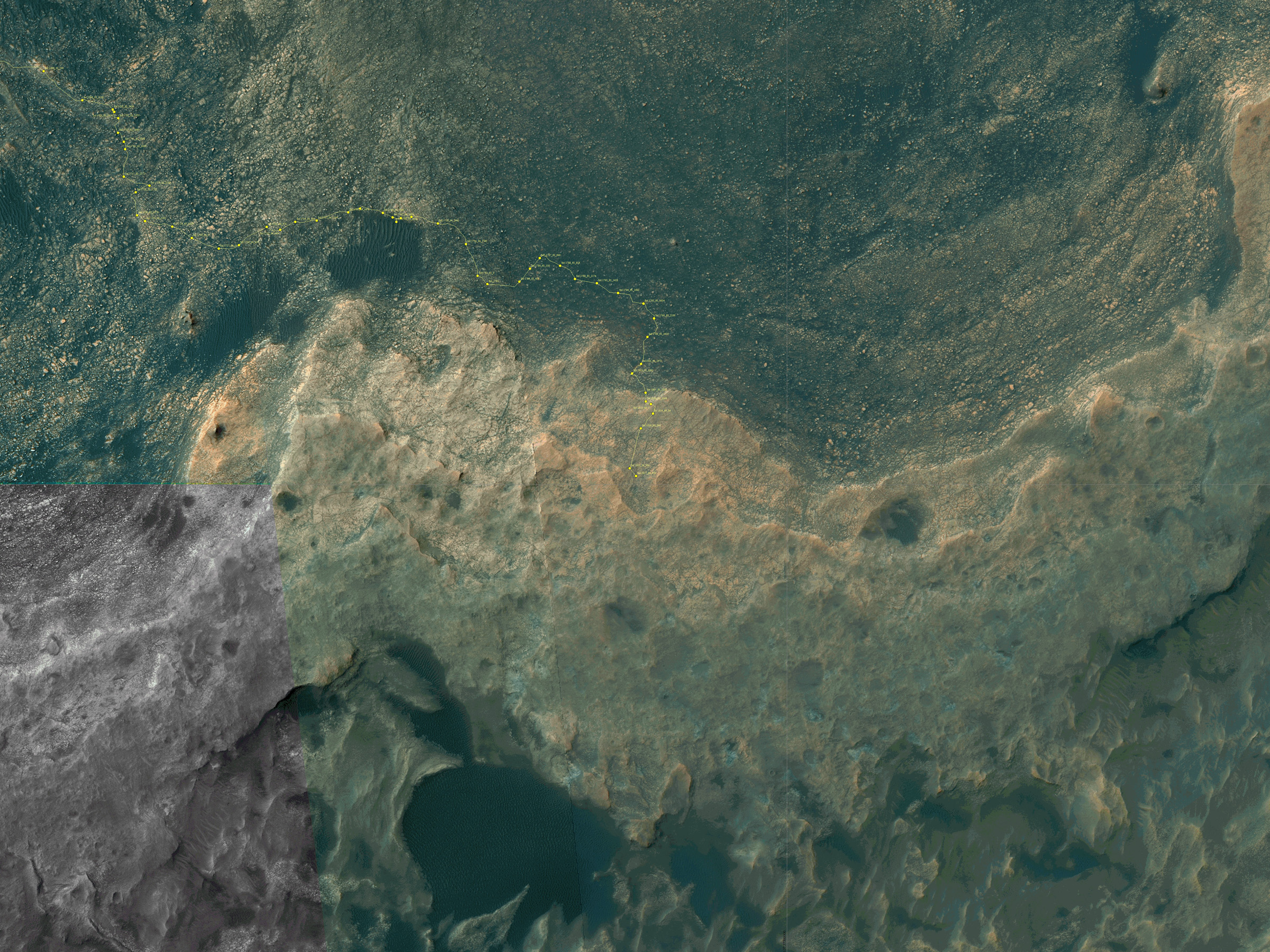
Map shows route driven by NASA’s Mars rover Curiosity through Sol 1827 of the rover’s mission on Mars (September 27, 2017). Numbering of the dots along the line indicate the sol number of each drive. North is up. Since touching down in Bradbury Landing in August 2012, Curiosity has driven 10.84 miles (17.45 kilometers). The base image from the map is from the High Resolution Imaging Science Experiment Camera (HiRISE) in NASA’s Mars Reconnaissance Orbiter. Credit: NASA/JPL/UA
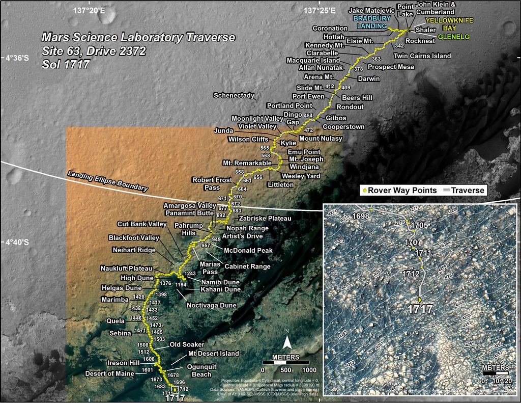
Curiosity’s Traverse Map Through Sol 1717. This map shows the route driven by NASA’s Mars rover Curiosity through the 1717 Martian day, or sol, of the rover’s mission on Mars (June 05, 2017). The base image from the map is from the High Resolution Imaging Science Experiment Camera (HiRISE) in NASA’s Mars Reconnaissance Orbiter. Credit: NASA/JPL-Caltech/Univ. of Arizona