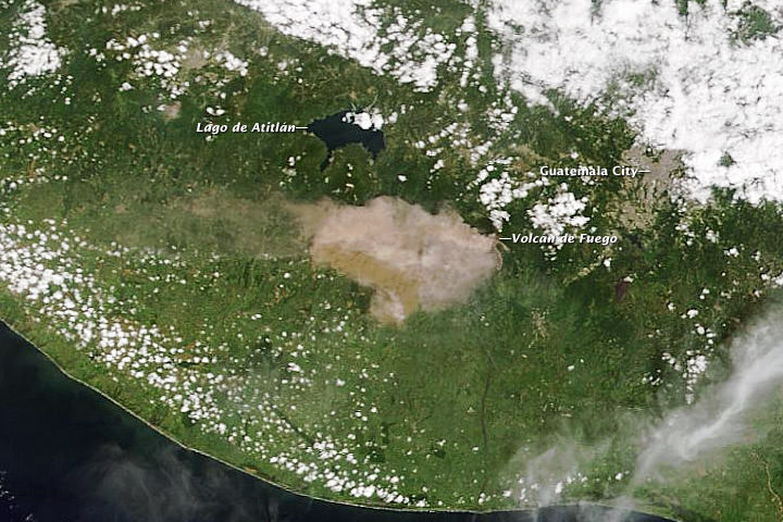
Satellite View of Guatemalan Volcano Erupting
A natural-color image captured the eruption of Volcan de Fuego as it occurred. Credit: NASA/Moderate Resolution Imaging Spectroradiometer (MODIS) aboard the Terra satellite. One of Central American’s most active volcanos erupted on September 13th, 2012 prompting officials to evacuate 35,000 residents in Guatemala. The Volcan de Fuego, or Fire Volcano, began belching out ash at … Continue reading "Satellite View of Guatemalan Volcano Erupting"
Nancy Atkinson