
[/caption]
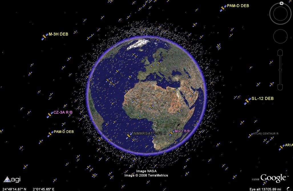
OK, I’ve just wasted an hour in simulated space, checking out some of the active and junked satellites orbiting our planet. Google Earth can be an addictive thing at the best of times, but when 13,000 of the satellites in Earth orbit can be viewed by a new plug-in for the program, you may find yourself hooked for longer than usual. The United States Strategic Command keeps very close tabs on what is orbiting our planet and where they are at any given time, and now with the help of Google Earth, you can explore the satellites, plot their orbital trajectories and see just how crowded space can be. Never before have geostationary communication satellites been so interesting!
Tracking space junk is paramount to all our activities in space. Every time we put a “useful” satellite into orbit – to service our communication needs, monitor the weather or spy on other countries – we are amplifying the growing space junk problem surrounding Earth. In February, I wrote a Universe Today article reporting on Google Earth’s ability to plot all known bits of space junk orbiting the Earth. I think it shocked many to see the problem in dazzling 3D. Now a new plug-in has been released detailing the positions of 13,000 alive and dead satellites being tracked by the US military.
At the end of last month, the danger of discarded satellite parts became all too real for the crew of the International Space Station. Nancy wrote about the heroic efforts of the (soon to be dumped) ATV that boosted the station clear of passing debris from a disintegrated Russian satellite. According to officials, the ATV carried out a 5 minute burn, slowing the station and lowering its orbit by 1.5 km (1 mile). The chunk of Russian spy satellite was allowed to pass without incident.
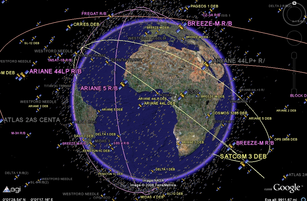
Now you can see the space debris being carefully watched by the US and do some satellite tracking yourself. This new Google Earth plug-in (.kmz file for Google Earth) allows you not only to get information on the 13,000 objects tracked by the US Strategic Command, it also lets you plot their orbits. All the way from low Earth to geostationary orbits, you can access information about who launched the satellite, whether it is active or not, its launch date, mass and orbital information (apogee/perigee). By clicking “Display Trajectory in Fixed Frame” in the information panel that appears when you select the satellite, the orbital path is displayed. It is worth noting that this is the orbital trajectory in relation to the Earth’s rotation (or the “fixed frame”), so geostationary satellites will appear to have no orbital motion, as you’d expect.
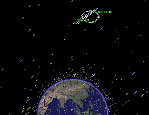
I spent a long time clicking on the various satellites, constantly surprised by the huge number of inactive satellites there were. I also checked out some information on satellites I’d never heard of (like the active InSat-3A/4B geostationary communication satellites I found oscillating around each other, pictured).
Although it is shocking to see the sheer number of satellites out there (reminding me that Kessler Syndrome could be a very real threat in the future), learning about the stuff orbiting Earth was great fun.
Source: Slashdot
Lots of junk up there! And it will increase over the years… what will be the end solution?
J.E.T.,
The solution, shoot them all down.
The good solution, there isn’t any, I don’t think.