Astonishing Hi-Resolution Satellite Views of the Destruction from the Moore, Oklahoma Tornado
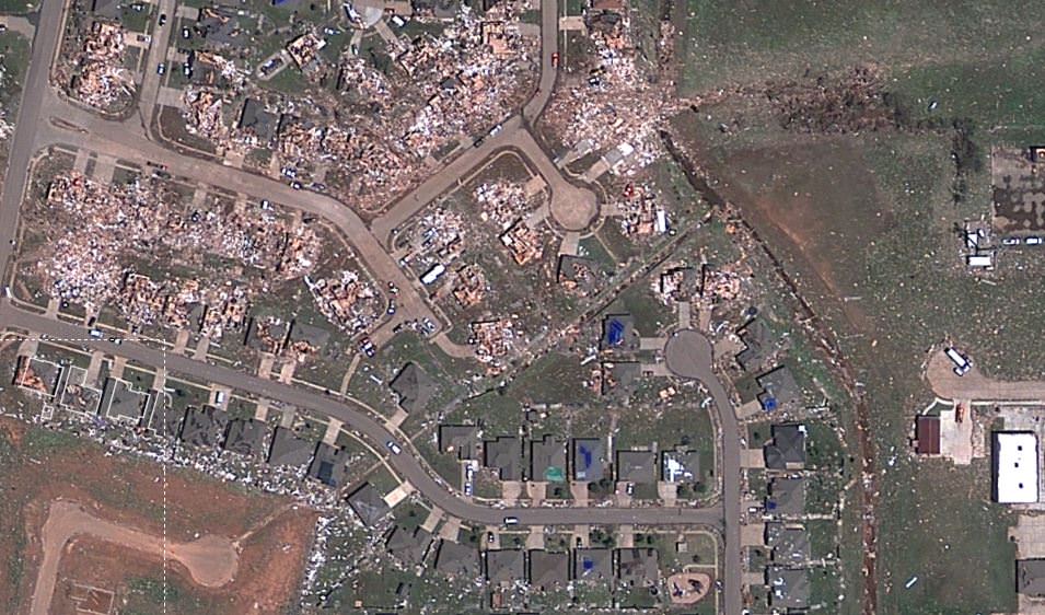
A new satellite map from Google and Digital Globe shows just-released satellite imagery of the damage from the tornado that struck the area of Moore, Oklahoma on May 20, 2013. It’s been called one of the most powerful and destructive tornadoes ever recorded — determined to be an EF5 tornado, the strongest rating for a … Continue reading "Astonishing Hi-Resolution Satellite Views of the Destruction from the Moore, Oklahoma Tornado"
Nancy Atkinson